Carroll County is the name of thirteen counties in the U.S.A. All, except for the one in Tennessee, are named after Charles Carroll of Carrollton, a signer of the U.S. Declaration of Independence from Maryland:
A county seat is an administrative center, seat of government, or capital city of a county or civil parish. The term is used in Canada, China, Romania, Taiwan and the United States. County towns have a similar function in the United Kingdom and Republic of Ireland, and historically in Jamaica.

McCracken County is a county located in the U.S. state of Kentucky. As of the 2010 census, the population was 65,565. The county seat and only municipality is Paducah. McCracken County was the 78th county formed, having been created in 1825.
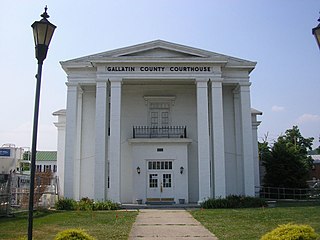
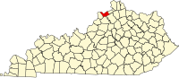
Gallatin County, is a county in the northeastern part of the U.S. state of Kentucky. As of the 2010 census, the population was 8,589. Its county seat is Warsaw.

Carroll County is a county located in the U.S. state of Kentucky. As of the 2010 census, the population was 10,811. Its county seat is Carrollton. The county was formed in 1838 and named for Charles Carroll of Carrollton, the last living signer of the Declaration of Independence. It is located at the confluence of the Kentucky and Ohio Rivers.
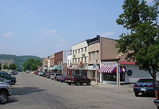
Carrollton is a home rule-class city in—and the county seat of—Carroll County, Kentucky, United States, at the confluence of the Ohio and Kentucky rivers. The population was 3,938 at the 2010 census.

Julian Morton Carroll is an American lawyer and politician from the state of Kentucky. A Democrat, he is a member of the Kentucky Senate, representing Anderson, Franklin, Woodford, Gallatin and Owen counties. From 1974 to 1979, he served as the 54th Governor of Kentucky, succeeding Wendell H. Ford, who resigned to accept a seat in the U.S. Senate. He was the first Kentucky governor from the state's far-western Jackson Purchase region. The lieutenant governor he served with Thelma Stovall was the first woman to be elected Lieutenant Governor of Kentucky.
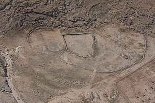
Gilgal is the name of one or more places in the Hebrew Bible. Gilgal is mentioned 39 times, in particular in the Book of Joshua, as the place where the Israelites camped after crossing the Jordan River. The Hebrew term Gilgal most likely means "circle of stones". Its name appears in Koine Greek on the Madaba Map.
Carroll High School can refer to:

This is a list of properties and historic districts in Kentucky that are listed on the National Register of Historic Places. There are listings in all of Kentucky's 120 counties.

This is a list of the National Register of Historic Places listings in Carroll County, Kentucky.
Carroll County High School is a secondary school located at 1706 Highland Ave in the city of Carrollton, Kentucky. It is part of the Carroll County Public Schools (Kentucky) district.
Carroll County Public Schools is a school district located in Carrollton, Kentucky that serves all students residing in Carroll County, Kentucky.
The 1996 United States presidential election in Kentucky took place on November 5, 1996, as part of the 1996 United States presidential election. Voters chose 8 representatives, or electors to the Electoral College, who voted for president and vice president.
Kentucky Route 227 is a 52.762-mile-long (84.912 km) state highway in Kentucky that runs from U.S. Route 460 near Georgetown, Kentucky to US 42 and KY 36 in Carrollton, Kentucky.

The Eagle Station meteorite is a pallasite and type specimen of the Eagle Station grouplet.
The 1975 Kentucky gubernatorial election was held on November 4, 1975. Incumbent Democrat Julian Carroll defeated Republican nominee Robert E. Gable with 62.84% of the vote.

Langstaff is a rural unincorporated community in central Carroll County, Kentucky, United States. The community is located where Kentucky Route 1112 branches off from Kentucky Route 227.
Tomtown is a ghost town in southern Carroll County, Kentucky, United States.