McCracken County is a county located in the far western portion of U.S. state of Kentucky. As of the 2010 census, the population was 65,565. The county seat and only municipality is Paducah. McCracken County was the 78th county formed in the state, having been created in 1825. It is part of the historic Jackson Purchase, territory sold by the Chickasaw people to General Andrew Jackson and Governor Isaac Shelby; this territory was located at the extreme western end of Kentucky.

Spencer County is a county located in the U.S. state of Kentucky. As of the 2010 census, the population was 17,061. Its county seat is Taylorsville. The county was founded in 1824 and named for Spier Spencer.

Carroll County is a county located in the northern part of the U.S. state of Kentucky. As of the 2010 census, the population was 10,811. Its county seat is Carrollton. The county was formed in 1838 and named for Charles Carroll of Carrollton, the last living signer of the Declaration of Independence. It is located at the confluence of the Kentucky and Ohio Rivers.

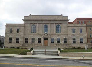
Boyle County is a county located in the U.S. state of Kentucky. As of the 2010 census, the population was 28,432. Its county seat is Danville. The county was formed in 1842 and named for John Boyle (1774–1835), a U.S. Representative, chief justice of the Kentucky Court of Appeals and later federal judge for the District of Kentucky.

Carroll County is a county located in the U.S. state of Illinois. As of the 2010 census, the population was 15,387. Its county seat is Mount Carroll.
Carroll County is a county located in the northwestern part of the State of Georgia. As of the 2010 census, its population was approximately 110,527. Its county seat is the city of Carrollton.

Danville is a home rule-class city in Boyle County, Kentucky, United States. It is the seat of its county. The population was 16,218 at the 2010 Census. Danville is the principal city of the Danville Micropolitan Statistical Area, which includes all of Boyle and Lincoln counties.
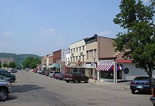
Carrollton is a home rule-class city in—and the county seat of—Carroll County, Kentucky, United States, at the confluence of the Ohio and Kentucky rivers. The population was 3,938 at the 2010 census.

Worthville is a home rule-class city in Carroll County, Kentucky, United States. The population was 185 at the 2010 census.

Annville is an unincorporated community and census-designated place (CDP) in Jackson County, Kentucky, United States. The population was 1,095 at the 2010 census. The community was named for local resident Nancy Ann Johnson. It is the largest community in Jackson County.
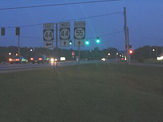
Kentucky Route 55 is a 140.858-mile-long (226.689 km) state highway in the U.S. Commonwealth of Kentucky.
State Route 22 is a 172.8-mile long (278.1 km) south-to-north state highway in the western part of Tennessee, United States. It begins at the Mississippi state line in McNairy County, where the roadway continues as Mississippi Highway 2. It ends at the Kentucky state line in Lake County, when it crosses into the Kentucky Bend, a detached portion of Fulton County, Kentucky. The monument for the 1862 Battle of Island Number Ten in the American Civil War is located on SR 22, about 3 mi (4.8 km) north of Tiptonville.

Salem Township is one of twelve townships in Carroll County, Illinois, USA. As of the 2010 census, its population was 348 and it contained 169 housing units.

The Huntington–Ashland metropolitan area is a metropolitan area in the Appalachian Plateau region of the United States. Referred to locally as the “Tri-State area”, the region spans seven counties in the three states of West Virginia, Kentucky, and Ohio. With a population of 361,580, the Tri-State area is nestled along the banks of the Ohio River. The region offers a diverse range of outdoor activities.
Draffenville is an unincorporated community in Marshall County, Kentucky, United States. It is next to Benton, and lies at the intersection of the Julian M. Carroll Purchase Parkway, U.S. Route 68, and U.S. Route 641. Several businesses, Marshall County High School, and Mike Miller County Park are located in the community.
West Paducah is an unincorporated community in McCracken County, Kentucky, United States. Its elevation is 361 feet.
Kentucky Route 227 is a 52.762-mile-long (84.912 km) state highway in Kentucky that runs from U.S. Route 460 near Georgetown, Kentucky to US 42 and KY 36 in Carrollton, Kentucky.

The Cincinnati metropolitan area, informally known as Greater Cincinnati or the Greater Cincinnati Tri-State Area, is a metropolitan area that includes counties in the U.S. states of Ohio, Kentucky, and Indiana around the Ohio city of Cincinnati. The United States Census Bureau's formal name for the area is the Cincinnati–Middletown, OH–KY–IN Metropolitan Statistical Area. As of the 2010 U.S. Census, this MSA had a population of 2,114,580, making Greater Cincinnati the 29th most populous metropolitan area in the United States, the largest metro area primarily in Ohio, followed by Columbus (2nd) and Cleveland (3rd). The Census also lists the Cincinnati–Wilmington–Maysville, OH–KY–IN Combined Statistical Area, which adds Clinton County, Ohio and Mason County, Kentucky for a 2014 estimated population of 2,208,450. The Cincinnati metropolitan area is considered part of the Great Lakes Megalopolis.
Kentucky Route 389 (KY 389) is a 29.030-mile-long (46.719 km) state highway in the U.S. state of Kentucky. The highway connects mostly rural areas of Henry and Carroll counties with Lockport, English, and the Carrollton area.