
Coventina was a Romano-British goddess of wells and springs. She is known from multiple inscriptions at one site in Northumberland, England, an area surrounding a wellspring near Carrawburgh on Hadrian's Wall. It is possible that other inscriptions, two from Hispania and one from Narbonensis, refer to Coventina, but this is disputed.

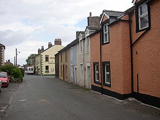
Ravenglass is a coastal village in that lies between Barrow-in-Furness and Whitehaven, on the estuary of three rivers: the Esk, Mite and Irt. It is the only coastal village in the Lake District National Park. Formerly in the historical county of Cumberland, it is now part of the civil parish of Muncaster, the unitary authority of Cumberland, and the ceremonial county of Cumbria.

Hardknott Roman Fort is an archeological site, the remains of the Roman fort Mediobogdum, located on the western side of the challenging Hardknott Pass in the English Lake District. The fort was built between 120 and 138 on a rocky spur, and was initially garrisoned by a detachment of the Cohors IV Delmatarum from the Dalmatian coast. It was abandoned around a decade later, then reoccupied circa 200 and remained in use for much of the next two centuries.

Housesteads Roman Fort was an auxiliary fort on Hadrian's Wall, at Housesteads, Northumberland, England. It is dramatically positioned on the end of the mile-long crag of the Whin Sill over which the Wall runs, overlooking sparsely populated hills. It was called the "grandest station" on the Wall and is one of the best-preserved and extensively displayed forts. It was occupied for almost 300 years. It was located 5.3 miles west from Carrawburgh fort, 6 miles east of Great Chesters fort and about two miles north east of the existing fort at Vindolanda on the Stanegate road.

Segedunum was a Roman fort at modern-day Wallsend, North Tyneside in North East England. The fort lay at the eastern end of Hadrian's Wall near the banks of the River Tyne. It was in use for approximately 300 years from around 122 AD to almost 400. Today Segedunum is the most thoroughly excavated fort along Hadrian's Wall, and is operated as Segedunum Roman Fort, Baths and Museum. It forms part of the Hadrian's Wall UNESCO World Heritage Site.

Ravenglass Roman Bath House is a ruined ancient Roman bath house at Ravenglass, Cumbria, England. Belonging to a 2nd-century Roman fort and naval base, the bath house is described by Matthew Hyde in his update to the Pevsner Guide to Cumbria as "an astonishing survival". The still standing walls are 13 ft high, there are patches of the internal rendering, in dull red and white cement, and traces of the splayed window openings remain.

Magnis or Magna was a Roman fort near Hadrian's Wall in northern Britain. Its ruins are now known as Carvoran Roman Fort and are located near Carvoran, Northumberland, in northern England. It was built on the Stanegate frontier and Roman road, linking Coria (Corbridge) in the east to Luguvalium (Carlisle) in the west, before the building of Hadrian's Wall.

Pons Aelius, or Newcastle Roman Fort, was an auxiliary castra and small Roman settlement on Hadrian's Wall in the Roman province of Britannia Inferior, situated on the north bank of the River Tyne close to the centre of present-day Newcastle upon Tyne, and occupied between the 2nd and 4th centuries AD.

Alauna was a castrum or fort in the Roman province of Britannia. It occupied a coastal site just north of the town of Maryport in the English county of Cumbria.

Portus Adurni was a Roman fort in the Roman province of Britannia situated at the north end of Portsmouth Harbour. It was part of the Saxon Shore, and is the best-preserved Roman fort north of the Alps. Around an eighth of the fort has been excavated.

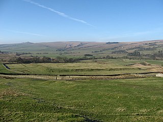
Carrawburgh is a settlement in Northumberland. In Roman times, it was the site of a 3+1⁄2-acre (1.5 ha) auxiliary fort on Hadrian's Wall called Brocolitia, Procolita, or Brocolita.
Cohors quarta Gallorum equitata was a Roman auxiliary cohort containing both infantry and cavalry contingents.

Aesica was a Roman fort, one and a half miles north of the small town of Haltwhistle in Northumberland,. It was the ninth fort on Hadrian's Wall, between Vercovicium (Housesteads) 6.0 miles to the east and Banna (Birdoswald) 6.5 miles to the west.

Uxelodunum was a Roman fort with associated civilian settlement (vicus) in modern-day Carlisle, Cumbria, England. It was the largest fort on Hadrian's Wall and is now buried beneath the suburb of Stanwix.
The Rudge Cup is a small enamelled bronze cup found in 1725 at Rudge, near Froxfield, in Wiltshire, England. The cup was found down a well on the site of a Roman villa. It is important in that it lists five of the forts on the western section of Hadrian's Wall, thus aiding scholars in identifying the forts correctly. The information on the cup has been compared with the two major sources of information regarding forts on the Wall, the Notitia Dignitatum and the Ravenna Cosmography.

Coggabata, or Congavata / Concavata, was a Roman fort on Hadrian's Wall, between Aballava to the east and Mais (Bowness-on-Solway) to the west. It was built on a hill commanding views over the flatter land to the east and west and to the shore of the Solway Firth to the north. Its purpose was to guard the southern end of two important Solway fords, the Stonewath and the Sandwath.
Maia, or Mais, in Cumbria, England was a Roman fort on Hadrian's Wall, and was the last fort at the western end of the Wall, overlooking the Solway Firth.
Habitancum was an ancient Roman fort (castrum) located at Risingham, Northumberland, England. The fort was one of series of built along the extension of Dere Street, a Roman road running from York to Corbridge and onwards to Melrose, in Scotland.

Bewcastle Roman Fort was built to the north of Hadrian's Wall as an outpost fort possibly intended for scouting and intelligence. The remains of the fort are situated at the village of Bewcastle, Cumbria, 7 miles (11 km) to the north of the Roman fort at Birdoswald, on Hadrian's Wall.

Portus Lemanis, also known as Lemanae, was the Latin name of a Roman Saxon Shore fort, settlement and port in southern Kent. The modern village of Lympne derives its name from the ancient port. The site, known locally as Stutfall Castle, is on private land which is accessible by public footpath.


