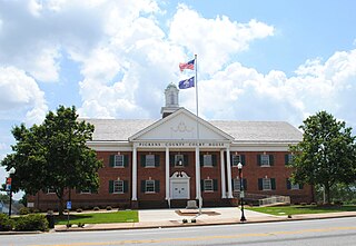
Pickens County is a county located in the northwest part of the U.S. state of South Carolina. As of the 2020 census, its population was 131,404. Its county seat is Pickens. The county was created in 1826. It is part of the Greenville-Anderson-Greer, SC Metropolitan Statistical Area.

Pickens, formerly called Pickens Courthouse, is a city in and the county seat of Pickens County, South Carolina, United States. The population was 3,126 at the 2010 census. Pickens changed its classification from a town to a city in 1998, but it was not reported to the Census Bureau until 2001. It was named after Andrew Pickens (1739–1817), an American revolutionary soldier and US Congressman for South Carolina.

Mount Monadnock, or Grand Monadnock, is a mountain in the town of Jaffrey, New Hampshire. It is the most prominent mountain peak in southern New Hampshire and is the highest point in Cheshire County. It lies 38 miles (61 km) southwest of Concord and 62 miles (100 km) northwest of Boston. At 3,165 feet (965 m), Mount Monadnock is nearly 1,000 feet (305 m) higher than any other mountain peak within 30 miles (48 km) and rises 2,000 feet (610 m) above the surrounding landscape. Monadnock's bare, isolated, and rocky summit provides expansive views. It is known for being featured in the writings of Ralph Waldo Emerson and Henry David Thoreau.

Crowders Mountain State Park is a 5,217-acre (21.11 km2) North Carolina state park in Gaston County, North Carolina in the United States. It is near Kings Mountain, North Carolina and on the outskirts of Gastonia, North Carolina, it includes the peaks of Crowder's Mountain and The Pinnacle. Crowders Mountain is named for Crowders Creek which originates near its base. The cliffs are a popular destination for rock climbers.

Hanging Rock State Park is a 9,011-acre (3,647 ha) North Carolina state park in Stokes County, North Carolina in the United States. The park is 30 miles (48 km) north of Winston-Salem and is located approximately 2 miles (3.2 km) from Danbury in Stokes County.

Black Mountain is the highest mountain peak in the Commonwealth of Kentucky, United States, with a summit elevation of 4,145 feet (1,263 m) above mean sea level and a top-to-bottom height of over 2,500 feet (760 m). The summit is located at approximately 36°54′51″N82°53′38″W in Harlan County, Kentucky near the Virginia border, just above the towns of Lynch, Kentucky and Appalachia, Virginia.

Arabia Mountain purchase was initiated by newly elected DeKalb County Chief Executive Officer Vernon Jones. Upon Jones taken office in January 2001, he immediately recognized the need for additional parks, and the importance of preservation of greenspace. Jones went to work involving community stakeholders and spearheaded a $125 million bond referendum in his first two months in office. In a special election, it passed overwhelmingly by the citizens of DeKalb County. The initial purchase was a 900 acre track that included Arabia Mountain. Additional joining acreage was acquired, creating a haven for the protection of natural wildlife, and resources. The Jones Administration continued its efforts and collaborated with Congresswoman Denise Majette, Congressman Jack Kinston, and Senator Saxsby Chambliss in passage in both houses federal legislation authorizing and declaring Arabia Mountain a National Heritage area.Arabia Mountain, a part of Arabia Mountain National Heritage Area, is the northern of two peaks in the Davidson-Arabia Mountain Nature Preserve, in DeKalb County, Georgia, United States. A low saddle separates it from Bradley Mountain, several hundred feet to its south. The two form a monadnock. The peak is 955 feet (290 m) above sea level, rising 172 feet (52 m) above Arabia Lake reservoir. Bradley Mountain is closer to the visitor trails than Arabia Mountain and is often misidentified by visitors as Arabia Mountain.

Pores Knob is a mountain peak located in Wilkes County, North Carolina, United States.

The Black Mountains are a mountain range in western North Carolina, in the southeastern United States. They are part of the Blue Ridge Province of the Southern Appalachian Mountains. The Black Mountains are the highest mountains in the Eastern United States. The range takes its name from the dark appearance of the red spruce and Fraser fir trees that form a spruce-fir forest on the upper slopes which contrasts with the brown or lighter green appearance of the deciduous trees at lower elevations. The Eastern Continental Divide, which runs along the eastern Blue Ridge crest, intersects the southern tip of the Black Mountain range.

Crowders Mountain is one of two main peaks within Crowders Mountain State Park, the other peak being The Pinnacle. The park is located in the Western Piedmont of North Carolina between the cities of Kings Mountain and Gastonia or about 25 miles (40 km) west of Charlotte. Crowders Mountain abruptly rises nearly 800 feet (240 m) above the surrounding terrain, and has an elevation of 1,625 feet above sea level.

The Metacomet-Monadnock Trail is a 114-mile-long (183 km) hiking trail that traverses the Metacomet Ridge of the Pioneer Valley region of Massachusetts and the central uplands of Massachusetts and southern New Hampshire. Although less than 70 miles (110 km) from Boston and other large population centers, the trail is considered remarkably rural and scenic and includes many areas of unique ecologic, historic, and geologic interest. Notable features include waterfalls, dramatic cliff faces, exposed mountain summits, woodlands, swamps, lakes, river floodplain, farmland, significant historic sites, and the summits of Mount Monadnock, Mount Tom and Mount Holyoke. The Metacomet-Monadnock Trail is maintained largely through the efforts of the Western Massachusetts Chapter of the Appalachian Mountain Club (AMC). Much of the trail is a portion of the New England National Scenic Trail.

Glade Mountain, elevation 3,672 feet (1,119 m), is the highest point in the Ellicott Rock Wilderness, which straddles Georgia, North Carolina and South Carolina. It is also in the Chattahoochee National Forest in Rabun County, Georgia.

Little Mountain is a monadnock that is the highest point in the Midlands region of South Carolina. It has an elevation of 813 feet above mean sea level and is located in southeastern Newberry County, about 25 miles from Columbia. The monadnock itself rises 300 feet above the surrounding belt of hills and is formed of Carolina slate.

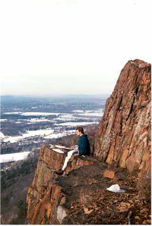
Farley Ledges, 1,067 feet (325 m) is a bluff knob located on the southeast side of Northfield Mountain in eastern Franklin County, Massachusetts. The ledge is notable for its extensive rock climbing ascents; it rises 700 feet (210 m) above the small village of Farley and has been used by rock climbers since the 1930s. The Western Massachusetts Climbers Coalition has been active in purchasing land to preserve access to the mountain; 2007 purchases included a parcel along Route 2 developed into a trailhead with a parking lot and access corridor to the ledges. The 110-mile (180 km) Metacomet-Monadnock Trail ascends the wooded north side of the ledges where Briggs Brook Falls tumbles from the ridgecrest; a marked rock climbing access loop trail departs from the Metacomet-Monadnock Trail to traverse both the summit of the ledges and the extensive boulder field beneath.

Tully Mountain, 1,163 ft (354 m), is a prominent, steep-sided monadnock located in north central Massachusetts in the town of Orange. It is part of the Tully Mountain Wilderness Management Area. An exposed east facing ledge on the summit provides views of the Millers River valley, Mount Monadnock, Mount Wachusett, and the Wapack Range. The 22-mile (35 km) Tully Trail traverses the mountain.

Paris Mountain State Park is a state park in the U.S. state of South Carolina, located five miles (8 km) north of Greenville. Activities available in the 1,540-acre (6 km2) park include hiking, biking, swimming and picnicking. The 13-acre (52,609 m2) Lake Placid offers swimming and fishing. Canoes, kayaks, and pedal boats are seasonally available for rental; private boats are not permitted. Camping is allowed and campsites range from rustic, back country sites to paved sites with water and electricity hook-ups. The park's Civilian Conservation Corps (CCC) structures, including the Camp Buckhorn lodge, are listed on the National Register of Historic Places. m.

Glassy Mountain is a mountain in the Chattahoochee National Forest in Rabun County, Georgia, with its USGS GNIS summit at 34°50′44″N83°30′02″W, which is 3,415 feet (1,041 m) AMSL. It is bypassed on its northern flank by a major two-lane highway that carries U.S. Route 76 and Georgia State Route 2 east and west.
Big Butt Mountain or Big Butt are the names of five distinct mountains in Western North Carolina. Butt in this context is a corruption of butte.

Breccia Peak is a mountain in the southern Absaroka Range of the Rocky Mountains. It is located in Teton County in the U.S. state of Wyoming, close to the southwest border of the Teton Wilderness within the Bridger-Teton National Forest.


