
Johnson County is a county located in the U.S. state of Tennessee. As of the 2020 census, the population was 17,948. Its county seat is Mountain City. It is the state's northeasternmost county, sharing borders with Virginia and North Carolina.

Fairfield County is a county located in the U.S. state of South Carolina. As of the 2020 census, its population was 20,948. Its county seat is Winnsboro.

Dillon County is a county located in the U.S. state of South Carolina. As of the 2020 census, the county's population was 28,292. The county seat is Dillon.

Surry County is a county located in the U.S. state of North Carolina. As of the 2020 census, the population was 71,359. Its county seat is Dobson, and its largest community is Mount Airy.

Gaston County is a county in the U.S. state of North Carolina. As of the 2020 census, the population was 227,943. The county seat is Gastonia. Dallas served as the original county seat from 1846 until 1911.

Lincoln County is a county located in the east central portion of the U.S. state of Georgia. As of the 2020 census, the population was 7,690. The county seat is Lincolnton. The county was created on February 20, 1796. Lincoln County is included in the Augusta-Richmond County, GA-SC metropolitan statistical area, the Savannah River forming its northeastern border. Located above the fall line, it is part of the Central Savannah River Area (CSRA) and a member of the CSRA Regional Development Center.

Troy is a town in Cheshire County, New Hampshire, United States. The population was 2,130 at the 2020 census. It is situated in southwestern New Hampshire, west of Mount Monadnock.

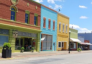
Bamberg is a city in and the county seat of Bamberg County, South Carolina, United States. The population was 3,607 at the 2010 census.
Wade Hampton is a census-designated place (CDP) in Greenville County, South Carolina, United States. The population was 20,622 at the 2010 census. It is named for American Civil War general and South Carolina governor Wade Hampton.
Seven Oaks is a census-designated place (CDP) in Lexington County, South Carolina, United States, 8 miles (13 km) northwest of downtown Columbia, the state capital. The population of the CDP was 15,144 at the 2010 census. It is part of the Columbia Metropolitan Statistical Area.

Little Mountain is a town in Newberry County, South Carolina, United States. The population was 291 at the 2010 census. The town took its name from nearby Little Mountain.

Pickens, formerly called Pickens Courthouse, is a city in and the county seat of Pickens County, South Carolina, United States. The population was 3,126 at the 2010 census. Pickens changed its classification from a town to a city in 1998, but it was not reported to the Census Bureau until 2001. It was named after Andrew Pickens (1739–1817), an American revolutionary soldier and US Congressman for South Carolina.

St. Andrews is a census-designated place (CDP) in Richland County, South Carolina, United States. The population was 20,493 at the 2010 census. It is part of the Columbia, South Carolina Metropolitan Statistical Area.
Saluda is a town in Saluda County, South Carolina, United States, along the Little Saluda River. The population was 3,565 at the 2010 census. It is the county seat of Saluda County.
Kings Mountain is a small suburban city within the Charlotte metropolitan area in Cleveland and Gaston counties, North Carolina, United States. Most of the city is in Cleveland County, with a small eastern portion in Gaston County. The population was 10,296 at the 2010 census.

Monetta is a town in Aiken and Saluda counties, South Carolina, United States. The population was 236 at the 2010 census.

Pores Knob is a mountain peak located in Wilkes County, North Carolina, United States.
Boomer is a farming community located in Wilkes County, North Carolina. Legally it is a township, a non-governmental county subdivision. The population was 1,266 at the 2020 Census.
Dallas Township is a township in north-central Gaston County, North Carolina, United States. As of the 2010 census it had a population of 21,436. It includes the incorporated towns of Dallas, High Shoals, and Stanley. It also includes small portions of the city of Gastonia and a small outlying portion of the town of Ranlo. Unincorporated areas in the township include Alexis, Hardins, Ashebrook Park, and Vinton Woods.

Glassy Mountain is a mountain close to Pickens, South Carolina, USA, in northwestern South Carolina, with a summit elevation of 1,703 feet above mean sea level. While it is an isolated monadnock, it is still close to the Blue Ridge, providing views of nearby summits such as Table Rock and Caesar's Head as well as Greenville. The mountain gets its name from a large, bare, granite face on its north side. At the top of this rock face are small springs that trickle down the mountain, giving it a "glassy" appearance in the sun. It is easily accessible, as a small service road for transmitter towers leads to the summit. Local high schoolers often paint the rock face with graduation years. These year numbers can be so large as to be seen on aerial imaging of the mountain

