Saluda Mountains

Last updated
Saluda Mountains
USA North Carolina relief location map.jpg
Red triangle with thick white border.svg
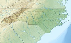
Saluda Mountains
Located along the North and South Carolina border
USA South Carolina relief location map.svg
Red triangle with thick white border.svg
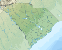
Saluda Mountains
Saluda Mountains (South Carolina)
Usa edcp relief location map.png
Red triangle with thick white border.svg
Saluda Mountains
Saluda Mountains (the United States)
Highest point
Peak Grassy Top Mountain
Elevation 3,258 ft (993 m)
Coordinates 35°09′22″N82°31′36″W / 35.15611°N 82.52667°W / 35.15611; -82.52667
Geography
CountryFlag of the United States (23px).png  United States
States North Carolina and South Carolina
Parent range Blue Ridge Mountains

The Saluda Mountains are a mountain range that straddles along the North Carolina and South Carolina border, in the southeastern United States. They are part of the Blue Ridge Province of the Southern Appalachian Mountains. [1]

Contents

Geography

The range begins at Standingstone Mountain, near Caesars Head State Park, and go northeasterly to Blakes Peak, near Saluda, North Carolina. Straddling the North and South Carolina state line, it is flanked by the Green and Saluda rivers.

Notable summits

Listed are the ten highest summits in the range.

MountainElevationCoordinatesGeneral areaNamed after
Grassy Top Mountain 3,258 feet (993 m) 35°09′21″N82°31′36″W / 35.15583°N 82.52667°W / 35.15583; -82.52667 (Grassy Top Mountain) Greenville County, SC Henderson County, NC
Standingstone Mountain 3,209 feet (978 m) 35°08′39″N82°34′22″W / 35.14417°N 82.57278°W / 35.14417; -82.57278 (Standingstone Mountain) Greenville County, SC Henderson County, NC
Hogback Mountain 3,130 feet (950 m) 35°09′57″N82°30′15″W / 35.16583°N 82.50417°W / 35.16583; -82.50417 (Hogback Mountain) Greenville County, SC Henderson County, NC
Big Top 3,048 feet (929 m) 35°09′57″N82°29′39″W / 35.16583°N 82.49417°W / 35.16583; -82.49417 (Big Top) Greenville County, SC Henderson County, NC
Mackerel Mountain 3,038 feet (926 m) 35°10′28″N82°29′11″W / 35.17444°N 82.48639°W / 35.17444; -82.48639 (Mackerel Mountain) Greenville County, SC Henderson County, NC
Corbin Mountain 3,031 feet (924 m) 35°10′05″N82°26′05″W / 35.16806°N 82.43472°W / 35.16806; -82.43472 (Corbin Mountain) Greenville County, SC Henderson County, NC
Pruett Mountain 3,022 feet (921 m) 35°10′03″N82°26′04″W / 35.16750°N 82.43444°W / 35.16750; -82.43444 (Pruett Mountain) Greenville County, SC
McCarrol Mountain 2,982 feet (909 m) 35°10′27″N82°28′27″W / 35.17417°N 82.47417°W / 35.17417; -82.47417 (McCarrol Mountain) Greenville County, SC Henderson County, NC
Frank Mountain 2,933 feet (894 m) 35°10′40″N82°27′37″W / 35.17778°N 82.46028°W / 35.17778; -82.46028 (Frank Mountain) Greenville County, SC Henderson County, NC
Long Mountain 2,923 feet (891 m) 35°11′30″N82°28′05″W / 35.19167°N 82.46806°W / 35.19167; -82.46806 (Long Mountain) Henderson County, NC

Geology

History

Related Research Articles

<span class="mw-page-title-main">Saluda County, South Carolina</span> County in South Carolina, United States

Saluda County is a county in the U.S. state of South Carolina. As of the 2020 census, the population was 18,862. Its county seat is Saluda. The county was formed from northern and eastern portions of Edgefield County.

<span class="mw-page-title-main">Greenville County, South Carolina</span> County in South Carolina, United States

Greenville County is located in the U.S. state of South Carolina. As of the 2020 census, the population was 525,534, making it the most populous county in the state. Its county seat is Greenville. The county is also home to the Greenville County School District, the largest school system in South Carolina.

<span class="mw-page-title-main">Polk County, North Carolina</span> County in North Carolina, United States

Polk County is a county located in the U.S. state of North Carolina. As of the 2020 census, the population was 19,328. Its county seat is Columbus.

<span class="mw-page-title-main">Saluda, North Carolina</span> City in North Carolina, United States

Saluda is a city in Polk and Henderson counties in the U.S. state of North Carolina. The population was 713 at the 2010 census. Saluda is famous for sitting at the top of the Norfolk Southern Railway's Saluda Grade, which was the steepest main line standard-gauge railway line in the United States until Norfolk Southern ceased operations on the line in 2001. Saluda is close to the South Carolina state line, between Asheville, North Carolina, and Spartanburg, South Carolina.

<span class="mw-page-title-main">Saluda Grade</span> Steepest standard-gauge mainline railway grade in the United States

Saluda Grade was the steepest standard-gauge mainline railway grade in the United States. Owned by the Norfolk Southern Railway as part of its W Line, Saluda Grade in Polk County, North Carolina, gained 606 feet (185 m) in elevation in less than three miles (4.8 km) between Melrose and Saluda. Average grade was 4.24 percent for 2.6 miles (4.2 km) and maximum was 4.9% for about 300 feet (91 m). In December 2001, Norfolk Southern took the line containing the grade out of service for economic reasons. As of 2023, Saluda Grade is proposed to become a rail trail.

<span class="mw-page-title-main">Sassafras Mountain</span> Highest point in South Carolina, United States

Sassafras Mountain is the highest point in the state of South Carolina, United States. It is in the Blue Ridge Mountains, part of the Appalachian Mountains. An observation tower opened on top of Sassafras Mountain in 2019.

<span class="mw-page-title-main">U.S. Route 178</span> U.S. Highway in North and South Carolina

U.S. Highway 178 is a spur of U.S. Highway 78. It currently runs for 240.49 miles (387.03 km) from Dorchester, South Carolina, at U.S. Highway 78 to Rosman, North Carolina, at U.S. Highway 64. It passes through the states of South Carolina and North Carolina. It goes through the cities of Pickens, Anderson, North, Orangeburg, Harleyville, South Carolina and Bowman, South Carolina.

<span class="mw-page-title-main">Lake Murray (South Carolina)</span> Reservoir in South Carolina, United States

Lake Murray is a reservoir in the U.S. state of South Carolina. It is approximately 50,000 acres in size, and has roughly 650 mi of shoreline. It was impounded in the late 1920s to provide hydroelectric power to the state of South Carolina. Lake Murray is fed by the Saluda River, which flows from upstate South Carolina near the North Carolina state line. The Saluda Dam was an engineering feat at the time of its construction. The dam, using the native red clay soil and bedrock, was the largest earthen dam in the world when it was completed in 1930. Lake Murray itself is named after the project's chief engineer, William S. Murray. The Saluda Dam is approximately 1.5 miles (2.4 km) long and 220 feet (67 m) high. Lake Murray is 41 miles (66 km) long, and 14 miles (23 km) wide at its widest point. At the time when the lake was finished, it was the world's largest man-made reservoir.

<span class="mw-page-title-main">Saluda River</span> River in South Carolina, USA

The Saluda River is a principal tributary of the Congaree River, about 200 mi (320 km) long, in northern and western South Carolina in the United States. Via the Congaree River, it is part of the watershed of the Santee River, which flows to the Atlantic Ocean.

<span class="mw-page-title-main">Western North Carolina</span> Geographic region of the U.S. state of North Carolina

Western North Carolina is the region of North Carolina which includes the Appalachian Mountains; it is often known geographically as the state's Mountain Region. It contains the highest mountains in the Eastern United States, with 125 peaks rising to over 5,000 feet in elevation. Mount Mitchell at 6,684 feet, is the highest peak of the Appalachian Mountains and mainland eastern North America. The population of the 23 most commonly associated counties for the region, as measured by the 2020 U.S. Census, is 1,149,405. The region accounts for approximately 11% of North Carolina's total population.

<span class="mw-page-title-main">South Carolina's 3rd congressional district</span> U.S. House district for South Carolina

South Carolina's 3rd congressional district is a congressional district in western South Carolina bordering both Georgia and North Carolina. It includes all of Abbeville, Anderson, Edgefield, Greenwood, Laurens, McCormick, Oconee, Pickens, and Saluda counties and portions of Greenville and Newberry counties. The district is mostly rural, but much of the economy revolves around the manufacturing centers of Anderson and Greenwood. With a Cook Partisan Voting Index rating of R+21, it is the most Republican district in South Carolina.

<span class="mw-page-title-main">Sumter National Forest</span>

The Sumter National Forest is one of two forests in South Carolina that are managed together by the United States Forest Service, the other being the Francis Marion National Forest. The Sumter National Forest consists of 370,442 acres (1,499.13 km2) which are divided into 3 distinct sections in western and central South Carolina. The Enoree Ranger District is the largest, comprising roughly 170,000 acres in Chester, Fairfield, Laurens, Newberry, and Union counties. Next is the Long Cane Ranger District, comprising about 120,000 acres in Abbeville, Edgefield, Greenwood, McCormick, and Saluda counties. The smallest district is the Andrew Pickens Ranger District comprising over 85,000 acres which lies entirely in Oconee county and is part of the Appalachian Mountains. Forest headquarters of both South Carolina forests are located together in the state's capital city of Columbia.

William Butler was a United States representative from South Carolina.

<span class="mw-page-title-main">Poinsett Bridge</span> Bridge in Greenville County, South Carolina

Poinsett Bridge is the oldest bridge in South Carolina and perhaps in the entire southeastern United States. Named for Joel Roberts Poinsett, it was built in 1820 as part of a road from Columbia, South Carolina, to Saluda Mountain. The stone bridge, which includes a 14-foot (4.3 m) Gothic arch and stretches 130 feet (40 m) over Little Gap Creek, may have been designed by Robert Mills, architect of the Washington Monument. Though no longer in use, the bridge remains largely intact and is part of the 120-acre (48.6 ha) Poinsett Bridge Heritage Preserve. There is a nature trail a few hundred yards from the bridge. The bridge, about which ghost stories have been told for decades, is located off U.S. Highway 25 north of Greenville, South Carolina. The bridge was added to the National Register of Historic Places in 1970.

Jones Gap State Park is a South Carolina state park in northern Greenville County, near Marietta. The 3,964-acre (1,604 ha) park, which includes the headwaters of the Middle Saluda River, is, with Caesars Head State Park, administered by the state Department of Parks, Recreation, and Tourism as part of the Mountain Bridge Wilderness.

<span class="mw-page-title-main">U.S. Route 25 in South Carolina</span> Section of U.S. highway in South Carolina

U.S. Route 25 (US 25) is a 140.600-mile (226.274 km) United States Numbered Highway that travels from Brunswick, Georgia, to the Kentucky–Ohio state line, where Covington, Kentucky, meets Cincinnati, Ohio, at the Ohio River. In the U.S. state of South Carolina, it travels south to north in the western part of the state, serving the northern part of the Augusta metropolitan area, Greenwood, and Upstate South Carolina on its path from North Augusta to North Carolina in the Saluda Mountains, near Travelers Rest.

<span class="mw-page-title-main">Interstate 26 in South Carolina</span> Section of Interstate Highway in South Carolina, United States

Interstate 26 (I-26) is a South Carolina Interstate highway running generally east–west from near Landrum, in Spartanburg County, to U.S. Route 17 (US 17), in Charleston, South Carolina. It is also the longest Interstate Highway in South Carolina.

Mountain Page is an unincorporated community in Henderson County, North Carolina, United States. It is in the southeastern edge of the county. The ZIP code is 28773 with a Saluda address even though Saluda is in neighboring Polk County. Mountain Page is named after the locale Page family. The community backs up to the Greenville Watershed in neighboring Greenville County, South Carolina. The community is 12 miles south of Hendersonville, North Carolina the county seat. Mountain Page is a part of the Asheville Metropolitan Area.

The Cliffs Valley is a resort community and census-designated place (CDP) in Greenville County, South Carolina, United States. It was first listed as a CDP prior to the 2020 census with a population of 736.

References

  1. "Saluda Mountains". Geographic Names Information System . United States Geological Survey, United States Department of the Interior . Retrieved July 20, 2014.