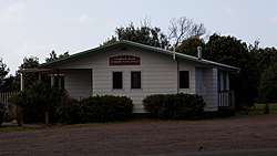
The area is also known as Kawahai, after a species of fish which has been a substantial food source for the local Ngāti Te Ata iwi.[4]
Glenbrook Beach was first subdivided in the mid 1920s.[5][6] Electric power supply was connected at the end of the decade.[7][8]
Demographics
Statistics New Zealand describes Glenbrook Beach as a rural settlement, which covers 1.17km2 (0.45sqmi)[1] and had an estimated population of 1,050 as of June 2025,[2] with a population density of 897 people per km2. Glenbrook Beach is part of the larger Glenbrook statistical area.[9]
Historical population
Year
Pop.
±% p.a.
2006
276
—
2013
300
+1.20%
2018
303
+0.20%
2023
840
+22.62%
The 2006 population is for a smaller area of 0.43 km2. Source: [10][11]
Glenbrook Beach had a population of 840 in the 2023 New Zealand census, an increase of 537 people (177.2%) since the 2018 census, and an increase of 540 people (180.0%) since the 2013 census. There were 417 males, 417 females and 6 people of other genders in 294 dwellings.[12] 2.5% of people identified as LGBTIQ+. The median age was 36.7 years (compared with 38.1 years nationally). There were 198 people (23.6%) aged under 15 years, 120 (14.3%) aged 15 to 29, 438 (52.1%) aged 30 to 64, and 84 (10.0%) aged 65 or older.[11]
People could identify as more than one ethnicity. The results were 73.6% European (Pākehā); 14.3% Māori; 13.6% Pasifika; 14.3% Asian; 2.9% Middle Eastern, Latin American and African New Zealanders (MELAA); and 2.9% other, which includes people giving their ethnicity as "New Zealander". English was spoken by 96.1%, Māori language by 2.9%, Samoan by 2.5%, and other languages by 18.9%. No language could be spoken by 2.9% (e.g. too young to talk). New Zealand Sign Language was known by 0.4%. The percentage of people born overseas was 32.5, compared with 28.8% nationally.[11]
Of those at least 15 years old, 150 (23.4%) people had a bachelor's or higher degree, 375 (58.4%) had a post-high school certificate or diploma, and 126 (19.6%) people exclusively held high school qualifications. The median income was $58,300, compared with $41,500 nationally. 111 people (17.3%) earned over $100,000 compared to 12.1% nationally. The employment status of those at least 15 was that 411 (64.0%) people were employed full-time, 63 (9.8%) were part-time, and 12 (1.9%) were unemployed.[11]
This page is based on this Wikipedia article Text is available under the CC BY-SA 4.0 license; additional terms may apply. Images, videos and audio are available under their respective licenses.