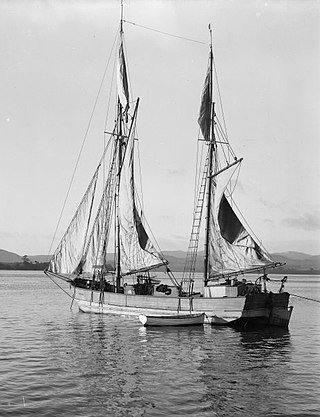
A scow is a smaller type of barge. Some scows are rigged as sailing scows. In the 19th and early 20th centuries, scows carried cargo in coastal waters and inland waterways, having an advantage for navigating shallow water or small harbours. Scows were in common use in the American Great Lakes and other parts of the U.S., Canada, southern England, and New Zealand. In modern times their main purpose is for recreation and racing; there are also garbage scows for aquatic transport of refuse.

Franklin District was a New Zealand territorial authority that lay between the Auckland metropolitan area and the Waikato Plains. As a formal territory, it was abolished on 31 October 2010 and divided between Auckland Council in the Auckland Region to the north and Waikato and Hauraki districts in the Waikato region to the south and east. The Auckland portion is now part of the Franklin Ward, which also includes rural parts of the former Manukau City.

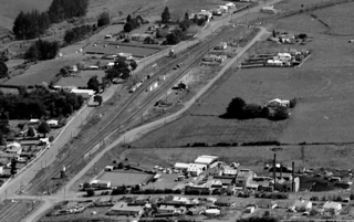
Waiuku is a rural town in the Auckland Region of New Zealand. It is located at the southern end of the Waiuku River, which is an estuarial arm of the Manukau Harbour, and lies on the isthmus of the Āwhitu Peninsula, which extends to the northeast. It is 40 kilometres southwest of Auckland city centre, and 12 kilometres north of the mouth of the Waikato River.
Postcodes in New Zealand consist of four digits, the first two of which specify the area, the third the type of delivery, and the last the specific lobby, RD number, or suburb. The present postcode system was introduced in New Zealand in June 2006, which, unlike the previous system, applies to all items of mail with effect from June 2008. In October 2008, New Zealand Post launched a 'remember your postcode' campaign, offering a $10,000 prize for remembering a postcode.

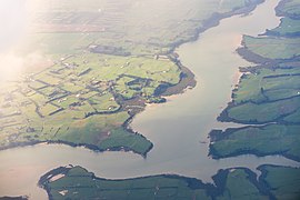
The Waiuku River, also known as the Waiuku Estuary, is an estuarial arm of the Manukau Harbour, near the town of Waiuku, south-west of Auckland. It joins the harbour at the south west and extends south for 12 kilometres (7 mi), having its head close to the town of Waiuku.

The Kumeu-Riverhead section was a short-lived railway line north-west of Auckland, New Zealand. It was built as part of the Kaipara-Riverhead Railway, which was isolated from the national railway network until 1881, just before closure of this section.

Ngāti Te Ata Waiohua is a Māori iwi from the area around the Manukau Harbour in the Auckland Region of New Zealand.
The Waiuku and Mission Bush Branches are two branches on the New Zealand railway network which are closely linked. The Mission Bush Branch connects the North Island Main Trunk railway to the Glenbrook Steel Mill.
Franklin South was a parliamentary electorate in the southern part of the Auckland Region of New Zealand from 1881 to 1890. During the three parliamentary terms of its existence, the electorate was represented by Ebenezer Hamlin.

Ebenezer Hamlin was a member of parliament in New Zealand, and an independent conservative.

Waiuku AFC is an amateur football club in New Zealand.
The Awaroa River is a short river in the Waikato District of New Zealand's North Island. It flows east from its source in the dunes near Karioitahi Beach and Lake Puketi, then south from Waiuku joining with the Aka Aka Stream before reaching the Waikato River in its tidal reaches close to Motutieke Island.
The Mangatangi River, or Mangatangi Stream, originates on the eastern slopes of the Hunua Ranges in New Zealand and flows roughly southwards until it is joined by the Ruaotehuia Stream just north of State Highway 2 between Mangatāwhiri and Maramarua, where it becomes the Maramarua River. Mangatangi can be translated as manga tangi to stream of weeping, or as rippling stream, or babbling brook.

The Āwhitu Peninsula is a long peninsula in the North Island of New Zealand, extending north from the mouth of the Waikato River to the entrance to Manukau Harbour.
Aka Aka is a rural locality on the Aka Aka Stream, a tributary of the Waikato River. It lies about 7 km southeast of Waiuku.
Otaua is a rural settlement in the Waikato District and Waikato region of New Zealand's North Island. It is located south of Waiuku and west of Aka Aka, on the northern side of the Waikato River. The Otaua area includes the Waikato North Head on the northern side of the Waikato River mouth, opposite Port Waikato to the south.

Paerātā railway station is a railway station under construction in Auckland, New Zealand. It is due to open in 2025 as part of the Auckland railway electrification project. It will serve the Paerata area, linking with the new Paerata Rise housing development. The station will be located on the existing North Island Main Trunk railway line, adjacent to the planned eastern extent of the development.

Portages in New Zealand, known in Māori as Tō or Tōanga Waka, are locations where waka (canoes) could easily be transported overland. Portages were extremely important for early Māori, especially along the narrow Tāmaki isthmus of modern-day Auckland, as they served as crucial transportation and trade links between the east and west coasts. Portages can be found across New Zealand, especially in the narrow Northland and Auckland regions, and the rivers of the Waikato Region.
Edward Joseph Bennett was a New Zealand rugby league footballer. Bennett played in the second row position. He represented the New Zealand rugby league team in two test matches against England in 1920. In the process he became the 144th player to represent New Zealand. He also played for the Waiuku rugby club, and the Newton Rangers, and Grafton Athletic rugby league clubs. Bennett also represented the Auckland and North Island rugby league teams.

The South Auckland volcanic field, also known as the Franklin Volcanic Field, is an area of extinct monogenetic volcanoes around Pukekohe, the Franklin area and north-western Waikato, south of the Auckland volcanic field. The field contains at least 82 volcanoes, which erupted between 550,000 and 1,600,000 years ago.


