
Seagrove was an airport located by Clarks Beach on the south shoreline of Manukau Harbour, New Zealand, near the small town of Waiuku.
Seagrove was an airport located by Clarks Beach on the south shoreline of Manukau Harbour, New Zealand, near the small town of Waiuku.
Seagrove aerodrome was built, after Japan's entry into World War II (with the sudden threat of invasion), in secret on commandeered private dairy farming land during World War II (1942) for the use of RNZAF and United States Navy aircraft. It was used initially for the air defence of Auckland. Originally it was to be named RNZAF Base Karaka, but as a good will gesture to the Clark family that gave up their farmland, retained the Homestead's name "Seagrove". Very few people knew of the base or its existence during the war, so well-guarded that airmen based at the nearby RNZAF Ardmore aerodrome would wonder why fighter aircraft would suddenly appear out of nowhere and disappear from view. [1]
By 1943, the air force base was used as an auxiliary to the much larger bases at Mangere aerodrome (now Auckland International Airport) and Ardmore aerodrome. Curtiss P-40 Kittyhawk point defence fighters and Douglas SBD-3 (and SBD-4) dive bombers were both assembled and based there. Two paved cinder top runways, each approximately 5000 ft long and 150 ft wide, were built in a 'Boomerang' layout, one running west to east the other running nor'northeast to sou'southwest, central thresholds meeting at the apex of the Seagrove promontory at the mouth of the Waiau Pa inlet. Temporary barracks, dug in revetments and maintenance facilities were built. At the end of the conflict in 1945 the base was 'revealed' and closed but used for a short time as a surplus aircraft dump. [2]
The base was returned to local (Clark family) land owners in the 1950s after being ruled out as a future site of a new Auckland international airport. Speedway enthusiasts used the runways for drag racing and speed time checks until the runway surfaces begin to deteriorate over time. There were plans to make the east–west runway into a certified drag racing strip but costs and the (then) isolated area saw enthusiasts move elsewhere. [3]
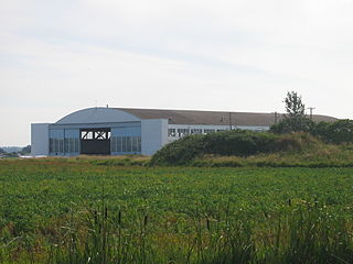
Today the site is marked by a small plaque dedicated to those who served there and the runway layout is still discernible to aircraft approaching Auckland International Airport as well as on Google Earth. Access is limited as the site is now productive farmland and private property. Such was the secrecy of this base, to this day most people in the area know very little of its existence. [4]
The Royal New Zealand Air Force is the aerial service branch of the New Zealand Defence Force. It was formed from New Zealand elements of the British Royal Air Force, becoming an independent force in 1923, although many RNZAF aircrew continued to serve in the Royal Air Force until the end of the 1940s.

An aerodrome or airdrome is a location from which aircraft flight operations take place, regardless of whether they involve air cargo, passengers, or neither, and regardless of whether it is for public or private use. Aerodromes include small general aviation airfields, large commercial airports, and military air bases.

Whenuapai is a suburb and aerodrome located in northwestern Auckland, in the North Island of New Zealand. It is located on the northwestern shore of the Waitematā Harbour, 15 kilometres to the northwest of Auckland's city centre. It is one of the landing points for the Southern Cross telecommunications Cables. The name is Māori for good land.
Canadian Forces Station Ladner is a former military airfield and communications station located beside Boundary Bay and 2.5 nautical miles east of Ladner in Delta, British Columbia, Canada, south of Vancouver and close to the U.S. border. After its closure it was reopened as Boundary Bay Airport.
RNZAF Base Ohakea is an operational base of the Royal New Zealand Air Force. Opened in 1939, it is located near Bulls, 25 km north-west of Palmerston North in the Manawatu. It is also a diversion landing point for civilian aircraft. The base's motto is Defensio per vires.

No. 25 Squadron of the Royal New Zealand Air Force was formed at Seagrove, Auckland in July 1943 with Douglas SBD Dauntless dive bombers and served in the Southern Pacific based at the Piva Airstrip on Bougainville, flying missions against Japanese forces on Bougainville and at Rabaul. It was disbanded in May 1944 and reformed as a fighter/ground attack squadron flying F4U Corsairs. It served in Santo, Guadalcanal, Los Negros and Emirau, before returning to New Zealand and being disbanded in September 1945. A SBD-4 Dauntless operated by 25 Squadron was for a time preserved in the Royal New Zealand Air Force Museum at Wigram, displayed in the condition which it was recovered after being lost with its crew while on a training mission at Espiritu Santo. One of the SBD-5 aircraft operated by 25 Squadron has been restored to flying condition in America for the "Planes of Fame" museum, in the colour scheme of an American aircraft.

Whangārei Airport is an airport 4 nautical miles to the south east of Whangārei city, in the suburb of Onerahi, on the east coast of Northland in the North Island of New Zealand. The airport has a single terminal with two gates.

Stanley Airport is located in Stanley, Hants County, Nova Scotia, Canada, approximately 12 nautical miles northeast of Windsor.

Norfolk Island Airport, also referred to as Norfolk Island International Airport, is the only airport on Norfolk Island, an external territory of Australia. The island is located in the Pacific Ocean between Australia, New Zealand, and New Caledonia. The airport is operated by the Administration of Norfolk Island, and is on the west side of the island.

Ardmore Airport is an airport 3 nautical miles (5.5 km) southeast of Manurewa in Auckland, New Zealand.

RAAF Base Townsville is a Royal Australian Air Force (RAAF) air base located in Garbutt, 2 nautical miles west of Townsville in Queensland, Australia. It is the headquarters for No. 1 Wing Australian Air Force Cadets and, along with Lavarack Barracks, establishes Townsville as a key military centre. The base's airfield is shared with the Townsville Airport.

Wigram Aerodrome is located in the Christchurch suburb of Sockburn, later to be split-suburb of Wigram and now split again as Wigram Skies. It was gifted by Sir Henry Wigram for the Canterbury (NZ) Aviation Company on 20 September 1916 and originally named Sockburn Airport. In 1923 that was then gifted to the Crown as a Royal New Zealand Air Force base. Charles Kingsford Smith made the first Trans-Tasman flight from Sydney to Wigram on 10 September 1928.

Invercargill Airport is a fully secured controlled international designated airport located 1.6 km west of the Central business district of Invercargill at the bottom of the South Island of New Zealand. It is the southernmost controlled airport in the Commonwealth. Formed on land reclaimed from the Waihopai/New River Estuary in 1938, the airport was prone to flooding, notably in 1984 when it was inoperable for two months. The Invercargill City Council considered moving the airport back to Dawson Farm, Myross Bush, the original site up to 1942. Instead, a large flood protection scheme was built, but during its construction heavy rain and an unusually high tidal surge flooded it again in 1987. There have been no problems since. The airport has a main secured terminal, a backup international secured terminal and 5 tarmac gates. Invercargill is the twelfth-busiest airport in New Zealand by passenger traffic.
Hood Aerodrome is an aerodrome, located in Masterton, New Zealand, it is located 1 NM South West of the town centre in the suburb of Solway. The aerodrome was named after George Hood, a pioneer Masterton aviator who died trying to make the first Trans-Tasman crossing in 1928. The aerodrome is used extensively for general aviation flights, and has also been used for commercial flights, Air New Zealand stopped serving the airport from 5 February 2014. Two new airlines have looked at re-instating a service to Auckland using larger aircraft but the runway will need to be lengthened to 1400m and widened to 30m first before it can start.
Gravesend Airport, located 2.5 miles (4.0 km) south-east of Gravesend town centre, Kent and 7.0 miles (11.3 km) west of Rochester. It was operated from 1932 until 1956. It was initially a civil airfield, and became a Royal Air Force station known as RAF Gravesend during the Second World War, when it was under the control of RAF Fighter Command during the Battle of Britain. It was the first RAF station to operate the North American Mustang III. The airport returned to civilian use at the conclusion of the Second World War, although it remained under the ownership of the Air Ministry until its closure in 1956. It is notable that a decision had to be made in 1954, by the Air Ministry, as to whether this civil airport should be retained and substantially enlarged, or the extensions east of Thong Lane be released for residential development. Kent County Council had made it clear that the land west of Thong Lane, was identified as a Civil Airport. Additionally, Kent County Council also informed the Air Ministry, that it would neither support nor oppose enlargement, acknowledging, however, that it would as a result of any such enlargement, the site becoming designated as a fully operational international airport.

West Auckland Airport Parakai West Auckland Airport is a general aviation (GA) airport on the North Western edge of Auckland, New Zealand. It is close to the town of Parakai and 2 nautical miles (3.8 km) northwest of Helensville at the southern end of the Kaipara Harbour. The Airport is operated by West Auckland Airport Company Ltd, under 'Airport Authority' status.

Mangere Aerodrome, named after a nearby suburb, was the original home of the Auckland Aero Club. It is now the site of Auckland Airport. Mangere Aerodrome's claim to fame was as the arrival point for New Zealand aviator, and aeroclub member, Jean Batten's solo flight from the United Kingdom in 1936. The RNZAF requisitioned the aerodrome from 1939 until 1944, renaming it RNZAF Station Mangere. In 1961, the Auckland Aero Club moved to Ardmore aerodrome and Mangere Aerodrome closed. The new Auckland Airport opened in 1965.
RNZAF Station Waipapakauri was a Royal New Zealand Air Force station located at Waipapakauri, 14 km north of Kaitaia, Northland Region, New Zealand. Originally established in 1933 as a small local aerodrome, it was commandeered as an air force base by the RNZAF at the outbreak of war in 1939.