Related Research Articles

The Royal New Zealand Air Force is the aerial service branch of the New Zealand Defence Force. It was formed initially in 1923 as a branch of the New Zealand Army, being known as the New Zealand Permanent Air Force, becoming an independent air force on 1 April 1937.

Whenuapai is a suburb and aerodrome located in northwestern Auckland, in the North Island of New Zealand. It is located on the shore of the Upper Waitematā Harbour, 15 kilometres to the northwest of Auckland's city centre. It is one of the landing points for the Southern Cross telecommunications Cables.
New Zealand National Airways Corporation, popularly known as NAC, established by the New Zealand National Airways Act, 1945, was the national domestic airline of New Zealand until 1978 when it amalgamated with New Zealand's international airline, Air New Zealand. The airline was headquartered in Wellington.

Wigram is a suburb in the southwest of Christchurch, New Zealand. The suburb lies close to the industrial estates of Sockburn and the satellite retail and residential zone of Hornby, and has undergone significant growth in recent years due to housing developments. It is seven kilometres to the west of the city centre.

Sir Timothy William Wallis was a New Zealand businessman and aviation entrepreneur. He pioneered live deer capture from helicopters, which led to a significant industry in New Zealand. He was a leader and international representative of the deer farming industry. Wallis also founded the Alpine Fighter Collection and the Warbirds over Wanaka air show.

RNZAF Base Auckland is a Royal New Zealand Air Force base located near the upper reaches of the Waitematā Harbour in Auckland, New Zealand. The base formerly comprised two separate airfields, Whenuapai and RNZAF Station Hobsonville. Hobsonville was established as a seaplane station in 1928 and was the RNZAF's primary flying boat base in New Zealand until 1967.

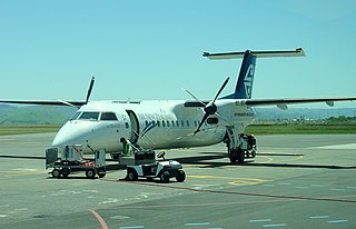
Whangārei Airport is an airport 4 nautical miles to the south east of Whangārei city, in the suburb of Onerahi, on the east coast of Northland in the North Island of New Zealand. The airport has a single terminal with two gates.

Ardmore Airport is an airport 3 nautical miles (5.5 km) southeast of Manurewa in Auckland, New Zealand.

Wigram Aerodrome is located in the Christchurch suburb of Sockburn, later to be split-suburb of Wigram and now split again as Wigram Skies. It was gifted by Sir Henry Wigram for the Canterbury (NZ) Aviation Company on 20 September 1916 and originally named Sockburn Airport. In 1923 that was then gifted to the Crown as a Royal New Zealand Air Force base. Charles Kingsford Smith made the first Trans-Tasman flight from Sydney to Wigram on 10 September 1928.

Invercargill Airport is a fully secured controlled international designated airport located 1.6 km west of the Central business district of Invercargill at the bottom of the South Island of New Zealand. It is the southernmost controlled airport in the Commonwealth. Formed on land reclaimed from the Waihopai/New River Estuary in 1938, the airport was prone to flooding, notably in 1984 when it was inoperable for two months. The Invercargill City Council considered moving the airport back to Dawson Farm, Myross Bush, the original site up to 1942. Instead, a large flood protection scheme was built, but during its construction heavy rain and an unusually high tidal surge flooded it again in 1987. There have been no problems since. The airport has a main secured terminal, a backup international secured terminal and 5 tarmac gates. Invercargill is the eleventh-busiest airport in New Zealand by passenger traffic.

Hawke's Bay Airport, commonly referred to as Napier Airport, is Hawke's Bay's main commercial airport, serving domestic flights to the main centres of Auckland, Wellington and Christchurch, and smaller centres such as Gisborne. The airport is located in the north of Napier and 20.7 km from Hastings.

Redhill Aerodrome is an operational general aviation aerodrome located 1.5 NM south-east of Redhill, Surrey, England, in green belt land.

Kapiti Coast Airport, also spelt Kāpiti Coast Airport and previously called Paraparaumu Airport, is on the Kāpiti Coast of New Zealand's North Island, between the Wellington dormitory suburbs of Paraparaumu Beach, Paraparaumu to the east, and Raumati Beach to the south. The Wharemauku Stream flows through part of the airport's land.

The de Havilland DH.94 Moth Minor was a 1930s British two-seat tourer/trainer aircraft built by de Havilland at Hatfield Aerodrome, England. With the start of the second world war production of the Moth Minor was moved to de Havilland Australia at Bankstown Aerodrome, Australia.
Hastings Aerodrome is a small airport located in Hastings, Hawke's Bay, New Zealand. It is sometimes referred to as Bridge Pa Aerodrome. It is owned and operated by the Hawke's Bay & East Coast Aero Club Inc.

The Great West Aerodrome, also known as Harmondsworth Aerodrome or Heathrow Aerodrome, was a grass airfield, operational between 1930 and 1944. It was on the southeast edge of the hamlet of Heathrow, in the parish of Harmondsworth. The Fairey Aviation Company owned and operated it, for assembly and flight testing of Fairey-manufactured aircraft. The area was to later be the site of London Heathrow Airport.

Seagrove was an airport located by Clarks Beach on the south shoreline of Manukau Harbour, New Zealand, near the small town of Waiuku.

Mangere Aerodrome, named after a nearby suburb, was the original home of the Auckland Aero Club. It is now the site of Auckland Airport. Mangere Aerodrome's claim to fame was as the arrival point for New Zealand aviator, and aeroclub member, Jean Batten's solo flight from the United Kingdom in 1936. The RNZAF requisitioned the aerodrome from 1939 until 1944, renaming it RNZAF Station Mangere. In 1961, the Auckland Aero Club moved to Ardmore aerodrome and Mangere Aerodrome closed. The new Auckland Airport opened in 1965.

Ocean Beach is an industrial area in the Southland Region of New Zealand. For around 100 years it was the site of a freezing works. This closed in 1991, and the site has been redeveloped as an aquaculture facility.
RNZAF Station Waipapakauri was a Royal New Zealand Air Force station located at Waipapakauri, 14 km north of Kaitaia, Northland Region, New Zealand. Originally established in 1933 as a small local aerodrome, it was commandeered as an air force base by the RNZAF at the outbreak of war in 1939.
References
- ↑ A Centenary of Invercargill Municipality 1976|Transport links chapter.[ full citation needed ]
- ↑ Invercargill Museum|City Council archives[ full citation needed ]
- ↑ Wartime RNZAF Stations|Wings over Cambridge[ full citation needed ]
- ↑ Southland Times Publication| 1984 Flood, & news items.[ full citation needed ]
- ↑ Invercargill Public Library|Reference Section[ full citation needed ]