Tokoroa is the fifth-largest town in the Waikato region of the North Island of New Zealand and largest settlement in the South Waikato District. Located 30 km southwest of Rotorua, close to the foot of the Mamaku Ranges, it is midway between Taupo and Hamilton on State Highway 1.
Ashburton Aerodrome is a small airport 2 NM to the east of Ashburton township on the east coast of the South Island, New Zealand. Newmans Air operated a Christchurch to Queenstown service via Ashburton in the 1980s which allowed skiers to connect to the nearby skifield of Mt. Hutt. Currently there are no scheduled services operating to Ashburton.
Balclutha Aerodrome is a small airport 0.5 Nautical Miles (1 km) southeast of Balclutha township on the east coast of the South Island, New Zealand.
Galatea Aerodrome is a small airfield located 4 Nautical miles (7.4 km) north northeast of Murupara township in the Bay of Plenty in the North Island of New Zealand.

Great Barrier Aerodrome is the major airfield on Great Barrier Island. It is a small, uncontrolled aerodrome at Claris on Great Barrier Island in the Hauraki Gulf off the North Island of New Zealand. Fuel is not available.

Greymouth Airport is a small, uncontrolled aerodrome located in the suburb of Blaketown, 1 Nautical mile (1.9 km) south of the Greymouth CBD on the West Coast of the South Island of New Zealand.

Kaikoura Airport is an uncontrolled aerodrome located 4 nautical miles southwest of Kaikoura at Peketa in the South Island of New Zealand.

Waiheke Island Aerodrome is a private airport on Waiheke Island, 17 nautical miles northeast of Auckland, New Zealand.
South Waikato District Council is the territorial authority for the South Waikato District of New Zealand.
North Shore Aerodrome, also called North Shore Airport and Dairy Flat Airfield, is a small, uncontrolled aerodrome located 2 nmi (3.7 km) south southwest of Silverdale, near Auckland in New Zealand's North Island.

The Tākaka Aerodrome serves the town of Tākaka, in the South Island of New Zealand.
The Thames Aerodrome serves the town of Thames, in the Waikato region of the North Island of New Zealand. It is 3 km south of the town of Thames. The Aerodrome is named in honour of former Thames resident Air Chief Marshal Sir Keith Park, Commander of 11 Group Fighter Command during the Battle of Britain.
Whitianga Aerodrome serves the town of Whitianga, New Zealand. The aerodrome is located 1.5 NM west of Whitianga on the eastern side of the Coromandel Peninsula in the North Island of New Zealand.

Omaka Aerodrome is a private airfield owned by the Marlborough Aero Club and used solely by private and vintage aircraft.
Te Kowhai Aerodrome is a privately owned airfield located near the township of Te Kowhai in the Waikato region of New Zealand. It was the home of the microlight aircraft manufacturer Micro Aviation NZ until the death of the company's founder, Max Clear, in 2011.
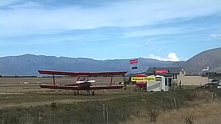
Pukaki Airport is a small airport in the Mackenzie District of the South Island of New Zealand. The airport is located about 3 km North from the township of Twizel and is 284 km from Christchurch.

Picton Aerodrome is a Non-Certificated Aerodrome 4 NM south of Picton township in the Marlborough District of the South Island in New Zealand. Sounds Air has 5 flights per day to Wellington. The Marlborough Sounds Airpark is located nearby offering 16 private hangars adjacent to the main runway with remote control access for the owners to park their aircraft. On 2 January 1986, seven people died when a Cessna aircraft crashed on takeoff near Picton. In another accident on 29 January 1996, five died when a Cessna Caravan crashed on approach to Picton.
State Highway 32 (SH 32) is a New Zealand state highway in the Central North Island. It forms part of a western traverse of Lake Taupō and a less busy alternative to SH 1, avoiding Taupō.
Mercer Airfield is an uncontrolled aerodrome 3.23 NM (6 km) northeast of Mercer Village in the Waikato region of New Zealand.
Taieri Aerodrome is an aerodrome 2.7 NM (5 km) west of Dunedin, New Zealand.
