Related Research Articles

The Waikato River is the longest river in New Zealand, running for 425 kilometres (264 mi) through the North Island. It rises on the eastern slopes of Mount Ruapehu, joining the Tongariro River system and flowing through Lake Taupō, New Zealand's largest lake. It then drains Taupō at the lake's northeastern edge, creates the Huka Falls, and flows northwest through the Waikato Plains. It empties into the Tasman Sea south of Auckland, at Port Waikato. It gives its name to the Waikato region that surrounds the Waikato Plains. The present course of the river was largely formed about 17,000 years ago. Contributing factors were climate warming, forest being reestablished in the river headwaters and the deepening, rather than widening, of the existing river channel. The channel was gradually eroded as far up river as Piarere, leaving the old Hinuera channel through the Hinuera Gap high and dry. The remains of the old course are seen clearly at Hinuera, where the cliffs mark the ancient river edges. The Waikato's main tributary is the Waipā River, which converges with it at Ngāruawāhia.
Henley is a township on New Zealand's Taieri Plains, named after the rowing centre Henley-on-Thames in England. It lies close to the confluence of the Taieri and Waipori Rivers at the eastern edge of the plain, at the foot of a low range of coastal hills. The township lies close to the ecologically significant Sinclair Wetlands, which lie 3.5 kilometres (2.2 mi) to the west.

The Piako River is a lowland river system that drains into the Firth of Thames on the North Island of New Zealand. Together with the Waihou River, it is one of the two main rivers systems which drains the Hauraki Plains. It is the dominant river system in the Matamata-Piako District, and on its journey it passes through the towns of Morrinsville and Ngatea.

The Waikato Plains form a large area of low-lying land in the northwest of the North Island of New Zealand. They are the alluvial plains of the Waikato River, the country's longest river with a length of 425 km (264 mi).

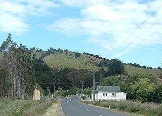
The Bombay Hills are a range of hills to the south of Auckland, New Zealand. Though only a small and seemingly insignificant range of hills, they lie at the southern boundary of the Auckland region, and serve as a divide between Auckland and the Waikato region. There is a 19th-century settlement, Bombay, on the old main road south of Auckland, the Great South Road.
Mangateparu is a farming service community located close to the west bank of the Piako River, eight kilometres north of Morrinsville in the Waikato region of New Zealand. It has a population of about 400 people. The local school was forced to close in 2004.
Horseshoe Lake is the name of four lakes in New Zealand.
The Waikato Expressway is a dual carriageway section of State Highway 1 in New Zealand's Waikato region. Constructed in stages, it forms part of the link between Auckland and Hamilton. Currently stretching from Auckland to south of Cambridge, the first section of the highway was built in 1993. Throughout its lifetime, it has undergone many upgrades to optimise traffic flow throughout the Waikato region, including various bypasses of many towns in the region, culminating with Hamilton in 2022.

The Mangatāwhiri River is a river of the Waikato region of New Zealand's North Island. It flows generally southwest from its sources in the Hunua Ranges southeast of Clevedon before flowing through a system of irrigation canals at the northern edge of the Waikato Plains close to the town of Pōkeno. It reaches the Waikato River close to the township of Mercer.

The Mathias River is a river of the Canterbury region of New Zealand's South Island. It flows from its origins in three rivers in the Southern Alps. Of these, the North Mathias River is the longest, flowing predominantly southwards from its source northeast of Mount Williams. After 18 kilometres (11 mi) its waters combine with those of the West Mathias River, which flows predominantly southwest for 13 kilometres (8 mi) from its sources 10 kilometres (6 mi) west of Mount Williams. The South Mathias River, a tributary of the West Mathias River, is a 6-kilometre (4 mi) long easterly-flowing river which meets the West Mathias 5 kilometres (3 mi) from its confluence with the North Mathias.

The Tauranga Taupō River is a river of the Hawke's Bay and Waikato Regions of New Zealand's North Island. It flows northwest from its sources at the northern end of the Kaimanawa Range to reach the eastern shore of Lake Taupō close to the settlement of Rangiita, 12 kilometres (7 mi) northeast of Tūrangi.
The Waiotaka River is a river of the Waikato Region of New Zealand's North Island. It flows northwest from its origins in the Kaimanawa Range to reach the southern shore of Lake Taupō 5 kilometres (3 mi) northeast of Tūrangi.
The Waitoa River is a major river of the Waikato Region of New Zealand's North Island. It flows initially northeast from its origins at Piarere, before veering north through the Hinuera Gap and across the Hinuera Plains to pass to the west of Matamata, Walton and Waharoa before running through the settlement of Waitoa and reaching the southern edge of the Hauraki Plains. It converges with the Piako River in the Kopuatai Peat Dome wetland, approximately 15 kilometres north of Morrinsville.
The Whangamarino River is a lowland river of the Waikato Region of New Zealand's North Island, draining the Whangamarino Wetland and associated farmland catchment. The river converges with the Waikato River just north of Meremere. The main tributary is the Maramarua River, which starts in the Hunua Ranges and forms the northern catchment of the Whangamarino River.
Lake Rotokawau is a dune lake on the Aupōuri Peninsula the Far North, New Zealand. The name is also used for lakes in the Kaipara District, Chatham Islands, in Bay of Plenty and near Lake Waikare in Waikato.
The Waingaro River is a river of the Waikato region of New Zealand's North Island. It flows generally southwest from its origins near Glen Afton and Glen Massey, west of Ngāruawāhia, to reach a northern arm of Raglan Harbour. Its main tributary is Kahuhuru Stream, which Highway 22 follows for several kilometres. Tributaries total about 170 kilometres (110 mi). At Waingaro it is fed by a hot spring.
The Mangatangi River, or Mangatangi Stream, originates on the eastern slopes of the Hunua Ranges in New Zealand and flows roughly southwards until it is joined by the Ruaotehuia Stream just north of State Highway 2 between Mangatāwhiri and Maramarua, where it becomes the Maramarua River. Mangatangi can be translated as manga tangi to stream of weeping, or as rippling stream, or babbling brook.
Te Houhou / George Sound is a fiord of the South Island of New Zealand. It is one of the fiords that form the coast of Fiordland.
Lake Rotongaro is located to the west of Ohinewai in the Waikato Region of New Zealand. It is a large shallow riverine lake, which links to the Waikato River. It is situated between the Waikato River and the larger Lake Whangape.
Motutere is a small township on the southeastern shore of Lake Taupō in New Zealand's Waikato region. It lies on Motutere Bay, close to the popular diving location, Te Poporo / Bulli Point, and approximately halfway between Taupō and Tūrangi, to both of which it is connected by SH1.
References
- ↑ Reed New Zealand atlas (2004) Auckland: Reed Publishing. Map 19. ISBN 0 7900 0952 8
- ↑ Reed, A.W. (1975). Place names of New Zealand. Wellington: A.H. & A.W. Reed. p. 327
37°57′S175°40′E / 37.95°S 175.67°E
| | This Waikato geography article is a stub. You can help Wikipedia by expanding it. |