Related Research Articles

Huntly is a town in the Waikato district and region of the North Island of New Zealand. It was on State Highway 1, 95 kilometres (59 mi) south of Auckland and 32 kilometres (20 mi) north of Hamilton. It is situated on the North Island Main Trunk (NIMT) railway and straddles the Waikato River. Huntly is within the Waikato District which is in the northern part of the Waikato region local government area.
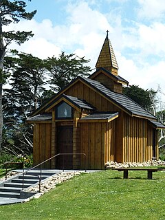
Norsewood is a small rural settlement in the Tararua District and Manawatū-Whanganui region of New Zealand's North Island. The town is situated east of the Ruahine Mountain range and is located 20 kilometres northeast of Dannevirke.
Tokoroa is the fifth-largest town in the Waikato region of the North Island of New Zealand and largest settlement in the South Waikato District. Located 30 km southwest of Rotorua, close to the foot of the Mamaku Ranges, it is midway between Taupo and Hamilton on State Highway 1.

Waikato District is a territorial authority of New Zealand, in the northern part of Waikato region, North Island. Waikato District is administered by the Waikato District Council, with headquarters in Ngāruawāhia.

Waipa District is a municipality in the Waikato region of New Zealand that is administered by the Waipa District Council. Its most populous town is Cambridge. The seat of the council is at the second most populous town, Te Awamutu. The district is south and south-east of the city of Hamilton. It has five wards: Te Awamutu, Cambridge, Pirongia, Maungatautari and Kakepuku.

Putāruru is a small town in the South Waikato District and the Waikato region of New Zealand's North Island. It lies on the western side of the Mamaku Ranges and in the upper basin of the Waihou River. It is on the Oraka Stream 65 kilometres south-east of Hamilton. State Highway 1 and the Kinleith Branch railway run through the town.
Waharoa is a rural community in the Waikato region of New Zealand's North Island. It is located 7 km north of Matamata, and is part of the Matamata-Piako District. It is located at the junction of the Kinleith Branch railway and the East Coast Main Trunk Railway. State Highway 27 runs through the town, which is serviced by several shops and cafes and by a petrol station. Matamata Airport is just over 3 km (1.9 mi) north of Waharoa.

Mangatainoka is a small settlement in the Tararua District of New Zealand's North Island. It is located on the banks of the Mangatainoka River, 5 km (3.1 mi) north of Pahiatua.
Ascot Park is a suburb of Porirua City approximately 22 kilometres (14 mi) north of Wellington in New Zealand.

Aotea is a suburb of Porirua.
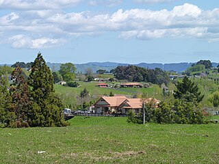
Rotokauri is a semi-rural suburb split between western Hamilton and Waikato District in New Zealand. It is one of the future urban zones of Hamilton, along with Peacocke. The northeastern parts of Rotokauri, within Hamilton, are sometimes called Burbush and Baverstock. Part of Rotokauri was taken into Hamilton with the 10th city extension in November 1989. Until then it had been in the Waipa County Council area.
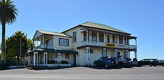
Rangiriri is a rural community in the Waikato District and Waikato region of New Zealand's North Island. It is located on the Waikato River near Lake Waikare in the Waikato District. State Highway 1 now bypasses Rangiriri.
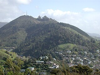
Bishopdale is one of the suburbs of Nelson, New Zealand.

Stepneyville is a suburb of Nelson, New Zealand.

Maitai is an inner suburb of Nelson, New Zealand. It lies at the western edge of Nelson city centre, immediately to the south of The Wood, on the northern bank of the Maitai River. A monument representing the location of the geographic centre of New Zealand is located in Maitai.
Enner Glynn is a suburb of Nelson, New Zealand. It lies to the south of Nelson city centre and east of Stoke, inland from Wakatu.
Nayland is a suburb of Stoke, New Zealand. It lies to the north of Stoke, close to Nelson Airport, southwest of Nelson city centre.
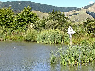
Saxton is a suburb of Nelson, New Zealand, south of Stoke and northwest of Richmond.

Kopu is a settlement in on the Coromandel Peninsula in New Zealand's North Island. It is located near Thames, in the Thames-Coromandel District in the Waikato region.

Kauaeranga Valley is a valley created by the Kauaeranga River, which flows from the Coromandel Range southwest to the Firth of Thames at Thames, New Zealand in the North Island. It contains the settlement of Kauaeranga on the Coromandel Peninsula. It is located near Thames, in the Thames-Coromandel District in the Waikato region. It covers a land area of 180.51 km2.
References
- ↑ "Statistical Area 2 2018 (generalised) GIS" (Data table). stats.govt.nz. Statistics New Zealand.
- 1 2 3 4 5 "Place Summary - Kinleith". Stats NZ. Statistics New Zealand.
- ↑ "Provisional Statistics". stats.govt.nz. Statistics New Zealand.