Related Research Articles

Auckland Airport is an international airport serving Auckland, the most populous city of New Zealand. It is the largest and busiest airport in the country, with over 16 million passengers served in the year ended August 2023. The airport is located near Māngere, a residential suburb, and Airport Oaks, a service-hub suburb 21 kilometres (13 mi) south of the Auckland city centre. It serves as the principal hub for Air New Zealand, and the New Zealand operating base for Jetstar.
City of Colorado Springs Municipal Airport, simply known as Colorado Springs Airport, is a city-owned public civil-military airport 6 miles (9.7 km) southeast of downtown Colorado Springs, in El Paso County, Colorado, United States. It is the second busiest commercial service airport in the state after Denver International Airport. Peterson Space Force Base, which is located on the north side of runway 13/31, is a tenant of the airport.

Kaiapoi is a town in the Waimakariri District of the Canterbury region, in the South Island of New Zealand. The town is located approximately 17 kilometres north of central Christchurch, close to the mouth of the Waimakariri River. It is considered a satellite town of Christchurch and is part of the Christchurch functional urban area. The town is named after the nearby Kaiapoi Pā.

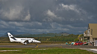
Rangiora is the largest town and seat of the Waimakariri District, in Canterbury, New Zealand. It is 29 kilometres (18 mi) north of Christchurch, and is part of the Christchurch metropolitan area. With an estimated population of 19,600, Rangiora is the 30th largest urban area in New Zealand, and the fifth-largest in the Canterbury region.

Oxford is a small town serving the farming community of North Canterbury, New Zealand. It is part of the Waimakariri District and is a linear town, approximately 2 kilometres (1.2 mi) long. Oxford has won awards for the most beautiful village and the most beautiful toilet.
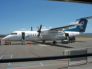
Wellington International Airport is an international airport located in the suburb of Rongotai in Wellington. It lies 3 NM or 5.5 km south-east from the city centre. It is a hub for Air New Zealand and Sounds Air. Wellington International Airport Limited, a joint venture between Infratil and the Wellington City Council, operates the airport. Wellington is the third busiest airport in New Zealand after Auckland and Christchurch, handling a total of 3,455,858 passengers in the year ending June 2022, and the third busiest in terms of aircraft movements. The airport, in addition to linking many New Zealand destinations with national and regional carriers, also has links to major cities in eastern Australia. It is the home of some smaller general aviation businesses, including the Wellington Aero Club, which operates from the general aviation area on the western side of the runway.

Waimakariri District is a local government district, located in the Canterbury Region of New Zealand's South Island. It is named after the Waimakariri River, which forms the district's southern boundary, separating it from Christchurch City and the Selwyn District. It is bounded in the north by the Hurunui District and in the east by the Pacific Ocean.
Palmerston North Airport, originally called Milson Aerodrome, is an airport in the Manawatū-Whanganui region of New Zealand, serving Palmerston North City and the Central North Island regions. It is located in the suburb of Milson, on the outskirts of Palmerston North, New Zealand, approximately 5.5 km (3.4ml) NE from the central business district of Palmerston North City. The airport is 100% owned by the Palmerston North City Council and covers an area of 208ha. The airport is New Zealand's 8th busiest and handled a total of 515,727 passengers in the 2016 financial year. The airport handles around 30 commercial passenger flights per day to and from Auckland, Christchurch, Hamilton, Napier, Nelson as well as cargo flights on week nights between Auckland and Christchurch.

Norfolk Island Airport, also referred to as Norfolk Island International Airport, is the only airport on Norfolk Island, an external territory of Australia. The island is located in the Pacific Ocean between Australia, New Zealand, and New Caledonia. The airport is operated by the Norfolk Island Regional Council, and is on the west side of the island.

Ardmore Airport is an airport 3 nautical miles (5.5 km) southeast of Manurewa in Auckland, New Zealand.

Great Barrier Aerodrome is the major airfield on Great Barrier Island. It is a small, non-towered aerodrome at Claris on Great Barrier Island in the Hauraki Gulf off the North Island of New Zealand. Fuel is not available.

New Plymouth Airport serves the city of New Plymouth, and the surrounding region of Taranaki. It is located on the west coast of New Zealand's North Island and is 11 km from the city centre, on State Highway 3 north to Auckland, and 4 km from the outer suburb/satellite town of Bell Block.
Hokitika Aerodrome is a small, uncontrolled aerodrome located 1.9 km north east of Hokitika in the suburb of Seaview on the West Coast of the South Island of New Zealand. It is also the closest domestic airport with scheduled flights to the town of Greymouth 40 km further north, the largest settlement on the coast.
Kaitaia Airport is an airport located 5km Northeast of Kaitaia, in the Far North District of New Zealand. The land the airport is situated on is owned by Crown and leased to the Far North District Council (FNDC), who contracts Far North Holdings Limited (FNHL) to manage the aerodrome.

Oamaru Airport is an airport located 20 km north of Oamaru alongside State Highway 1, at Hilderthorpe in the North Otago region and the Waitaki District of New Zealand.
Kerikeri Airport, also known as Bay of Islands Airport, is an airport at Kerikeri, New Zealand. It is a ten-minute drive from Kerikeri and a 50-minute flight to and from Auckland Airport.
Rotorua Airport is an airport in Rotorua, New Zealand. It is located on Te Ngae Road (SH30) in the suburb of Rotokawa, approximately 6 km north east of Rotorua CBD. The terminal consists of a two-storey building with six tarmac gates and is home to a cafe, book store and conference room. There are general aviation hangars located to both the north and the south of the main terminal, as well as an avgas pump at the southern end of the apron. The airport's main runway (18R/36L) is 2114m long and is sealed with asphalt. There is also a shorter grass runway (18L/36R) which runs parallel to the main runway, although the proximity of the two runways means that they can't be used simultaneously.
Hood Aerodrome is an aerodrome, located in Masterton, New Zealand, it is located 1 NM South West of the town centre in the suburb of Solway. The aerodrome was named after George Hood, a pioneer Masterton aviator who died trying to make the first Trans-Tasman crossing in 1928. The aerodrome is used extensively for general aviation flights, and has also been used for commercial flights, Air New Zealand stopped serving the airport from 5 February 2014. Two new airlines have looked at re-instating a service to Auckland using larger aircraft but the runway will need to be lengthened to 1400m and widened to 30m first before it can start.
Kempsey Airport is a small airport located in Aldavilla 4 nautical miles west of Kempsey, New South Wales, Australia. The airport is operated by Kempsey Shire Council and is mainly used for general aviation activities, including flight training, skydiving and emergency services uses. There are currently no scheduled passenger services to Kempsey.
Okiwi Airfield, also called Okiwi Station Airfield, is a small airfield located near the village of Ōkiwi on Great Barrier Island, New Zealand. It has a single bitumen runway, and a small terminal in the form of a wooden hut. The airfield is owned by Auckland Council and is used for general aviation.
References
- 1 2 "Rangiora Airport and Airfield". rangiora.com. Retrieved 26 January 2024.
- ↑ Council, Waimakariri District (3 August 2023). "Airfield". Waimakariri District Council. Retrieved 26 January 2024.