Related Research Articles

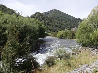
Te Kauparenui / Gowan River is in the South Island of New Zealand. Its source is at Lake Rotoroa and travels 11 kilometres before feeding into the Buller River. Mixed farming and forestry occurs on both banks of the river. The river has introduced trout which attracts recreational fishing.

The Canterbury Plains are an area in New Zealand centred in the Mid Canterbury, to the south of the city of Christchurch in the Canterbury region. Their northern extremes are at the foot of the Hundalee Hills in the Hurunui District, and in the south they merge into the plains of North Otago beyond the Waitaki River. The smaller Amuri Plain forms a northern extension of the plains.

The Waimakariri River is one of the largest rivers in Canterbury, on the eastern coast of New Zealand's South Island. It flows for 151 kilometres (94 mi) in a generally southeastward direction from the Southern Alps across the Canterbury Plains to the Pacific Ocean.

The Kaiapoi River is a minor river of north Canterbury, in New Zealand's South Island. Originally called the Cam River, it is a tributary of the Waimakariri River, which it joins at the larger river's estuary. The river is 16 kilometres (10 mi) long, and its drainage area is about 430 square kilometres (170 sq mi).

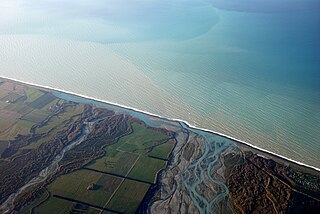
The Rakaia River is in the Canterbury Plains in New Zealand's South Island. The Rakaia River is one of the largest braided rivers in New Zealand. The Rakaia River has a mean flow of 203 cubic metres per second (7,200 cu ft/s) and a mean annual seven-day low flow of 87 m3/s (3,100 cu ft/s). In the 1850s, European settlers named it the Cholmondeley River, but this name lapsed into disuse. The name Rakaia comes from Māori "Ō Rakaia", meaning the place where people were arranged by ranks.
Lilburne is a surname. Notable people with the surname include:
The Garry River is a river in the Canterbury region of New Zealand. It arises in the Mount Thomas Forest near Mount Thomas and flows south-east into Ashley River / Rakahuri. Blowhard Stream is a tributary.

The Glentui River is a river in the Canterbury region of New Zealand. It arises on the slopes of Mount Richardson and flows south-east through the locality of Glentui and into Ashley River / Rakahuri, which exits in the Pacific Ocean. The river was earlier called Tui Creek, and the locality named from the station Glentui established by H.C.H. Knowles in 1854.
The Hawkins River is a river in New Zealand. A major tributary of Canterbury's Selwyn River, it flows generally southeast from its source to the southwest of Springfield, reaching the Selwyn 10 kilometres (6 mi) west of Burnham.
The Hororata River is a river of Canterbury, in the South Island of New Zealand. A tributary of the Selwyn River, the Hororata has its sources in rough hill country north of Windwhistle, and flows east through the township of Hororata before reaching the Selwyn 12 kilometres (7 mi) northwest of Dunsandel.
The Irwell River, New Zealand is a river of the Canterbury Plains, in New Zealand's South Island. A short river, it rises to the southeast of Dunsandel, flowing southeast to enter the broad, shallow Lake Ellesmere / Te Waihora.
The Karetu River is a river of New Zealand's eastern South Island. It flows south from the slopes of Mount Karetu before its outflow into the Okuku River at the edge of the Canterbury Plains 40 kilometres (25 mi) northwest of Christchurch.

The L II River is a small spring-fed river in Canterbury, New Zealand. It rises near Lincoln and flows through very flat farmland, mostly fed by land drainage ditches before emptying into Lake Ellesmere / Te Waihora just east of the mouth of the Selwyn River / Waikirikiri.
The Makerikeri River is a river of the north Canterbury region of New Zealand's South Island. It flows south from its headwaters 15 kilometres (9 mi) west of Amberley, reaching the Ashley River / Rakahuri close to Rangiora.

The Okuku River is a river of the north Canterbury region of New Zealand's South Island. It flows predominantly south from several sources in and close to the eastern edge of the Puketeraki Range west of Waikari, flowing through a steep gorge in the Okuku Range before flowing into the Ashley River / Rakahuri 20 kilometres (12 mi) east of Oxford.
The Okuti River is a river of Banks Peninsula, in the Canterbury region of New Zealand's South Island. It flows west to meet the Okana River. The combined waters form the Takiritawai River, a short stream which flows into the eastern end of Lake Forsyth 2 kilometres (1.2 mi) south of the settlement of Little River.
The Takiritawai River is a river of the Canterbury region of New Zealand's South Island. A short river of approximately 1.5 kilometres (0.93 mi), it flows from the confluence of the Okana and Okuti Rivers to feed the top of Lake Forsyth, at the southwest of Banks Peninsula.
The Eyre River is a river in the Canterbury region of New Zealand. It arises in the Puketeraki Range and flows south-east into the Waimakariri River near Christchurch International Airport. The connection with the Waimakariri is via a diversion channel running south-west, replacing the Eyre's original easterly flow. The river is named after Edward John Eyre, the Lieutenant-Governor of New Munster from 1848 to 1853.

St Saviour's at Holy Trinity is an Anglican church in Lyttelton, Christchurch, New Zealand. St Saviour's Chapel was relocated from West Lyttelton to Christchurch's Cathedral Grammar School in the 1970s. Following the earthquakes and the demolition of Holy Trinity Church, Lyttelton, St Saviour's was returned to Lyttelton to the site of Holy Trinity in 2013.

The Canterbury District Health Board was a district health board with the focus on providing healthcare to the Canterbury region of New Zealand, north of the Rangitata River. It was responsible for roughly 579,000 residents, or 12% of New Zealand's population. The Canterbury District Health Board covered a territory of 26,881 square kilometers and was divided between six territorial local authorities. In July 2022, the Canterbury DHB was merged into the national health service Te Whatu Ora.
References
- ↑ "Place name detail: Lilburne River". New Zealand Gazetteer. New Zealand Geographic Board . Retrieved 17 March 2018.
- ↑ http://www.linz.govt.nz/placenames/consultation-decisions/decisions-archive/20030626/26jun2003.pdf%5B%5D
43°04′33″S172°10′22″E / 43.075937°S 172.172695°E