The South Island is the largest of the three major islands of New Zealand in surface area, the other being the smaller but more populous North Island and sparsely populated Stewart Island. It is bordered to the north by Cook Strait, to the west by the Tasman Sea, to the south by the Foveaux Strait and Southern Ocean, and to the east by the Pacific Ocean. The South Island covers 150,437 square kilometres (58,084 sq mi), making it the world's 12th-largest island, constituting 56% of New Zealand's land area. At low altitudes, it has an oceanic climate.
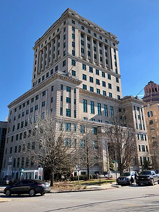
Buncombe County is a county located in the U.S. state of North Carolina. It is classified within Western North Carolina. The 2020 census reported the population was 269,452, making it the 7th-most populous county in North Carolina. Its county seat is Asheville. Buncombe County is part of the Asheville, NC Metropolitan Statistical Area.
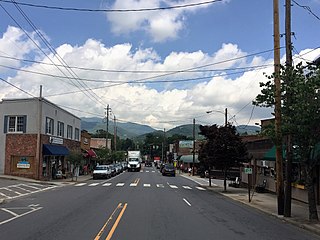
Black Mountain is a town in Buncombe County, North Carolina, United States. The population was 8,426 at the 2020 United States census. It is part of the Asheville Metropolitan Statistical Area. The town is named for the old train stop at the Black Mountain Depot and is located at the southern end of the Black Mountain range of the Blue Ridge Mountains in the Southern Appalachians.
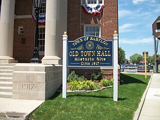
The Town of Babylon is one of ten towns in Suffolk County, New York, United States. Its population was 218,223 as of the 2020 census. Parts of Jones Beach Island, Captree Island and Fire Island are in the southernmost part of the town. It borders Nassau County to the west and the Atlantic Ocean to the south. At its westernmost point, it is about 20 miles (32 km) from New York City at the Queens border, and about 30 miles (48 km) from Manhattan. The village of Babylon is also within the town.

Kaiapoi is a town in the Waimakariri District of the Canterbury region, in the South Island of New Zealand. The town is located approximately 17 kilometres north of central Christchurch, close to the mouth of the Waimakariri River. It is considered a satellite town of Christchurch and is part of the Christchurch functional urban area. The town is named after the nearby Kaiapoi Pā.

Rangiora is the largest town and seat of the Waimakariri District, in Canterbury, New Zealand. It is 29 kilometres (18 mi) north of Christchurch, and is part of the Christchurch metropolitan area. With an estimated population of 19,600, Rangiora is the 30th largest urban area in New Zealand, and the fifth-largest in the Canterbury region.

The Swannanoa River flows through the Swannanoa Valley of the region of Western North Carolina, and is a major tributary to the French Broad River. Its headwaters arise in Black Mountain, North Carolina; however, it also has a major tributary near its headwaters: Flat Creek, which begins on the slopes of Mount Mitchell. The Swannanoa River ends at its confluence with the French Broad, now within the grounds of the 8,000-acre Biltmore Estate in Asheville.

Oxford is a small town serving the farming community of North Canterbury, New Zealand. It is part of the Waimakariri District and is a linear town, approximately 2 kilometres (1.2 mi) long. Oxford has won awards for the most beautiful village and the most beautiful toilet.

Waimakariri District is a local government district, located in the Canterbury Region of New Zealand's South Island. It is named after the Waimakariri River, which forms the district's southern boundary, separating it from Christchurch City and the Selwyn District. It is bounded in the north by the Hurunui District and in the east by the Pacific Ocean.

Lake Swannanoa is a residential lake community located within Jefferson Township, in Morris County, in the U.S. state of New Jersey. It is within the scenic Skylands Region and approximately 38 miles (61 km) by road from New York City.
The Eyreton Branch was a branch line railway that formed part of New Zealand's national rail network. Located in the Canterbury region of the South Island, it left the Main North Line in Kaiapoi and was built a mere ten kilometres south of the Oxford Branch. It opened in 1875 and operated until 1954, except for the first portion, which remained open until 1965.

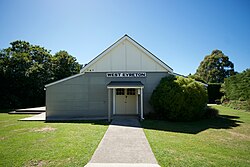
West Eyreton is a small rural village in the Canterbury region of New Zealand's South Island. It is west of Kaiapoi and north-west of Eyreton and is named after Edward John Eyre, a 19th-century lieutenant governor of the South Island, then known as New Munster. In the 2001 New Zealand census the population was 1,146, an increase of 306 or 36.4% since the 1996 census.

The Oxford Branch was a branch line railway that formed part of New Zealand's national rail network. It was located in the Canterbury region of the South Island, and ran roughly parallel with the Eyreton Branch that was located some ten kilometres south. It opened to Oxford in 1875 and survived until 1959.
The Canterbury Interior Main Line was a proposed railway line that would have linked many of the branch lines in the Canterbury region of New Zealand's South Island. Although it was never built in full, its most northerly portion was constructed.

The Main North Line, sometimes referred to as part of the South Island Main Trunk railway, is a railway line that runs north from Christchurch in New Zealand up the east coast of the South Island through Kaikōura and Blenheim to Picton. It is a major link in New Zealand's national rail network and offers a connection with roll-on roll-off ferries from Picton to Wellington. It was also the longest railway construction project in New Zealand's history, with the first stages built in the 1870s and not completed until 1945.
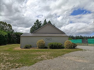
Swannanoa is a small village in Canterbury, New Zealand. It is located 35 kilometres northwest of the largest city in the South Island, Christchurch. The area has an estimated population of 1,040 with 280 pupils enrolled in the primary school. The population is slowly increasing due to new subdivisions being developed there and in neighbouring Mandeville North.
John Miles Verrall, also known as John Miles Verrell, was a 19th-century Member of Parliament in Canterbury, New Zealand. In his later years, he was known throughout the country as an advocate for a state bank.

Kaiapoi High School is a state co-educational secondary school located in Kaiapoi, in the Waimakariri District of New Zealand's South Island. The school serves 1,080 students from Years 9 to 13 as of February 2024.