Spencerville, New Zealand

Last updated

Spencerville
2010-09-06 - Spencerville.jpg
Spencerville and the Styx River
Spencerville, New Zealand
Coordinates: 43°25′55″S172°41′50″E / 43.432042°S 172.697250°E / -43.432042; 172.697250
Country New Zealand
Region Canterbury
Territorial authority Christchurch City
WardCoastal
CommunityWaitai Coastal-Burwood-Linwood
Electorates
Government
  Territorial Authority Christchurch City Council
  Regional council Environment Canterbury
   Mayor of Christchurch Phil Mauger
   Christchurch East MP Reuben Davidson
   Te Tai Tonga MP Tākuta Ferris
Area
  Total0.37 km2 (0.14 sq mi)
Population
 (June 2023) [1]
  Total570
  Density1,500/km2 (4,000/sq mi)

Spencerville is a semi-rural town on the east coast of Canterbury, New Zealand north of Christchurch. [2] The town backs on to Bottle Lake Forest and includes a large (1 hectare) park and 80 hectare camping ground. [2] These amenities, as well as wetlands and an animal and bird park make the town a popular camping area for Christchurch residents. [3] [4]

Contents

After the 2011 Christchurch earthquake, the New Zealand Government classified Spencerville land as Technical Category T3. [5] This requires repairers, builders and developers to meet stricter building standards. [5]

Demographics

Spencerville is defined by Statistics New Zealand as a rural settlement. It covers 0.37 km2 (0.14 sq mi) [6] and had an estimated population of 570 as of June 2023, [1] with a population density of 324 people per km2. It is part of the larger Brooklands-Spencerville statistical area.

Historical population
YearPop.±% p.a.
2006576    
2013507−1.81%
2018513+0.24%
Source: [7]

Before the 2023 census, the settlement had a smaller boundary, covering 0.34 km2 (0.13 sq mi). [6] Using that boundary, Spencerville had a population of 513 at the 2018 New Zealand census, an increase of 6 people (1.2%) since the 2013 census, and a decrease of 63 people (−10.9%) since the 2006 census. There were 165 households, comprising 264 males and 255 females, giving a sex ratio of 1.04 males per female, with 111 people (21.6%) aged under 15 years, 108 (21.1%) aged 15 to 29, 249 (48.5%) aged 30 to 64, and 45 (8.8%) aged 65 or older.

Ethnicities were 91.2% European/Pākehā, 13.5% Māori, 4.1% Pasifika, 4.1% Asian, and 2.9% other ethnicities. People may identify with more than one ethnicity.

Although some people chose not to answer the census's question about religious affiliation, 56.7% had no religion, 34.5% were Christian, 0.6% were Hindu, 0.6% were Buddhist and 2.3% had other religions.

Of those at least 15 years old, 90 (22.4%) people had a bachelor's or higher degree, and 60 (14.9%) people had no formal qualifications. 69 people (17.2%) earned over $70,000 compared to 17.2% nationally. The employment status of those at least 15 was that 213 (53.0%) people were employed full-time, 87 (21.6%) were part-time, and 15 (3.7%) were unemployed. [7]

Brooklands-Spencerville statistical area

Brooklands-Spencerville statistical area, which also includes Brooklands, covers 7.25 km2 (2.80 sq mi). [6] It had an estimated population of 760 as of June 2023, [8] with a population density of 105 people per km2.

Historical population for Brooklands-Spencerville
YearPop.±% p.a.
20061,746    
20131,134−5.98%
2018735−8.31%
Source: [9]
Damage to bridge on Spencerville Road crossing the Lower Styx river after the 2010 Canterbury earthquake Earthquake damage - bridge over Styx River.jpg
Damage to bridge on Spencerville Road crossing the Lower Styx river after the 2010 Canterbury earthquake

Brooklands-Spencerville had a population of 735 at the 2018 New Zealand census, a decrease of 399 people (−35.2%) since the 2013 census, and a decrease of 1,011 people (−57.9%) since the 2006 census. There were 240 households, comprising 372 males and 366 females, giving a sex ratio of 1.02 males per female. The median age was 39.7 years (compared with 37.4 years nationally), with 144 people (19.6%) aged under 15 years, 156 (21.2%) aged 15 to 29, 369 (50.2%) aged 30 to 64, and 66 (9.0%) aged 65 or older.

Ethnicities were 89.4% European/Pākehā, 11.8% Māori, 2.9% Pasifika, 5.3% Asian, and 2.4% other ethnicities. People may identify with more than one ethnicity.

The percentage of people born overseas was 19.6, compared with 27.1% nationally.

Although some people chose not to answer the census's question about religious affiliation, 55.9% had no religion, 32.2% were Christian, 0.4% were Hindu, 0.4% were Buddhist and 1.6% had other religions.

Of those at least 15 years old, 111 (18.8%) people had a bachelor's or higher degree, and 99 (16.8%) people had no formal qualifications. The median income was $36,000, compared with $31,800 nationally. 96 people (16.2%) earned over $70,000 compared to 17.2% nationally. The employment status of those at least 15 was that 315 (53.3%) people were employed full-time, 129 (21.8%) were part-time, and 18 (3.0%) were unemployed. [9]

Related Research Articles

<span class="mw-page-title-main">Kingston, New Zealand</span> Rural settlement in Otago, New Zealand

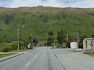
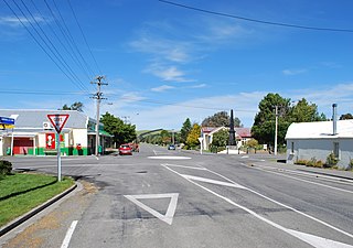
Kingston is a small town at the southernmost end of Lake Wakatipu, just north of the border of Otago and Southland, in New Zealand's South Island. It is 47 kilometres south of Queenstown by a road, "The Devil's Staircase", which winds between the lake to the west and The Remarkables mountains to the east. It is 70 kilometres north of Lumsden, and close to the headwaters of the Mataura River.

<span class="mw-page-title-main">Rakaia</span> Town in Canterbury, New Zealand

Rakaia is a town sited on the southern banks of the Rakaia River on the Canterbury Plains in New Zealand's South Island, approximately 57 km south of Christchurch on State Highway 1 and the Main South Line. Immediately north of the township are New Zealand's longest road bridge and longest rail bridge, both of which cross the wide shingle beds of the braided river at this point. Both bridges are approximately 1,750 metres (5,740 ft) in length.

<span class="mw-page-title-main">Leithfield</span> Town in Canterbury, New Zealand

Leithfield is a small town in north Canterbury, New Zealand. It is on State Highway 1, 5 kilometres (3.1 mi) south of Amberley and 42 kilometres (26 mi) north of Christchurch and 11.8 kilometres north of Waikuku. The Leithfield area consists of two semi-distinct areas, Leithfield Beach to the east of State Highway 1 and Leithfield Village adjacent to and immediately to the west of State Highway 1. Leithfield sits just south of the South Branch of the Kowai River.

<span class="mw-page-title-main">Dobson, New Zealand</span> Town in the South Island of New Zealand

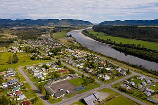
Dobson is a small town on the banks of the Grey River in the South Island of New Zealand. It is 10 kilometres (6 mi) east from the river's mouth at Greymouth. The settlement of Taylorville is across the river from Dobson, but no bridge directly connects the two. State Highway 7 passes through Dobson.

<span class="mw-page-title-main">Hurunui District</span> Territorial authority district in Canterbury, New Zealand

Hurunui District is a territorial local government district within the Canterbury Region on the east coast of New Zealand's South Island, north of Christchurch. It stretches from the east coast to the Main Divide. Its land area is 8,640.96 square kilometres (3,336.29 sq mi).

<span class="mw-page-title-main">Southbridge, New Zealand</span> Town in Canterbury, New Zealand

Southbridge is a small town on the Canterbury Plains in the South Island of New Zealand. It is located 45 kilometres (28 mi) southwest of Christchurch, between Leeston, Dunsandel and the Rakaia River.

<span class="mw-page-title-main">Purau</span> Settlement in Canterbury, New Zealand

Purau is a small town in Canterbury, New Zealand, facing Lyttelton Harbour.

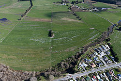
Doyleston is a minor Canterbury town in the South Island of New Zealand. It was named after Joseph Hastings Doyle, a publican from Christchurch who moved to the locality. Doyleston promised to be one of the main townships in the Ellesmere area, but before long Leeston overtook it and some businesses moved there. Doyleston had a school for many years, but it consolidated with Leeston School in the late 1930s.

<span class="mw-page-title-main">Springston</span> Rural settlement in Canterbury, New Zealand

Springston is a small rural Canterbury town in the South Island of New Zealand

<span class="mw-page-title-main">Kirwee</span> Settlement in Canterbury, New Zealand

Kirwee is a town located west of Christchurch in the Canterbury region of New Zealand's South Island. It was named after Karwi in India by retired British Army colonel De Renzie Brett. Kirwee is also home to the South Island Agricultural Field Days, held biennially.

<span class="mw-page-title-main">Waddington, New Zealand</span> Settlement in Canterbury, New Zealand

Waddington is a small village located in the Selwyn District of the Canterbury region of New Zealand's South Island, near the Waimakariri Gorge.

<span class="mw-page-title-main">Hawarden, New Zealand</span> Town in Canterbury, New Zealand

Hawarden is a small town in the Canterbury region of New Zealand's South Island. It is located near Waikari, just off State Highway 7.

<span class="mw-page-title-main">Dunsandel</span> Town in Canterbury, New Zealand

Dunsandel is a small rural town in the Canterbury region of the South Island, New Zealand. The town is located on the Canterbury Plains just south of the Selwyn River / Waikirikiri and about 40 km south of Christchurch. Dunsandel is a junction town on SH1, halfway between Christchurch and Ashburton, with roads leading to Leeston, Southbridge and Hororata. The town provides an important refreshment stop for main road travellers with eateries and coffee shops, as well as acting as a support town for the rural hinterland.

<span class="mw-page-title-main">Waikuku</span> Town in Canterbury, New Zealand

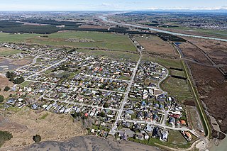
Waikuku is a small town in the Canterbury region of New Zealand, which sits 28 km north of central Christchurch. Waikuku lies 11.8 km (7.3 mi) south of Leithfield on state highway 1 and 3 km (1.9 mi) north of Woodend. In 1901 there were 86 people resident in Waikuku according to that year's census. Waikuku settlement had a population of 156 people at the time of the 2018 Census. It is popular with both those that commute into work in Christchurch each day and with owners of holiday houses. Waikuku was home to rope and twine works. This business started off using flax from local swamps. It closed in 1987. The nearby sandy beach and pine forests are popular with surfers, swimmers, campers and horse-riders, and the large estuary of the Ashley River hosts many species of birds.

<span class="mw-page-title-main">Prebbleton</span> Minor urban area in Canterbury, New Zealand

Prebbleton is a small town in the Selwyn District in the Canterbury Region of New Zealand. It is 11 km southwest of the centre of Christchurch and about 2 km south of the outlying industrial suburb of Hornby.

Stirling is a settlement in New Zealand. It is located in South Otago, approximately 5 km from Balclutha, and just north of the Matau Branch of the Clutha River.

<span class="mw-page-title-main">Timaru District</span> Territorial authority district in South Island, New Zealand

Timaru District is a local government district on New Zealand's South Island, administered by the Timaru District Council. It is part of the larger Canterbury Region. Timaru district was formed in 1989 from the amalgamation of Timaru City, Geraldine district, Temuka district and Stratham district.

<span class="mw-page-title-main">Brooklands, Christchurch</span> Suburb of Christchurch, New Zealand

Brooklands is the northernmost suburb of Christchurch, New Zealand. The settlement was built on former swamp land adjacent to Brooklands Lagoon, which forms part of the Waimakariri River mouth. The land damage sustained in the 2010 and 2011 Christchurch earthquakes and subsequent Red Zone classification resulted in the buyout and demolition of nearly all properties in Brooklands, effectively wiping the suburb off the map.

<span class="mw-page-title-main">Tai Tapu</span> Place in South Island, New Zealand

Tai Tapu, previously known as Taitapu, is a small town adjacent to the Halswell River and nestled in the Port Hills, located 6 km east of the town of Lincoln and 18 km south west of Christchurch in the Canterbury region of New Zealand's South Island. State Highway 75 passes through the centre of the village, connecting Christchurch with Akaroa and the Banks Peninsula.

<span class="mw-page-title-main">Sefton, New Zealand</span> Town in Canterbury, New Zealand

Sefton is a small town in the Waimakariri District, New Zealand, about 23 miles from Christchurch.

References

  1. 1 2 "Subnational population estimates (RC, SA2), by age and sex, at 30 June 1996-2023 (2023 boundaries)". Statistics New Zealand . Retrieved 25 October 2023. (regional councils); "Subnational population estimates (TA, SA2), by age and sex, at 30 June 1996-2023 (2023 boundaries)". Statistics New Zealand . Retrieved 25 October 2023. (territorial authorities); "Subnational population estimates (urban rural), by age and sex, at 30 June 1996-2023 (2023 boundaries)". Statistics New Zealand . Retrieved 25 October 2023. (urban areas)
  2. 1 2 "Community profile – Styx" (PDF). Christchurch City Council. November 2014. Retrieved 19 January 2021.
  3. "Spencer Park and Brooklands Lagoon" (PDF). Christchurch City Council. 2016. Retrieved 19 January 2021.
  4. Wright, Michael (5 January 2012). "Holidaymakers brush off quake fears". Stuff. Retrieved 19 January 2021.
  5. 1 2 Wright, Michael (9 April 2012). "Council turns down red-zone land deal". Stuff. Retrieved 19 January 2021.
  6. 1 2 3 "ArcGIS Web Application". statsnz.maps.arcgis.com. Retrieved 6 September 2021.
  7. 1 2 "Statistical area 1 dataset for 2018 Census". Statistics New Zealand. March 2020. 7024286, 7024287 and 7024288.
  8. "Population estimate tables - NZ.Stat". Statistics New Zealand . Retrieved 25 October 2023.
  9. 1 2 "Statistical area 1 dataset for 2018 Census". Statistics New Zealand. March 2020. Brooklands-Spencerville (317100). 2018 Census place summary: Brooklands-Spencerville