Waimairi Beach

Last updated

Waimairi Beach
Waimairi Surf Life Saving Club, Christchurch, New Zealand.jpg
Waimairi Surf Life Saving Club
Waimairi Beach
Coordinates: 43°28′55″S172°43′08″E / 43.482°S 172.719°E / -43.482; 172.719
CountryNew Zealand
City Christchurch
Local authority Christchurch City Council
Electoral wardCoastal
Area
[1]
  Land58 ha (143 acres)
Population
 (June 2022) [2]
  Total1,300
Bottle Lake Spencerville
Parklands
Pfeil oben.svg
Pfeil links.svgWaimairi BeachPfeil rechts.svg
Pfeil unten.svg
(Pegasus Bay)
North New Brighton

Waimairi Beach is a suburb of Christchurch, New Zealand. It is located north-east of the city. It is east of Parklands and north of North New Brighton. The word "waimairi" translates to "listless stream". [3]

Contents

One of the main roads through the suburb is Aston Drive. This was originally Vogel Street, named after Prime Minister Julius Vogel (1835–1899) and renamed to Aston Street in 1848 after local landowner Sidney John Aston (1886–1946) and then to Aston Drive in 1995. [4]

The area was part of Waimairi County until 1982, when the county was renamed to Waimairi District. [5] The district was amalgamated into the Christchurch City Council in 1989 as part of the 1989 New Zealand local government reforms. [6]

Demographics

Waimairi Beach covers 0.58 km2 (0.22 sq mi). [1] It had an estimated population of 1,300 as of June 2022, [2] with a population density of 2,241 people per km2.

Historical population
YearPop.±% p.a.
20061,062    
20131,266+2.54%
20181,308+0.65%
Source: [7]

Waimairi Beach had a population of 1,308 at the 2018 New Zealand census, an increase of 42 people (3.3%) since the 2013 census, and an increase of 246 people (23.2%) since the 2006 census. There were 471 households. There were 624 males and 684 females, giving a sex ratio of 0.91 males per female. The median age was 43.8 years (compared with 37.4 years nationally), with 279 people (21.3%) aged under 15 years, 165 (12.6%) aged 15 to 29, 669 (51.1%) aged 30 to 64, and 195 (14.9%) aged 65 or older.

Ethnicities were 95.9% European/Pākehā, 8.7% Māori, 2.5% Pacific peoples, 1.6% Asian, and 1.4% other ethnicities (totals add to more than 100% since people could identify with multiple ethnicities).

The proportion of people born overseas was 22.7%, compared with 27.1% nationally.

Although some people objected to giving their religion, 51.6% had no religion, 39.4% were Christian, 0.2% were Hindu, 0.2% were Buddhist and 1.6% had other religions.

Of those at least 15 years old, 285 (27.7%) people had a bachelor or higher degree, and 108 (10.5%) people had no formal qualifications. The median income was $44,900, compared with $31,800 nationally. The employment status of those at least 15 was that 546 (53.1%) people were employed full-time, 192 (18.7%) were part-time, and 36 (3.5%) were unemployed. [7]

Related Research Articles

<span class="mw-page-title-main">Riccarton, New Zealand</span> Suburb in Christchurch, New Zealand

Riccarton is a suburb of Christchurch. It is due west of the city centre, separated from it by Hagley Park. Upper Riccarton is to the west of Riccarton.

<span class="mw-page-title-main">Fendalton</span> Suburb in Christchurch, New Zealand

Fendalton is a suburb of Christchurch, in the South Island of New Zealand.

<span class="mw-page-title-main">Avonside</span> Suburb in Christchurch, New Zealand

Avonside is an eastern suburb in Christchurch, New Zealand. It is one of the oldest suburbs of the city, with only Heathcote being older.

<span class="mw-page-title-main">Burnside, Christchurch</span> Suburb in Christchurch, New Zealand

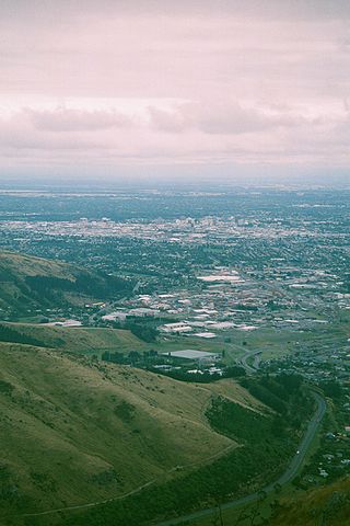
Burnside is a suburb of Christchurch, New Zealand, located southeast of Christchurch International Airport. As with most suburbs in Christchurch, it has no defined boundaries and is a general area.

Huntsbury is a suburb of Christchurch, New Zealand, on the fringes of the Port Hills three kilometres south of the city centre. Huntsbury amalgamated with Christchurch City on 1 April 1941, on the same day as the New Brighton borough joined the city council.

<span class="mw-page-title-main">Strowan</span> Suburb in Christchurch, New Zealand

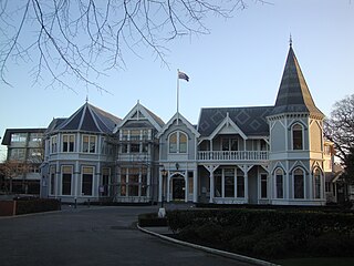
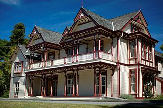
Strowan is an affluent suburb of Christchurch, New Zealand, located approximately 5 km north-west of Christchurch's central business district. It had a population of 3,705 at the 2013 census. It is located between the suburbs of Merivale, Papanui, Bryndwr, Fendalton, and St Albans.

<span class="mw-page-title-main">Avondale, Christchurch</span> Suburb in Christchurch, New Zealand

Avondale is a suburb of Christchurch in the South Island of New Zealand. It is located 6 kilometres (3.7 mi) northeast of the city center, and is close to the Avon River, four kilometers to the northwest of its estuary. The suburb is centered on Avondale Road and so named due to its proximity to the Avon River. It has a good sized park on Mervyn Drive called Avondale Park. This park has a kids playground, a tennis court, basketball court, and a football field in winter. There is ample vacant red zone land in Avondale for activities such as leisure and dog walking.

<span class="mw-page-title-main">Parklands, New Zealand</span> Suburb in Christchurch, New Zealand

Parklands is a suburb of Christchurch, New Zealand. It is located north east of the city centre near Bottle Lake Forest.

<span class="mw-page-title-main">South New Brighton</span> Suburb in Christchurch, New Zealand

South New Brighton is a coastal suburb on the eastern side of Christchurch city.

<span class="mw-page-title-main">Bottle Lake, New Zealand</span> Suburb in Christchurch, New Zealand

Bottle Lake is a suburb in the north-east of Christchurch with a low number of residents. Most of the suburb is covered by Bottle Lake Forest, which has since the mid-1970s become a popular recreation area.

<span class="mw-page-title-main">Hillsborough, Christchurch</span> Suburb in Christchurch, New Zealand

Hillsborough is a mixed industrial and residential suburb of Christchurch, New Zealand, located approximately 4 kilometres (2.5 mi) to the south-east of the city centre.

Hei Hei is a suburb of Christchurch, New Zealand. It is located in the west of Christchurch 11 kilometres (6.8 mi) from the central city, and is bisected by State Highway 1. The area was subdivided for poultry farming after World War I for returning serviceman, but the venture failed due to the poor soil conditions. The place name is related to the Māori word for chicken (heihei) due to the area's poultry farming history.

<span class="mw-page-title-main">Bromley, New Zealand</span> Suburb in Christchurch, New Zealand

Bromley is a suburb of the city of Christchurch, New Zealand. It lies to the east of the city centre, mostly between Pages Road and the Avon river estuary.

Russley is a suburb on the western side of Christchurch city.

Islington is a suburb on the western side of Christchurch city.

<span class="mw-page-title-main">Marshland, New Zealand</span> Suburb in Christchurch, New Zealand

Marshland is a semi-rural suburb on the northern side of Christchurch city. The land is primarily used for horticulture and dairy farming.

Broomfield is a suburb on the western side of Christchurch city.

Northcote is a suburb on the northern side of Christchurch, New Zealand.

Prestons is a suburb on the northeastern side of Christchurch city.

<span class="mw-page-title-main">North New Brighton</span> Suburb in Christchurch, New Zealand

North New Brighton is a suburb on the northern side of Christchurch city. It was originally known as North Beach and was readily accessible from Christchurch city by tram. It was renamed North New Brighton in 1953.

References

  1. 1 2 "ArcGIS Web Application". statsnz.maps.arcgis.com. Retrieved 26 September 2021.
  2. 1 2 "Population estimate tables - NZ.Stat". Statistics New Zealand . Retrieved 25 October 2022.
  3. "Meaning of waimairi". Christchurch Cities Libraries. Retrieved 9 October 2016.
  4. "Christchurch Street Names - A - Aston Drive" (PDF). Christchurch City Libraries. February 2016. p. 75.
  5. "Christchurch: A Chronology - 1982". Christchurch City Libraries. Retrieved 26 September 2021.
  6. "Christchurch: A Chronology - 1989". Christchurch City Libraries. Retrieved 26 September 2021.
  7. 1 2 "Statistical area 1 dataset for 2018 Census". Statistics New Zealand. March 2020. Waimairi Beach (326000). 2018 Census place summary: Waimairi Beach