Mount Pleasant, New Zealand

Last updated

Mount Pleasant
Mount Pleasant, New Zealand 1024.jpg
Mount Pleasant in 2010
Mount Pleasant, New Zealand
Coordinates: 43°33′47″S172°42′58″E / 43.563°S 172.716°E / -43.563; 172.716
CountryNew Zealand
City Christchurch
Local authority Christchurch City Council
Electoral wardHeathcote
Community board Waihoro Spreydon-Cashmere-Heathcote
Area
[1]
  Land248 ha (613 acres)
Population
 (June 2023) [2]
  Total3,870
(Avon Heathcote Estuary)
Ferrymead
Pfeil oben.svg
Pfeil links.svgMount PleasantPfeil rechts.svg
Pfeil unten.svg
Redcliffs
Heathcote Valley Port Hills
Mount Pleasant from the Christchurch 360 Trail Christchurch 360 Trail 013.jpg
Mount Pleasant from the Christchurch 360 Trail

Mount Pleasant (Tauhinukorokio [3] [ failed verification ]) is a coastal suburb of Christchurch, New Zealand. The suburb is located on the northern flank of the mountain Tauhinukorokio/Mount Pleasant in the Port Hills. It takes its name from the English version of the mountain's name.

Contents

The area was originally administered by the borough of Sumner. A petition in September 1920, by 57 of the suburb's 66 ratepayers, asked for it to be included as a riding of the Heathcote County. At the time of the petition, the area was mostly farmland, with 21 dwelling houses and an estimated population of 80. Whilst the mayor of Sumner, John Barr, submitted against the petition, it was granted and took effect on 1 April 1921. [4] As a result of the 1989 local government reforms, Heathcote County was amalgamated with and became part of Christchurch City Council.

The suburb and its houses were extensively damaged in the 2011 Christchurch earthquake. [5] [6] [7]

Demographics

Mount Pleasant covers 2.48 km2 (0.96 sq mi). [1] It had an estimated population of 3,870 as of June 2023, [2] with a population density of 1,560 people per km2.

Historical population
YearPop.±% p.a.
20063,984    
20133,024−3.86%
20183,567+3.36%
Source: [8]

Mount Pleasant had a population of 3,567 at the 2018 New Zealand census, an increase of 543 people (18.0%) since the 2013 census, and a decrease of 417 people (−10.5%) since the 2006 census. There were 1,419 households, comprising 1,734 males and 1,833 females, giving a sex ratio of 0.95 males per female. The median age was 48.4 years (compared with 37.4 years nationally), with 558 people (15.6%) aged under 15 years, 468 (13.1%) aged 15 to 29, 1,761 (49.4%) aged 30 to 64, and 780 (21.9%) aged 65 or older.

Ethnicities were 93.9% European/Pākehā, 4.9% Māori, 0.7% Pasifika, 3.6% Asian, and 2.3% other ethnicities. People may identify with more than one ethnicity.

The percentage of people born overseas was 24.1, compared with 27.1% nationally.

Although some people chose not to answer the census's question about religious affiliation, 57.4% had no religion, 33.3% were Christian, 0.1% had Māori religious beliefs, 0.5% were Hindu, 0.3% were Muslim, 0.7% were Buddhist and 1.7% had other religions.

Of those at least 15 years old, 1,116 (37.1%) people had a bachelor's or higher degree, and 246 (8.2%) people had no formal qualifications. The median income was $46,600, compared with $31,800 nationally. 939 people (31.2%) earned over $70,000 compared to 17.2% nationally. The employment status of those at least 15 was that 1,527 (50.7%) people were employed full-time, 501 (16.7%) were part-time, and 57 (1.9%) were unemployed. [8]

Education

Te Kura O Paeraki - Mt Pleasant School is a full primary school catering for years 1 to 8. [9] It had a roll of 335 as of February 2024. [10] The school started in a private house in 1928. [11]

Climate

The highest recorded temperature at Mount Pleasant is 39.3 °C (103 °F) recorded on 7 of February 1973. [12]

Climate data for Mount Pleasant (1981–2010)
MonthJanFebMarAprMayJunJulAugSepOctNovDecYear
Mean daily maximum °C (°F)21.2
(70.2)
20.6
(69.1)
19.4
(66.9)
16.9
(62.4)
14.2
(57.6)
11.9
(53.4)
10.9
(51.6)
11.9
(53.4)
14.0
(57.2)
16.0
(60.8)
17.6
(63.7)
19.6
(67.3)
16.2
(61.1)
Daily mean °C (°F)17.2
(63.0)
16.9
(62.4)
15.6
(60.1)
13.5
(56.3)
11.1
(52.0)
8.8
(47.8)
8.0
(46.4)
8.7
(47.7)
10.4
(50.7)
12.2
(54.0)
13.7
(56.7)
15.6
(60.1)
12.6
(54.8)
Mean daily minimum °C (°F)13.2
(55.8)
13.3
(55.9)
11.9
(53.4)
10.1
(50.2)
8.1
(46.6)
5.7
(42.3)
5.2
(41.4)
5.6
(42.1)
6.9
(44.4)
8.4
(47.1)
9.8
(49.6)
11.7
(53.1)
9.2
(48.5)
Average rainfall mm (inches)37.2
(1.46)
46.5
(1.83)
42.6
(1.68)
46.9
(1.85)
60.9
(2.40)
57.5
(2.26)
72.2
(2.84)
69.5
(2.74)
43.3
(1.70)
54.9
(2.16)
54.0
(2.13)
69.9
(2.75)
655.4
(25.8)
Source: NIWA [13]

Related Research Articles

<span class="mw-page-title-main">Sumner, New Zealand</span> Suburb of Christchurch, New Zealand

Sumner is a coastal seaside suburb of Christchurch, New Zealand and was surveyed and named in 1849 in honour of John Bird Sumner, the then newly appointed Archbishop of Canterbury and president of the Canterbury Association. Originally a separate borough, it was amalgamated with the city of Christchurch as communications improved and the economies of scale made small town boroughs uneconomic to operate.

<span class="mw-page-title-main">Port Hills</span> Range of hills of Canterbury, New Zealand

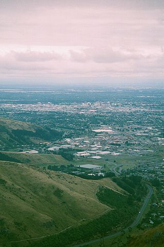
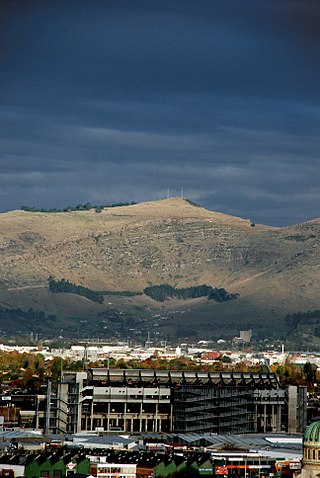
The Port Hills are a range of hills in Canterbury Region of New Zealand, so named because they lie between the city of Christchurch and its port at Lyttelton. They are an eroded remnant of the Lyttelton volcano, which erupted millions of years ago.

<span class="mw-page-title-main">Ferrymead</span> Suburb of Christchurch, New Zealand

Ferrymead is a suburb south-east of Christchurch, New Zealand. It is the main thoroughfare for reaching the eastern sea suburbs such as Sumner, as well as home to a number of cliff-top residences and businesses along the estuary front. After the 2011 Canterbury earthquake, a number of prominent Christchurch businesses relocated to the Ferrymead area, making it into a secondary business hub.

<span class="mw-page-title-main">Waltham, New Zealand</span> Suburb of Christchurch, New Zealand

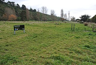
Waltham is an inner suburb of Christchurch, New Zealand, located approximately 2 kilometres south-east of the city centre. State Highway 76, part of Christchurch's ring road system, and known there as Brougham Street, runs through the suburb, as does the Lyttelton Line rail corridor. Amenities include Lancaster Park, Christchurch's former sports venue, now a community park, and Waltham pool.

<span class="mw-page-title-main">Woolston, New Zealand</span> Suburb of Christchurch, New Zealand

Woolston is an industrial and residential suburb of Christchurch in the South Island of New Zealand. It is situated 3 kilometres southeast of the city centre, close to major arterial routes including State Highways 74 and 76 to Banks Peninsula. The Heathcote River flows through the suburb.

<span class="mw-page-title-main">Heathcote Valley</span> Suburb of Christchurch, New Zealand

Heathcote Valley is a suburb of Christchurch, New Zealand. It is named after Sir William Heathcote, who was secretary of the Canterbury Association.

<span class="mw-page-title-main">Addington, New Zealand</span> Suburb of Christchurch, New Zealand

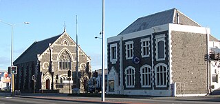
Addington is a major suburb of Christchurch, New Zealand. It is sited 2.5 kilometres (1.6 mi) south-west of the city centre.

<span class="mw-page-title-main">Sydenham, New Zealand</span> Suburb of Christchurch, New Zealand

Sydenham is an inner suburb of Christchurch, New Zealand, two kilometres south of the city centre, on and around the city's main street, Colombo Street. It is a residential, retail and light industrial suburb.

<span class="mw-page-title-main">Mount Cook, Wellington</span> Suburb of Wellington City, New Zealand

Mount Cook is an inner city suburb of New Zealand's capital city of Wellington, The North Island, New Zealand, 1.74km dead south of Wellington's Central Business District. Its local constituency area is the Wellington Central, and is part of the City of Wellington local government area. The suburb stands on the southern fringe of the central city alongside Te Aro and to the north of Newtown.

<span class="mw-page-title-main">Beckenham, New Zealand</span> Suburb of Christchurch, New Zealand

Beckenham is an inner suburb of Christchurch, New Zealand, located three kilometres south of the city centre. The Heathcote River winds through this predominantly residential suburb, a section of which is often referred to locally as the "Beckenham Loop". Beckenham is bounded by Sydenham to the north, Somerfield to the west, Cashmere and Huntsbury to the south and St Martins to the east.

St Martins is an inner suburb of Christchurch, New Zealand, located two kilometres south of the city centre.

<span class="mw-page-title-main">Bexley, New Zealand</span> Suburb of Christchurch, New Zealand

Bexley is an eastern suburb of Christchurch, New Zealand. It is located on the right bank of the Avon River / Ōtākaro approximately one kilometre from the Avon Heathcote Estuary. It is enclosed within a bend in the Avon River and borders the suburb of Aranui.

<span class="mw-page-title-main">Redcliffs</span> Suburb of Christchurch, New Zealand

Redcliffs is an outer coastal suburb of Christchurch, Canterbury, New Zealand.

<span class="mw-page-title-main">Avondale, Christchurch</span> Suburb of Christchurch, New Zealand

Avondale is a suburb of Christchurch in the South Island of New Zealand. It is located 6 kilometres (3.7 mi) northeast of the city center, and is close to the Avon River / Ōtākaro, four kilometres to the northwest of its estuary. The suburb is centred on Avondale Road and so named due to its proximity to the Avon River. It has a good sized park on Mervyn Drive called Avondale Park. This park has a kids playground, a tennis court, basketball court, and a football field in winter. There is ample vacant red zone land in Avondale for activities such as leisure and dog walking.

Hoon Hay is an outer suburb of Christchurch, New Zealand, located at the base of the Port Hills and about 5 kilometres southwest of Cathedral Square. The area was named by Captain Wickham Talbot Harvey, a captain of the British Royal 10th Hussars, who moved to the area in 1852 and named it after the farm in Hoon, Derbyshire where he grew up. Harvey only stayed in the area for four years, before a fire destroyed his property and prompted him to return to the United Kingdom. Further fires in the following years destroyed the woodland which was on the property, including several large tōtara, causing it to be converted into farmland. Remnants of this forest remain visible in the area, including with tree stumps being discovered during flood mitigation work on the Ōpāwaho / Heathcote River.

<span class="mw-page-title-main">Southshore, New Zealand</span> Suburb of Christchurch, New Zealand

Southshore is an eastern coastal suburb within Christchurch, New Zealand. It is located on a narrow 2.5 km (1.6 mi) long sandspit that runs along the eastern side of the Avon Heathcote Estuary. The suburb is 8 km (5.0 mi) eastwards from the city centre and 5 km (3.1 mi) south from New Brighton's main retail area. Before urbanisation, the area was predominantly swamplands, bordered by large sand dunes which had some Māori presence. The area holds historical and cultural importance to local Māori iwi because of the large amounts of resources and seafood gathered in the area and estuary prior to European occupation.

<span class="mw-page-title-main">Tauhinukorokio / Mount Pleasant</span> Mountain in New Zealand

Tauhinukorokio / Mount Pleasant, also known just as either Mount Pleasant or Tauhinukorokio individually, is the highest elevation in the eastern Port Hills in Christchurch, New Zealand. It once held a Māori pā, but there was little left of it when European settlers first arrived in the 1840s. The hill was first used as a sheep run, and became the base trig station for the survey of Canterbury. It was also used as a signal station to make residents aware of ships coming into Lyttelton Harbour / Whakaraupō. During World War II, an extensive heavy anti-aircraft artillery (HAA) battery was built near the summit, and the foundations of those buildings still exist.

Clifton is a hillside suburb above Sumner in Christchurch, New Zealand.

<span class="mw-page-title-main">Richmond Hill, New Zealand</span> Suburb in Christchurch, New Zealand

Richmond Hill is a hillside suburb above Sumner in Christchurch, New Zealand.

<span class="mw-page-title-main">Bromley, New Zealand</span> Suburb of Christchurch, New Zealand

Bromley is a suburb of the city of Christchurch, New Zealand. It lies to the east of the city centre, mostly between Pages Road and the Avon river estuary.

References

  1. 1 2 "ArcGIS Web Application". statsnz.maps.arcgis.com. Retrieved 27 December 2023.
  2. 1 2 "Population estimate tables - NZ.Stat". Statistics New Zealand . Retrieved 25 October 2023.
  3. "Tauhinu Korokio — Mt Pleasant".
  4. Menzies, J. F. (1941). Sumner (PDF). Christchurch: Simpson & Williams Ltd. pp. 32–33. Retrieved 31 March 2013.
  5. Fisher, David (28 February 2011). "Christchurch earthquake: 'This is no place to live any more'" via New Zealand Herald.
  6. "Mt Pleasant Earthquake Damage – Mapping the damage – Mt Pleasant Centre".
  7. "Mt Pleasant Earthquake Stories".
  8. 1 2 "Statistical area 1 dataset for 2018 Census". Statistics New Zealand. March 2020. Mount Pleasant (332000). 2018 Census place summary: Mount Pleasant
  9. Education Counts: Mount Pleasant School
  10. "New Zealand Schools Directory". New Zealand Ministry of Education. Retrieved 14 March 2024.
  11. "Mount Pleasant School 75th Jubilee Souvenir Booklet". Mount Pleasant School. 2003.
  12. "High temperatures in Canterbury, Marlborough and Hawkes Bay 7 February 1973" (PDF). NIWA. Retrieved 9 September 2024.
  13. "CliFlo -The National Climate Database (Agent number: 4871)". NIWA. Retrieved 9 September 2024.