Bromley | |
---|---|
Coordinates: 43°33′00″S172°42′00″E / 43.55000°S 172.70000°E | |
Country | New Zealand |
City | Christchurch |
Local authority | Christchurch City Council |
Electoral ward | Linwood |
Community board | Waitai Coastal-Burwood-Linwood |
Area | |
• Land | 747 ha (1,846 acres) |
Population (June 2023) [2] | |
• Total | 3,020 |
Wainoni | Bexley, New Zealand | (Residential red zone) |
Linwood | Bromley | (Avon Heathcote Estuary / Ihutai) |
Woolston | Ferrymead |
Bromley is a suburb of the city of Christchurch, New Zealand. It lies to the east of the city centre, mostly between Pages Road and the Avon Heathcote Estuary. [3]
Bromley was named after the town in north-west Kent in England. [4]
In 1883, a sewage farm was established next to the Avon estuary. This was later developed when sewage works were built between 1958 and 1962. [5] As of 2018, the area includes oxidation ponds and a wildlife reserve. [6]
From 1913, Christchurch City Council looked for additional cemetery space and one of the options under consideration was a reserve that the city owned in Bromley, which at the time was located in Heathcote County. In 1915, the designation of the land was changed, preparatory work happened in 1917, and in July the Bromley Cemetery opened for burials. This was just prior to the 1918 flu pandemic and the new cemetery became the main burial ground for flu victims from the eastern part of the city. The cemetery was extended in size in 1940. [7] Ruru Lawn Cemetery opened in 1941 and is the burial ground for the victims of the 1947 Ballantyne's fire. [8] Memorial Park Cemetery has been in use since 1956 and, like Ruru Lawn Cemetery, is operational. [9]
The various parks and cemeteries in Bromley form a buffer between the residential area in the west, and the industrial area and sewage treatment plant in the east. The exception is Maces Road, where the north side is industrial and the south side is residential. Like other suburbs in the east of Christchurch, and in proximity to the Avon River or the Avon Heathcote Estuary, Bromley suffered great damage in the 2011 Christchurch earthquake. [6] None of the land in the suburb was red zoned, though. [10]
Bromley comprises two statistical areas. Bromley South is primarily residential. Bromley North contains the industrial area, the sewage treatment plant, and some rural land.
Name | Area (km2) | Population | Density (per km2) | Households | Median age | Median income |
---|---|---|---|---|---|---|
Bromley South | 1.24 | 2,949 | 2,378 | 1,086 | 35.0 years | $28,000 [11] |
Bromley North | 6.23 | 57 | 9.1 | 27 | 44.3 years | $37,500 [12] |
New Zealand | 37.4 years | $31,800 |
Bromley South covers 1.24 km2 (0.48 sq mi). [1] It had an estimated population of 2,960 as of June 2023, [2] with a population density of 2,387 people per km2.
Year | Pop. | ±% p.a. |
---|---|---|
2006 | 2,940 | — |
2013 | 2,922 | −0.09% |
2018 | 2,949 | +0.18% |
Source: [13] |
Bromley South had a population of 2,949 at the 2018 New Zealand census, an increase of 27 people (0.9%) since the 2013 census, and an increase of 9 people (0.3%) since the 2006 census. There were 1,086 households, comprising 1,488 males and 1,461 females, giving a sex ratio of 1.02 males per female. The median age was 35.0 years (compared with 37.4 years nationally), with 633 people (21.5%) aged under 15 years, 606 (20.5%) aged 15 to 29, 1,374 (46.6%) aged 30 to 64, and 336 (11.4%) aged 65 or older.
Ethnicities were 75.0% European/Pākehā, 19.4% Māori, 12.1% Pasifika, 7.4% Asian, and 2.8% other ethnicities. People may identify with more than one ethnicity.
The percentage of people born overseas was 16.8, compared with 27.1% nationally.
Although some people chose not to answer the census's question about religious affiliation, 55.0% had no religion, 29.4% were Christian, 0.9% had Māori religious beliefs, 2.1% were Hindu, 1.6% were Muslim, 0.6% were Buddhist and 2.1% had other religions.
Of those at least 15 years old, 177 (7.6%) people had a bachelor's or higher degree, and 702 (30.3%) people had no formal qualifications. The median income was $28,000, compared with $31,800 nationally. 168 people (7.3%) earned over $70,000 compared to 17.2% nationally. The employment status of those at least 15 was that 1,167 (50.4%) people were employed full-time, 303 (13.1%) were part-time, and 123 (5.3%) were unemployed. [13]
Bromley North covers 6.23 km2 (2.41 sq mi). [1] It had an estimated population of 60 as of June 2023, [2] with a population density of 10 people per km2.
Year | Pop. | ±% p.a. |
---|---|---|
2006 | 48 | — |
2013 | 63 | +3.96% |
2018 | 57 | −1.98% |
Source: [14] |
Bromley North had a population of 57 at the 2018 New Zealand census, a decrease of 6 people (−9.5%) since the 2013 census, and an increase of 9 people (18.8%) since the 2006 census. There were 27 households, comprising 33 males and 21 females, giving a sex ratio of 1.57 males per female. The median age was 44.3 years (compared with 37.4 years nationally), with 9 people (15.8%) aged under 15 years, 6 (10.5%) aged 15 to 29, 39 (68.4%) aged 30 to 64, and 6 (10.5%) aged 65 or older.
Ethnicities were 78.9% European/Pākehā, 21.1% Māori, and 5.3% Asian. People may identify with more than one ethnicity.
The percentage of people born overseas was 10.5, compared with 27.1% nationally.
Although some people chose not to answer the census's question about religious affiliation, 63.2% had no religion, 15.8% were Christian, 5.3% were Muslim and 5.3% had other religions.
Of those at least 15 years old, 3 (6.2%) people had a bachelor's or higher degree, and 18 (37.5%) people had no formal qualifications. The median income was $37,500, compared with $31,800 nationally. 6 people (12.5%) earned over $70,000 compared to 17.2% nationally. The employment status of those at least 15 was that 27 (56.2%) people were employed full-time, and 6 (12.5%) were part-time. [14]
Bromley School is a contributing primary school catering for years 1 to 6. [15] It had a roll of 372 as of August 2024. [16] The school opened in 1880. [4]
Climate data for Bromley (1962–1990 normals, extremes 1962–1990, 2019–present) | |||||||||||||
---|---|---|---|---|---|---|---|---|---|---|---|---|---|
Month | Jan | Feb | Mar | Apr | May | Jun | Jul | Aug | Sep | Oct | Nov | Dec | Year |
Record high °C (°F) | 36.2 (97.2) | 39.0 (102.2) | 34.5 (94.1) | 30.7 (87.3) | 26.5 (79.7) | 22.6 (72.7) | 22.6 (72.7) | 23.1 (73.6) | 25.3 (77.5) | 30.2 (86.4) | 30.1 (86.2) | 34.0 (93.2) | 39.0 (102.2) |
Mean maximum °C (°F) | 30.9 (87.6) | 30.4 (86.7) | 28.5 (83.3) | 25.1 (77.2) | 21.1 (70.0) | 17.8 (64.0) | 17.3 (63.1) | 18.7 (65.7) | 21.6 (70.9) | 24.7 (76.5) | 26.7 (80.1) | 28.7 (83.7) | 32.5 (90.5) |
Mean daily maximum °C (°F) | 21.7 (71.1) | 21.2 (70.2) | 19.9 (67.8) | 17.2 (63.0) | 13.9 (57.0) | 11.5 (52.7) | 10.8 (51.4) | 12.0 (53.6) | 14.4 (57.9) | 16.6 (61.9) | 18.5 (65.3) | 20.3 (68.5) | 16.5 (61.7) |
Daily mean °C (°F) | 17.5 (63.5) | 17.0 (62.6) | 15.7 (60.3) | 12.9 (55.2) | 9.8 (49.6) | 7.3 (45.1) | 6.8 (44.2) | 8.0 (46.4) | 10.1 (50.2) | 12.2 (54.0) | 14.1 (57.4) | 16.0 (60.8) | 12.3 (54.1) |
Mean daily minimum °C (°F) | 13.2 (55.8) | 12.8 (55.0) | 11.7 (53.1) | 8.7 (47.7) | 5.6 (42.1) | 3.1 (37.6) | 2.8 (37.0) | 4.0 (39.2) | 6.0 (42.8) | 7.8 (46.0) | 9.7 (49.5) | 11.8 (53.2) | 8.1 (46.6) |
Mean minimum °C (°F) | 7.6 (45.7) | 6.9 (44.4) | 5.5 (41.9) | 2.8 (37.0) | −0.4 (31.3) | −2.0 (28.4) | −2.5 (27.5) | −1.4 (29.5) | 0.2 (32.4) | 2.2 (36.0) | 3.9 (39.0) | 6.0 (42.8) | −3.0 (26.6) |
Record low °C (°F) | 4.4 (39.9) | 4.4 (39.9) | 1.9 (35.4) | 0.0 (32.0) | −3.1 (26.4) | −6.0 (21.2) | −3.8 (25.2) | −3.4 (25.9) | −2.2 (28.0) | −1.3 (29.7) | 1.0 (33.8) | 0.8 (33.4) | −6.0 (21.2) |
Average rainfall mm (inches) | 40.9 (1.61) | 34.8 (1.37) | 49.3 (1.94) | 60.0 (2.36) | 61.9 (2.44) | 51.8 (2.04) | 71.4 (2.81) | 50.1 (1.97) | 33.9 (1.33) | 45.6 (1.80) | 43.1 (1.70) | 44.0 (1.73) | 586.8 (23.1) |
Source: NIWA [17] [18] |
Ferrymead is a suburb south-east of Christchurch, New Zealand. It is the main thoroughfare for reaching the eastern sea suburbs such as Sumner, as well as home to a number of cliff-top residences and businesses along the estuary front. After the 2011 Canterbury earthquake, a number of prominent Christchurch businesses relocated to the Ferrymead area, making it into a secondary business hub.
Waltham is an inner suburb of Christchurch, New Zealand, located approximately 2 kilometres south-east of the city centre. State Highway 76, part of Christchurch's ring road system, and known there as Brougham Street, runs through the suburb, as does the Lyttelton Line rail corridor. Amenities include Lancaster Park, Christchurch's former sports venue, now a community park, and Waltham pool.
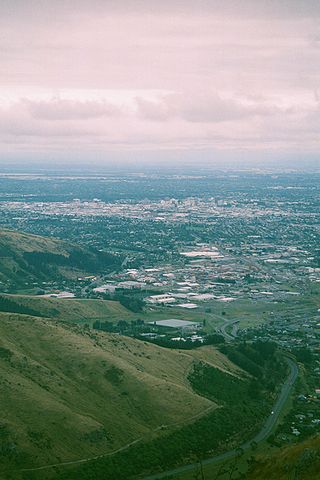
Woolston is an industrial and residential suburb of Christchurch in the South Island of New Zealand. It is situated 3 kilometres southeast of the city centre, close to major arterial routes including State Highways 74 and 76 to Banks Peninsula. The Heathcote River flows through the suburb.
Heathcote Valley is a suburb of Christchurch, New Zealand. It is named after Sir William Heathcote, who was secretary of the Canterbury Association.
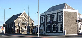
Sydenham is an inner suburb of Christchurch, New Zealand, two kilometres south of the city centre, on and around the city's main street, Colombo Street. It is a residential, retail and light industrial suburb.
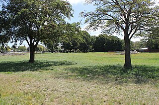
Avonside is an eastern suburb in Christchurch, New Zealand. It is one of the oldest suburbs of the city, with only Heathcote being older.
Merivale is a suburb of Christchurch, New Zealand, north of the city centre. Like all suburbs in Christchurch, it has no defined boundaries and is a general area, but for the purposes of statistical analysis only, Statistics New Zealand defines it as being Heaton Street to the north, Papanui Road to the east, Harper and Bealey Avenues to the south and Rossall Street to the west, although Real Estate advertising often will claim residences outside this area, especially St Albans to the east of Papanui Road, as being Merivale due to the perceived desirability of the area. The area directly west of Rossall Street, which is called Holmwood by Statistics New Zealand, is sometimes considered part of Merivale.
Beckenham is an inner suburb of Christchurch, New Zealand, located three kilometres south of the city centre. The Heathcote River winds through this predominantly residential suburb, a section of which is often referred to locally as the "Beckenham Loop". Beckenham is bounded by Sydenham to the north, Somerfield to the west, Cashmere and Huntsbury to the south and St Martins to the east.
St Martins is an inner suburb of Christchurch, New Zealand, located two kilometres south of the city centre.
Bexley is an eastern suburb of Christchurch, New Zealand. It is located on the right bank of the Avon River / Ōtākaro approximately one kilometre from the Avon Heathcote Estuary. It is enclosed within a bend in the Avon River and borders the suburb of Aranui.
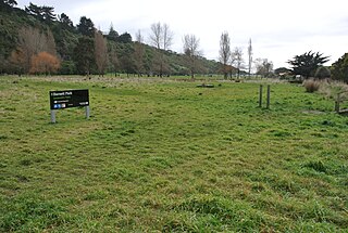
Redcliffs is an outer coastal suburb of Christchurch, Canterbury, New Zealand.
Richmond is a minor suburb of Christchurch, New Zealand.
Avondale is a suburb of Christchurch in the South Island of New Zealand. It is located 6 kilometres (3.7 mi) northeast of the city center, and is close to the Avon River / Ōtākaro, four kilometres to the northwest of its estuary. The suburb is centred on Avondale Road and so named due to its proximity to the Avon River. It has a good sized park on Mervyn Drive called Avondale Park. This park has a kids playground, a tennis court, basketball court, and a football field in winter. There is ample vacant red zone land in Avondale for activities such as leisure and dog walking.
Dallington is a suburb of Christchurch, New Zealand, on the north-east side of the city.
Mount Pleasant (Tauhinukorokio) is a coastal suburb of Christchurch, New Zealand. The suburb is located on the northern flank of the mountain Tauhinukorokio/Mount Pleasant in the Port Hills. It takes its name from the English version of the mountain's name.
Hoon Hay is an outer suburb of Christchurch, New Zealand, located at the base of the Port Hills and about 5 kilometres southwest of Cathedral Square. The area was named by Captain Wickham Talbot Harvey, a captain of the British Royal 10th Hussars, who moved to the area in 1852 and named it after the farm in Hoon, Derbyshire where he grew up. Harvey only stayed in the area for four years, before a fire destroyed his property and prompted him to return to the United Kingdom. Further fires in the following years destroyed the woodland which was on the property, including several large tōtara, causing it to be converted into farmland. Remnants of this forest remain visible in the area, including with tree stumps being discovered during flood mitigation work on the Ōpāwaho / Heathcote River.
Wainoni is one of the eastern suburbs of Christchurch. It is a lower socio-economic area.
Hillsborough is a mixed industrial and residential suburb of Christchurch, New Zealand, located approximately 4 kilometres (2.5 mi) to the south-east of the city centre.
Hillmorton is a suburb of south-western Christchurch, New Zealand. The suburb is centred around the intersection of Lincoln Road and Hoon hay Road, two arterial routes which form part of State Highway 75 and feed into the Christchurch Southern Motorway which runs to the north of the suburb.
Prestons is a suburb on the northeastern side of Christchurch city.