Bishopdale, Christchurch

Last updated

Bishopdale
Orauwhata Bishopdale Library and Community Centre, Christchurch, New Zealand.jpg
Ōrauwhata Bishopdale Library and Community Centre
Bishopdale, Christchurch
Coordinates: 43°29′20″S172°35′09″E / 43.4890°S 172.5857°E / -43.4890; 172.5857
CountryNew Zealand
City Christchurch
Local authority Christchurch City Council
Electoral wardHarewood
Area
[1]
  Land320 ha (790 acres)
Population
 (June 2022) [2]
  Total9,520
Casebrook
Harewood
Pfeil oben.svg
Pfeil links.svgBishopdalePfeil rechts.svg
Pfeil unten.svg
Northcote
Burnside Bryndwr Papanui

Bishopdale is a residential suburb located in the north of Christchurch, New Zealand.

Contents

Bishopdale lies close to Christchurch International Airport at Harewood and Christchurch's zoo, Orana Wildlife Park.

History

The suburb takes its name from the three Bishop brothers, James (1826–1910), Robert (1827–1909) and William (1829–1903), who bought land in the area in 1858 or 1859 and established pipfruit orchards. Initially, the area was called "Bishopsdale", but the second 's' was dropped[ when? ][ by whom? ] from the name. [3] [4] Part of Greers Road (the section between Harewood Road and Sawyers Arms Road) was formerly called Bishop's Road. [5] It was renamed in 1948 to avoid confusion with Bishops Road in Papanui and Bishop Street in St Albans. [4]

Bishopdale is overall a middle-class suburb, with a wide range of people living in the area. Most of the houses date from the 1960s, and use either brick or wood, single-storey designs. The area boasts a lot of parks and recreational areas, and a small shopping mall.

Demographics

Bishopdale, comprising the statistical areas of Bishopdale North, Bishopdale West and Bishopdale South, covers 3.20 km2 (1.24 sq mi). [1] It had an estimated population of 9,520 as of June 2022, with a population density of 2,975 people per km2.

Historical population
YearPop.±% p.a.
20068,952    
20139,057+0.17%
20189,306+0.54%
Source: [6]

Bishopdale had a population of 9,306 at the 2018 New Zealand census, an increase of 249 people (2.7%) since the 2013 census, and an increase of 354 people (4.0%) since the 2006 census. There were 3,504 households. There were 4,569 males and 4,734 females, giving a sex ratio of 0.97 males per female, with 1,788 people (19.2%) aged under 15 years, 1,839 (19.8%) aged 15 to 29, 4,092 (44.0%) aged 30 to 64, and 1,590 (17.1%) aged 65 or older.

Ethnicities were 79.8% European/Pākehā, 8.9% Māori, 4.3% Pacific peoples, 13.1% Asian, and 2.8% other ethnicities (totals add to more than 100% since people could identify with multiple ethnicities).

The proportion of people born overseas was 22.9%, compared with 27.1% nationally.

Although some people objected to giving their religion, 49.9% had no religion, 38.3% were Christian, 0.8% were Hindu, 0.9% were Muslim, 1.0% were Buddhist and 2.2% had other religions.

Of those at least 15 years old, 1,575 (20.9%) people had a bachelor or higher degree, and 1,425 (19.0%) people had no formal qualifications. The employment status of those at least 15 was that 3,795 (50.5%) people were employed full-time, 1,116 (14.8%) were part-time, and 249 (3.3%) were unemployed. [6]

Individual statistical areas
NamePopulationHouseholdsMedian ageMedian income
Bishopdale North4,2031,61438.6 years$35,200 [7]
Bishopdale West2,8621,08637.3 years$31,700 [8]
Bishopdale South2,24180436.3 years$30,200 [9]
New Zealand37.4 years$31,800

Economy

Retail

Bishopdale Village Mall was established in Bishopdale in the 1960s. [10] It has 600 carparks and 80 retailers, including a New World supermarket. [11]

Education

Breens Intermediate is an intermediate school catering for years 7 to 8. [12] It has a roll of 150. The school, initially named Fendalton Intermediate, opened in 1976. [13] :21

Bishopdale School, Cotswold School and Isleworth School are contributing primary schools catering for years 1 to 6. [14] [15] [16] They have rolls of 150, 498 and 237, respectively. Bishopdale School opened in 1957, [13] :19 Cotswold in 1968 [13] :48 and Isleworth in 1962. [13] :86

Emmanuel Christian School is a state-integrated interdenominational school for years 1 to 10. [17] It has a roll of 256.

All these schools are coeducational, and all except Emmanuel Christian School are state schools. Rolls are as of April 2023. [18]

Religion

Bishopdale has a library and many churches, including Presbyterian, Jehovah's Witnesses and Catholic.

Margaret Mahy has set her book The Changeover in Bishopdale; it is called Gardendale in that popular book, and production of a film of the same name began in 2016. [19]

Related Research Articles

<span class="mw-page-title-main">Waltham, New Zealand</span> Suburb in Christchurch, New Zealand

Waltham is an inner suburb of Christchurch, New Zealand, located approximately two kilometres south-east of the city centre. State Highway 76, part of Christchurch's ring road system, and known there as Brougham Street, runs through the suburb, as does the Lyttelton Line rail corridor.

<span class="mw-page-title-main">Papanui</span> Suburb in Christchurch, New Zealand

Papanui is a major suburb of Christchurch, New Zealand. It is situated five kilometers to the northwest of the city centre. Papanui is a middle socio-economic area with a population of 3,645 consisting predominantly of Pākehā 86.9%, Asian 7.6%, Māori 5.3%, Pacific peoples 3.1%, Middle Eastern/Latin American/African 0.7%. The suburb is located at the junction of three busy thoroughfares; Papanui Road leading to the City, the Main North Road that leads to North Canterbury and Harewood Road that leads to Christchurch International Airport. However, as with most Christchurch suburbs, Papanui has no defined borders.

<span class="mw-page-title-main">Mairehau</span> Suburb in Christchurch, New Zealand

Mairehau is a suburb of Christchurch, New Zealand. It is located four kilometres north of the city centre, close to the edge of the urbanised central city area. Much new development is being carried out on the northern edge of Mairehau.

<span class="mw-page-title-main">Fendalton</span> Suburb in Christchurch, New Zealand

Fendalton is a suburb of Christchurch, in the South Island of New Zealand.

<span class="mw-page-title-main">Halswell</span> Suburb in Christchurch, New Zealand

Originally a separate village, Halswell is now a residential suburb of Christchurch, New Zealand, located 9 kilometres (5.6 mi) southwest of Cathedral Square on State Highway 75.

<span class="mw-page-title-main">Hornby, New Zealand</span> Suburb in Christchurch, New Zealand

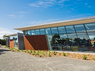
Hornby is a major residential and retail suburb at the western edge of Christchurch, New Zealand. The suburb is directly connected to other parts of Christchurch and the South Island by a number of main arterial routes, including State Highway 1 and the Christchurch Southern Motorway.

<span class="mw-page-title-main">Shirley, New Zealand</span> Suburb in Christchurch, New Zealand

Shirley, sometimes referred to as Windsor, is a suburb of Christchurch, New Zealand, about 5 kilometres (3.1 mi) north-east of the city centre. The area was used for farming from the 1850s, and subdivision started in the early 20th century, with most of the houses being built between 1950 and 1980.

<span class="mw-page-title-main">Bryndwr</span> Suburb in Christchurch, New Zealand

Bryndwr is a suburb in the north-west of Christchurch, New Zealand.

<span class="mw-page-title-main">St Albans, New Zealand</span> Suburb in Christchurch, New Zealand

St Albans is a large, inner-northern suburb of Christchurch, New Zealand, located directly north of the Christchurch Central Business District. It is the second largest suburb in the city by population, with a population of 13,137 at the 2018 Census. The suburb falls within the Christchurch Central electorate and is represented by Duncan Webb, who has been the member of parliament since the 2017 general election. St Albans is one of the most diverse residential neighbourhoods in Christchurch, with a wide range of densities, architectural styles and housing ages throughout the suburb. It has everything from run-down high-density council-owned flats, to modern luxurious high-density flats and apartments; old mid-density workers cottages through to large low-density estates of various ages.

<span class="mw-page-title-main">Spreydon</span> Suburb in Christchurch, New Zealand

Spreydon is a suburb of Christchurch, New Zealand, 4 kilometres (2.5 mi) south-south-west of Cathedral Square. The most central street through Spreydon is Barrington Street. Spreydon is flanked by the suburbs Hoon Hay, Sydenham, and Lower Cashmere. State Highway 76 marks the northern boundary of the suburb, including the eastern end of the Christchurch Southern Motorway.

<span class="mw-page-title-main">Burnside, Christchurch</span> Suburb in Christchurch, New Zealand

Burnside is a suburb of Christchurch, New Zealand, located southeast of Christchurch International Airport. As with most suburbs in Christchurch, it has no defined boundaries and is a general area.

<span class="mw-page-title-main">Linwood, New Zealand</span> Suburb in Christchurch, New Zealand

Linwood is an inner suburb of the city of Christchurch, New Zealand. It lies to the east of the city centre, mostly between Ferry Road and Linwood Avenue, two of the major arterial roads to the eastern suburbs of Christchurch.

<span class="mw-page-title-main">Somerfield, New Zealand</span> Suburb in Christchurch, New Zealand

Somerfield is a suburb in the south of Christchurch, New Zealand. It is nominally bordered by the Ōpāwaho / Heathcote River to the south and west, Strickland and Colombo Streets to the east, and Milton Street to the north. The suburb includes Somerfield School, Somerfield Park and a small number of shops which service the local area, although it is predominantly residential. Somerfield is also known for its wide variety of trees, especially along the banks of the Ōpāwaho / Heathcote River.

<span class="mw-page-title-main">Strowan</span> Suburb in Christchurch, New Zealand

Strowan is an affluent suburb of Christchurch, New Zealand, located approximately 5 km north-west of Christchurch's central business district. It had a population of 3,705 at the 2013 census. It is located between the suburbs of Merivale, Papanui, Bryndwr, Fendalton, and St Albans.

<span class="mw-page-title-main">Avondale, Christchurch</span> Suburb in Christchurch, New Zealand

Avondale is a suburb of Christchurch in the South Island of New Zealand. It is located 6 kilometres (3.7 mi) northeast of the city center, and is close to the Avon River, four kilometers to the northwest of its estuary. The suburb is centered on Avondale Road and so named due to its proximity to the Avon River. It has a good sized park on Mervyn Drive called Avondale Park. This park has a kids playground, a tennis court, basketball court, and a football field in winter. There is ample vacant red zone land in Avondale for activities such as leisure and dog walking.

<span class="mw-page-title-main">Upper Riccarton</span> Suburb in Christchurch, New Zealand

Upper Riccarton is a suburb of Christchurch. It is due west of Riccarton.

<span class="mw-page-title-main">Harewood, New Zealand</span> Suburb in Christchurch, New Zealand

Harewood is a northwestern suburb of Christchurch, New Zealand. The suburb is split by State Highway 1, with the bulk of Harewood's residential areas to the east of the highway and its industrial areas to the west.

<span class="mw-page-title-main">Aidanfield</span> Suburb in Christchurch, New Zealand

Aidanfield is a suburb in the south-west of Christchurch, New Zealand, about 8 kilometres (5.0 mi) from the city centre. The land, which had been owned by the Good Shepherd Sisters since 1886, now incorporates the Mount Magdala Institute and the St John of God Chapel, which has a Category I heritage listing by the New Zealand Historic Places Trust. The first residents moved into the suburb in 2002. The developer caused controversy in 2007–2008 by applying to have a group of farm buildings demolished to allow for further subdivision. Christchurch City Council was widely criticised for approving the demolition despite the buildings having had a heritage listing in the Christchurch City Plan.

Nelson South is an inner suburb of Nelson, New Zealand. It lies to the southwest of Nelson city centre, between it and Bishopdale, close to the foot of The Grampians. The main inland route to Stoke, New Zealand, Waimea Road, is Nelson South's main road.

Casebrook is a suburb on the northern side of Christchurch city.

References

  1. 1 2 "ArcGIS Web Application". statsnz.maps.arcgis.com. Retrieved 9 September 2021.
  2. "Population estimate tables - NZ.Stat". Statistics New Zealand . Retrieved 25 October 2022.
  3. Harper, Margaret (July 2011). "Christchurch Place Names" (PDF). Christchurch City Libraries. p. 25. Retrieved 30 September 2011. The family bought land on an accommodation road (later Bishop's Road) near Harewood Road. They planted pipfruit orchards there. The name Bishopdale was first used with the establishment of Bishopdale School which was built on the old Bishop property. The name became official when the Ministry of Works named the Bishopdale Shopping Centre.
  4. 1 2 Reed, A. W. (2010). Peter Dowling (ed.). Place Names of New Zealand. Rosedale, North Shore: Raupo. p. 49. ISBN   978-0-14-320410-7.
  5. Harper, Margaret (July 2011). "Christchurch Street Names F to G" (PDF). Christchurch City Libraries. p. 95. Retrieved 1 October 2011.
  6. 1 2 "Statistical area 1 dataset for 2018 Census". Statistics New Zealand. March 2020. Bishopdale North (317800), Bishopdale West (318000) and Bishopdale South (319000).
  7. 2018 Census place summary: Bishopdale North
  8. 2018 Census place summary: Bishopdale West
  9. 2018 Census place summary: Bishopdale South
  10. "Christchurch City Council Contextual History" (PDF). ccc.govt.nz. Christchurch City Council.
  11. "Shop Bishopdale Village". bishopdalevillagemall.co.nz. Bishopdale Village.
  12. Education Counts: Breens Intermediate
  13. 1 2 3 4 "Miscellaneous Local Historical Information" (PDF). Christchurch City Libraries. Retrieved 9 September 2021.
  14. Education Counts: Bishopdale School
  15. Education Counts: Cotswold School
  16. Education Counts: Isleworth School
  17. Education Counts: Emmanuel Christian School
  18. "New Zealand Schools Directory". New Zealand Ministry of Education. Retrieved 12 December 2022.
  19. Matthews, Philip (25 June 2016). "Lights, camera, Christchurch: the city on film". The Press . pp. C1–C2. Retrieved 26 June 2016.