Canterbury is a region of New Zealand, located in the central-eastern South Island. The region covers an area of 44,503.88 square kilometres (17,183.04 sq mi), making it the largest region in the country by area. It is home to a population of 694,400.

Waltham is an inner suburb of Christchurch, New Zealand, located approximately 2 kilometres south-east of the city centre. State Highway 76, part of Christchurch's ring road system, and known there as Brougham Street, runs through the suburb, as does the Lyttelton Line rail corridor. Amenities include Lancaster Park, Christchurch's former sports venue, now a community park, and Waltham pool.

Belfast is a suburb of Christchurch, New Zealand. It is in the north of the city 10 km (6.2 mi) from Cathedral Square, close to the banks of the Waimakariri River.
Riccarton is a suburb of Christchurch. It is due west of the city centre, separated from it by Hagley Park. Upper Riccarton is to the west of Riccarton.

Heathcote Valley is a suburb of Christchurch, New Zealand. It is named after Sir William Heathcote, who was secretary of the Canterbury Association.

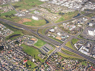
Hornby is a major residential and retail suburb at the western edge of Christchurch, New Zealand. The suburb is directly connected to other parts of Christchurch and the South Island by a number of main arterial routes, including State Highway 1 and the Christchurch Southern Motorway.
Sydenham is an inner suburb of Christchurch, New Zealand, 2 kilometres south of the city centre, on and around the city's main street, Colombo Street. It is a residential, retail and light industrial suburb.
Redwood is a northern suburb of Christchurch, New Zealand, which includes the sub-division of Redwood Springs. It is bordered by the Styx River to the north. Before the area was settled the original forest cover was tōtara and kahikatea. Like much of Christchurch, the early settlers drained the swamps and cut the bush to create farmland.

Spreydon is a suburb of Christchurch, New Zealand, 4 kilometres (2.5 mi) south-south-west of Cathedral Square. The most central street through Spreydon is Barrington Street. Spreydon is flanked by the suburbs Hoon Hay, Sydenham, and Lower Cashmere. State Highway 76 marks the northern boundary of the suburb, including the eastern end of the Christchurch Southern Motorway.
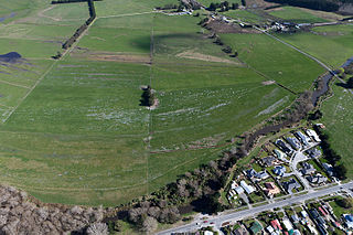
Huntsbury is a suburb of Christchurch, New Zealand, on the fringes of the Port Hills three kilometres south of the city centre. Huntsbury amalgamated with Christchurch City on 1 April 1941, on the same day as the New Brighton borough joined the city council.
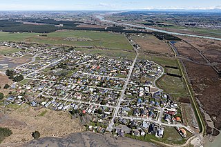
Spencerville is a semi-rural town on the east coast of Canterbury, New Zealand north of Christchurch. The town backs on to Bottle Lake Forest and includes a large park and 80 hectare camping ground. These amenities, as well as wetlands and an animal and bird park make the town a popular camping area for Christchurch residents.
Manukau, or Manukau Central, is a suburb of South Auckland, New Zealand, centred on the Manukau City Centre business district. It is located 23 kilometres south of the Auckland Central Business District, west of the Southern Motorway, south of Papatoetoe, and north of Manurewa. The industrial and commercial suburb of Wiri lies to the east and south.

Avonhead is a suburb of the New Zealand city of Christchurch. It has two primary schools, a shopping centre and several parks.
Brooklands is the northernmost suburb of Christchurch, New Zealand. The settlement was built on former swamp land adjacent to Brooklands Lagoon, which forms part of the Waimakariri River mouth. The land damage sustained in the 2010 and 2011 Christchurch earthquakes and subsequent Red Zone classification resulted in the buyout and demolition of nearly all properties in Brooklands, effectively wiping the suburb off the map.

South New Brighton is a coastal suburb on the eastern side of Christchurch city. The area previously had some Māori presence. The suburb also contains a primary school.

Bottle Lake is an area in the north-east of Christchurch with a low number of residents. Most of the area is covered by Bottle Lake Forest, which has since the mid-1970s become a popular recreation area.
Hillsborough is a mixed industrial and residential suburb of Christchurch, New Zealand, located approximately 4 kilometres (2.5 mi) to the south-east of the city centre.
Hei Hei is a suburb of Christchurch, New Zealand. It is located in the west of Christchurch 11 kilometres (6.8 mi) from the central city, and is bisected by State Highway 1. The area was subdivided for poultry farming after World War I for returning serviceman, but the venture failed due to the poor soil conditions. The place name is related to the Māori word for chicken (heihei) due to the area's poultry farming history.

Kainga is a settlement on the southern bank of the Waimakariri River, just north of Christchurch, in Canterbury, New Zealand. It lies immediately to the south of Kaiapoi, on a small road leading northeast from State Highway 1.

Marshland is a semi-rural suburb on the northern side of Christchurch city. The land is primarily used for horticulture and dairy farming.