
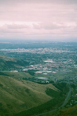
Christchurch is the largest city in the South Island and the second-largest city by urban area population in New Zealand. Christchurch has an urban population of 415,100, and a metropolitan population of over half a million. It is located in the Canterbury Region, near the centre of the east coast of the South Island, east of the Canterbury Plains. It is located near the southern end of Pegasus Bay, and is bounded to the east by the Pacific Ocean and to the south by the ancient volcanic complex of the Banks Peninsula. The Avon River (Ōtākoro) winds through the centre of the city, with a large urban park along its banks. With the exception of the Port Hills, it is a relatively flat city, on an average around 20 m (66 ft) above sea level. Christchurch has a reputation for being an English city, with its architectural identity and nickname the 'Garden City' due to similarities with garden cities in England, but also has a historic Māori heritage. Christchurch has a temperate oceanic climate with regular moderate rainfall.

Opawa is an inner residential suburb of Christchurch, New Zealand. It is located approximately 3.5 kilometres south-east of the city centre. Prior to European settlement, much of the area consisted of marshlands and mixed-use vegetation. By the 1850s, the area was sparsely populated by settlers and became a dairying locality, with many of the early settlers being farmers and people of English descent. Opawa had little development in its early years as it transitioned into a residential suburb.
Woolston is an industrial and residential suburb of Christchurch in the South Island of New Zealand. It is situated 3 kilometres southeast of the city centre, close to major arterial routes including State Highways 74 and 76 to Banks Peninsula. The Heathcote River flows through the suburb.
Addington is a major suburb of Christchurch, New Zealand. It is sited 2.5 kilometres (1.6 mi) south-west of the city centre.

Cashmere is a suburb which rises above the southern end of the city of Christchurch in New Zealand's South Island, on the north side of the Port Hills. It covers an area of 4.71 km2 (1.82 sq mi) and has a population of 6,453 as at 2018.
Originally a separate village, Halswell is now a residential suburb of Christchurch, New Zealand, located 9 kilometres (5.6 mi) southwest of Cathedral Square on State Highway 75.
Sydenham is an inner suburb of Christchurch, New Zealand, 2 kilometres south of the city centre, on and around the city's main street, Colombo Street. It is a residential, retail and light industrial suburb.
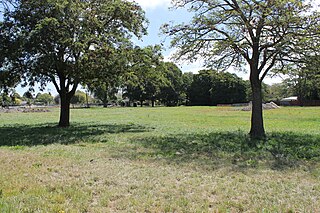
Avonside is an eastern suburb in Christchurch, New Zealand. It is one of the oldest suburbs of the city, with only Heathcote being older.

Rolleston is the seat and largest town in the Selwyn District, in the Canterbury region of New Zealand's South Island. It is located on the Canterbury Plains 22 kilometres (14 mi) south-west of Christchurch, and is part of the wider Christchurch metropolitan area.

Shirley, sometimes referred to as Windsor, is a suburb of Christchurch, New Zealand, about 5 kilometres (3.1 mi) north-east of the city centre. The area was used for farming from the 1850s, and subdivision started in the early 20th century, with most of the houses being built between 1950 and 1980.

Bryndwr is a suburb in the north-west of Christchurch, New Zealand.

St Albans is a large, inner-northern suburb of Christchurch, New Zealand, located directly north of the Christchurch Central Business District. It is the second largest suburb in the city by population, with a population of 13,137 at the 2018 Census. The suburb falls within the Christchurch Central electorate and is represented by Duncan Webb, who has been the member of parliament since the 2017 general election.

Beckenham is an inner suburb of Christchurch, New Zealand, located three kilometres south of the city centre. The Heathcote River winds through this predominantly residential suburb, a section of which is often referred to locally as the "Beckenham Loop". Beckenham is bounded by Sydenham to the north, Somerfield to the west, Cashmere and Huntsbury to the south and St Martins to the east.
Strowan is an affluent suburb of Christchurch, New Zealand, located approximately 5 km north-west of Christchurch's central business district. It had a population of 3,705 at the 2013 census. It is located between the suburbs of Merivale, Papanui, Bryndwr, Fendalton, and St Albans.

Avondale is a suburb of Christchurch in the South Island of New Zealand. It is located 6 kilometres (3.7 mi) northeast of the city center, and is close to the Avon River / Ōtākaro, four kilometres to the northwest of its estuary. The suburb is centred on Avondale Road and so named due to its proximity to the Avon River. It has a good sized park on Mervyn Drive called Avondale Park. This park has a kids playground, a tennis court, basketball court, and a football field in winter. There is ample vacant red zone land in Avondale for activities such as leisure and dog walking.

Dallington is a suburb of Christchurch, New Zealand, on the north-east side of the city.

Mount Pleasant (Tauhinukorokio) is a coastal suburb of Christchurch, New Zealand. The suburb is located on the northern flank of the mountain Tauhinukorokio/Mount Pleasant in the Port Hills. It takes its name from the English version of the mountain's name.

Aranui is one of the eastern suburbs of Christchurch. It is a low socio-economic area. In its early years, Aranui grew along Pages Road, the suburb's main road. Aranui soon became a working-class suburb. There are also areas of light-industrial premises in Aranui.

Southshore is an eastern coastal suburb within Christchurch, New Zealand. It is located on a narrow 2.5 km (1.6 mi) long sandspit that runs along the eastern side of the Avon Heathcote Estuary and west of the Pacific Ocean. The suburb is 8 km (5.0 mi) east of the city centre and 5 km (3.1 mi) south of New Brighton's main retail area.
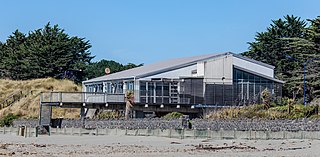
North New Brighton is a suburb on the northern side of Christchurch city. It was originally known as North Beach and was readily accessible from Christchurch city by tram. It was renamed North New Brighton in 1953. A large sports centre and swimming pool is on the same locale as the former Queen Elizabeth II Park. The centre was rebuilt and opened in 2018.
