Upper Riccarton

Last updated

Upper Riccarton
St Peter's Anglican Church 96.jpg
St Peter's Anglican Church, a landmark of Upper Riccarton, showing damage from the 2011 Christchurch earthquake
Upper Riccarton
Coordinates: 43°31′54″S172°34′27″E / 43.53178°S 172.57427°E / -43.53178; 172.57427
CountryNew Zealand
City Christchurch
Local authority Christchurch City Council
Electoral ward
  • Riccarton
  • Waimairi
Community board
  • Waipuna Halswell-Hornby-Riccarton
  • Waimāero Fendalton-Waimairi-Harewood
Area
[1]
  Land220 ha (540 acres)
Population
 (June 2023) [2]
  Total8,050
Avonhead Ilam Fendalton
Sockburn
Pfeil oben.svg
Pfeil links.svgUpper RiccartonPfeil rechts.svg
Pfeil unten.svg
Riccarton
Wigram Middleton Addington
Antonio House, a heritage property built in 1909 Antonio House 99.jpg
Antonio House, a heritage property built in 1909

Upper Riccarton is a suburb of Christchurch. It is due west of Riccarton. [lower-alpha 1]

Contents

Upper Riccarton is made up of residential, retail and education areas. It includes a major intersection known as "Church Corner" (the intersection of Riccarton, Main South and Yaldhurst Roads), as well as the Bush Inn Shopping Centre and multiple schools.

A local landmark is St Peter's Church. The original wooden church, consecrated in 1858, was built by Isaac Luck. The later stone church was built between 1876 and 1929, with Benjamin Mountfort the architect for the initial work, but Cecil Wood undertaken most of the architectural design. [4] The old Māori name for Upper Riccarton is Rakipaoa. [5]

Demographics

Upper Riccarton, comprising the statistical areas of Upper Riccarton, Bush Inn and Wharenui, covers 2.20 km2 (0.85 sq mi). [1] It had an estimated population of 8,050 as of June 2023, with a population density of 3,659 people per km2.

Historical population
YearPop.±% p.a.
20066,183    
20136,903+1.59%
20187,533+1.76%
Source: [6]

Upper Riccarton had a population of 7,533 at the 2018 New Zealand census, an increase of 630 people (9.1%) since the 2013 census, and an increase of 1,350 people (21.8%) since the 2006 census. There were 2,223 households, comprising 4,026 males and 3,507 females, giving a sex ratio of 1.15 males per female, with 852 people (11.3%) aged under 15 years, 2,973 (39.5%) aged 15 to 29, 2,508 (33.3%) aged 30 to 64, and 1,200 (15.9%) aged 65 or older.

Ethnicities were 56.6% European/Pākehā, 7.5% Māori, 4.4% Pasifika, 35.0% Asian, and 3.7% other ethnicities. People may identify with more than one ethnicity.

The percentage of people born overseas was 43.5, compared with 27.1% nationally.

Although some people chose not to answer the census's question about religious affiliation, 43.7% had no religion, 40.1% were Christian, 0.3% had Māori religious beliefs, 3.5% were Hindu, 2.8% were Muslim, 1.6% were Buddhist and 3.2% had other religions.

Of those at least 15 years old, 1,485 (22.2%) people had a bachelor's or higher degree, and 903 (13.5%) people had no formal qualifications. 315 people (4.7%) earned over $70,000 compared to 17.2% nationally. The employment status of those at least 15 was that 2,271 (34.0%) people were employed full-time, 1,218 (18.2%) were part-time, and 348 (5.2%) were unemployed. [6]

Individual statistical areas
NameArea
(km2)
PopulationDensity
(per km2)
HouseholdsMedian ageMedian
income
Upper Riccarton0.521,6833,23747729.3 years$19,700 [7]
Bush Inn0.843,0903,67994228.4 years$17,000 [8]
Wharenui0.842,7603,28680430.8 years$20,100 [9]
New Zealand37.4 years$31,800

Economy

Bush Inn Centre is located in Upper Riccarton and has 60 stores. [10]

Education

Riccarton High School is a secondary school for years 9 to 13. [11] It has a roll of 1,026 students. It opened in 1958. [12]

Kirkwood Intermediate is an intermediate school for years 7 to 8, [13] with a roll of 274 students. It opened in 1959. [14] :88

Te Kāpehu Riccarton School is a full primary school catering for years 1 to 8. [15] It has a roll of 317 students. The school opened in 1859 as Riccarton Church School, and became Riccarton District School in 1864, and later Riccarton Primary School. [14] :157

Middleton Grange School is a state-integrated composite school for years 1 to 13. [16] It has a roll of 1,437 students. It started as a private Christian school in 1964 and became state-integrated in 1996. [17]

Villa Maria College is a Catholic state-integrated girls' secondary school for years 7 to 13. [18] It has a roll of 828 students. The school opened in 1918, and became state-integrated in 1981. [19] The corresponding Catholic primary and boys' schools, Our Lady of Victories and St Thomas of Canterbury College, are in Sockburn.

Schools are coeducational and state operated unless otherwise noted. Rolls are as of February 2024. [20]

The Upper Riccarton Library is operated as a joint community and school library with Riccarton High. This began with the signing of an agreement in 2004 and was opened on 23 January 2006. [21] The library features a café, meeting rooms and multiple other community resources. [22]

Notes

  1. Riccarton was originally referred to as Lower Riccarton, the whole area being known as Riccarton. [3]

Related Research Articles

<span class="mw-page-title-main">Gore, New Zealand</span> Town in Southland region, New Zealand

Gore is a town and district in the Southland region of the South Island of New Zealand. It has a resident population of 8,240 as of June 2023. Gore is known for its country music scene and hosts an annual country music festival. The town is also surrounded by farmland and is an important centre for agriculture in the region.

<span class="mw-page-title-main">Papanui</span> Suburb of Christchurch, New Zealand

Papanui is a major suburb of Christchurch, New Zealand. It is situated five kilometres to the northwest of the city centre. Papanui has a population of 3,645 consisting predominantly of Pākehā 86.9%, Asian 7.6%, Māori 5.3%, Pacific peoples 3.1%, Middle Eastern/Latin American/African 0.7%. The suburb is located at the junction of three busy thoroughfares; Papanui Road leading to the city, the Main North Road that leads to North Canterbury and Harewood Road that leads to Christchurch International Airport. However, as with most Christchurch suburbs, Papanui has no defined borders.

<span class="mw-page-title-main">Riccarton, New Zealand</span> Suburb of Christchurch, New Zealand

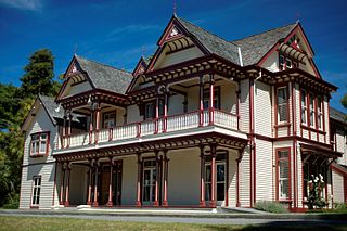
Riccarton is a suburb of Christchurch. It is due west of the city centre, separated from it by Hagley Park. Upper Riccarton is to the west of Riccarton.

<span class="mw-page-title-main">Ōrākei</span> Suburb of Auckland

Ōrākei is a suburb of Auckland city, in the North Island of New Zealand. It is located on a peninsula five kilometres to the east of the city centre, on the shore of the Waitematā Harbour, which lies to the north, and Hobson Bay and Ōrākei Basin, two arms of the Waitematā, which lie to the west and south. To the east is the suburb of Mission Bay. Takaparawhau / Bastion Point is a coastal piece of land in Ōrākei. Between Takaparawhau and Paritai Drive is Ōkahu Bay and Reserve.

<span class="mw-page-title-main">Fendalton</span> Suburb of Christchurch, New Zealand

Fendalton is a suburb of Christchurch, in the South Island of New Zealand.

<span class="mw-page-title-main">Addington, New Zealand</span> Suburb of Christchurch, New Zealand

Addington is a major suburb of Christchurch, New Zealand. It is sited 2.5 kilometres (1.6 mi) south-west of the city centre.

<span class="mw-page-title-main">Halswell</span> Suburb of Christchurch, New Zealand

Originally a separate village, Halswell is now a residential suburb of Christchurch, New Zealand, located 9 kilometres (5.6 mi) southwest of Cathedral Square on State Highway 75.

<span class="mw-page-title-main">Bryndwr</span> Suburb of Christchurch, New Zealand

Bryndwr is a suburb in the north-west of Christchurch, New Zealand.

<span class="mw-page-title-main">Bishopdale, Christchurch</span> Suburb of Christchurch, New Zealand

Bishopdale is a residential suburb located in the north of Christchurch, New Zealand.

<span class="mw-page-title-main">Spreydon</span> Suburb of Christchurch, New Zealand

Spreydon is a suburb of Christchurch, New Zealand, 4 kilometres (2.5 mi) south-south-west of Cathedral Square. The most central street through Spreydon is Barrington Street. Spreydon is flanked by the suburbs Hoon Hay, Sydenham, and Lower Cashmere. State Highway 76 marks the northern boundary of the suburb, including the eastern end of the Christchurch Southern Motorway.

<span class="mw-page-title-main">Riccarton High School</span> School

Riccarton High School is a state co-educational secondary school located in Upper Riccarton, a suburb of Christchurch, New Zealand. With a roll of 1,026 students, it is one of the five largest secondary schools in Christchurch.

<span class="mw-page-title-main">Beckenham, New Zealand</span> Suburb of Christchurch, New Zealand

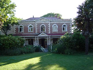
Beckenham is an inner suburb of Christchurch, New Zealand, located three kilometres south of the city centre. The Ōpāwaho / Heathcote River winds through this predominantly residential suburb, a section of which is often referred to locally as the "Beckenham Loop". Beckenham is bounded by Sydenham to the north, Somerfield to the west, Cashmere and Huntsbury to the south and St Martins to the east.

St Martins is an inner suburb of Christchurch, New Zealand, located two kilometres south of the city centre.
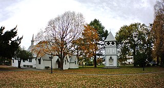
 Primarily a residential area, St Martins is host to a small shopping mall complex situated on Wilsons Road, the main thoroughfare through the suburb.

<span class="mw-page-title-main">Dallington, New Zealand</span> Suburb of Christchurch, New Zealand

Dallington is a suburb of Christchurch, New Zealand, on the north-east side of the city.

Wakari is a residential suburb of the New Zealand city of Dunedin. It is located 2.5 kilometres (1.6 mi) to the northwest of the city centre, immediately to the west of the ridge which runs to the west of the city's centre. Wakari lies to the north of the upper reaches of the Kaikorai Valley, and is also north of the suburb of Kaikorai. The suburbs of Roslyn and Maori Hill are situated on the ridge immediately to the southeast and east of Wakari. The suburb of Halfway Bush lies to the northwest, and the smaller suburb of Helensburgh lies to the north.

<span class="mw-page-title-main">Maori Hill</span> Suburb of Dunedin, New Zealand

Māori Hill is a residential suburb of the New Zealand city of Dunedin. It is located at the northern end of the ridge which runs in a crescent around the central city's western edge, 2 kilometres (1.2 mi) to the northwest of the city centre, immediately above and within the Town Belt. It is connected to Dunedin North, which lies to the east, via Drivers Road, the suburbs of Roslyn and Kaikorai to the southwest via Highgate, and the suburb of Wakari to the northwest via Balmacewen Road.

<span class="mw-page-title-main">Christchurch Central City</span> Central area of Christchurch, New Zealand

Christchurch Central City or Christchurch City Centre is the geographical centre and the heart of Christchurch, New Zealand. It is defined as the area within the Four Avenues and thus includes the densely built up central city, some less dense surrounding areas of residential, educational and industrial usage, and green space including Hagley Park, the Christchurch Botanic Gardens and the Barbadoes Street Cemetery.

<span class="mw-page-title-main">Hillmorton, New Zealand</span> Suburb of Christchurch, New Zealand

Hillmorton is a suburb of south-western Christchurch, New Zealand. The suburb is centred around the intersection of Lincoln Road and Hoon hay Road, two arterial routes which form part of State Highway 75 and feed into the Christchurch Southern Motorway which runs to the north of the suburb.

<span class="mw-page-title-main">North New Brighton</span> Suburb of Christchurch, New Zealand

North New Brighton is a suburb on the northern side of Christchurch city. It was originally known as North Beach and was readily accessible from Christchurch city by tram. It was renamed North New Brighton in 1953.

References

  1. 1 2 "ArcGIS Web Application". statsnz.maps.arcgis.com. Retrieved 19 September 2021.
  2. "Population estimate tables - NZ.Stat". Statistics New Zealand . Retrieved 25 October 2023.
  3. "Early Riccarton/Fendalton". Christchurch City Libraries. CCC. Retrieved 30 June 2023.
  4. "St. Peter's Anglican Church Cemetery, Upper Riccarton". Christchurch: Christchurch City Libraries . Retrieved 15 March 2013.
  5. Taylor, W.A (1952). Lore and history of the South Island Māori. Christchurch, New Zealand. p. 49.{{cite book}}: CS1 maint: location missing publisher (link)
  6. 1 2 "Statistical area 1 dataset for 2018 Census". Statistics New Zealand. March 2020. Upper Riccarton (322000), Bush Inn (321800) and Wharenui (322700).
  7. 2018 Census place summary: Upper Riccarton
  8. 2018 Census place summary: Bush Inn
  9. 2018 Census place summary: Wharenui
  10. "Bush Inn Centre". bushinncentre.co.nz. Ganson Management.
  11. Education Counts: Riccarton High School
  12. "Celebrating 60 years of Riccarton High School". Riccarton High School. Retrieved 19 September 2021.
  13. Education Counts: Kirkwood Intermediatel
  14. 1 2 "Miscellaneous Local Historical Information" (PDF). Christchurch City Libraries. Retrieved 21 September 2021.
  15. Education Counts: Te Kāpehu Riccarton School
  16. Education Counts: Middleton Grange School
  17. "Our History". Middleton Grange School. Retrieved 19 September 2021.
  18. Education Counts: Villa Maria College
  19. "About US - Our History". Villa Maria College. Retrieved 19 September 2021.
  20. "New Zealand Schools Directory". New Zealand Ministry of Education. Retrieved 14 March 2024.
  21. http://christchurchcitylibraries.com/Bibliofile/2006/UpperRiccarton/Opening/OpeningDay.asp Opening day photo library
  22. "About Upper Riccarton Library". my.christchurchcitylibraries.com. Retrieved 13 June 2020.