Marshland, New Zealand

Last updated

Marshland
Windsor Golf Course, Christchurch.jpg
Windsor Golf Course with Marshland in the distance
Marshland, New Zealand
Coordinates: 43°28′30″S172°39′07″E / 43.475°S 172.652°E / -43.475; 172.652
CountryNew Zealand
City Christchurch
Local authority Christchurch City Council
Electoral ward
  • Harewood
  • Innes
Community board
  • Waimāero Fendalton-Waimairi-Harewood
  • Waipapa Papanui-Innes-Central
  • Waitai Coastal-Burwood-Linwood
Area
[1]
  Land896 ha (2,214 acres)
Population
 (June 2023) [2]
  Total1,070
Belfast Kainga Bottle Lake
Redwood
Pfeil oben.svg
Pfeil links.svgMarshlandPfeil rechts.svg
Pfeil unten.svg
Prestons
Northcote Mairehau Shirley

Marshland is a semi-rural suburb on the northern side of Christchurch city. The land is primarily used for horticulture and dairy farming. [3]

Contents

The suburb is named for the peaty soil, and was also called Rhodes' Swamp after landowner and politician Robert Heaton Rhodes (1815–1884). [4]

State Highway 74 forms the western and southern boundary of the suburb. The Styx River runs northeast through Marshland. [5]

Demographics

Marshland covers 8.96 km2 (3.46 sq mi). [1] It had an estimated population of 1,070 as of June 2023, [2] with a population density of 119 people per km2.

Historical population
YearPop.±% p.a.
2006783    
2013759−0.44%
2018789+0.78%
Source: [6]

Before the 2023 census, the suburb had a larger boundary, covering 10.11 km2 (3.90 sq mi). [1] Using that boundary, Marshland had a population of 789 at the 2018 New Zealand census, an increase of 30 people (4.0%) since the 2013 census, and an increase of 6 people (0.8%) since the 2006 census. There were 258 households, comprising 408 males and 381 females, giving a sex ratio of 1.07 males per female. The median age was 41.1 years (compared with 37.4 years nationally), with 135 people (17.1%) aged under 15 years, 162 (20.5%) aged 15 to 29, 387 (49.0%) aged 30 to 64, and 105 (13.3%) aged 65 or older.

Ethnicities were 87.5% European/Pākehā, 12.5% Māori, 1.5% Pasifika, 7.6% Asian, and 1.1% other ethnicities. People may identify with more than one ethnicity.

The percentage of people born overseas was 16.3, compared with 27.1% nationally.

Although some people chose not to answer the census's question about religious affiliation, 50.6% had no religion, 40.3% were Christian, 0.4% were Muslim, 0.8% were Buddhist and 1.5% had other religions.

Of those at least 15 years old, 111 (17.0%) people had a bachelor's or higher degree, and 120 (18.3%) people had no formal qualifications. The median income was $37,700, compared with $31,800 nationally. 123 people (18.8%) earned over $70,000 compared to 17.2% nationally. The employment status of those at least 15 was that 330 (50.5%) people were employed full-time, 96 (14.7%) were part-time, and 18 (2.8%) were unemployed. [6]

Education

Marshland School is a full primary school catering for years 1 to 8. [7] It had a roll of 522 as of February 2024. [8] The school opened in 1888. [9]

Related Research Articles

<span class="mw-page-title-main">Waltham, New Zealand</span> Suburb of Christchurch, New Zealand

Waltham is an inner suburb of Christchurch, New Zealand, located approximately 2 kilometres south-east of the city centre. State Highway 76, part of Christchurch's ring road system, and known there as Brougham Street, runs through the suburb, as does the Lyttelton Line rail corridor.

<span class="mw-page-title-main">Mairehau</span> Suburb of Christchurch, New Zealand

Mairehau is a suburb of Christchurch, New Zealand. It is located four kilometres north of the city centre, close to the edge of the urbanised central city area. Much new development is being carried out on the northern edge of Mairehau.

<span class="mw-page-title-main">Addington, New Zealand</span> Suburb of Christchurch, New Zealand

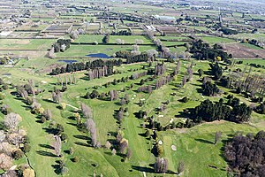
Addington is a major suburb of Christchurch, New Zealand. It is sited 2.5 kilometres (1.6 mi) south-west of the city centre.

<span class="mw-page-title-main">Halswell</span> Suburb of Christchurch, New Zealand

Originally a separate village, Halswell is now a residential suburb of Christchurch, New Zealand, located 9 kilometres (5.6 mi) southwest of Cathedral Square on State Highway 75.

<span class="mw-page-title-main">Hornby, New Zealand</span> Suburb of Christchurch, New Zealand

Hornby is a major residential and retail suburb at the western edge of Christchurch, New Zealand. The suburb is directly connected to other parts of Christchurch and the South Island by a number of main arterial routes, including State Highway 1 and the Christchurch Southern Motorway.

<span class="mw-page-title-main">Avonside</span> Suburb of Christchurch, New Zealand

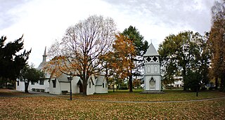
Avonside is an eastern suburb in Christchurch, New Zealand. It is one of the oldest suburbs of the city, with only Heathcote being older.

St Martins is an inner suburb of Christchurch, New Zealand, located two kilometres south of the city centre. Primarily a residential area, St Martins is host to a small shopping mall complex situated on Wilsons Road, the main thoroughfare through the suburb.

<span class="mw-page-title-main">Strowan</span> Suburb of Christchurch, New Zealand

Strowan is an affluent suburb of Christchurch, New Zealand, located approximately 5 km north-west of Christchurch's central business district. It had a population of 3,705 at the 2013 census. It is located between the suburbs of Merivale, Papanui, Bryndwr, Fendalton, and St Albans.

<span class="mw-page-title-main">Mount Pleasant, New Zealand</span> Suburb of Christchurch, New Zealand

Mount Pleasant (Tauhinukorokio) is a coastal suburb of Christchurch, New Zealand. The suburb is located on the northern flank of the mountain Tauhinukorokio/Mount Pleasant in the Port Hills. It takes its name from the English version of the mountain's name.

<span class="mw-page-title-main">Prebbleton</span> Minor urban area in Canterbury, New Zealand

Prebbleton is a small town in the Selwyn District in the Canterbury Region of New Zealand. It is 11 km southwest of the centre of Christchurch and about 2 km south of the outlying industrial suburb of Hornby.

<span class="mw-page-title-main">Edgeware</span> Suburb of Christchurch, New Zealand

Edgeware is a suburb of Christchurch, New Zealand, to the north of the central city. It is centred on a cluster of some 20 shops that make up Edgeware Village on Edgeware Road near Colombo Street's northern end. The boundaries of the suburb are debated. Google maps includes St Albans park as being within the boundaries of Edgeware, while excluding the Edgeware shops at the western end of Edgeware Road.

<span class="mw-page-title-main">Phillipstown, New Zealand</span> Suburb of Christchurch, New Zealand

Phillipstown is a small inner suburb of the city of Christchurch, New Zealand. It lies south-east of the city centre being bordered by Cashel Street to the north, Aldwins Road to the east, Ferry Road to the south, and Fitzgerald Avenue to the west.

<span class="mw-page-title-main">Parklands, New Zealand</span> Suburb of Christchurch, New Zealand

Parklands is a suburb of Christchurch, New Zealand. It is located north east of the city centre near Bottle Lake Forest.

<span class="mw-page-title-main">Wainoni, Christchurch</span> Suburb of Christchurch, New Zealand

Wainoni is one of the eastern suburbs of Christchurch. It is a lower socio-economic area.

<span class="mw-page-title-main">Bromley, New Zealand</span> Suburb of Christchurch, New Zealand

Bromley is a suburb of the city of Christchurch, New Zealand. It lies to the east of the city centre, mostly between Pages Road and the Avon river estuary.

<span class="mw-page-title-main">Middleton, New Zealand</span> Suburb of Christchurch, New Zealand

Middleton is a predominantly industrial and wholesale suburb of Christchurch, New Zealand. It is located in the west of the city, between Wigram and Addington, and immediately to the south of Upper Riccarton.

<span class="mw-page-title-main">Russley</span> Suburb of Christchurch, New Zealand

Russley is a suburb on the western side of Christchurch city.

Broomfield is a suburb on the western side of Christchurch city.

Northcote is a suburb on the northern side of Christchurch, New Zealand.

Prestons is a suburb on the northeastern side of Christchurch city.

References

  1. 1 2 3 "ArcGIS Web Application". statsnz.maps.arcgis.com. Retrieved 25 April 2024.
  2. 1 2 "Population estimate tables - NZ.Stat". Statistics New Zealand . Retrieved 25 October 2023.
  3. "Marshland". New Zealand Ministry for Culture and Heritage. Retrieved 10 September 2021.
  4. "Christchurch Place Names: A - M : Islington" (PDF). Christchurch City Libraries. February 2016. p. 179.
  5. Harriss, Gavin (April 2021). Marshland, Canterbury (Map).
  6. 1 2 "Statistical area 1 dataset for 2018 Census". Statistics New Zealand. March 2020. Marshland (318400). 2018 Census place summary: Marshland
  7. Education Counts: Marshland School
  8. "New Zealand Schools Directory". New Zealand Ministry of Education. Retrieved 14 March 2024.
  9. "Miscellaneous Local Historical Information" (PDF). Christchurch City Libraries. p. 103. Retrieved 10 September 2021.