This article needs additional citations for verification .(June 2010) |
State Highway 74 | ||||
---|---|---|---|---|
Christchurch Ring Road | ||||
Route information | ||||
Maintained by NZ Transport Agency | ||||
Length | 28.4 km (17.6 mi) | |||
Major junctions | ||||
North end | SH 1 (Christchurch Northern Motorway) at Belfast | |||
Southeast end | Gladstone Quay at Lyttelton | |||
Location | ||||
Country | New Zealand | |||
Major cities | Christchurch | |||
Highway system | ||||
|
State Highway 74 is a state highway in New Zealand servicing the eastern suburbs of Christchurch. Mostly two-lane, it is composed of limited-access expressways, with part of the highway as the Christchurch-Lyttelton Motorway, and connects the city to its port town of Lyttelton.
The highway begins immediately north of Belfast, with ramps connecting to the Western Bypass of the Christchurch Northern Motorway on State Highway 1. It then proceeds in a southerly direction on the Christchurch Northern Corridor (which opened in 2020) around the suburbs of Belfast, Northwood and Redwood.
At Mairehau, the highway turns east onto Queen Elizabeth II (QEII) Drive and begins its concurrency with the Christchurch Ring Road. As a dual carriageway, QEII Drive skirts through the northern suburbs of Christchurch, with major intersections at Innes Road and Marshland Road. After the Burwood Road traffic lights, the road changes name to Travis Road, drops to single carriage and runs in an easterly direction to the Anzac Drive/Frosts Road roundabout, where the highway turns right.
Now with the name Anzac Drive, the highway runs through the suburbs of Aranui and Bexley until reaching the Breezes Road/Bridge Street Roundabout. After the roundabout, the road changes name to Dyers Road. At Palinurus Road, the concurrency with the Ring Road ends, but Dyers Road keeps going in a southerly direction until the Ferry Road roundabout.
After the roundabout, the highway changes name to Tunnel Road and turns into the Christchurch-Lyttelton Motorway and passes through two interchanges before passing through the Lyttelton road tunnel.
In Lyttelton, the road changes name to Norwich Quay and acts as the main thoroughfare through the town and its associated port before terminating at the port gates as Gladstone Quay.
The route of SH 74 has been rearranged quite frequently for a State Highway, initially gazetted in 1964 upon the opening of the Lyttelton Road Tunnel, it only consisted of the motorway and the short section through Lyttelton.
When State Highway 1 went through Christchurch was rerouted to bypass the city in the early 1990s, State Highways 73 and 74 were extended to cover much of the original route, with SH 74 initially continuing through at QEII Drive/Northcote Road to travel via Cranford and Sherborne Streets. In Christchurch CBD, the route turned left onto Bealey Avenue and then onto the parallel one-way roads Madras and Barbadoes Street. The road then turned left onto Moorhouse Avenue and then right onto Waltham Road before turning left again onto Brougham Street. The road then proceeded in a south-easterly direction until the Port Hills Road interchange with Tunnel Road. [1] In 2004, the route was realigned to its current route, with much of the previous route either revoked or taken over by SH 73. [2]
In November 2017, the Christchurch Northern Motorway's Western Bypass was opened, taking State Highway 1 to the west of Belfast, and State Highway 74's route was extended north along SH1's previous route up Main North Road from the Johns Road intersection to the previously existing motorway. [3]
With the recent opening of the Christchurch Northern Corridor as a road of national significance, [4] SH 74, bypasses the northern suburbs of Redwood and Belfast. Previously the highway followed Main North Road and the western section of QEII Drive. [5] The Christchurch Northern Corridor opened in December 2020. [6]
This article contains a bulleted list or table of intersections which should be presented in a properly formatted junction table.(November 2021) |
For Tunnel Road's major intersection, refer to Christchurch-Lyttelton Motorway
Territorial authority | Location | km | jct | Destinations | Notes |
---|---|---|---|---|---|
Christchurch City | Belfast | 0 | SH 1 ( Christchurch Northern Motorway ) | SH 74 begins Northbound exit and southbound entrance only SH 74/Christchurch Northern Corridor concurrency begins | |
Mairehau | Christchurch Northern Corridor (southbound) – City Centre | SH 74/Christchurch Northern Corridor concurrency ends SH 74/Christchurch Ring Road concurrency begins | |||
Christchurch Northern Corridor (northbound) (Queen Elizabeth II Drive – west) | |||||
9.7 | (Innes Road) – Mairehau, Saint Albans | ||||
Marshland | 10.3 | (Marshland Road) – Kaiapoi, Shirley | |||
New Brighton | 13.7 | (Frosts Road) – Parklands (Travis Road) – North New Brighton | |||
14.5 | (New Brighton Road) – New Brighton, Dallington, City Centre | ||||
14.6 | Avon River / Ōtākaro Bridge | ||||
Wainoni | 15.2 | (Wainoni Road) – New Brighton, Wainoni, Linwood | |||
Bexley | 16.4 | (Pages Road) – New Brighton, Linwood, City Centre | |||
Bromley | 18.0 | (Bridge Street) – South New Brighton (Breezes Road) – Aranui, City Centre | |||
21.2 | (Linwood Avenue) – Ferrymead, Sumner, Linwood, City Centre | ||||
Woolston | 21.7 | SH 74A (Palinurus Road) – Woolston, City Centre | SH 74/Christchurch Ring Road concurrency ends | ||
22.0 | (Ferry Road) – Sumner, Woolston, City Centre | Christchurch-Lyttelton Motorway (Tunnel Road) begins | |||
22.1 | Ōpāwaho / Heathcote River Bridge | ||||
Heathcote | 24.3 | SH 76 (Port Hills Road) – Healthcote, Opawa, City Centre | |||
26.0 | (Bridle Path Road) – Heathcote | Northbound exit and southbound entrance only | |||
26.1 | Lyttelton Road Tunnel (1.97 km (1.22 mi)) | ||||
Lyttelton | 28.1 | ||||
28.1 | (Simeon Quay) – Naval Point, Governors Bay | Christchurch-Lyttelton Motorway (Tunnel Road) ends | |||
28.5 | (Oxford Street) – Town Centre, Sumner | ||||
28.8 | (Gladstone Quay) – Port | SH 74 ends |
Christchurch Ring Road | |
Location | Bromley–Woolston |
Length | 2.1 km (1.3 mi) |
State Highway 74A is a minor Christchurch arterial road connecting the southeastern industrial suburbs of Bromley and Woolston. It was gazetted as a new state highway in 2003 at the same time SH 74 was shifted to its current location. [2] It is just over 2 kilometres long and consists of three roads – Garlands Road, Palinurus Road and Rutherford Street. It runs concurrent with the Christchurch Ring Road for its entire length.
This article contains a bulleted list or table of intersections which should be presented in a properly formatted junction table.(November 2021) |
Territorial authority | Location | km | jct | Destinations | Notes |
---|---|---|---|---|---|
Christchurch City | Woolston | 0 | SH 74 north (Dyers Road) – Bromley, New Brighton, Picton SH 74 south (Dyers Road) – Lyttelton | SH 74A begins SH 74A/Christchurch Ring Road concurrency begins | |
0.5 | (Ferry Road) – Sumner, Woolston, City Centre | ||||
0.7 | Ōpāwaho / Heathcote River | ||||
Opawa | 1.9 | Lyttelton Line | |||
2.1 | SH 76 east (Opawa Road) – Lyttelton SH 76 west (Opawa Road) – Waltham, City Centre | SH 74A ends SH 74A/Christchurch Ring Road concurrency ends |
The M50 motorway is a C-shaped orbital motorway in Dublin and the busiest motorway in Ireland. The current route was built in various sections over the course of 27 years, from 1983 to 2010. It begins at Dublin Port, running northward through the Dublin Port Tunnel and along a portion of the Airport Motorway. It then turns west at its junction with the M1, circling the northern, western and southern suburbs of Dublin, before merging with the M11 at Shankill in South East Dublin. The road forms part of European route E01.
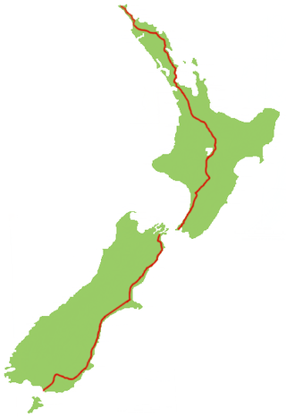
State Highway 1 is the longest and most significant road in the New Zealand road network, running the length of both main islands. It appears on road maps as SH 1 and on road signs as a white number 1 on a red shield, but it has the official designations SH 1N in the North Island, SH 1S in the South Island.
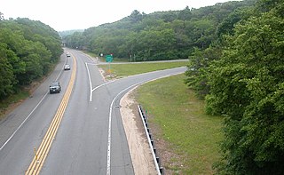
A two-lane expressway or two-lane freeway is an expressway or freeway with only one lane in each direction, and usually no median barrier. It may be built that way because of constraints, or may be intended for expansion once traffic volumes rise. The term super two is often used by roadgeeks for this type of road, but traffic engineers use that term for a high-quality surface road. Most of these roads are not tolled.
State Route 3 is a 120.67-mile-long (194.20 km) state highway located in southern Maine. It is a major interregional highway, connecting the Interstate 95 corridor to the Atlantic coast. The western terminus is at SR 8, SR 11 and SR 27 in Augusta and the eastern terminus is at SR 102 and SR 198 in Mount Desert. Major cities and towns along the length of SR 3 include Augusta, Belfast, Ellsworth, and Bar Harbor.
State Highway 20 (SH 20), also known as the Southwestern Motorway, is a New Zealand state highway linking State Highway 1 at Manukau with State Highway 16 in Point Chevalier, via Māngere and Onehunga. Along with its spurs, State Highway 20A and 20B, the state highway serves Auckland Airport, the country's largest, therefore making SH 20 a key arterial route connecting the airport to the wider Auckland region and most of the upper North Island. The route also forms the southern part of the Western Ring Route, a 48 kilometres (30 mi) motorway route bypassing central Auckland.
Dorset is a county in South West England. The county is largely rural and therefore does not have a dense transport network, and is one of the few English counties without a motorway. Owing to its position on the English Channel coast, and its natural sheltered harbours, it has a maritime history, though lack of inland transport routes has led to the decline of its ports.
State Highway 2 runs north–south through eastern parts of the North Island of New Zealand from the outskirts of Auckland to Wellington. It runs through Tauranga, Gisborne, Napier, Hastings and Masterton. It is the second-longest highway in the North Island, after State Highway 1, which runs the length of both of the country's main islands.
The Christchurch Southern Motorway is the main southern route into and out of Christchurch, New Zealand. The motorway forms part of State Highway 1 and State Highway 76.
The Christchurch–Lyttelton Motorway, also known as Tunnel Road, is part of the road network connecting Christchurch, New Zealand with its port at Lyttelton. It is part of State Highway 74.
The Christchurch Northern Motorway is the main northern route into and out of Christchurch, New Zealand. The motorway forms part of State Highway 1 and State Highway 74.
State Highway 73 is a major east-west South Island state highway in New Zealand connecting Christchurch on the east coast with Cass/Hokitika via the Southern Alps. It is mostly two lane, with some single-lane bridges north of Springfield but is mostly dual carriageway in Christchurch. The fourth and fifth-highest points of New Zealand's state highway network are on this road at Porters Pass and Arthur's Pass respectively.
Several special routes of U.S. Route 74 exist. In order from west to east they are as follows.
The North–South Corridor is a series of component motorways travelling through Adelaide, South Australia that will eventually form a continuous link from Old Noarlunga in the outer southern metropolitan Adelaide suburbs through to Gawler in northern metropolitan Adelaide, comprising a distance of 78km. Under South Australia's road route system, the corridor is signed as route M2.
The Western Belfast Bypass is an approximately five-kilometre-long (3.1 mi), four lane, grade separated motorway recently built to bypass the northern Christchurch suburb of Belfast, New Zealand. It is estimated that its construction will result in 17,000 fewer vehicles using Main North Road through Belfast, and shorten travel times between the north and west of Christchurch. In addition, the motorway will allow for improved public transport, cycling, and pedestrian options on Main North Road. It is expected that 21,500 vehicles per day will use the WBB motorway by 2026. The speed limit along the route is 100 km/h.
State Highway 76 (SH 76) is a state highway in Christchurch, New Zealand. This highway was gazetted in 2012 after stage 1 of the Christchurch Southern Motorway was completed. Beforehand, much of SH 76 was part of SH 73 and included the former two-lane Christchurch Arterial Motorway, which was upgraded to four lanes. SH 76 includes the entire length of the Christchurch Southern Motorway and forms the most direct route from the south of Christchurch to the city centre and Lyttelton.
The Western Corridor is a road in Christchurch, New Zealand which connects the suburb of Belfast, New Zealand, in the north to Hornby in the south and connects the Canterbury region to Christchurch Airport. Most of the traffic on the corridor heads to the city, the airport, Belfast or Hornby, while 15% of traffic travels further north or south.
U.S. Route 74 Alternate is an alternate route of U.S. Route 74 in Western North Carolina, running from the town of Forest City to the city of Asheville. It replaced US 74's former mainline route in 1994, when its parent highway was moved onto a new freeway alignment running from Forest City to I-26 in Columbus, North Carolina, and from there to I-40 and US 23 in Enka, North Carolina. Its alignment, a narrow, winding road, greatly differs from US 74 today, straying from its parent route by as much as ~14 miles, separated by as much as half an hour of driving time. Throughout its routing, it is in Buncombe, Henderson, and Rutherford counties.