This article needs additional citations for verification .(July 2015) |
State Highway 8 | ||||
---|---|---|---|---|
Route information | ||||
Maintained by NZ Transport Agency | ||||
Length | 457 km (284 mi) | |||
Major junctions | ||||
North (clockwise) end | SH 1 (Hilton Highway) at Washdyke | |||
SH 8A (Bells Lane) to SH 6 near Tarras SH 8B to SH 6 near Cromwell | ||||
South (anticlockwise) end | SH 1 at Clarksville | |||
Location | ||||
Country | New Zealand | |||
Primary destinations | Pleasant Point, Fairlie, Lake Tekapo, Twizel, Omarama, Cromwell, Clyde, Alexandra, Roxburgh, Lawrence | |||
Highway system | ||||
|
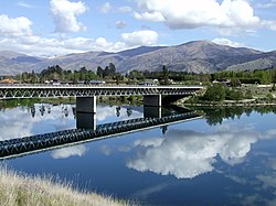
State Highway 8 is one of New Zealand's eight national highways. It forms an anticlockwise loop through the southern scenic regions of the Mackenzie Basin and Central Otago, starting and terminating in junctions with State Highway 1. Distances are measured from north to south.
For most of its length SH8 is a two-lane single carriageway, with at-grade intersections and property accesses directly off the road, both in rural and urban areas.
The highway leaves SH1 at Washdyke, an industrial suburb of Timaru, travelling initially northwest through Pleasant Point then continuing to the town of Fairlie. From here the route tends westward and rapidly increases in altitude, passing the southern end of the two great Mackenzie Basin lakes of Tekapo and Pukaki.
From Pukaki the highway turns southwest across the upper reaches of the Waitaki Valley, passing through the former hydroelectricity service town of Twizel and Omarama before again climbing to cross the Lindis Pass, which, at 971 metres, is the highest point on the highway's path. The highway winds along the valley of the Lindis River, reaching the upper Clutha River not far from Tarras.
From here, the highway runs close to the eastern shore of the man-made Lake Dunstan before passing the historic town of Cromwell. The highway turns south as it travels through the Cromwell Gorge passing the country's third largest[ citation needed ] hydroelectric dam, the Clyde Dam at Clyde. The highway continues along the Clutha Valley through the town of Alexandra and past Lake Roxburgh to the town of Roxburgh. Much of this part of the highway's journey is past fruit orchards, and historic gold-diggings from the Central Otago Gold Rush.
From Roxburgh, the highway turns southeastward, passing Ettrick, Raes Junction and Beaumont, where it turns away from the Clutha, before reaching Lawrence, close to the original strike in the Central Otago Gold Rush. From here, the highway continues past Waitahuna and the twisting Manuka Gorge, reaching the plain of the Tokomairaro River at Clarksville, three kilometres south of Milton.
State Highway 8 has two spurs: State Highway 8A and State Highway 8B. These two spurs connect the highway with State Highway 6, which lies on the western bank of Lake Dunstan. State Highway 8A runs for 23 km from SH 6 at Luggate to connect with SH8 close to Tarras. State Highway 8B runs for just 2.6 km from SH8 at Deadmans Point across the lake to the town of Cromwell. SH 8B forms part of the main route between Queenstown and Christchurch.
The course of SH8 between Clyde and Tarras was substantially altered during the 1980s as part of the construction of the Clyde Dam, which flooded much of the Cromwell Gorge, including the former route of the highway. A completely new section was built between Clyde and Cromwell; for SH8B the old single-lane bridge crossing the Clutha was replaced with a new two-lane bridge approximately 1.5 km to the north.
The southern end of SH8 between Clarksville and Cromwell roughly follows the route taken by many miners and prospectors during the Otago Gold Rush of the 1860s. Many of the important sites of the gold rush lie close to the Highway and the Kawarau Gorge which extends to the northwest from Cromwell. These include the town of Lawrence, which was the hub of prospecting around the original gold strike at Gabriel's Gully.
The former Roxburgh Branch rail line ran roughly parallel with the highway's southern course for much of its length.
In 2006, SH8 had an annual average daily traffic volume (AADT – daily estimate) of between 1,188 vehicles at Bendigo, and 4,897 vehicles on the Clyde side of Alexandra. Over the eleven sites measured, between 9.0% and 15.3% of the vehicles were classified as heavy (3.5 tonnes or greater). For the spurs, SH8A AADT ranged from 646 to 858 vehicles, while the volume of vehicles on SH8B was 3,930 on Deadmans Point Bridge, and 4,500 near the SH6 junction. [1]
Territorial authority | Location | km | mi | Destinations | Notes |
---|---|---|---|---|---|
Timaru District | Washdyke | 0 | 0.0 | SH 1 north – Temuka, Christchurch SH 1 south – Timaru, Dunedin | SH 8 begins |
Mackenzie District | Fairlie | 57 | 35 | SH 79 – Geraldine, Christchurch | |
Burkes Pass | 83 | 52 | Burkes Pass 706 m (2,316 ft) | ||
Lake Pukaki | 146 | 91 | SH 80 – Glentanner, Aoraki / Mount Cook | ||
Waitaki District | Omarama | 185 | 115 | SH 83 – Kurow, Oamaru | |
Waitaki District / Central Otago District boundary | Lindis Pass | 219 | 136 | Lindis Pass 972 m (3,189 ft) | |
Central Otago District | Tarras | 267 | 166 | SH 8A – Wanaka, West Coast | |
Cromwell | 294 | 183 | SH 8B – Cromwell, Queenstown | ||
Alexandra | 328 | 204 | SH 85 – Ranfurly, Dunedin | ||
Central Otago District / Clutha District boundary | Raes Junction | 397 | 247 | SH 90 – Tapanui, Gore | |
Clutha District | Clarksville | 460 | 290 | SH 1 north – Milton, Dunedin SH 1 south – Balclutha, Invercargill | SH 8 ends |
1.000 mi = 1.609 km; 1.000 km = 0.621 mi |
Alexandra is a town in the Central Otago district of the South Island of New Zealand. It is on the banks of the Clutha River, on State Highway 8, 188 kilometres (117 mi) by road from Dunedin and 33 kilometres (21 mi) south of Cromwell. The nearest towns to Alexandra via state highway 8 are Clyde seven kilometers to the northwest and Roxburgh forty kilometers to the south. State highway 85 also connects Alexandra to Omakau, Lauder, Oturehua, Ranfurly and on to Palmerston on the East Otago coast.
The Clutha River is the second longest river in New Zealand and the longest in the South Island. It flows south-southeast 338 kilometres (210 mi) through Central and South Otago from Lake Wānaka in the Southern Alps to the Pacific Ocean, 75 kilometres (47 mi) south west of Dunedin. It is the highest volume river in New Zealand, and the swiftest, with a catchment of 21,960 square kilometres (8,480 sq mi), discharging a mean flow of 614 cubic metres per second (21,700 cu ft/s). The river is known for its scenery, gold-rush history, and swift turquoise waters. A river conservation group, the Clutha Mata-Au River Parkway Group, is working to establish a regional river parkway, with a trail, along the entire river corridor.
The Clyde Dam, New Zealand's third-largest hydroelectric dam, is built on the Clutha River / Mata-Au near the town of Clyde. It is owned and operated by Contact Energy.
Cromwell is a town in Central Otago in the Otago region of New Zealand.
Central Otago is located in the inland part of the Otago region in the South Island of New Zealand. The motto for the area is "A World of Difference".
The Kawarau River is a river in the South Island of New Zealand. It drains Lake Wakatipu in northwestern Otago via the lake's Frankton Arm. The river flows generally eastwards for about 60 kilometres (37 mi) and passes through the steep Kawarau Gorge until it joins Lake Dunstan near Cromwell. Before the construction of the Clyde High Dam, the Kawarau joined the Clutha River / Mata-Au in a spectacular confluence at Cromwell. The Shotover River enters the Kawarau from the north; the Nevis River enters it from the south. With many rapids and strong currents, the river can be dangerous and has claimed many lives. It is popular for bungy jumping and kayaking.
Lake Dunstan is a man-made lake and reservoir in the South Island of New Zealand.
Lindis Pass is located in the South Island of New Zealand. A carpark at the top of the pass provides access to a viewpoint and two short trails to other viewing spots.
The Cromwell Gorge is a deep gorge on the Clutha River in the Otago region of New Zealand's South Island. It stretches for 20 km south of the town of Cromwell towards Alexandra. It is one of three substantial river gorges in Central Otago, the others being the Kawarau Gorge to the west of Cromwell, and the Roxburgh Gorge downstream from Alexandra.
The Otago Gold Rush was a gold rush that occurred during the 1860s in Central Otago, New Zealand. This was the country's biggest gold strike, and led to a rapid influx of foreign miners to the area - many of them veterans of other hunts for the precious metal in California and Victoria, Australia.
Clyde, formerly Dunstan, is a small town in Central Otago, New Zealand with a population of 1,250 in June 2021. It is located on the Clutha River, between Cromwell and Alexandra.
The Central Otago wine region is a geographical indication in New Zealand's South Island, and the world's southernmost commercial wine growing region. Central Otago is best known for Pinot Noir, but many white wine varieties are also popular.
The Otago Central Railway (OCR) or in later years Otago Central Branch Railway, now often referred to as the Taieri Gorge Railway, was a secondary railway line in Central Otago, in the South Island of New Zealand.
The Roxburgh Branch was a branch line railway built in the Otago region of New Zealand's South Island that formed part of the country's national rail network. Originally known as the Lawrence Branch, it was one of the longest construction projects in New Zealand railway history, beginning in the 1870s and not finished until 1928. The full line was closed in 1968.
Tarras is a small farming settlement in Central Otago, in the South Island of New Zealand.
State Highway 6 is a major New Zealand state highway. It extends from the Marlborough region in the northeastern corner of the South Island across the top of the island, then down the length of the island, initially along the West Coast and then across the Southern Alps through inland Otago and finally across the Southland Plains to the island's south coast. Distances are measured from north to south.
The Kawarau Gorge is a major river gorge created by the Kawarau River in Central Otago, in the South Island of New Zealand. The towns of Queenstown and Cromwell are linked by State Highway 6 through the gorge.
The Clutha Mata-Au River Parkway Group, New Zealand, started in December 2004, and is an Incorporated Society, with private charitable status only, being deregistered from New Zealand Charities Services in December 2021. The Group was set up in response to land development issues along the Clutha River / Mata-Au corridor, much of which has high scenic and recreational values. The project aims to establish a regional river parkway, including a river trail, along the entire 338 km river corridor from Lake Wānaka to the Pacific Ocean.
The Gold Fields District electorate was a 19th-century parliamentary electorate in the Otago region, New Zealand. It was created in 1862, with the first elections in the following year, and it returned two members. It was one of eventually three special interest constituencies created to meet the needs of gold miners. All three of these electorates were abolished in 1870. A unique feature of the Gold Fields District was that it was superimposed over other electorates, and voting was open to those who had held a mining license for some time. As such, suffrage was more relaxed than elsewhere in New Zealand, as voting was otherwise tied to property ownership. Another feature unique to the gold mining electorates was that no electoral rolls were prepared, but voting could be done upon showing a complying miner's license.
Bendigo is a settlement and historic area in Central Otago, in the southern South Island of New Zealand. It is located some 20 kilometres to the north of Cromwell, to the east of the head of Lake Dunstan, on the banks of the Bendigo Creek, a small tributary of the Clutha River.