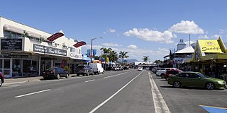
Paeroa is a town in the Hauraki District of the Waikato Region in the North Island of New Zealand. Located at the base of the Coromandel Peninsula, it is close to the junction of the Waihou River and Ohinemuri River, and is approximately 20 kilometres south of the Firth of Thames.
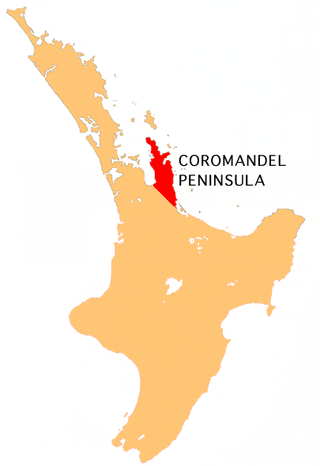
The Coromandel Peninsula on the North Island of New Zealand extends 85 kilometres (53 mi) north from the western end of the Bay of Plenty, forming a natural barrier protecting the Hauraki Gulf and the Firth of Thames in the west from the Pacific Ocean to the east. It is 40 kilometres (25 mi) wide at its broadest point. Almost its entire population lives on the narrow coastal strips fronting the Hauraki Gulf and the Bay of Plenty. In clear weather the peninsula is clearly visible from Auckland, the country's biggest city, which lies on the far shore of the Hauraki Gulf, 55 kilometres (34 mi) to the west. The peninsula is part of the Thames-Coromandel District and the Waikato Region.
Hikuai is a small community on the Tairua River near the base of the Coromandel Peninsula in the North Island of New Zealand. It lies 40 kilometres north of Waihi and 10 kilometres southwest of Tairua, close to the junction of State Highways 25 and 25A, the latter of which is a winding road cutting across the steep Coromandel Range of hills. It is a tourist hot spot at times such as New Zealand Labour Day weekend, the Christmas and New Year holiday, and especially when Tairua and Pauanui are busy.
The Waihou River is located in the northern North Island of New Zealand. Its former name, Thames River, was bestowed by Captain James Cook in November 1769, when he explored 14 mi (23 km) of the river from the mouth. An older Māori name was "Wai Kahou Rounga". A 1947 Geographic Board enquiry ruled that the official name would be Waihou.
The Ohinemuri River is located in the northern half of New Zealand's North Island, at the base of the Coromandel Peninsula.

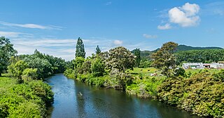
The Tairua River is a river located on the east coast of the Coromandel Peninsula in the North Island of New Zealand. It flows north and then northeast for a total of 35 kilometers from its source in the Coromandel Range, west of Whangamata, passing through the town of Hikuai before emptying into the Tairua Harbour, which opens into the Pacific Ocean at Tairua on the peninsula's east coast. [citation needed] The small Shoe Island lies directly opposite the river's mouth, 2 kilometers out into the Pacific.

The Hauraki Plains are a geographical area located in the northern North Island of New Zealand, at the lower (northern) end of the Thames Valley. They are located 75 kilometres south-east of Auckland, at the foot of the Coromandel Peninsula and occupy the southern portion of a rift valley bounded on the north-west by the Hunua Ranges, to the east by the Coromandel and Kaimai ranges and to the west by a series of undulating hills which separate the plains from the much larger plains of the Waikato River.
Whitianga is a town on the Coromandel Peninsula, in the Waikato region of New Zealand's North Island. The town is located on Mercury Bay, on the northeastern coast of the peninsula. The town has a permanent population of 6,440 as of June 2023, making it the second-largest town on the Coromandel Peninsula behind Thames.

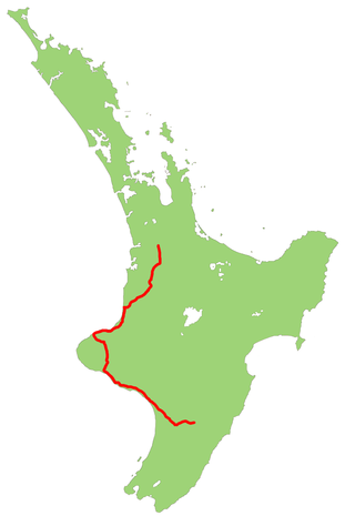
State Highway 1 is the longest and most significant road in the New Zealand road network, running the length of both main islands. It appears on road maps as SH 1 and on road signs as a white number 1 on a red shield, but it has the official designations SH 1N in the North Island, SH 1S in the South Island.

Opoutere is a locality and beach on the eastern side of the Coromandel Peninsula of New Zealand. It lies to the east of State Highway 25, south of Pauanui and north of Whangamatā. The Wharekawa Harbour lies to the south east.

The Historic Kopu Bridge is a single-lane swing bridge that spans the Waihou River, near its emergence into the Firth of Thames in the Thames-Coromandel District of New Zealand's North Island. The bridge was completed in 1928 and was part of State Highway 25. The swinging span in the middle of the bridge is 43 metres long and with an overall length of 463 metres, the bridge was the longest and oldest single lane bridge within the state highway network. It is also New Zealand's only remaining operational swing bridge.
State Highway 3 (SH 3) is one of New Zealand's eight national state highways. It serves the west coast of the country's North Island and forms a link between State Highway 1 and State Highway 2. Distances are measured from north to south.

State Highway 2 runs north–south through eastern parts of the North Island of New Zealand from the outskirts of Auckland to Wellington. It runs through Tauranga, Gisborne, Napier, Hastings and Masterton. It is the second-longest highway in the North Island, after State Highway 1, which runs the length of both of the country's main islands.

State Highway 29 (SH 29) is a New Zealand state highway that travels over the Kaimai Ranges linking the Bay of Plenty and Waikato regions. For most of its length, SH 29 is a two-lane single carriageway with occasional passing lanes and slow vehicle bays. 5 km of it near its eastern terminus is part of the Takitimu Drive Toll Road.
State Highway 27 (SH 27) is a state highway in the Waikato region of the North Island of New Zealand. It is an important north–south link along the Waihou/Piako valley and forms an important transport route across the mostly dairy farming Matamata-Piako District. SH 27, in conjunction with SH 2, is often used as an alternative route to SH 1 between Auckland and Tauranga, Rotorua and Taupō.

Kauaeranga Valley is a valley created by the Kauaeranga River, which flows from the Coromandel Range southwest to the Firth of Thames at Thames, New Zealand in the North Island. It contains the settlement of Kauaeranga on the Coromandel Peninsula. It is located near Thames, in the Thames-Coromandel District in the Waikato region. It covers a land area of 180.51 km2.

The Coromandel Volcanic Zone (CVZ) is an extinct intraplate volcanic arc stretching from Great Barrier Island in the north, through the Coromandel Peninsula, to the Kaimai Range in the south. The area of transition between it and the newer and still active Taupō Volcanic Zone is now usually separated and is called the Tauranga Volcanic Centre. Its volcanic activity was associated with the formation and most active period of the Hauraki Rift.
Between 11 and 16 April 1981, the Waikato experienced flooding due to high levels of rain and wind. It mostly affected the Thames-Coromandel area and Paeroa. Over 2,250 evacuations took place. Insurance payouts cost $7,000,000. Over 200 homes were flooded.


