"},"population":{"wt":"{{Decimals|{{formatnum:{{NZ population data 2023 SA2|Mairehau North|y}}|R}}+{{formatnum:{{NZ population data 2023 SA2|Mairehau South|y}}|R}}|0}}"},"popdate":{"wt":"{{NZ population data 2023 SA2|||y}}"},"popref":{"wt":"{{NZ population data 2023 SA2||||y}}"},"airports":{"wt":""},"hospitals":{"wt":""},"map":{"wt":"{{infobox mapframe|coord={{coord|-43.499|172.640}}|zoom=11}}"},"caption2":{"wt":""}},"i":1}},"\n",{"template":{"target":{"wt":"Adjacent place\n","href":"./Template:Adjacent_place"},"params":{"centre":{"wt":"Mairehau"},"north":{"wt":"[[Marshland,New Zealand|Marshland]]"},"northeast":{"wt":"[[Prestons,New Zealand|Prestons]]"},"east":{"wt":"[[Shirley,New Zealand|Shirley]]"},"southeast":{"wt":"[[Richmond,Christchurch|Richmond]]"},"south":{"wt":"[[Edgeware]]"},"southwest":{"wt":"[[St Albans,New Zealand|St Albans]]"},"west":{"wt":"[[Northcote,Christchurch|Northcote]]"},"northwest":{"wt":"[[Redwood,Christchurch|Redwood]]"}},"i":2}},"\n",{"template":{"target":{"wt":"stack end","href":"./Template:Stack_end"},"params":{},"i":3}}]}" id="mwCQ">.mw-parser-output .stack{box-sizing:border-box}.mw-parser-output .stack>div{margin:1px;overflow:hidden}@media all and (min-width:720px){.mw-parser-output .stack-clear-left{float:left;clear:left}.mw-parser-output .stack-clear-right{float:right;clear:right}.mw-parser-output .stack-left{float:left}.mw-parser-output .stack-right{float:right}.mw-parser-output .stack-margin-clear-left{float:left;clear:left;margin-right:1em}.mw-parser-output .stack-margin-clear-right{float:right;clear:right;margin-left:1em}.mw-parser-output .stack-margin-left{float:left;margin-right:1em}.mw-parser-output .stack-margin-right{float:right;margin-left:1em}}
Mairehau | |
---|---|
![]() Mairehau High School | |
![]() | |
Coordinates: 43°29′56″S172°38′25″E / 43.498884°S 172.640324°E | |
Country | New Zealand |
City | Christchurch |
Local authority | Christchurch City Council |
Electoral ward |
|
Community board | Waipapa Papanui-Innes-Central |
Area | |
• Land | 348 ha (860 acres) |
Population (June 2024) [2] | |
• Total | 7,120 |
Redwood | Marshland | Prestons |
Northcote | ![]() ![]() ![]() ![]() | Shirley |
St Albans | Edgeware | Richmond |
Mairehau (Māori pronunciation: [maiɾɛːhau] ) is a suburb of Christchurch, New Zealand. It is located 4 kilometres (2.5 miles) north of the city centre, close to the edge of the urbanised central city area. Much new development is being carried out on the northern edge of Mairehau.
The suburb was named after Rose Mairehau (Maire) Hutton (née Rhodes), daughter of Arthur Rhodes, who in turn was Mayor of Christchurch in 1901–1902 and a major local property owner. [3] [4]
Mairehau, comprising the statistical areas of Mairehau North and Mairehau South, covers 3.48 km2 (1.34 sq mi). [1] It had an estimated population of 7,120 as of June 2024, with a population density of 2,046 people per km2.
Year | Pop. | ±% p.a. |
---|---|---|
2006 | 5,781 | — |
2013 | 6,510 | +1.71% |
2018 | 6,870 | +1.08% |
Source: [5] |
Before the 2023 census, Mairehau had a larger boundary, covering 3.61 km2 (1.39 sq mi). [1] Using that boundary, Mairehau had a population of 6,870 at the 2018 New Zealand census, an increase of 360 people (5.5%) since the 2013 census, and an increase of 1,089 people (18.8%) since the 2006 census. There were 2,547 households, comprising 3,321 males and 3,549 females, giving a sex ratio of 0.94 males per female, with 1,335 people (19.4%) aged under 15 years, 1,350 (19.7%) aged 15 to 29, 2,976 (43.3%) aged 30 to 64, and 1,206 (17.6%) aged 65 or older.
Ethnicities were 84.7% European/Pākehā, 10.3% Māori, 4.0% Pasifika, 8.4% Asian, and 2.9% other ethnicities. People may identify with more than one ethnicity.
The percentage of people born overseas was 20.0, compared with 27.1% nationally.
Although some people chose not to answer the census's question about religious affiliation, 51.4% had no religion, 38.0% were Christian, 0.3% had Māori religious beliefs, 0.9% were Hindu, 1.0% were Muslim, 0.5% were Buddhist and 2.1% had other religions.
Of those at least 15 years old, 1,167 (21.1%) people had a bachelor's or higher degree, and 966 (17.5%) people had no formal qualifications. 894 people (16.2%) earned over $70,000 compared to 17.2% nationally. The employment status of those at least 15 was that 2,781 (50.2%) people were employed full-time, 738 (13.3%) were part-time, and 186 (3.4%) were unemployed. [5]
Name | Area (km2) | Population | Density (per km2) | Households | Median age | Median income |
---|---|---|---|---|---|---|
Mairehau North | 2.22 | 3,123 | 1,407 | 1,158 | 42.4 years | $30,800 [6] |
Mairehau South | 1.39 | 3,747 | 2,696 | 1,389 | 33.6 years | $38,300 [7] |
New Zealand | 37.4 years | $31,800 |
Mairehau High School is a secondary school for years 9 to 13. [8] It has a roll of 420. The school opened in 1961. [9]
Mairehau School is a full primary school catering for years 1 to 8. [10] It has a roll of 388. The school opened in 1953. [11] Birch Grove School closed and merged with Mairehau School in 2004. [12] Glenmoor School closed in 2014. [13]
St Francis of Assisi Catholic School is a state-integrated full primary school catering for years 1 to 8. [14] It has a roll of 467. The school opened in 2016 [15] as the result of a merger between Our Lady of Fatima School and St Paul's School. [12]
All these schools are coeducational. Rolls are as of November 2024. [16]
Fendalton is a suburb of Christchurch, in the South Island of New Zealand.
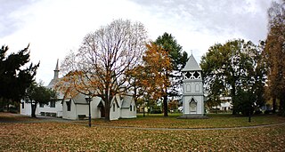
Addington is a major suburb of Christchurch, New Zealand. It is sited 2.5 kilometres (1.6 mi) south-west of the city centre.
Bishopdale is a residential suburb located in the north of Christchurch, New Zealand.
St Albans is a large, inner-northern suburb of Christchurch, New Zealand, located directly north of the Christchurch Central Business District. It is the second largest suburb in the city by population, with a population of 13,137 at the 2018 Census. The suburb falls within the Christchurch Central electorate and is represented by Duncan Webb, who has been the member of parliament since the 2017 general election.
Fairfield is a suburb to the northeast of central Hamilton, New Zealand. Fairfield is named after the dairy farm of John Davies, who bought 100 acres from F. R. Claude. This area experienced rapid growth in the 1950s and 60s.
Merivale is a suburb of Christchurch, New Zealand, north of the city centre. Like all suburbs in Christchurch, it has no defined boundaries and is a general area, but for the purposes of statistical analysis only, Statistics New Zealand defines it as being Heaton Street to the north, Papanui Road to the east, Harper and Bealey Avenues to the south and Rossall Street to the west, although Real Estate advertising often will claim residences outside this area, especially St Albans to the east of Papanui Road, as being Merivale due to the perceived desirability of the area. The area directly west of Rossall Street, which is called Holmwood by Statistics New Zealand, is sometimes considered part of Merivale.
Burnside is a suburb of Christchurch, New Zealand, located southeast of Christchurch International Airport. As with most suburbs in Christchurch, it has no defined boundaries and is a general area.
Somerfield is a suburb in the south of Christchurch, New Zealand. It is nominally bordered by the Ōpāwaho / Heathcote River to the south and west, Strickland and Colombo Streets to the east, and Milton Street to the north. The suburb includes Somerfield School, Somerfield Park and a small number of shops which service the local area, although it is predominantly residential. Somerfield is also known for its wide variety of trees, especially along the banks of the Ōpāwaho / Heathcote River.
Westown is a suburb of New Plymouth, in the western North Island of New Zealand. It is located to the southwest of the city centre and west of Frankleigh Park.
Fitzroy is a coastal suburb of New Plymouth, in the western North Island of New Zealand. It is located to the north-east of the city centre.
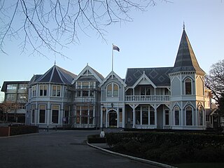
Strowan is an inner city suburb of Christchurch, New Zealand, located approximately 5 km north-west of Christchurch's central business district. It had a population of 3,705 at the 2013 census. It is located between the suburbs of Merivale, Papanui, Bryndwr, Fendalton, and St Albans.
Dallington is a suburb of Christchurch, New Zealand, on the north-east side of the city.
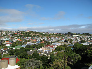
Tahuna and Tainui are two small, somewhat vaguely defined suburbs of the New Zealand city of Dunedin. They lie to the south of Andersons Bay and Musselburgh, close to Dunedin's southern coastline. Both are often considered parts of either Musselburgh or Andersons Bay.
Upper Riccarton is a suburb of Christchurch. It is due west of Riccarton.
Sockburn is an industrial suburb of Christchurch, New Zealand, located between Hornby and Riccarton, some 7 kilometres (4.3 mi) west of the Christchurch city centre. The suburb is roughly bounded by the triangle formed by State Highway 1 in the west, Main South Road (SH73a) in the south and SH73 in the north. The suburb of Wigram, containing the city's former RNZAF base, is located nearby. One of the city's main horseracing circuits, Riccarton Racecourse, is located close to Sockburn's northern edge, and Racecourse was the initial name for the area. The name Sockburn is likely to have come from the village of Sockburn in County Durham, England.
Hei Hei is a suburb of Christchurch, New Zealand. It is located in the west of Christchurch 11 kilometres (6.8 mi) from the central city, and is bisected by State Highway 1. The area was subdivided for poultry farming after World War I for returning serviceman, but the venture failed due to the poor soil conditions. The place name is related to the Māori word for chicken (heihei) due to the area's poultry farming history.
Windsor is a suburb of New Zealand's southernmost city, Invercargill.
Greymouth Central is the central business district of Greymouth on the West Coast of New Zealand, which also contains residential housing.
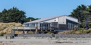
North New Brighton is a suburb on the northern side of Christchurch city. It was originally known as North Beach and was readily accessible from Christchurch city by tram. It was renamed North New Brighton in 1953. A large sports centre and swimming pool is on the same locale as the former Queen Elizabeth II Park. The centre was rebuilt and opened in 2018.