Merivale, Christchurch

Last updated

Merivale
Christchurch Chinese Methodist Church, Christchurch, New Zealand 12.jpg
Chinese Methodist Church
Merivale, Christchurch
Coordinates: 43°31′01″S172°36′59″E / 43.517031°S 172.616522°E / -43.517031; 172.616522 Coordinates: 43°31′01″S172°36′59″E / 43.517031°S 172.616522°E / -43.517031; 172.616522
Country New Zealand
City Christchurch
Local authority Christchurch City Council
Electoral wardFendalton
Area
[1]
  Land223 ha (551 acres)
Population
 (June 2022) [2]
  Total5,210
Strowan
Fendalton
Pfeil oben.svg
Pfeil links.svgMerivalePfeil rechts.svg
Pfeil unten.svg
St Albans
Riccarton Hagley Park Christchurch Central City

Merivale is a suburb of Christchurch, New Zealand, north of the city centre. Like all suburbs in Christchurch, it has no defined boundaries and is a general area, but for the purposes of statistical analysis only, Statistics New Zealand [3] defines it as being Heaton Street to the north, Papanui Road to the east, Harper and Bealey Avenues to the south and Rossall Street to the west, although Real Estate advertising often will claim residences outside this area, especially St Albans to the east of Papanui Road, as being Merivale due to the perceived desirability of the area. The area directly west of Rossall Street, which is called Holmwood by Statistics New Zealand, is sometimes considered part of Merivale.[ citation needed ]

Contents

The area is predominantly residential.

Early history

Charlotte Jackson of Rugby arrived in 1851 for her two rural sections which went from Merivale Lane to Aikmans Road and from Papanui Road to Boundary Road. She named the 100 acres (0.40 km2) block Merevale. Her brother-in-law, the Rev. Thomas Jackson, was the vicar of Merevale, near Atherstone in Warwickshire. Charlotte Jackson later sold the sections. In December 1859 she sold the northern 50 acres (200,000 m2) to Capt. T. H. Withers of Deptford, and in 1862 the southern 50 acres (200,000 m2) to William Sefton Moorhouse. Moorhouse built a magnificent home on Merevale farm at 31 Naseby Street, which was demolished after the Christchurch earthquakes of 2010/2011. [4] Subsequent owners of the property included John Studholme, John Thomas Peacock and Alfred Louisson. [5]

Merivale Shopping Centre (1983) Merivale Shopping Centre (1983).jpg
Merivale Shopping Centre (1983)

A hotel has stood at the intersection of Papanui Road and Bealey Avenue since 1865. Carlton Hotel was built in its place in 1906 in time for the New Zealand International Exhibition. [6] The hotel was demolished in April 2011 and has since been rebuilt to a contemporary design. [7]

There are still a few of the narrow streets and lanes and many of the original cottages have been restored.

Demographics

Merivale, comprising the statistical areas of Merivale and Holmwood, covers 2.23 km2 (0.86 sq mi). [1] It had an estimated population of 5,210 as of June 2022, with a population density of 2,336 people per km2.

Historical population
YearPop.±% p.a.
20065,553    
20135,016−1.44%
20185,034+0.07%
Source: [8]

Merivale had a population of 5,034 at the 2018 New Zealand census, an increase of 18 people (0.4%) since the 2013 census, and a decrease of 519 people (−9.3%) since the 2006 census. There were 2,076 households. There were 2,274 males and 2,757 females, giving a sex ratio of 0.82 males per female, with 786 people (15.6%) aged under 15 years, 981 (19.5%) aged 15 to 29, 2,292 (45.5%) aged 30 to 64, and 966 (19.2%) aged 65 or older.

Ethnicities were 86.8% European/Pākehā, 4.7% Māori, 1.3% Pacific peoples, 10.3% Asian, and 2.6% other ethnicities (totals add to more than 100% since people could identify with multiple ethnicities).

The proportion of people born overseas was 25.8%, compared with 27.1% nationally.

Although some people objected to giving their religion, 46.6% had no religion, 43.4% were Christian, 0.8% were Hindu, 0.6% were Muslim, 0.7% were Buddhist and 2.6% had other religions.

Of those at least 15 years old, 1,749 (41.2%) people had a bachelor or higher degree, and 288 (6.8%) people had no formal qualifications. The employment status of those at least 15 was that 2,085 (49.1%) people were employed full-time, 753 (17.7%) were part-time, and 108 (2.5%) were unemployed. [8]

Individual statistical areas
NamePopulationHouseholdsMedian ageMedian income
Merivale2,9041,28442.1 years$44,700 [9]
Holmwood2,13079246.7 years$52,800 [10]
New Zealand37.4 years$31,800

Economy

Merivale Mall

Merivale Mall, the local shopping centre, covers 7,580 m². It has 55 retailers including FreshChoice. [11]

Education

Kilburn House at St Margaret's College Warren House, Christchurch 02.jpg
Kilburn House at St Margaret's College

Elmwood Normal School is a coeducational contributing primary school catering for years 1 to 6. [12] It has a roll of 472. The school opened in 1882. [13] :57

St Margaret's College is a private Anglican girls' school for years 1 to 13. [14] It has a roll of 810. The school opened in 1910. [13] :163

Rangi Ruru Girls' School is a private Presbyterian girls' school for years 7 to 13. [15] It has a roll of 689. The school opened in 1889. [16]

Selwyn House School is a private full primary girls' school for years 1 to 8. [17] It has a roll of 283. It opened in 1929, with the forerunner Miss Sanders' School founded in 1875. [13] :168

Ferndale School is a special school [18] with a roll of 131.

Rolls are as of July 2022. [19]

Related Research Articles

<span class="mw-page-title-main">Papanui</span> Suburb of Christchurch in Christchurch City Council, New Zealand

Papanui is a major suburb of Christchurch, New Zealand. It is situated five kilometers to the northwest of the city centre. Papanui is a middle socio-economic area with a population of 3,645 consisting predominantly of Pākehā 86.9%, Asian 7.6%, Māori 5.3%, Pacific peoples 3.1%, Middle Eastern/Latin American/African 0.7%. The suburb is located at the junction of three busy thoroughfares; Papanui Road leading to the City, the Main North Road that leads to North Canterbury and Harewood Road that leads to Christchurch International Airport. However, as with most Christchurch suburbs, Papanui has no defined borders.
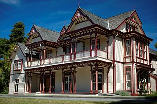
<span class="mw-page-title-main">Riccarton, New Zealand</span> Suburb of Christchurch in New Zealand

Riccarton is a suburb of Christchurch. It is due west of the city centre, separated from it by Hagley Park. Upper Riccarton is to the west of Riccarton.

<span class="mw-page-title-main">Shirley, New Zealand</span> Suburb of Christchurch in Christchurch City Council, New Zealand

Shirley, sometimes referred to as Windsor, is a suburb of Christchurch, New Zealand, about 5 kilometres (3.1 mi) north-east of the city centre. The area was used for farming from the 1850s, and subdivision started in the early 20th century, with most of the houses being built between 1950 and 1980.

<span class="mw-page-title-main">Bryndwr</span> Suburb of Christchurch in New Zealand

Bryndwr is a suburb in the north-west of Christchurch, New Zealand.

<span class="mw-page-title-main">Rangi Ruru Girls' School</span> School

Rangi Ruru Girls' School is a New Zealand private girls' day and boarding secondary school located in Merivale, an inner suburb of Christchurch. The school is affiliated to the Presbyterian Church, and serves approximately 689 girls from Years 7 to 13.

<span class="mw-page-title-main">Bishopdale, Christchurch</span> Suburb of Christchurch in Christchurch City Council, New Zealand

Bishopdale is a residential suburb located in the north of Christchurch, New Zealand.

<span class="mw-page-title-main">St Albans, New Zealand</span> Suburb of Christchurch in Christchurch City Council, New Zealand

St Albans is a large, inner-northern suburb of Christchurch, New Zealand, located directly north of the Christchurch Central Business District. It is the second largest suburb in the city by population, with a population of 13,137 at the 2018 Census. The suburb falls within the Christchurch Central electorate and is represented by Duncan Webb, who has been the member of parliament since the 2017 general election. St Albans is one of the most diverse residential neighbourhoods in Christchurch, with a wide range of densities, architectural styles and housing ages throughout the suburb. It has everything from run-down high-density council-owned flats, to modern luxurious high-density flats and apartments; old mid-density workers cottages through to large low-density estates of various ages.

<span class="mw-page-title-main">Burnside, Christchurch</span> Suburb of Christchurch in Christchurch City Council, New Zealand

Burnside is a suburb of Christchurch, New Zealand, located southeast of Christchurch International Airport. As with most suburbs in Christchurch, it has no defined boundaries and is a general area.
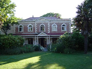
<span class="mw-page-title-main">Linwood, New Zealand</span> Suburb of Christchurch in Christchurch City Council, New Zealand

Linwood is an inner suburb of the city of Christchurch, New Zealand. It lies to the east of the city centre, mostly between Ferry Road and Linwood Avenue, two of the major arterial roads to the eastern suburbs of Christchurch.

<span class="mw-page-title-main">Ilam (New Zealand electorate)</span> Electoral district in Canterbury, New Zealand

Ilam is a New Zealand parliamentary electorate. Formed for the 1996 election, it was held by Gerry Brownlee of the National Party until the 2020 election, when Sarah Pallett of the Labour Party unseated Brownlee in an upset victory.
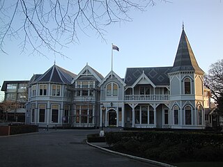
<span class="mw-page-title-main">Strowan</span> Suburb of Christchurch in Christchurch City Council, New Zealand

Strowan is an affluent suburb of Christchurch, New Zealand, located approximately 5 km north-west of Christchurch's central business district. It had a population of 3,705 at the 2013 census. It is located between the suburbs of Merivale, Papanui, Bryndwr, Fendalton, and St Albans.

<span class="mw-page-title-main">Arthur Rhodes (politician)</span> New Zealand politician

Arthur Edgar Gravenor Rhodes was a New Zealand Member of Parliament and Mayor of Christchurch.

<span class="mw-page-title-main">Upper Riccarton</span> Suburb of Christchurch in Christchurch City Council, New Zealand

Upper Riccarton is a suburb of Christchurch. It is due west of Riccarton.

<span class="mw-page-title-main">Christchurch Central City</span> Suburb of Christchurch in Christchurch City Council, New Zealand

Christchurch Central City or Christchurch City Centre is the geographical centre and the heart of Christchurch, New Zealand. It is defined as the area within the Four Avenues and thus includes the densely built up central city, some less dense surrounding areas of residential, educational and industrial usage, and green space including Hagley Park, the Christchurch Botanic Gardens and the Barbadoes Street Cemetery.

<span class="mw-page-title-main">Aidanfield</span> Suburb of Christchurch in Christchurch City Council, New Zealand

Aidanfield is a suburb in the south-west of Christchurch, New Zealand, about 8 kilometres (5.0 mi) from the city centre. The land, which had been owned by the Good Shepherd Sisters since 1886, now incorporates the Mount Magdala Institute and the St John of God Chapel, which has a Category I heritage listing by the New Zealand Historic Places Trust. The first residents moved into the suburb in 2002. The developer caused controversy in 2007–2008 by applying to have a group of farm buildings demolished to allow for further subdivision. Christchurch City Council was widely criticised for approving the demolition despite the buildings having had a heritage listing in the Christchurch City Plan.

Mary Victoria Gibson was a New Zealand teacher and school principal.

Robert William England was a New Zealand architect from Christchurch.

<span class="mw-page-title-main">Bromley, New Zealand</span> Suburb of Christchurch in Christchurch City Council, New Zealand

Bromley is a suburb of the city of Christchurch, New Zealand. It lies to the east of the city centre, mostly between Pages Road and the Avon river estuary.
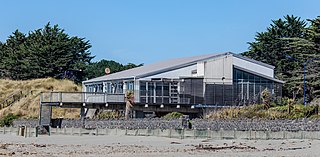
<span class="mw-page-title-main">North New Brighton</span> Suburb of Christchurch in Christchurch City Council, New Zealand

North New Brighton is a suburb on the northern side of Christchurch city. It was originally known as North Beach and was readily accessible from Christchurch city by tram. It was renamed North New Brighton in 1953.

<span class="mw-page-title-main">The Four Avenues</span>

The Four Avenues are a group of four major arterial boulevards — Bealey Avenue, Fitzgerald Avenue, Moorhouse Avenue, and either Rolleston Ave or Deans Avenue — that surround the city centre of Christchurch, New Zealand. Serving as an inner ring road, they popularly form the limits of the city centre, separating it from the city's suburbs. Almost all of the city's commercial heart lies within the approximately rectangular 9.8-square-kilometre (3.8 sq mi) area formed by the four avenues. The term "within the Four Avenues" is widely used in Christchurch to refer to the central city. By extension, Christchurch as a whole is sometimes referred to as "The Four Avenues".

References

  1. 1 2 "ArcGIS Web Application". statsnz.maps.arcgis.com. Retrieved 21 September 2021.
  2. "Population estimate tables - NZ.Stat". Statistics New Zealand . Retrieved 25 October 2022.
  3. Statistics New Zealand.
  4. St Albans, from Swamp to Suburbs, An Informal History. New Zealand Federation of University Women Canterbury Branch. 1989. pp. 10–18. ISBN   0-473-00693-6.
  5. "Historic Christchurch House For Sale". Canterbury Heritage. Archived from the original on 21 October 2013. Retrieved 15 October 2013.
  6. "Carlton Hotel". Register of Historic Places. Heritage New Zealand . Retrieved 10 April 2011.
  7. Davis, Joanna (9 April 2011). "Historic hotel for urgent demolition". The Press . Retrieved 10 April 2011.
  8. 1 2 "Statistical area 1 dataset for 2018 Census". Statistics New Zealand. March 2020. Merivale (323000) and Holmwood (322600).
  9. 2018 Census place summary: Merivale
  10. 2018 Census place summary: Holmwood
  11. "Merivale Mall". ampcapital.com. AMP Capital.
  12. Education Counts: Elmwood Normal School
  13. 1 2 3 "Miscellaneous Local Historical Information" (PDF). Christchurch City Libraries. Retrieved 21 September 2021.
  14. Education Counts: St Margaret's College
  15. Education Counts: Rangi Ruru Girls' School
  16. "Our School – Our Principal". Rangi Ruru Girls' School. Retrieved 21 September 2021.
  17. Education Counts: Selwyn House School
  18. Education Counts: Ferndale School
  19. "New Zealand Schools Directory". New Zealand Ministry of Education. Retrieved 19 August 2022.