South New Brighton

Last updated

South New Brighton
Damaged pier South New Brighton Park.jpg
A new pier subsequently damaged by both the September 2010 and February 2011 earthquakes
South New Brighton
Coordinates: 43°31′48″S172°44′13″E / 43.530°S 172.737°E / -43.530; 172.737
CountryNew Zealand
City Christchurch
Local authority Christchurch City Council
Electoral wardCoastal
Community board Waitai Coastal-Burwood-Linwood
Area
[1]
  Land277 ha (684 acres)
Population
 (June 2023) [2]
  Total3,270
New Brighton (Pegasus Bay)
Pfeil oben.svg
Pfeil links.svgSouth New BrightonPfeil rechts.svg
Pfeil unten.svg
(Avon Heathcote Estuary) Southshore

South New Brighton is a coastal suburb on the eastern side of Christchurch city.

Contents

The suburb was officially named in 1953, after a suggestion that it be called South Brighton was rejected because there is already Brighton near Dunedin. [3]

South Brighton Community Hall opened in 1961. It was damaged by the 2010-2011 earthquakes and demolished. In 2013, a preschool building was moved from QEII Park to the site as a replacement. [4]

Demographics

The statistical area of South New Brighton, which also includes Southshore, covers 2.77 km2 (1.07 sq mi). [1] It had an estimated population of 3,270 as of June 2023, [2] with a population density of 1,181 people per km2.

Historical population
YearPop.±% p.a.
20063,645    
20133,228−1.72%
20183,234+0.04%
Source: [5]

South New Brighton had a population of 3,234 at the 2018 New Zealand census, an increase of 6 people (0.2%) since the 2013 census, and a decrease of 411 people (−11.3%) since the 2006 census. There were 1,287 households, comprising 1,596 males and 1,641 females, giving a sex ratio of 0.97 males per female. The median age was 39.2 years (compared with 37.4 years nationally), with 684 people (21.2%) aged under 15 years, 519 (16.0%) aged 15 to 29, 1,575 (48.7%) aged 30 to 64, and 453 (14.0%) aged 65 or older.

Ethnicities were 92.5% European/Pākehā, 13.0% Māori, 3.2% Pasifika, 2.6% Asian, and 2.3% other ethnicities. People may identify with more than one ethnicity.

The percentage of people born overseas was 20.4, compared with 27.1% nationally.

Although some people chose not to answer the census's question about religious affiliation, 62.2% had no religion, 26.3% were Christian, 0.1% had Māori religious beliefs, 0.3% were Hindu, 0.2% were Muslim, 0.6% were Buddhist and 2.5% had other religions.

Of those at least 15 years old, 576 (22.6%) people had a bachelor's or higher degree, and 393 (15.4%) people had no formal qualifications. The median income was $34,300, compared with $31,800 nationally. 432 people (16.9%) earned over $70,000 compared to 17.2% nationally. The employment status of those at least 15 was that 1,296 (50.8%) people were employed full-time, 423 (16.6%) were part-time, and 102 (4.0%) were unemployed. [5]

Education

South New Brighton School is a full primary school catering for years 1 to 8. [6] [7] [8] It had a roll of 422 as of April 2023. [9] The school opened in 1922. [10]

Related Research Articles

Waltham is an inner suburb of Christchurch, New Zealand, located approximately two kilometres south-east of the city centre. State Highway 76, part of Christchurch's ring road system, and known there as Brougham Street, runs through the suburb, as does the Lyttelton Line rail corridor.

<span class="mw-page-title-main">Opawa</span> Suburb of Christchurch, New Zealand

Opawa is an inner suburb of Christchurch, New Zealand, located 2.5 kilometres south-east of the city centre.

<span class="mw-page-title-main">Heathcote Valley</span> Suburb of Christchurch, New Zealand

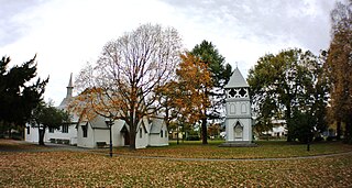
Heathcote Valley is a suburb of Christchurch, New Zealand. It is named after Sir William Heathcote, who was secretary of the Canterbury Association.

<span class="mw-page-title-main">Addington, New Zealand</span> Suburb of Christchurch, New Zealand

Addington is a major suburb of Christchurch, New Zealand. It is sited 2.5 kilometres (1.6 mi) south-west of the city centre.

<span class="mw-page-title-main">Hornby, New Zealand</span> Suburb of Christchurch, New Zealand

Hornby is a major residential and retail suburb at the western edge of Christchurch, New Zealand. The suburb is directly connected to other parts of Christchurch and the South Island by a number of main arterial routes, including State Highway 1 and the Christchurch Southern Motorway.

<span class="mw-page-title-main">Avonside</span> Suburb of Christchurch, New Zealand

Avonside is an eastern suburb in Christchurch, New Zealand. It is one of the oldest suburbs of the city, with only Heathcote being older.

<span class="mw-page-title-main">Strowan</span> Suburb of Christchurch, New Zealand

Strowan is an affluent suburb of Christchurch, New Zealand, located approximately 5 km north-west of Christchurch's central business district. It had a population of 3,705 at the 2013 census. It is located between the suburbs of Merivale, Papanui, Bryndwr, Fendalton, and St Albans.

<span class="mw-page-title-main">Dallington, New Zealand</span> Suburb of Christchurch, New Zealand

Dallington is a suburb of Christchurch, New Zealand, on the north-east side of the city.

<span class="mw-page-title-main">Harewood, New Zealand</span> Suburb of Christchurch, New Zealand

Harewood is a northwestern suburb of Christchurch, New Zealand. The suburb is split by State Highway 1, with the bulk of Harewood's residential areas to the east of the highway and its industrial areas to the west.

<span class="mw-page-title-main">Phillipstown, New Zealand</span> Suburb of Christchurch, New Zealand

Phillipstown is a small inner suburb of the city of Christchurch, New Zealand. It lies south-east of the city centre being bordered by Cashel Street to the north, Aldwins Road to the east, Ferry Road to the south, and Fitzgerald Avenue to the west.

<span class="mw-page-title-main">Wainoni, Christchurch</span> Suburb of Christchurch, New Zealand

Wainoni is one of the eastern suburbs of Christchurch. It is a lower socio-economic area.

<span class="mw-page-title-main">Hillsborough, Christchurch</span> Suburb of Christchurch, New Zealand

Hillsborough is a mixed industrial and residential suburb of Christchurch, New Zealand, located approximately 4 kilometres (2.5 mi) to the south-east of the city centre.

<span class="mw-page-title-main">Sockburn, New Zealand</span> Suburb in Christchurch, New Zealand

Sockburn is an industrial suburb of Christchurch, New Zealand, located between Hornby and Riccarton, some 7 kilometres (4.3 mi) west of the Christchurch city centre. The suburb is roughly bounded by the triangle formed by State Highway 1 in the west, Main South Road (SH73a) in the south and SH73 in the north. The suburb of Wigram, containing the city's former RNZAF base, is located nearby. One of the city's main horseracing circuits, Riccarton Racecourse, is located close to Sockburn's northern edge, and Racecourse was the initial name for the area. The name Sockburn is likely to have come from the village of Sockburn in County Durham, England.

<span class="mw-page-title-main">Waimairi Beach</span> Suburb of Christchurch, New Zealand

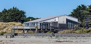
Waimairi Beach is a suburb of Christchurch, New Zealand. It is located north-east of the city. It is east of Parklands and north of North New Brighton. The word "waimairi" translates to "listless stream".

<span class="mw-page-title-main">Bromley, New Zealand</span> Suburb of Christchurch, New Zealand

Bromley is a suburb of the city of Christchurch, New Zealand. It lies to the east of the city centre, mostly between Pages Road and the Avon river estuary.

<span class="mw-page-title-main">Russley</span> Suburb of Christchurch, New Zealand

Russley is a suburb on the western side of Christchurch city.

Islington is a suburb on the western side of Christchurch city.

<span class="mw-page-title-main">Marshland, New Zealand</span> Suburb of Christchurch, New Zealand

Marshland is a semi-rural suburb on the northern side of Christchurch city. The land is primarily used for horticulture and dairy farming.

Northcote is a suburb on the northern side of Christchurch, New Zealand.

<span class="mw-page-title-main">North New Brighton</span> Suburb of Christchurch, New Zealand

North New Brighton is a suburb on the northern side of Christchurch city. It was originally known as North Beach and was readily accessible from Christchurch city by tram. It was renamed North New Brighton in 1953.

References

  1. 1 2 "ArcGIS Web Application". statsnz.maps.arcgis.com. Retrieved 5 January 2024.
  2. 1 2 "Population estimate tables - NZ.Stat". Statistics New Zealand . Retrieved 25 October 2023.
  3. "Christchurch Place Names: N-Z : South New Brighton" (PDF). Christchurch City Libraries. February 2016. p. 79.
  4. "Miscellaneous Local Historical Information" (PDF). Christchurch City Libraries. pp. 178–9. Retrieved 7 October 2021.
  5. 1 2 "Statistical area 1 dataset for 2018 Census". Statistics New Zealand. March 2020. South New Brighton (331700). 2018 Census place summary: South New Brighton
  6. Education Counts: South New Brighton School
  7. "First names catch on in schools". The Press . www.pressreader.com. 5 December 2009. Retrieved 4 December 2021.
  8. "South New Brighton School – 2021". South New Brighton School. 23 September 2021. Archived from the original on 4 December 2021. Retrieved 15 February 2024.
  9. "New Zealand Schools Directory". New Zealand Ministry of Education. Retrieved 12 December 2022.
  10. Ray Lewis, ed. (1972). "South New Brighton School, 1922-1972 : golden jubilee celebrations". South New Brighton School.