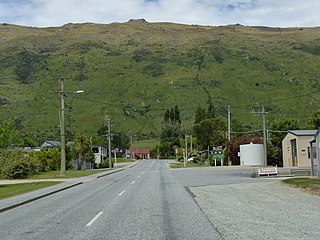
Kingston is a small town at the southernmost end of Lake Wakatipu, just north of the border of Otago and Southland, in New Zealand's South Island. It is 47 kilometres south of Queenstown by a road, "The Devil's Staircase", which winds between the lake to the west and The Remarkables mountains to the east. It is 70 kilometres north of Lumsden, and close to the headwaters of the Mataura River.

Selwyn District is a predominantly rural district in central Canterbury, on the east coast of New Zealand's South Island. It is named after the Selwyn River / Waikirikiri, which is in turn named after Bishop George Selwyn, the first Anglican bishop of New Zealand who, in 1843 and 1844, travelled the length of the country by horse, foot, boat and canoe, leaving in his wake a sprinkling of locations that now bear his name.

Springfield, called Kowai Pass until 1880, is a small town in the Selwyn District of Canterbury, in the South Island, of New Zealand. Springfield is situated in the foothills of the Southern Alps as the most westerly town of the Canterbury Plains. Springfield is 65 kilometres (40 mi) west of Christchurch on State Highway 73, 9.7 kilometres (6.0 mi) northwest of Sheffield and 22.7 kilometres (14.1 mi) from Darfield. It is located close to Porters Ski Area, Mount Cheeseman, Broken River, Temple Basin and Craigieburn ski fields. Springfield has a long association with the Midland railway line.

West Melton is a town in the Selwyn District, in the Canterbury region of New Zealand's South Island. It is located 24 kilometres (15 mi) west of Christchurch and is part of the Christchurch metropolitan area. The town has a population of 2,450, making it the 123rd-largest urban area in New Zealand, the 16th-largest in Canterbury and fifth-largest in the Selwyn District.

Springston is a small rural Canterbury town in the South Island of New Zealand

Sheffield is a small village located in the Selwyn District of the Canterbury region of New Zealand's South Island, near the Waimakariri Gorge.

Glentunnel is a village located in the Selwyn District of the Canterbury region of New Zealand's South Island.
Templeton is a small town on the outskirts of Christchurch. Lying along State Highway 1. Templeton has been the centre of harness racing in Canterbury.

Dunsandel is a small rural town in the Canterbury region of the South Island, New Zealand. The town is located on the Canterbury Plains just south of the Selwyn River / Waikirikiri and about 40 km south of Christchurch. Dunsandel is a junction town on SH1, halfway between Christchurch and Ashburton, with roads leading to Leeston, Southbridge and Hororata. The town provides an important refreshment stop for main road travellers with eateries and coffee shops, as well as acting as a support town for the rural hinterland.

Sockburn is an industrial suburb of Christchurch, New Zealand, located between Hornby and Riccarton, some 7 kilometres (4.3 mi) west of the Christchurch city centre. The suburb is roughly bounded by the triangle formed by State Highway 1 in the west, Main South Road (SH73a) in the south and SH73 in the north. The suburb of Wigram, containing the city's former RNZAF base, is located nearby. One of the city's main horseracing circuits, Riccarton Racecourse, is located close to Sockburn's northern edge, and Racecourse was the initial name for the area. The name Sockburn is likely to have come from the village of Sockburn in County Durham, England.
Hei Hei is a suburb of Christchurch, New Zealand. It is located in the west of Christchurch 11 kilometres (6.8 mi) from the central city, and is bisected by State Highway 1. The area was subdivided for poultry farming after World War I for returning serviceman, but the venture failed due to the poor soil conditions. The place name is related to the Māori word for chicken (heihei) due to the area's poultry farming history.

Waimairi Beach is a suburb of Christchurch, New Zealand. It is located north-east of the city. It is east of Parklands and north of North New Brighton. The word "waimairi" translates to "listless stream".

Bromley is a suburb of the city of Christchurch, New Zealand. It lies to the east of the city centre, mostly between Pages Road and the Avon river estuary.
Waikeria is a rural community in the Otorohanga District and Waikato region of New Zealand's North Island.
Irwell was a small rural township in Canterbury, New Zealand on the intersection of Leeston and Selwyn Lake Roads. All that remains are the former school hall, a church, and a small number of houses.

Yaldhurst is a semi-rural suburb on the western outskirts of Christchurch city. Frederick William Delamain (1835–1910), a settler and horse breeder, named a horse Yaldhurst after some stables in England. The area was named after the horse.

Russley is a suburb on the western side of Christchurch city.
Broomfield is a suburb on the western side of Christchurch city.
Northcote is a suburb on the northern side of Christchurch, New Zealand.

Motukarara is a locality to the northeast of Lake Ellesmere / Te Waihora in the Selwyn District of New Zealand. State Highway 75 passes through the centre of the village, connecting Christchurch with Akaroa and the Banks Peninsula. The Little River Branch, which operated between 1886 and 1962, ran through Motukarara, and is now a shared walkway and cycleway.
