
Ferrymead is a suburb south-east of Christchurch, New Zealand. It is the main thoroughfare for reaching the eastern sea suburbs such as Sumner, as well as home to a number of cliff-top residences and businesses along the estuary front. After the 2011 Canterbury earthquake, a number of prominent Christchurch businesses relocated to the Ferrymead area, making it into a secondary business hub.

Waltham is an inner suburb of Christchurch, New Zealand, located approximately 2 kilometres south-east of the city centre. State Highway 76, part of Christchurch's ring road system, and known there as Brougham Street, runs through the suburb, as does the Lyttelton Line rail corridor. Amenities include Lancaster Park, Christchurch's former sports venue, now a community park, and Waltham pool.

Opawa is an inner residential suburb of Christchurch, New Zealand. It is located approximately 3.5 kilometres south-east of the city centre. Initially Opawa was a low-lying area, and a continuation of the Sydenham swamp. By the 1860s, the area was sparsely populated by European settlers and later became a rural-agricultural locality, with many of the early settlers of English descent. As Woolston emerged as an industrial hub nearby, Opawa was heavily urbanised, transforming it into an upscale residential area and its population largely included factory workers and businesspeople. Notable heritage-listed buildings in the suburb include "Risingholme" and "The Hollies". In its formative days, Opawa was a riding of the Heathcote County Council. It later amalgamated in to the city area in 1916.
Woolston is a large light-industrial and residential suburb of Christchurch in the South Island of New Zealand. It is situated 3 kilometres southeast of the city centre, close to major arterial routes including State Highways 74 and 76 to Banks Peninsula. The Ōpāwaho / Heathcote River flows through the suburb.

Heathcote Valley is a suburb of Christchurch, New Zealand. It is named after Sir William Heathcote, who was secretary of the Canterbury Association.
Addington is a major suburb of Christchurch, New Zealand. It is sited 2.5 kilometres (1.6 mi) south-west of the city centre.

Hornby is a major residential and retail suburb at the western edge of Christchurch, New Zealand. The suburb is directly connected to other parts of Christchurch and the South Island by a number of main arterial routes, including State Highway 1 and the Christchurch Southern Motorway.
Avonside is an eastern suburb in Christchurch, New Zealand. It is one of the oldest suburbs of the city, with only Heathcote being older.
Linwood is an inner suburb of the city of Christchurch, New Zealand. It lies to the east of the city centre, mostly between Ferry Road and Linwood Avenue, two of the major arterial roads to the eastern suburbs of Christchurch.

Avondale is a suburb of Christchurch in the South Island of New Zealand. It is located 6 kilometres (3.7 mi) northeast of the city center, and is close to the Avon River / Ōtākaro, four kilometres to the northwest of its estuary. The suburb is centred on Avondale Road and so named due to its proximity to the Avon River. It has a good sized park on Mervyn Drive called Avondale Park. This park has a kids playground, a tennis court, basketball court, and a football field in winter. There is ample vacant red zone land in Avondale for activities such as leisure and dog walking.

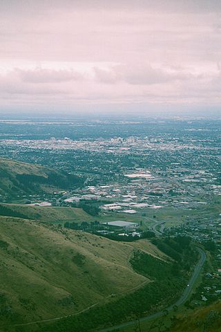
Mount Pleasant (Tauhinukorokio) is a coastal suburb of Christchurch, New Zealand. The suburb is located on the northern flank of the mountain Tauhinukorokio/Mount Pleasant in the Port Hills. It takes its name from the English version of the mountain's name.

Harewood is a northwestern suburb of Christchurch, New Zealand. The suburb is split by State Highway 1, with the bulk of Harewood's residential areas to the east of the highway and its industrial areas to the west.

Aidanfield is a suburb in the south-west of Christchurch, New Zealand, about 8 kilometres (5.0 mi) from the city centre. The land, which had been owned by the Good Shepherd Sisters since 1886, now incorporates the Mount Magdala Institute and the St John of God Chapel, which has a Category I heritage listing by the New Zealand Historic Places Trust. The first residents moved into the suburb in 2002. The developer caused controversy in 2007–2008 by applying to have a group of farm buildings demolished to allow for further subdivision. Christchurch City Council was widely criticised for approving the demolition despite the buildings having had a heritage listing in the Christchurch City Plan.

Wainoni is one of the eastern suburbs of Christchurch. It is a lower socio-economic area.

Sockburn is an industrial suburb of Christchurch, New Zealand, located between Hornby and Riccarton, some 7 kilometres (4.3 mi) west of the Christchurch city centre. The suburb is roughly bounded by the triangle formed by State Highway 1 in the west, Main South Road (SH73a) in the south and SH73 in the north. The suburb of Wigram, containing the city's former RNZAF base, is located nearby. One of the city's main horseracing circuits, Riccarton Racecourse, is located close to Sockburn's northern edge, and Racecourse was the initial name for the area. The name Sockburn is likely to have come from the village of Sockburn in County Durham, England.

Bromley is a suburb of the city of Christchurch, New Zealand. It lies to the east of the city centre, mostly between Pages Road and the Avon river estuary.

Russley is a suburb on the western side of Christchurch city.

Marshland is a semi-rural suburb on the northern side of Christchurch city. The land is primarily used for horticulture and dairy farming.
Northcote is a suburb on the northern side of Christchurch, New Zealand.
North New Brighton is a suburb on the northern side of Christchurch city. It was originally known as North Beach and was readily accessible from Christchurch city by tram. It was renamed North New Brighton in 1953.

