
The Crow, whose autonym is Apsáalooke, also spelled Absaroka, are Native Americans living primarily in southern Montana. Today, the Crow people have a federally recognized tribe, the Crow Tribe of Montana, with an Indian reservation, the Crow Indian Reservation, located in the south-central part of the state.

Crows Nest National Park is a national park on the edge of the Darling Downs of southern Queensland, Australia. It is divided into a number of sections which are located in both Crows Nest and Grapetree, 40 km west of Esk in the South East Queensland bioregion. A 236 ha national park was first declared in 1967. The park has been extended south along the Great Dividing Range and now covers 17.9 km2 (6.91 sq mi). The average elevation of the terrain is 503 metres.

Crow Agency is a census-designated place (CDP) in Big Horn County, Montana, United States and is near the actual location for the Little Bighorn National Monument and re-enactment produced by the Real Bird family known as Battle of the Little Bighorn Reenactment. The population was 1,616 at the 2010 census. It is the governmental headquarters of the Crow Native Americans. It is also the location of the "agency offices" where the federal Superintendent of the Crow Indian Reservation and his staff interacts with the Crow Tribe, pursuant to federal treaties and statutes.

The Hutt Valley is the large area of fairly flat land in the Hutt River valley in the Wellington region of New Zealand. Like the river that flows through it, it takes its name from Sir William Hutt, a director of the New Zealand Company in early colonial New Zealand.

The Little Bighorn River is a 138-mile-long (222 km) tributary of the Bighorn River in the United States in the states of Montana and Wyoming. The Battle of the Little Bighorn, also known as the Battle of the Greasy Grass, was fought on its banks on June 25–26, 1876, as well as the Battle of Crow Agency in 1887.

Arthur's Pass National Park is located in the South Island of New Zealand and covers 1,185 km2 of mostly mountainous terrain. Adjacent to it lies Craigieburn Forest Park. The park is administered by the Department of Conservation.
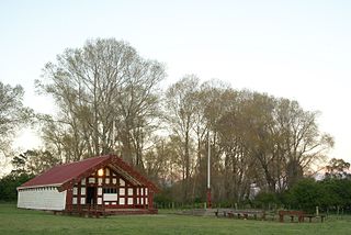
Ngāti Toa, Ngāti Toarangatira or Ngāti Toa Rangatira, is a Māori iwi (tribe) based in the southern North Island and in the northern South Island of New Zealand. Its rohe extends from Whanganui in the north, Palmerston North in the east, Ngāti Toa remains a small iwi with a population of only about 9000. The iwi is centred around Porirua, Plimmerton, Kāpiti, Blenheim and Arapaoa Island. It has four marae: Takapūwāhia and Hongoeka in Porirua City, and Whakatū and Wairau in the north of the South Island. Ngāti Toa's governing body has the name Te Rūnanga o Toa Rangatira.

The Waimakariri River is one of the largest rivers in Canterbury, on the eastern coast of New Zealand's South Island. It flows for 151 kilometres (94 mi) in a generally southeastward direction from the Southern Alps across the Canterbury Plains to the Pacific Ocean.
Ruatoria is a town in the Waiapu Valley of the Gisborne Region in the northeastern corner of New Zealand's North Island. The town was originally known as Cross Roads then Manutahi and was later named Ruatorea in 1913, after the Māori Master female grower Tōrea who had some of the finest storage pits in her Iwi at the time (Te-Rua-a-Tōrea). In 1925 the name was altered to "Ruatoria", although some texts retain the original spelling.

The Zealand River is a 6.3-mile-long (10.1 km) river in the White Mountains of New Hampshire in the United States. It is a tributary of the Ammonoosuc River and part of the Connecticut River watershed.

The Kawhātau River is a river of about 55 km (34 mi) in the southwestern North Island of New Zealand. Its source is in the Ruahine Range and its outflow is into the larger Rangitīkei River, which it meets close to Mangaweka. It was given the official name of Kawhātau River in 2020. It is joined by the Pourangaki River at Upper Kawhātau.
The Raid at Ožbalt was the most successful known prison break of the Second World War. It was an operation on 31 August 1944 in which 105 Allied prisoners of war (POWs) were rescued by Slovene Partisans, Special Operations Executive (SOE), and MI9. The majority were liberated from a work site at the village of Ožbalt about 25 kilometres (16 mi) west of Maribor on the railway line to Dravograd in the German Reichsgau Steiermark (Styria), now part of modern-day northern Slovenia. Six of the liberated POWs were separated from the group during an engagement with the Germans a few days after their liberation. One later reunited with the escape group. Following a 14-day trek across 250 kilometres (160 mi) they were flown out of a Partisan airfield at Semič to Bari, Italy. The successful escapees consisted of twenty Frenchmen, nine New Zealanders, twelve Australians, and fifty-nine British POWs.

Lower Hutt is a city in the Wellington Region of New Zealand. Administered by the Hutt City Council, it is one of the four cities that constitute the Wellington metropolitan area.
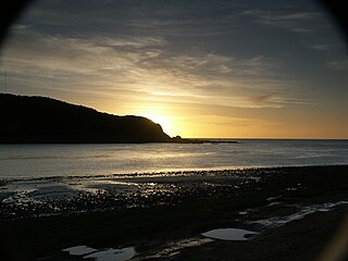
The Crow River is a river in Arthur's Pass National Park, Canterbury, New Zealand. It arises near Mount Rolleston and flows south into the Waimakariri River.

The Harman River is a river of New Zealand. It starts in the Browning Range of the Southern Alps and becomes the Arahura River, which flows into the Tasman Sea north of Hokitika.

Ōhinetamatea River / Saltwater Creek is a river in the Westland District of New Zealand.

The Paringa River is a river of the West Coast Region of New Zealand's South Island. It flows generally northwest from its origins in the Southern Alps west of Mount McCullaugh, reaching the Tasman Sea 10 km (6.2 mi) southwest of Bruce Bay. Geologist Jeremy Kilner wrote his 2005 bachelor's with honours thesis at the University of Otago about this valley; the title of his thesis was: Geophysical survey of the Paringa River valley, South Westland.
The Crow River is a river located in Kahurangi National Park in the West Coast Region of New Zealand. It arises in the Wharepapa / Arthur Range and flows south-west and then north-west into the Karamea River. The river may be named after the South Island kōkako, sometimes called the orange-wattled crow.
Mount Damfool is a mountain in the Southern Alps of New Zealand. It is a grade 1+ climb that can be completed in a long day from the Bealey Bridge via the Anti Crow River valley.


