Courtenay, New Zealand

Last updated

Courtenay
settlement
Courtenay township.JPG
Old West Coast Road passing through Courtenay
New Zealand location map.svg
Disc Plain red.svg
Courtenay
Coordinates: 43°27′55″S172°14′2″E / 43.46528°S 172.23389°E / -43.46528; 172.23389 Coordinates: 43°27′55″S172°14′2″E / 43.46528°S 172.23389°E / -43.46528; 172.23389
Country New Zealand
Region Canterbury
Territorial authority Selwyn District
Time zone UTC+12 (NZST)
  Summer (DST) UTC+13 (NZDT)
Postcode
7671
Area code 03
Local iwi Ngāi Tahu

Courtenay is a settlement in inland Canterbury, New Zealand. It was once important as a place where the Waimakariri River could be forded and was a coach stop on the way to the West Coast. Its decline began when the Midland Line was routed via the nearby Kirwee.

Contents

History

Early pioneers in Canterbury found it challenging to cross the Waimakariri River, and struggled with its pronunciation. [1] In 1849, the chief surveyor of the Canterbury Association, Joseph Thomas, gave it the name Courtenay River after the Canterbury Association member, Lord Courtenay, but it lapsed into disuse and the river was soon called again by its Māori name. [2] [3] The best opportunity for fording the river was 35 kilometres (22 mi) from Christchurch and the settlement that developed on the south bank at the ford took the European name of the river. [1] When building timber ran low in Christchurch, the logs from the Harewood Forest at Oxford were brought across the river at Courtenay. [1]

Courtenay is a fertile agricultural district. It originally formed part of the Racecourse Hill and Desert runs, the former of which was originally taken up by John Watts-Russell. [4] The latter was bought by the Rev Octavius Mathias for his friend, the Rev John Owen, a member of the Canterbury Association who never came out to New Zealand. [5] Courtenay was one of the earliest settled districts in Canterbury, and among the first residents was Colonel De Renzie Brett. [4]

A hotel was built in 1861 and operated by Charles White, and a store was opened at the township in the days when Cobb & Co coaches ran through it on their way to the West Coast. [4] A second hotel, the Halfway House, was opened by Charles Watson just east of Courtenay. It was so named because it was equidistant to Christchurch and Sheffield, and Cobb & Co made it its breakfast stop on the journey from Christchurch. [1]

Memorial for 150 years of Courtenay District outside the Courtenay Domain 150 years of Courtenay District.JPG
Memorial for 150 years of Courtenay District outside the Courtenay Domain

However, the formation of the railway to Springfield through Kirwee, and the consequent loss of the coach traffic, spoiled the business prospects of the township, and both the hotel and store were subsequently closed. The Courtenay Road Board, of which Colonel Brett was the first chairman, had jurisdiction in the district, and meetings were held at the Courtenay Hotel. Subsequently the Board's headquarters were transferred to Kirwee. The Courtenay Agricultural and Pastoral Association, and a horticultural society, were also formed in the early days, and shows were initially held at the Desert homestead, but later at Kirwee. [4]

St. Matthew's church is an Anglican church, located where Halkett and Woolshed Roads meet. [4] The township had a country model school, i.e. a school where trainee teachers worked under the supervision of experienced teachers. The school closed long ago, but the building is still in existence. [1] Courtenay celebrated its 150th history in 2000, and a memorial is located next to Old West Coast Road.

The Waimakariri River makes a sweeping curve across the Canterbury Plains, and Courtenay is located on its extreme convex point. River terraces are low-lying, and old flood channels starting at Courtenay can easily be recognised on aerial photos. The flood risk was recognised early on, but no action was taken until Christchurch was hit by a devastating flood in February 1868 that saw Victoria Square 1 metre (3 ft 3 in) under water. The Waimakariri flood waters had reached the source of the Avon River in Avonhead, and water rose very quickly in central Christchurch. [1] [6] Subsequently, flood banks were built by the Canterbury Provincial Council. [1]

The Courtenay district gave its name to a general electorate. The 1902 electoral redistribution created six new electorates, including Courtenay. It existed for two parliamentary terms and was abolished for the 1908 election. [7]

Notes

  1. 1 2 3 4 5 6 7 Crean, Mike (31 May 2014). "Tiny township has links with the past". The Press . p. C14.
  2. Blain 2007, pp. 25–27.
  3. Hight 1957, p. 121.
  4. 1 2 3 4 5 NZETC 1903, p. 738.
  5. Blain 2007, pp. 64f.
  6. "1868". Christchurch City Libraries . Retrieved 19 October 2014.
  7. McRobie 1989, pp. 67–72.

Related Research Articles

<span class="mw-page-title-main">Waimakariri River</span> River in Canterbury, New Zealand

The Waimakariri River is one of the largest rivers in Canterbury, on the eastern coast of New Zealand's South Island. It flows for 151 kilometres (94 mi) in a generally southeastward direction from the Southern Alps across the Canterbury Plains to the Pacific Ocean.

<span class="mw-page-title-main">Ōpāwaho / Heathcote River</span> River in Christchurch, New Zealand

The Ōpāwaho / Heathcote River lies within the city boundaries of Christchurch, New Zealand, and is fed from springs near Templeton Road, with a catchment area in wet weather extending as far west as Yaldhurst and Pound Road. It meanders around the base of the Port Hills from west to south-east.

The 2nd New Zealand Parliament was a term of the Parliament of New Zealand. It opened on 15 April 1856, following New Zealand's 1855 election. It was dissolved on 5 November 1860 in preparation for 1860–61 election. The 2nd Parliament was the first under which New Zealand had responsible government, meaning that unlike previously, the Cabinet was chosen by Parliament rather than by the Governor.

Selwyn is a village in the Selwyn District of Canterbury, New Zealand. It was laid out in the 1860s for a population of 2,000 people, but it currently has very few houses.

<span class="mw-page-title-main">Oxford, New Zealand</span> Town in Canterbury, New Zealand

Oxford is a small town serving the farming community of North Canterbury, New Zealand. It is part of the Waimakariri District and is a linear town, approximately 2 kilometres (1.2 mi) long. Originally, it was served by the Oxford Branch railway, and had two stations, East Oxford and West Oxford. The line closed in 1959 and was dismantled. Some railway signs and the remnants of railway platforms can still be seen along Oxford Road on the way to Rangiora.

<span class="mw-page-title-main">Waimakariri District</span> Territorial authority district in South Island, New Zealand

Waimakariri District is a local government district, located in the Canterbury Region of New Zealand's South Island. It is named after the Waimakariri River, which forms the district's southern boundary, separating it from Christchurch City and the Selwyn District. It is bounded in the north by the Hurunui District and in the east by the Pacific Ocean.

<span class="mw-page-title-main">Sheffield, New Zealand</span> Village in Canterbury, New Zealand

Sheffield is a small village located in the Selwyn District of the Canterbury region of New Zealand's South Island, near the Waimakariri Gorge.

Omata was a New Zealand electorate. It was located in Taranaki and based on the township of Omata. One of the original 24 electorates, it existed from 1853 to 1870.

Wairarapa and Hawke's Bay is a former parliamentary electorate in the Wellington region of New Zealand, from 1853 to 1859, when it was extended into previously unincorporated territories, split in two and replaced by County of Hawke with its southern portion being the newly created Wairarapa electorate. It is the first general electorate to have been abolished in New Zealand.
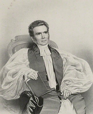
<span class="mw-page-title-main">Samuel Hinds (bishop)</span>

Samuel Hinds, was a British clergyman. He was appointed Bishop of Norwich in 1849 and resigned in 1857. Hinds was of the Broad Church in his views. He had strong links with the Ngati Kuri (Wai262) and Te Patu tribes of New Zealand, noting a paramount Maori chief Rata Ngaromotu of Ngati Kahu and the colonisation of New Zealand and the town of Hinds, New Zealand is named after him.

Lincoln was a parliamentary electorate in the Canterbury region of New Zealand from 1881 to 1890. It was represented by two Members of Parliament.

<span class="mw-page-title-main">Courtenay (New Zealand electorate)</span> Former electorate in Canterbury, New Zealand

Courtenay was a parliamentary electorate in Canterbury, New Zealand from 1902 to 1908. The electorate was represented by one Member of Parliament, Charles Lewis.

Ellesmere was a parliamentary electorate in the Canterbury region of New Zealand. It existed for two periods between 1861 and 1928 and was represented by six Members of Parliament.

Northern Division was a two-member parliamentary electorate in the Auckland Region, New Zealand from 1853 to 1870.

<span class="mw-page-title-main">Andrew Duncan (mayor)</span>

Andrew Duncan was Mayor of Christchurch 1869–1870. From a working-class background in Scotland, he emigrated to New Zealand as a young man and became a highly respected member of the Christchurch community. He is remembered for his later work as an immigration agent in Scotland on behalf of the Canterbury Province.
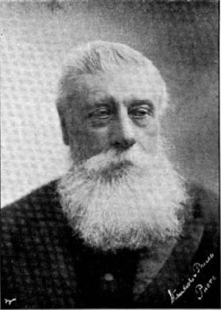
<span class="mw-page-title-main">Henry Richard Webb</span> New Zealand businessman and politician

Henry Richard Webb JP FRMS was a New Zealand businessman and politician. He represented Lyttelton in Parliament for 2½ years and was a supporter of education in his later years. Born in Australia, he came to Canterbury in 1868.

<span class="mw-page-title-main">State Highway 73 (New Zealand)</span> Road in New Zealand

State Highway 73 is a major east-west South Island state highway in New Zealand connecting Christchurch on the east coast with Cass/Hokitika via the Southern Alps. It is mostly two lane, with some single-lane bridges north of Springfield but is mostly dual carriageway in Christchurch. The fourth and fifth-highest points of New Zealand's state highway network are on this road at Porters Pass and Arthur's Pass respectively.

<span class="mw-page-title-main">Guise Brittan</span>

William Guise Brittan, mostly known as Guise Brittan and commonly referred to as W. G. Brittan, was the first Commissioner of Crown Lands for Canterbury in New Zealand.

<span class="mw-page-title-main">Joseph Thomas (surveyor)</span> New Zealand surveyor

Captain Joseph Thomas (1803–?) was a British explorer and the chief surveyor for Lyttelton, Sumner and Christchurch in New Zealand. He took up surveying after service in the British army, gaining the rank of lieutenant. In the 1840s, he explored many parts of New Zealand and worked for the New Zealand Company. This gained him employment with the Canterbury Association, which sent him to New Zealand in 1848. Thomas' role was to find a suitable site for their proposed settlement, and what became the Canterbury region with Christchurch as its capital was the result of his efforts. He was dismissed in early 1851 over quarrels with John Robert Godley, the agent of the Canterbury Association, just after the first settlers had arrived in the colony. Thomas' life after 1853 is unknown. Having allowed for Hagley Park as a generous central city green space is regarded as his major achievement, and it is his lasting legacy.

Marmaduke Dixon was an early settler in North Canterbury, New Zealand. He went to sea early in his life before he settled on the north bank of the Waimakariri River. An innovative farmer, he chaired a number of road boards and was a member of the Canterbury Provincial Council.

References