Selwyn Huts

Last updated

Selwyn Huts
Rural settlement
Selwyn Huts 4.jpg
Selwyn Huts in August 2023
Selwyn Huts
Coordinates: 43°42′58″S172°26′28″E / 43.716°S 172.441°E / -43.716; 172.441
Country New Zealand
Region Canterbury
Territorial authority Selwyn District
WardEllesmere
Electorates
Government
  Territorial authority Selwyn District Council
  Regional council Environment Canterbury
   Mayor of Selwyn Sam Broughton
   Selwyn MP Nicola Grigg
   Te Tai Tonga MP Tākuta Ferris
Area
[1]
  Total0.13 km2 (0.05 sq mi)
Elevation
15 m (49 ft)
Population
 (June 2023) [2]
  Total90
  Density690/km2 (1,800/sq mi)
Time zone UTC+12 (New Zealand Standard Time)
  Summer (DST) UTC+13 (New Zealand Daylight Time)
Area code 03

Selwyn Huts, also called Upper Selwyn Huts, is a rural settlement close to the northern shore of Lake Ellesmere / Te Waihora in the Selwyn District of New Zealand. Lower Selwyn Huts is a smaller settlement 2.8 km further south. [3]

Contents

The settlement consists of private dwellings on public land, and has existed since 1895. [4] Residents pay an annual licensing fee for use of the land. [5]

Lower Selwyn Huts was affected by flooding in 2021. [6]

Demographics

Selwyn Huts covers 0.13 km2 (0.050 sq mi). [1] It had an estimated population of 90 as of June 2023, [2] with a population density of 692 people per km2. Selwyn Huts is part of the Irwell statistical area. [7]

Historical population
YearPop.±% p.a.
200681    
201360−4.20%
201890+8.45%
Source: [8]

Selwyn Huts had a population of 90 at the 2018 New Zealand census, an increase of 30 people (50.0%) since the 2013 census, and an increase of 9 people (11.1%) since the 2006 census. There were 57 households, comprising 42 males and 48 females, giving a sex ratio of 0.88 males per female. The median age was 59.0 years (compared with 37.4 years nationally), with 9 people (10.0%) aged under 15 years, 6 (6.7%) aged 15 to 29, 51 (56.7%) aged 30 to 64, and 21 (23.3%) aged 65 or older.

Ethnicities were 93.3% European/Pākehā, 10.0% Māori, and 3.3% Pasifika. People may identify with more than one ethnicity.

Although some people chose not to answer the census's question about religious affiliation, 43.3% had no religion, and 36.7% were Christian.

Of those at least 15 years old, 12 (14.8%) people had a bachelor's or higher degree, and 18 (22.2%) people had no formal qualifications. The median income was $22,500, compared with $31,800 nationally. 9 people (11.1%) earned over $70,000 compared to 17.2% nationally. The employment status of those at least 15 was that 39 (48.1%) people were employed full-time, and 9 (11.1%) were part-time. [8]

See also

Related Research Articles

<span class="mw-page-title-main">Leeston</span> Town in South Island, New Zealand

Leeston is a town on the Canterbury Plains in the South Island of New Zealand. It is located 30 kilometres southwest of Christchurch, between the shore of Lake Ellesmere / Te Waihora and the mouth of the Rakaia River. The town is home to a growing number of services which have increased and diversified along with the population. Leeston has a supermarket, schools, churches, hospital, gym, cafes, restaurants, medical centre, pharmacy and post office. The Selwyn District Council currently has a service office in Leeston, after the headquarters was shifted to Rolleston.

<span class="mw-page-title-main">Selwyn District</span> Territorial authority district in Canterbury, New Zealand

Selwyn District is a predominantly rural district in central Canterbury, on the east coast of New Zealand's South Island. It is named after the Selwyn River / Waikirikiri, which is in turn named after Bishop George Selwyn, the first Anglican bishop of New Zealand who, in 1843 and 1844, travelled the length of the country by horse, foot, boat and canoe, leaving in his wake a sprinkling of locations that now bear his name.

<span class="mw-page-title-main">Birdlings Flat</span> Town in Canterbury, New Zealand

{{Infobox settlement

 | name = Birdlings Flat
<span class="mw-page-title-main">Purau</span> Settlement in Canterbury, New Zealand

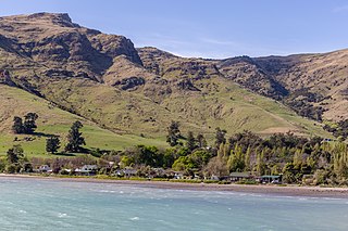
Purau is a small town in Canterbury, New Zealand, facing Lyttelton Harbour.

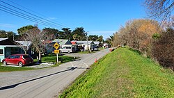
Doyleston is a minor Canterbury town in the South Island of New Zealand. It was named after Joseph Hastings Doyle, a publican from Christchurch who moved to the locality. Doyleston promised to be one of the main townships in the Ellesmere area, but before long Leeston overtook it and some businesses moved there. Doyleston had a school for many years, but it consolidated with Leeston School in the late 1930s.

<span class="mw-page-title-main">Springston</span> Rural settlement in Canterbury, New Zealand

Springston is a small rural Canterbury town in the South Island of New Zealand

<span class="mw-page-title-main">Sheffield, New Zealand</span> Settlement in Canterbury, New Zealand

Sheffield is a small village located in the Selwyn District of the Canterbury region of New Zealand's South Island, near the Waimakariri Gorge.

<span class="mw-page-title-main">Whitecliffs</span> Settlement in Canterbury, New Zealand

Whitecliffs is a village located in the Selwyn District of the Canterbury region of New Zealand's South Island. It has also been known as South Malvern, and the name of Whitecliffs comes from terrace cliffs above the Selwyn River / Waikirikiri.

<span class="mw-page-title-main">Glentunnel</span> Settlement in Canterbury, New Zealand

Glentunnel is a village located in the Selwyn District of the Canterbury region of New Zealand's South Island.

<span class="mw-page-title-main">Coalgate, New Zealand</span> Settlement in Canterbury, New Zealand

Coalgate is a small town in the Selwyn District of the Canterbury region of New Zealand's South Island. It is located roughly an hour west of Christchurch on State Highway 77. The town's name stems from it being the "gateway" to the lignite coal fields around Whitecliffs, the Rakaia Gorge, and The Acheron River. Coal mining declined in the 20th century and has now ceased, but since the 1950s, commercial processing of nontronite has taken place in Coalgate.

<span class="mw-page-title-main">Waddington, New Zealand</span> Settlement in Canterbury, New Zealand

Waddington is a small village located in the Selwyn District of the Canterbury region of New Zealand's South Island, near the Waimakariri Gorge.

<span class="mw-page-title-main">Spencerville, New Zealand</span> Suburb of Christchurch, New Zealand

Spencerville is a semi-rural town on the east coast of Canterbury, New Zealand north of Christchurch. The town backs on to Bottle Lake Forest and includes a large park and 80 hectare camping ground. These amenities, as well as wetlands and an animal and bird park make the town a popular camping area for Christchurch residents.

<span class="mw-page-title-main">Dunsandel</span> Town in Canterbury, New Zealand

Dunsandel is a small rural town in the Canterbury region of the South Island, New Zealand. The town is located on the Canterbury Plains just south of the Selwyn River / Waikirikiri and about 40 km south of Christchurch. Dunsandel is a junction town on SH1, halfway between Christchurch and Ashburton, with roads leading to Leeston, Southbridge and Hororata. The town provides an important refreshment stop for main road travellers with eateries and coffee shops, as well as acting as a support town for the rural hinterland.

<span class="mw-page-title-main">Castle Hill Village</span> Settlement in Canterbury, New Zealand

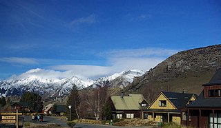
Castle Hill Village is an alpine village in Canterbury, New Zealand that started in 1982.

<span class="mw-page-title-main">Prebbleton</span> Minor urban area in Canterbury, New Zealand

Prebbleton is a small town in the Selwyn District in the Canterbury Region of New Zealand. It is 11 km southwest of the centre of Christchurch and about 2 km south of the outlying industrial suburb of Hornby.

<span class="mw-page-title-main">Timaru District</span> Territorial authority district in South Island, New Zealand

Timaru District is a local government district on New Zealand's South Island, administered by the Timaru District Council. It is part of the larger Canterbury Region. Timaru district was formed in 1989 from the amalgamation of Timaru City, Geraldine district, Temuka district and Stratham district.

<span class="mw-page-title-main">Ashburton District</span> Territorial authority district in Canterbury, New Zealand

Ashburton District is a territorial authority district in the Canterbury Region of the South Island of New Zealand. It encompasses the town of Ashburton, a number of small towns and settlements and the surrounding rural area, roughly coterminous with Mid Canterbury. The district had a population of 36,800 as of June 2023.

<span class="mw-page-title-main">Waimate District</span> Territorial authority district in Canterbury Region, New Zealand

Waimate District is a territorial authority district located in the Canterbury Region of the South Island of New Zealand. The main town is Waimate, while there are many smaller rural communities dispersed throughout the area. Its boundary to the south is the Waitaki River, to the west Lake Benmore and to the north-east the Pareora River.

Milford Huts is a bach community in the Timaru district and Canterbury region of New Zealand's South Island. Milford Huts is on the northern side of the Ōpihi River mouth, 7.5 kilometres southeast of Temuka by road.

Makikihi is a small town in the Waimate District of south Canterbury region of New Zealand's South Island. It is located on State Highway 1 12.2 kilometres south of Saint Andrews, Canterbury, and 15.5 kilometres northeast of Waimate. It is close to the mouth of Makikihi River.

References

  1. 1 2 "ArcGIS Web Application". statsnz.maps.arcgis.com. Retrieved 25 October 2021.
  2. 1 2 "Subnational population estimates (RC, SA2), by age and sex, at 30 June 1996-2023 (2023 boundaries)". Statistics New Zealand . Retrieved 25 October 2023. (regional councils); "Subnational population estimates (TA, SA2), by age and sex, at 30 June 1996-2023 (2023 boundaries)". Statistics New Zealand . Retrieved 25 October 2023. (territorial authorities); "Subnational population estimates (urban rural), by age and sex, at 30 June 1996-2023 (2023 boundaries)". Statistics New Zealand . Retrieved 25 October 2023. (urban areas)
  3. Harriss, Gavin (July 2021). "NZ Topo Map" (Map). Selwyn Huts, Canterbury.
  4. Mitchell, Charlie (2 March 2019). "Historic community at Selwyn Huts in climate change limbo". Stuff.
  5. Bolger, Devon (31 March 2020). "A 'complete joke': Canterbury community reacts to 70% fee hike". Otago Daily Times.
  6. Porter, Nadine (2 June 2021). "Race against time to save tiny Selwyn Huts community bracing for more flooding". Stuff.
  7. 2018 Census place summary: Irwell
  8. 1 2 "Statistical area 1 dataset for 2018 Census". Statistics New Zealand. March 2020. 7026938.