Coalgate, New Zealand

Last updated

Coalgate
Village
Coalgate Main Street.JPG
Bridge Street, November 2011
Coalgate, New Zealand
Coordinates: 43°29′S171°58′E / 43.483°S 171.967°E / -43.483; 171.967
Country New Zealand
Region Canterbury
Territorial authority Selwyn District
WardMalvern
CommunityMalvern
Electorates
Government
  Territorial authority Selwyn District Council
  Regional council Environment Canterbury
   Mayor of Selwyn Sam Broughton
   Selwyn MP Nicola Grigg
   Te Tai Tonga MP Tākuta Ferris
Area
[1]
  Total1.09 km2 (0.42 sq mi)
Population
 (June 2023) [2]
  Total380
  Density350/km2 (900/sq mi)
Time zone UTC+12 (New Zealand Standard Time)
  Summer (DST) UTC+13 (New Zealand Daylight Time)
Area code 03

Coalgate is a small town in the Selwyn District of the Canterbury region of New Zealand's South Island. [3] It is located roughly an hour west of Christchurch on State Highway 77. The town's name stems from it being the "gateway" to the lignite coal fields around Whitecliffs, the Rakaia Gorge, and The Acheron River. Coal mining declined in the 20th century and has now ceased, but since the 1950s, commercial processing of nontronite has taken place in Coalgate. [4]

Contents

Demographics

Coalgate is described by Statistics New Zealand as a rural settlement, and covers 1.09 km2 (0.42 sq mi). [1] It had an estimated population of 380 as of June 2023, [2] with a population density of 349 people per km2. It is part of the Glentunnel statistical area. [5]

Historical population
YearPop.±% p.a.
2006228    
2013315+4.73%
2018339+1.48%
Source: [6]

Before the 2023 census, the settlement had a smaller boundary, covering 0.75 km2 (0.29 sq mi). [1] Using that boundary, Coalgate had a population of 339 at the 2018 New Zealand census, an increase of 24 people (7.6%) since the 2013 census, and an increase of 111 people (48.7%) since the 2006 census. There were 138 households, comprising 165 males and 174 females, giving a sex ratio of 0.95 males per female, with 75 people (22.1%) aged under 15 years, 51 (15.0%) aged 15 to 29, 165 (48.7%) aged 30 to 64, and 51 (15.0%) aged 65 or older.

Ethnicities were 98.2% European/Pākehā, 8.0% Māori, and 0.9% Pasifika. People may identify with more than one ethnicity.

Although some people chose not to answer the census's question about religious affiliation, 65.5% had no religion, 23.9% were Christian, 0.9% had Māori religious beliefs, 0.9% were Buddhist and 0.9% had other religions.

Of those at least 15 years old, 45 (17.0%) people had a bachelor's or higher degree, and 69 (26.1%) people had no formal qualifications. 51 people (19.3%) earned over $70,000 compared to 17.2% nationally. The employment status of those at least 15 was that 159 (60.2%) people were employed full-time, 39 (14.8%) were part-time, and 6 (2.3%) were unemployed. [6]

Services

Coalgate Tavern, November 2011 Coalgate Tavern.JPG
Coalgate Tavern, November 2011

Notable features are the Coalgate Tavern and the Coalgate Cabins, both situated on the main road to Hororata. Coalgate also has a walkway through the old Coalgate Domain. In addition to these there is also a Coalgate bowling green. A garage is also located in Coalgate.

The town has access to the Selwyn River and is situated to the east of Glentunnel.

Transport

On 3 November 1875, the Whitecliffs Branch railway was opened, with a station in Coalgate. It was here that a private line diverged from the state-operated New Zealand Railways Department network. On 31 March 1962, the railway closed, but some of the line's old formation and the Coalgate station platform can still be found. [7]

Coalgate is serviced by State Highway 77/Inland Scenic Route 72.

Related Research Articles

<span class="mw-page-title-main">Darfield, New Zealand</span> Town in Canterbury, New Zealand

Darfield is a town in the Selwyn District of the South Island of New Zealand. It is 35 kilometres west of Christchurch. Its population is 3,150 as of June 2023.

<span class="mw-page-title-main">Kaka Point</span> Rural settlement in Otago, New Zealand

Kaka Point is a small town at the northern edge of The Catlins, an area of the southern South Island of New Zealand. It is located 14km south of Balclutha and 8km north of the headland of Nugget Point. It has a seasonally fluctuating population, and there are numerous cribs at the settlement. The settlement's best−known resident was Māori poet Hone Tuwhare, who lived in Kaka Point for many years until he died in 2008. Kaka Point is named for the kākā bird, whose signature call is "ka-aa."

Doyleston is a minor Canterbury town in the South Island of New Zealand. It was named after Joseph Hastings Doyle, a publican from Christchurch who moved to the locality. Doyleston promised to be one of the main townships in the Ellesmere area, but before long Leeston overtook it and some businesses moved there. Doyleston had a school for many years, but it consolidated with Leeston School in the late 1930s.

Allanton is a small town in Otago, New Zealand, located some 20 kilometres southwest of Dunedin on State Highway 1. The settlement lies at the eastern edge of the Taieri Plains close to the Taieri River at the junction of the main road to Dunedin International Airport at Momona.

<span class="mw-page-title-main">Sheffield, New Zealand</span> Settlement in Canterbury, New Zealand

Sheffield is a small village located in the Selwyn District of the Canterbury region of New Zealand's South Island, near the Waimakariri Gorge.

<span class="mw-page-title-main">Kirwee</span> Settlement in Canterbury, New Zealand

Kirwee is a town located west of Christchurch in the Canterbury region of New Zealand's South Island. It was named after Karwi in India by retired British Army colonel De Renzie Brett. Kirwee is also home to the South Island Agricultural Field Days, held biennially.

<span class="mw-page-title-main">Whitecliffs</span> Settlement in Canterbury, New Zealand

Whitecliffs is a village located in the Selwyn District of the Canterbury region of New Zealand's South Island. It has also been known as South Malvern, and the name of Whitecliffs comes from terrace cliffs above the Selwyn River / Waikirikiri.

<span class="mw-page-title-main">Glentunnel</span> Settlement in Canterbury, New Zealand

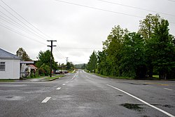
Glentunnel is a village located in the Selwyn District of the Canterbury region of New Zealand's South Island.

<span class="mw-page-title-main">Waddington, New Zealand</span> Settlement in Canterbury, New Zealand

Waddington is a small village located in the Selwyn District of the Canterbury region of New Zealand's South Island, near the Waimakariri Gorge.

<span class="mw-page-title-main">Lake Hood</span> Artificial lake in Canterbury, South Island

Lake Hood is a man-made recreational lake, located 6 km south-east of Tinwald in the locality of Huntingdon, Canterbury, New Zealand. It was opened in 2001 by the Right Honourable Jenny Shipley. It is 2.3 km long by 1 km wide and is more than 80 hectares (0.80 km2) in area. It features an eight lane rowing course and separate waterskiing and jet skiing areas, and is home to Water Ski Lake Hood. It is increasing in popularity for rowing, as it is not as susceptible to wind as the main South Island rowing venue, Lake Ruataniwha.

Woodlands is a small town in the Southland region of New Zealand's South Island on the banks of the Waihopai River. It is northeast of Invercargill between Dacre and Longbush. Other nearby settlements are Rakahouka to the northwest and Rimu and Waituna to the south.

<span class="mw-page-title-main">Dunsandel</span> Town in Canterbury, New Zealand

Dunsandel is a small rural town in the Canterbury region of the South Island, New Zealand. The town is located on the Canterbury Plains just south of the Selwyn River / Waikirikiri and about 40 km south of Christchurch. Dunsandel is a junction town on SH1, halfway between Christchurch and Ashburton, with roads leading to Leeston, Southbridge and Hororata. The town provides an important refreshment stop for main road travellers with eateries and coffee shops, as well as acting as a support town for the rural hinterland.

<span class="mw-page-title-main">Pukenui</span> Place in Northland Region, New Zealand

Pukenui is a locality on the southwest side of Houhora Harbour on the Aupouri Peninsula of Northland, New Zealand. State Highway 1 runs through it. The name means "large hill" in the Māori language.

<span class="mw-page-title-main">Luggate</span> Town in the South Island of New Zealand

Luggate is a small town in the South Island of New Zealand. It is located on State Highway 6 between Wānaka and Cromwell, near the junction with State Highway 8A, approximately 15 km from the Wānaka township, just past Wānaka Airport.

<span class="mw-page-title-main">Prebbleton</span> Minor urban area in Canterbury, New Zealand

Prebbleton is a small town in the Selwyn District in the Canterbury Region of New Zealand. It is 11 km southwest of the centre of Christchurch and about 2 km south of the outlying industrial suburb of Hornby.

<span class="mw-page-title-main">Ashley, New Zealand</span> Settlement in Canterbury, New Zealand

Ashley is a small town in North Canterbury, in the South Island of New Zealand. It used to have a railway station on the Main North Line that runs through the village.

<span class="mw-page-title-main">Pōhara</span> Settlement in Tasman District, New Zealand

Pōhara is a rural locality in the Tasman District of New Zealand's South Island. The locality is northeast of Tākaka and southwest of Tata Beach. To the north is Limestone Bay, part of Golden Bay / Mohua

<span class="mw-page-title-main">Selwyn Huts</span> Rural settlement in Canterbury, New Zealand

Selwyn Huts, also called Upper Selwyn Huts, is a rural settlement close to the northern shore of Lake Ellesmere / Te Waihora in the Selwyn District of New Zealand. Lower Selwyn Huts is a smaller settlement 2.8 km further south.

Milford Huts is a bach community in the Timaru district and Canterbury region of New Zealand's South Island. Milford Huts is on the northern side of the Ōpihi River mouth, 7.5 kilometres southeast of Temuka by road.

<span class="mw-page-title-main">Plummers Point</span> Rural settlement in the Bay of Plenty, New Zealand

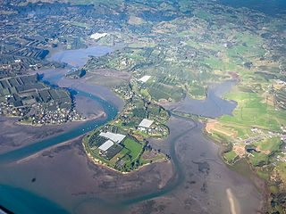
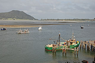
Plummers Point is a rural settlement in the Western Bay of Plenty District and Bay of Plenty Region of New Zealand's North Island. It is on a headland on the southern side of Tauranga Harbour, opposite Motuhoa Island, and between Mangawhai Bay and Te Puna Estuary. The East Coast Main Trunk forms its southern boundary.

References

  1. 1 2 3 "ArcGIS Web Application". statsnz.maps.arcgis.com. Retrieved 25 May 2024.
  2. 1 2 "Subnational population estimates (RC, SA2), by age and sex, at 30 June 1996-2023 (2023 boundaries)". Statistics New Zealand . Retrieved 25 October 2023. (regional councils); "Subnational population estimates (TA, SA2), by age and sex, at 30 June 1996-2023 (2023 boundaries)". Statistics New Zealand . Retrieved 25 October 2023. (territorial authorities); "Subnational population estimates (urban rural), by age and sex, at 30 June 1996-2023 (2023 boundaries)". Statistics New Zealand . Retrieved 25 October 2023. (urban areas)
  3. "Place name detail: Coalgate". New Zealand Gazetteer. New Zealand Geographic Board . Retrieved 2 April 2008.
  4. Selwyn District Council, "Glentunnel and Coalgate" Archived 17 September 2008 at the Wayback Machine , accessed 19 May 2008.
  5. 2018 Census place summary: Glentunnel
  6. 1 2 "Statistical area 1 dataset for 2018 Census". Statistics New Zealand. March 2020. 7026690 and 7026691.
  7. David Leitch and Brian Scott, Exploring New Zealand's Ghost Railways, revised edition (Wellington: Grantham House, 1998 [1995]), 71-2.