Doyleston

Last updated

Doyleston
Rural settlement
Doyleston
Coordinates: 43°45′S172°18′E / 43.750°S 172.300°E / -43.750; 172.300
Country New Zealand
Region Canterbury
Territorial authority Selwyn District
WardEllesmere
Electorates
Government
  Territorial authority Selwyn District Council
  Regional council Environment Canterbury
   Mayor of Selwyn Sam Broughton
   Selwyn MP Nicola Grigg
   Te Tai Tonga MP Tākuta Ferris
Area
[1]
  Total0.60 km2 (0.23 sq mi)
Elevation
15 m (49 ft)
Population
 (June 2023) [2]
  Total350
  Density580/km2 (1,500/sq mi)
Time zone UTC+12 (New Zealand Standard Time)
  Summer (DST) UTC+13 (New Zealand Daylight Time)
Area code 03

Doyleston is a minor Canterbury town in the South Island of New Zealand. It was named after Joseph Hastings Doyle, a publican from Christchurch who moved to the locality. Doyleston promised to be one of the main townships in the Ellesmere area, but before long Leeston overtook it and some businesses moved there. Doyleston had a school for many years, but it consolidated with Leeston School in the late 1930s.

Contents

Doyleston featured a hall on the main street (the second on the site), but partly due to a car crash it was pulled down, making way for new housing. Doyleston's main attraction now is Osborne Park, which has been the centre for junior football in Ellesmere for a number of years.

Demographics

Doyleston covers 0.60 km2 (0.23 sq mi). [1] It had an estimated population of 350 as of June 2023, [2] with a population density of 583 people per km2. Doyleston is part of the Irwell statistical area. [3]

Historical population
YearPop.±% p.a.
2006249    
2013312+3.27%
2018324+0.76%
Source: [4]

Doyleston had a population of 324 at the 2018 New Zealand census, an increase of 12 people (3.8%) since the 2013 census, and an increase of 75 people (30.1%) since the 2006 census. There were 120 households, comprising 174 males and 147 females, giving a sex ratio of 1.18 males per female, with 72 people (22.2%) aged under 15 years, 36 (11.1%) aged 15 to 29, 186 (57.4%) aged 30 to 64, and 27 (8.3%) aged 65 or older.

Ethnicities were 93.5% European/Pākehā, 10.2% Māori, 0.9% Pasifika, 1.9% Asian, and 1.9% other ethnicities. People may identify with more than one ethnicity.

Although some people chose not to answer the census's question about religious affiliation, 61.1% had no religion, 26.9% were Christian, 0.9% were Hindu and 1.9% had other religions.

Of those at least 15 years old, 24 (9.5%) people had a bachelor's or higher degree, and 51 (20.2%) people had no formal qualifications. 39 people (15.5%) earned over $70,000 compared to 17.2% nationally. The employment status of those at least 15 was that 153 (60.7%) people were employed full-time, 33 (13.1%) were part-time, and 3 (1.2%) were unemployed. [4]

Notable people

Related Research Articles

<span class="mw-page-title-main">Leeston</span> Town in South Island, New Zealand

Leeston is a town on the Canterbury Plains in the South Island of New Zealand. It is located 30 kilometres southwest of Christchurch, between the shore of Lake Ellesmere / Te Waihora and the mouth of the Rakaia River. The town is home to a growing number of services which have increased and diversified along with the population. Leeston has a supermarket, schools, churches, hospital, gym, cafes, restaurants, medical centre, pharmacy and post office. The Selwyn District Council currently has a service office in Leeston, after the headquarters was shifted to Rolleston.

<span class="mw-page-title-main">Birdlings Flat</span> Town in Canterbury, New Zealand

{{Infobox settlement

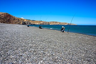
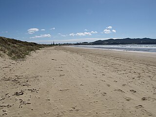
 | name = Birdlings Flat
<span class="mw-page-title-main">Kaka Point</span> Rural settlement in Otago, New Zealand

Kaka Point is a small town at the northern edge of The Catlins, an area of the southern South Island of New Zealand. It is located 14km south of Balclutha and 8km north of the headland of Nugget Point. It has a seasonally fluctuating population, and there are numerous cribs at the settlement. The settlement's best−known resident was Māori poet Hone Tuwhare, who lived in Kaka Point for many years until he died in 2008. Kaka Point is named for the kākā bird, whose signature call is "ka-aa."

<span class="mw-page-title-main">Springston</span> Rural settlement in Canterbury, New Zealand

Springston is a small rural Canterbury town in the South Island of New Zealand

<span class="mw-page-title-main">Whitecliffs</span> Settlement in Canterbury, New Zealand

Whitecliffs is a village located in the Selwyn District of the Canterbury region of New Zealand's South Island. It has also been known as South Malvern, and the name of Whitecliffs comes from terrace cliffs above the Selwyn River / Waikirikiri.

<span class="mw-page-title-main">Tata Beach</span> Settlement in Tasman District, New Zealand

Tata Beach is a beach and small coastal settlement of predominantly holiday houses in the South Island, New Zealand. Found in the Golden Bay region, it is approximately 14 kilometres (8.7 mi) north-east of Tākaka.

<span class="mw-page-title-main">Dunsandel</span> Town in Canterbury, New Zealand

Dunsandel is a small rural town in the Canterbury region of the South Island, New Zealand. The town is located on the Canterbury Plains just south of the Selwyn River / Waikirikiri and about 40 km south of Christchurch. Dunsandel is a junction town on SH1, halfway between Christchurch and Ashburton, with roads leading to Leeston, Southbridge and Hororata. The town provides an important refreshment stop for main road travellers with eateries and coffee shops, as well as acting as a support town for the rural hinterland.

Bombay is a rural community in the Bombay Hills at the southern boundary of Auckland Region of New Zealand. The Auckland Southern Motorway runs through Bombay.

<span class="mw-page-title-main">Tai Tapu</span> Place in South Island, New Zealand

Tai Tapu, previously known as Taitapu, is a small town adjacent to the Halswell River and nestled in the Port Hills, located 6 km east of the town of Lincoln and 18 km south west of Christchurch in the Canterbury region of New Zealand's South Island. State Highway 75 passes through the centre of the village, connecting Christchurch with Akaroa and the Banks Peninsula.

<span class="mw-page-title-main">Waikuku Beach</span> Town in Canterbury, New Zealand

Waikuku Beach is a small settlement on the coast of the Canterbury region of New Zealand, about 3 km (1.9 mi) east of the settlement of Waikuku.

<span class="mw-page-title-main">Rārangi</span> Town in Marlborough, New Zealand

Rārangi is a very small town in the South Island of New Zealand which is approximately 15 minutes drive to the north-east of Blenheim, on the coast of Cloudy Bay.

<span class="mw-page-title-main">North Shore ward</span> Ward of Auckland in New Zealand

North Shore Ward is an Auckland Council ward that elects two councillors and covers the Devonport-Takapuna and Kaipātiki Local Boards. The two councillors are currently Richard Hills and Chris Darby.

<span class="mw-page-title-main">Waitematā and Gulf ward</span> Ward of Auckland in New Zealand

Waitematā and Gulf Ward is an Auckland Council ward which elects one councillor and covers the Great Barrier, Waiheke, and Waitematā Local Boards. The current councillor is Mike Lee.

Irwell was a small rural township in Canterbury, New Zealand on the intersection of Leeston and Selwyn Lake Roads. All that remains are the former school hall, a church, and a small number of houses.

<span class="mw-page-title-main">Ruby Bay</span> Settlement in Tasman District, New Zealand

Ruby Bay is a settlement in the Tasman District of New Zealand's upper South Island. It is located between Māpua and Tasman on Te Mamaku / Ruby Bay. Ruby Bay was named after small 'rubies' found within the moutere gravel.

<span class="mw-page-title-main">Selwyn Huts</span> Rural settlement in Canterbury, New Zealand

Selwyn Huts, also called Upper Selwyn Huts, is a rural settlement close to the northern shore of Lake Ellesmere / Te Waihora in the Selwyn District of New Zealand. Lower Selwyn Huts is a smaller settlement 2.8 km further south.

<span class="mw-page-title-main">Tokerau Beach</span> Place in Northland Region, New Zealand

Tokerau Beach is a settlement on the northwestern side of Doubtless Bay on the Karikari Peninsula of Northland, New Zealand.

Rangitane or Rangitāne is a settlement on the east bank of the Rangitane River and the northern shore of the Kerikeri Inlet in the Far North District of New Zealand. It is 13 km north-west of Kerikeri by road.

<span class="mw-page-title-main">Grahams Beach</span> Place in Auckland Region, New Zealand

Grahams Beach is a rural settlement on the northern tip of the Āwhitu Peninsula and south coast of the Manukau Harbour in the Auckland Region of New Zealand. The settlement as described by Statistics New Zealand also includes Big Bay.

<span class="mw-page-title-main">Waiomu</span> Rural settlement in New Zealand

Waiomu is a settlement on the west coast of the Coromandel Peninsula of New Zealand, between Tapu to the north and Te Puru to the south. State Highway 25 runs through it.

References

  1. 1 2 "ArcGIS Web Application". statsnz.maps.arcgis.com. Retrieved 25 October 2021.
  2. 1 2 "Subnational population estimates (RC, SA2), by age and sex, at 30 June 1996-2023 (2023 boundaries)". Statistics New Zealand . Retrieved 25 October 2023. (regional councils); "Subnational population estimates (TA, SA2), by age and sex, at 30 June 1996-2023 (2023 boundaries)". Statistics New Zealand . Retrieved 25 October 2023. (territorial authorities); "Subnational population estimates (urban rural), by age and sex, at 30 June 1996-2023 (2023 boundaries)". Statistics New Zealand . Retrieved 25 October 2023. (urban areas)
  3. 2018 Census place summary: Irwell
  4. 1 2 "Statistical area 1 dataset for 2018 Census". Statistics New Zealand. March 2020. 7026832 and 7026833.
  5. Mountier, Mary. "Laurel Amy Eva Campbell". Dictionary of New Zealand Biography . Ministry for Culture and Heritage . Retrieved 23 April 2017.