Darfield, New Zealand

Last updated

Darfield
Darfield Sign and Main Street.JPG
Darfield sign on New Zealand State Highway 73, the main street of Darfield
Darfield, New Zealand
Coordinates: 43°29′S172°07′E / 43.483°S 172.117°E / -43.483; 172.117
Country New Zealand
Region Canterbury
Territorial authority Selwyn District
WardMalvern
CommunityMalvern
Electorates [1]
Government
  Territorial authority Selwyn District Council
  Regional council Environment Canterbury
   Mayor of Selwyn Sam Broughton
   Selwyn MP Nicola Grigg
   Te Tai Tonga MP Tākuta Ferris
Area
[2]
  Total15.14 km2 (5.85 sq mi)
Population
 (June 2023) [3]
  Total3,150
  Density210/km2 (540/sq mi)
Time zone UTC+12 (NZST)
  Summer (DST) UTC+13 (NZDT)
Postcode(s)
7510
Area code 03
Local iwi Ngāi Tahu

Darfield is a town in the Selwyn District of the South Island of New Zealand. It is 35 kilometres west of Christchurch. Its population is 3,150 as of June 2023. [3]

Contents

Darfield is the main town between Christchurch and the West Coast region. It is often called "The township under the nor'west arch" in reference to a characteristic weather phenomenon that often creates an arch of cloud in an otherwise clear sky to the west of the township. This is caused by the condensation of water particles channelled upwards over the Southern Alps.

Darfield lies in the Malvern district's arable and pastoral farming area. It is a gateway to the scenic Waimakariri and Rakaia rivers and the Southern Alps, and is also a popular lift-off place for hot air ballooning.

Darfield is located around the former junction of the railway lines coming from Christchurch and going to Whitecliffs (where coal was mined) and Springfield and on to the West Coast.

History

Darfield was first known as White Cliffs Junction, but was then renamed in 1879 to Horndon Junction. This name was changed again to avoid confusion with Hornby [railway] Junction (close by in Christchurch).

Darfield acquired its name from John Jebson who named it after the village in Yorkshire, England. The name refers to a field frequented by deer. [4]

A stone mill for grinding flour was built in 1887. It was powered by the Selwyn County Council's water race.

2000s–present

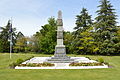
A magnitude 7.1 earthquake occurred near Darfield at 4:35 am on 4 September 2010, causing widespread damage to both the town and to surrounding areas including the city of Christchurch. [5]

Fonterra invested $500 million in a milk processing plant which was opened in 2013 in Darfield. This includes the world's largest dryer which is used in the process to make instant wholemilk powder. [6] [7]

Climate

Located on the Canterbury Plains at an altitude of 193 metres (633 feet) above sea level, the Köppen-Geiger climate classification for Darfield is Cfb (Oceanic). On several days a year, Darfield is subject to the nor'west Foehn wind, which is very dry and has the capability to raise the temperature by several degrees per hour. On the contrary, the town is also susceptible to cold blasts from the Southern Ocean, especially during winter, when a southerly wind blows. The average annual temperature in Darfield is 11.6 °C (52.9 °F). The highest recorded temperature is 40.7 °C (105.3 °F), set on 8 February 1973, while the lowest recorded temperature is -8.0 °C (17.6 °F), set on 7 June 2012. The highest minimum temperature is 25.7 °C (78.3 °F), set on 6 February 2011, while the lowest maximum temperature is 0.6 °C (33.1 °F), set on 12 July 2017. On average, Darfield can expect to see 38.3 days of frost per year, and 49 days where the maximum temperature exceeds 26.7 °C (80 °F).

Climate data for Darfield, 193 m
MonthJanFebMarAprMayJunJulAugSepOctNovDecYear
Record high °C (°F)38.4
(101.1)
40.7
(105.3)
37.6
(99.7)
31.4
(88.5)
27.2
(81.0)
22.3
(72.1)
20.5
(68.9)
23.3
(73.9)
27.8
(82.0)
30.0
(86.0)
31.9
(89.4)
36.5
(97.7)
40.7
(105.3)
Mean daily maximum °C (°F)23.0
(73.4)
22.7
(72.9)
20.6
(69.1)
17.4
(63.3)
14.4
(57.9)
11.4
(52.5)
10.9
(51.6)
12.3
(54.1)
14.8
(58.6)
17.0
(62.6)
19.1
(66.4)
21.3
(70.3)
17.1
(62.8)
Daily mean °C (°F)16.9
(62.4)
16.5
(61.7)
14.9
(58.8)
12.0
(53.6)
9.3
(48.7)
6.6
(43.9)
6.2
(43.2)
7.3
(45.1)
9.5
(49.1)
11.4
(52.5)
13.2
(55.8)
15.4
(59.7)
11.6
(52.9)
Mean daily minimum °C (°F)10.8
(51.4)
10.6
(51.1)
9.4
(48.9)
6.6
(43.9)
4.3
(39.7)
2.0
(35.6)
1.6
(34.9)
2.4
(36.3)
4.2
(39.6)
5.8
(42.4)
7.4
(45.3)
9.6
(49.3)
6.2
(43.2)
Record low °C (°F)0.6
(33.1)
1.6
(34.9)
0.3
(32.5)
−0.3
(31.5)
−2.1
(28.2)
−8.0
(17.6)
−6.4
(20.5)
−3.1
(26.4)
−2.6
(27.3)
−2.2
(28.0)
−1.2
(29.8)
0.2
(32.4)
−8.0
(17.6)
Average rainfall mm (inches)60.3
(2.37)
51.1
(2.01)
60.5
(2.38)
78.8
(3.10)
58.1
(2.29)
61.8
(2.43)
59.4
(2.34)
68.1
(2.68)
46.7
(1.84)
67.6
(2.66)
54.6
(2.15)
63.9
(2.52)
730.9
(28.78)
Source 1: Climate-data.org [8]
Source 2: weatherbase.com [9]

Demographics

Darfield is described by Statistics New Zealand as a small urban area, and covers 15.14 km2 (5.85 sq mi). [2] It had an estimated population of 3,150 as of June 2023, [3] with a population density of 208 people per km2.

Historical population
YearPop.±% p.a.
20061,974    
20132,397+2.81%
20182,724+2.59%
Source: [10]

Darfield had a population of 2,724 at the 2018 New Zealand census, an increase of 327 people (13.6%) since the 2013 census, and an increase of 750 people (38.0%) since the 2006 census. There were 1,053 households, comprising 1,338 males and 1,389 females, giving a sex ratio of 0.96 males per female. The median age was 43.9 years (compared with 37.4 years nationally), with 507 people (18.6%) aged under 15 years, 435 (16.0%) aged 15 to 29, 1,218 (44.7%) aged 30 to 64, and 564 (20.7%) aged 65 or older.

Ethnicities were 94.6% European/Pākehā, 6.6% Māori, 1.4% Pasifika, 2.0% Asian, and 3.1% other ethnicities. People may identify with more than one ethnicity.

The percentage of people born overseas was 16.3, compared with 27.1% nationally.

Although some people chose not to answer the census's question about religious affiliation, 52.5% had no religion, 38.3% were Christian, 0.2% were Hindu, 0.2% were Muslim, 0.1% were Buddhist and 1.1% had other religions.

Of those at least 15 years old, 348 (15.7%) people had a bachelor's or higher degree, and 462 (20.8%) people had no formal qualifications. The median income was $36,400, compared with $31,800 nationally. 450 people (20.3%) earned over $70,000 compared to 17.2% nationally. The employment status of those at least 15 was that 1,146 (51.7%) people were employed full-time, 324 (14.6%) were part-time, and 39 (1.8%) were unemployed. [10]

The population of Darfield was 830 people in 1971. [11]

Education

Darfield has numerous kindergartens. The original Darfield school was opened in 1883 with a total of 18 students attending. By 1902 the school had two teachers and ninety-three students children on the school roll. [12]

Darfield Primary School is Darfield's sole primary school, catering for years 1 to 6. [13] It has 256 students.

Darfield High School is Darfield's sole intermediate/high school, catering for years 7 to 13. [14] It has 827 students. The school was established in 1951 as a secondary school, and expanded to cover intermediate students in 1978. [15]

Both schools are coeducational. Rolls are as of February 2024. [16]

Industry

Many industries are present in Darfield, including brick-making, seed cleaning, and a Fonterra factory, which processes milk powder. The factory has a series of railway sidings and a container loading centre. [17]

Services

SH73/South Terrace, October 2013 Darfield Main Street 001.JPG
SH73/South Terrace, October 2013

Darfield has a shopping precinct along the main street, including a Four Square supermarket. The town also has many churches, most notably St Joseph's Catholic Church and Trinity Church (Anglican, Methodist, Presbyterian). Darfield has two resthomes.

Other services include: a bakery, bank, cafés and bars, hotels, a library, motels, numerous petrol stations, a post office, and a veterinary clinic.

Darfield is also has police, fire and ambulance stations, as well as a medical centre and a hospital.

Selwyn is not connected to a district wide sewage scheme. This necessitates all homes to have their own septic tanks. [7]

Recreation

Darfield has a domain, which includes duck ponds and the community centre. Football and rugby fields, tennis courts and a Scouts building are also located in the domain.

Westview Park is located in between the Midland railway line and State Highway 73 and to the west of Four Square Darfield. It boasts attractions such as the Whitecliffs Branch historical site and a skatepark.

McHughs Forest Park is located northwest of Darfield. It was planted in 1893 to provide timber for mid Canterbury. It contains a mix of Douglas Fir, Pinus Radiata, Macrocarpa, Larch, Spruce and other exotic species. There are a series of walking tracks within the forest.

Transport

Clock at Darfield, October 2013 Darfield Clock.JPG
Clock at Darfield, October 2013

Bus

Darfield is serviced with the 86 bus route, a morning and evening express route that connects the town with Central Christchurch, via Kirwee, West Melton and Yaldhurst. [18]

Rail

Darfield is served by the Midland railway line. The TranzAlpine train stops twice daily (request only); en route to the West Coast and on its return trip back to Christchurch.

Road

Darfield is served by State Highway 73 (Great Alpine Highway), connecting Christchurch with the West Coast region and State Highway 77, connecting Darfield with Ashburton via Methven, the Rakaia Gorge and Glentunnel.

Notable people

Related Research Articles

Edgecumbe is a town in the Bay of Plenty Region of the North Island of New Zealand, 15 kilometres (9.3 mi) to the west of Whakatāne and 8 kilometres (5.0 mi) south of the Bay's coast.

<span class="mw-page-title-main">Lincoln, New Zealand</span> Town in Canterbury, New Zealand

Lincoln is a town in the Selwyn District, in the Canterbury Region of New Zealand's South Island. The town is located on the Canterbury Plains to the west of Banks Peninsula, 22 kilometres southwest of Christchurch. The town has a population of 10,250, making it the second largest town in the Selwyn District behind nearby Rolleston.

<span class="mw-page-title-main">Oxford, New Zealand</span> Town in Canterbury, New Zealand

Oxford is a small town serving the farming community of North Canterbury, New Zealand. It is part of the Waimakariri District and is a linear town, approximately 2 kilometres (1.2 mi) long. Originally, it was served by the Oxford Branch railway, and had two stations, East Oxford and West Oxford. The line closed in 1959 and was dismantled. Some railway signs and the remnants of railway platforms can still be seen along Oxford Road on the way to Rangiora.

<span class="mw-page-title-main">Waipara</span> Town in Canterbury, New Zealand

Waipara is a small town in north Canterbury, New Zealand, on the banks of the Waipara River. Its name translates to "Muddy Water", wai meaning water and para meaning mud.

<span class="mw-page-title-main">Selwyn District</span> Territorial authority district in Canterbury, New Zealand

Selwyn District is a predominantly rural district in central Canterbury, on the east coast of New Zealand's South Island. It is named after the Selwyn River / Waikirikiri, which is in turn named after Bishop George Selwyn, the first Anglican bishop of New Zealand who, in 1843 and 1844, travelled the length of the country by horse, foot, boat and canoe, leaving in his wake a sprinkling of locations that now bear his name.

<span class="mw-page-title-main">Springfield, New Zealand</span> Settlement in Canterbury, New Zealand

Springfield, called Kowai Pass until 1880, is a small town in the Selwyn District of Canterbury, in the South Island, of New Zealand. Springfield is situated in the foothills of the Southern Alps as the most westerly town of the Canterbury Plains. Springfield is 65 kilometres (40 mi) west of Christchurch on State Highway 73, 9.7 kilometres (6.0 mi) northwest of Sheffield and 22.7 kilometres (14.1 mi) from Darfield. It is located close to Porters Ski Area, Mount Cheeseman, Broken River, Temple Basin and Craigieburn ski fields. Springfield has a long association with the Midland railway line.

<span class="mw-page-title-main">Waimakariri District</span> Territorial authority district in South Island, New Zealand

Waimakariri District is a local government district, located in the Canterbury Region of New Zealand's South Island. It is named after the Waimakariri River, which forms the district's southern boundary, separating it from Christchurch City and the Selwyn District. It is bounded in the north by the Hurunui District and in the east by the Pacific Ocean.

<span class="mw-page-title-main">Rolleston, New Zealand</span> Town in the South Island of New Zealand

Rolleston is the seat and largest town in the Selwyn District, in the Canterbury region of New Zealand's South Island. It is located on the Canterbury Plains 22 kilometres (14 mi) south-west of Christchurch, and is part of the wider Christchurch metropolitan area. The town has a population of 29,600, making it New Zealand's 23rd-largest urban area and the second-largest in Canterbury.

<span class="mw-page-title-main">Southbridge, New Zealand</span> Town in Canterbury, New Zealand

Southbridge is a small town on the Canterbury Plains in the South Island of New Zealand. It is located 45 kilometres (28 mi) southwest of Christchurch, between Leeston, Dunsandel and the Rakaia River.

<span class="mw-page-title-main">West Melton, New Zealand</span> Settlement in Canterbury, New Zealand

West Melton is a town in the Selwyn District, in the Canterbury region of New Zealand's South Island. It is located 24 kilometres (15 mi) west of Christchurch and is part of the Christchurch metropolitan area. The town has a population of 2,450, making it the 123rd-largest urban area in New Zealand, the 16th-largest in Canterbury and fifth-largest in the Selwyn District.

<span class="mw-page-title-main">Sheffield, New Zealand</span> Settlement in Canterbury, New Zealand

Sheffield is a small village located in the Selwyn District of the Canterbury region of New Zealand's South Island, near the Waimakariri Gorge.

<span class="mw-page-title-main">Kirwee</span> Settlement in Canterbury, New Zealand

Kirwee is a town located west of Christchurch in the Canterbury region of New Zealand's South Island. It was named after Karwi in India by retired British Army colonel De Renzie Brett. Kirwee is also home to the South Island Agricultural Field Days, held biennially.

<span class="mw-page-title-main">Glentunnel</span> Settlement in Canterbury, New Zealand

Glentunnel is a village located in the Selwyn District of the Canterbury region of New Zealand's South Island.

<span class="mw-page-title-main">Coalgate, New Zealand</span> Settlement in Canterbury, New Zealand

Coalgate is a small town in the Selwyn District of the Canterbury region of New Zealand's South Island. It is located roughly an hour west of Christchurch on State Highway 77. The town's name stems from it being the "gateway" to the lignite coal fields around Whitecliffs, the Rakaia Gorge, and The Acheron River. Coal mining declined in the 20th century and has now ceased, but since the 1950s, commercial processing of nontronite has taken place in Coalgate.

<span class="mw-page-title-main">Waddington, New Zealand</span> Settlement in Canterbury, New Zealand

Waddington is a small village located in the Selwyn District of the Canterbury region of New Zealand's South Island, near the Waimakariri Gorge.

Edendale is a town in the Southland region of New Zealand's South Island. The township is situated on the Southland Plains just to the west of the Mataura River. Before the town was called Edendale, it was known by the names Maorirua, Mataura Plains and Stuart's Bush.

<span class="mw-page-title-main">Dunsandel</span> Town in Canterbury, New Zealand

Dunsandel is a small rural town in the Canterbury region of the South Island, New Zealand. The town is located on the Canterbury Plains just south of the Selwyn River / Waikirikiri and about 40 km south of Christchurch. Dunsandel is a junction town on SH1, halfway between Christchurch and Ashburton, with roads leading to Leeston, Southbridge and Hororata. The town provides an important refreshment stop for main road travellers with eateries and coffee shops, as well as acting as a support town for the rural hinterland.

Longburn is a rural settlement just outside Palmerston North in the Manawatū-Whanganui area of New Zealand. Made up of large dairy processing plants Longburn is often mistaken to be a small township and not seen as a large satellite town of Palmerston North. The township is home to both Longburn School and Longburn Adventist College.

<span class="mw-page-title-main">Arthur's Pass</span> Settlement in Canterbury, New Zealand

Arthur's Pass, previously called Camping Flat then Bealey Flats, and for some time officially Arthurs Pass, is a township in the Southern Alps of the South Island of New Zealand, located in the Selwyn district. It is a popular base for exploring Arthur's Pass National Park.

<span class="mw-page-title-main">Hororata</span> Settlement in Canterbury, New Zealand

Hororata is a village at the northwestern edge of the Canterbury Plains in the South Island of New Zealand. It is located 15 kilometres southwest of Darfield, five kilometres south of Glentunnel, and 50 kilometres west of Christchurch, on the banks of the Hororata River. Hororata, when translated from Maori means "drooping rata". There are a large number of rata growing in the district.

References

  1. "Electorate Boundaries". Archived from the original on 8 February 2013. Retrieved 20 December 2016.
  2. 1 2 "ArcGIS Web Application". statsnz.maps.arcgis.com. Retrieved 17 October 2021.
  3. 1 2 3 "Subnational population estimates (RC, SA2), by age and sex, at 30 June 1996-2023 (2023 boundaries)". Statistics New Zealand . Retrieved 25 October 2023. (regional councils); "Subnational population estimates (TA, SA2), by age and sex, at 30 June 1996-2023 (2023 boundaries)". Statistics New Zealand . Retrieved 25 October 2023. (territorial authorities); "Subnational population estimates (urban rural), by age and sex, at 30 June 1996-2023 (2023 boundaries)". Statistics New Zealand . Retrieved 25 October 2023. (urban areas)
  4. "Darfield | NZHistory, New Zealand history online". nzhistory.govt.nz. Retrieved 27 November 2020.
  5. Booker, Jarrod (4 September 2010). ""Extremely violent" 7.4 quake hits Christchurch". The New Zealand Herald .
  6. "Fonterra sinking millions into South Island". Stuff. 14 November 2014. Retrieved 27 November 2020.
  7. 1 2 "Small town life: Does Darfield need a gimmick to put itself on the map?". Stuff. 8 August 2015. Retrieved 27 November 2020.
  8. | "Climate-data.org – Climate Data for Cities Worldwide". openstreetmap.org. Retrieved 22 December 2020.
  9. /ref> "Weatherbase". CantyMedia. Retrieved 22 December 2020.
  10. 1 2 "Statistical area 1 dataset for 2018 Census". Statistics New Zealand. March 2020. Darfield (334000). 2018 Census place summary: Darfield
  11. Taonga, New Zealand Ministry for Culture and Heritage Te Manatu. "Darfield district". teara.govt.nz. Retrieved 27 November 2020.
  12. "Darfield | NZETC". nzetc.victoria.ac.nz. Retrieved 27 November 2020.
  13. Education Counts: Darfield School
  14. Education Counts: Darfield High School
  15. "About Darfield High School". Darfield High School. Retrieved 17 October 2021.
  16. "New Zealand Schools Directory". New Zealand Ministry of Education. Retrieved 14 March 2024.
  17. "KiwiRail opens South Island Freight Link". International Railway Journal. 20 April 2013.
  18. "Darfield/City | Metro Christchurch". metroinfo.co.nz. Retrieved 21 September 2020.
  19. "Henry Shipley". archive.nzc.nz. Retrieved 22 December 2022.
  20. Egan, Brendon (19 December 2022). "'Genuine allrounders are like gold dust: Newest Black Cap Henry Shipley could fill a key need". Stuff. Retrieved 22 December 2022.