
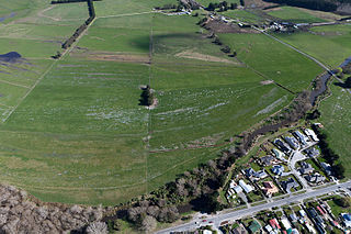
The Port Hills are a range of hills in Canterbury Region of New Zealand, so named because they lie between the city of Christchurch and its port at Lyttelton. They are an eroded remnant of the Lyttelton volcano, which erupted millions of years ago.

Selwyn District is a predominantly rural district in central Canterbury, on the east coast of New Zealand's South Island. It is named after the Selwyn River / Waikirikiri, which is in turn named after Bishop George Selwyn, the first Anglican bishop of New Zealand who, in 1843 and 1844, travelled the length of the country by horse, foot, boat and canoe, leaving in his wake a sprinkling of locations that now bear his name.

Hornby is a major residential and retail suburb at the western edge of Christchurch, New Zealand. The suburb is directly connected to other parts of Christchurch and the South Island by a number of main arterial routes, including State Highway 1 and the Christchurch Southern Motorway.
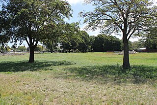
Avonside is an eastern suburb in Christchurch, New Zealand. It is one of the oldest suburbs of the city, with only Heathcote being older.

Springfield, called Kowai Pass until 1880, is a small town in the Selwyn District of Canterbury, in the South Island, of New Zealand. Springfield is situated in the foothills of the Southern Alps as the most westerly town of the Canterbury Plains. Springfield is 65 kilometres (40 mi) west of Christchurch on State Highway 73, 9.7 kilometres (6.0 mi) northwest of Sheffield and 22.7 kilometres (14.1 mi) from Darfield. It is located close to Porters Ski Area, Mount Cheeseman, Broken River, Temple Basin and Craigieburn ski fields. Springfield has a long association with the Midland railway line.

Bexley is an eastern suburb of Christchurch, New Zealand. It is located on the west bank of the Avon River / Ōtākaro approximately one kilometre from the Avon Heathcote Estuary. It is enclosed within a bend in the Avon River and borders the suburb of Aranui.
Spencerville is a semi-rural town on the east coast of Canterbury, New Zealand north of Christchurch. The town backs on to Bottle Lake Forest and includes a large park and 80 hectare camping ground. These amenities, as well as wetlands and an animal and bird park make the town a popular camping area for Christchurch residents.

Porters, is a commercial ski resort just over an hour's drive (98 km) west from Christchurch, in the South Island of New Zealand. Originally functioning as a club skifield, it has one beginner magic carpet, one platter tow, one chairlift and three t-bars. The difficulty of the slopes is distributed as 15% beginner, 35% intermediate and 50% advanced. Modern grooming equipment is used, and snowmaking facilities operate along the main pistes along the chairlift.

Dunsandel is a small rural town in the Canterbury region of the South Island, New Zealand. The town is located on the Canterbury Plains just south of the Selwyn River / Waikirikiri and about 40 km south of Christchurch. Dunsandel is a junction town on SH1, halfway between Christchurch and Ashburton, with roads leading to Leeston, Southbridge and Hororata. The town provides an important refreshment stop for main road travellers with eateries and coffee shops, as well as acting as a support town for the rural hinterland.
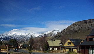
Castle Hill Village is an alpine village in Canterbury, New Zealand that started in 1982.

Prebbleton is a small town in the Selwyn District in the Canterbury Region of New Zealand. It is 11 km southwest of the centre of Christchurch and about 2 km south of the outlying industrial suburb of Hornby.

Harewood is a northwestern suburb of Christchurch, New Zealand. The suburb is split by State Highway 1, with the bulk of Harewood's residential areas to the east of the highway and its industrial areas to the west.
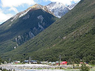
Arthur's Pass, previously called Camping Flat then Bealey Flats, and for some time officially Arthurs Pass, is a township in the Southern Alps of the South Island of New Zealand, located in the Selwyn district. It is a popular base for exploring Arthur's Pass National Park.

Timaru District is a local government district on New Zealand's South Island, administered by the Timaru District Council. It is part of the larger Canterbury Region. Timaru district was formed in 1989 from the amalgamation of Timaru City, Geraldine district, Temuka district and Stratham district.

Wainoni is one of the eastern suburbs of Christchurch. It is a lower socio-economic area.

Bottle Lake is a suburb in the north-east of Christchurch with a low number of residents. Most of the suburb is covered by Bottle Lake Forest, which has since the mid-1970s become a popular recreation area.

Ashburton Central is the central suburb and central business district of Ashburton, in the Ashburton District and Canterbury Region of New Zealand's South Island.
McLeans Island is a rural area north and northwest of Christchurch city, and south of Waimakariri River.
Islington is a suburb on the western side of Christchurch city.
Seaview is a suburb of Timaru, in the South Canterbury area and Canterbury region of New Zealand's South Island. It is located immediately west of the town centre.

