
Brightwater is a town 20 kilometres (12 mi) southwest of Nelson in Tasman district in the South Island of New Zealand. It stands on the banks of the Wairoa River. Brightwater was first named Spring Grove. Alfred Saunders, the owner of a local flax mill situated on the banks of the Wairoa River and a prominent temperance activist, renamed it Brightwater because of the clarity of the water in Wairoa River. The settlement was named in 1855, but the area was settled as early as 1843.

Albert Town is located to the east of Wānaka in Otago, New Zealand. Until recently only a farming settlement, the population boom in this area has led to much new development. The confluence of the Clutha and Hāwea Rivers is located here. The town was named after Prince Albert of Saxe-Coburg and Gotha. Albert Town was formerly called Newcastle.
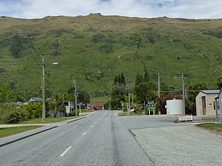
Kingston is a small town at the southernmost end of Lake Wakatipu, just north of the border of Otago and Southland, in New Zealand's South Island. It is 47 kilometres south of Queenstown by a road, "The Devil's Staircase", which winds between the lake to the west and The Remarkables mountains to the east. It is 70 kilometres north of Lumsden, and close to the headwaters of the Mataura River.

Ōmokoroa is a small urban area in the Western Bay of Plenty District of New Zealand. The suburb is considered part of Greater Tauranga, and is within the Coromandel electorate. Ōmokoroa began as a small rural holiday village, but is expanding to be a commuter town, with a 25-minute drive to Tauranga City.

Ōhura is a small town in the west of the North Island of New Zealand. It is located to the west of Taumarunui in the area known as the King Country, in inland Manawatū-Whanganui. It lies on the banks of the Mangaroa Stream, a tributary of the Ōhura River which is a tributary of the Whanganui River.
Te Kowhai is a small rural town situated 15 km north west of Hamilton City in New Zealand. It consists of mainly dairy and cattle farms and also includes a small dairy/takeaway, fresh vegetable and fruit store, cafe, bakery, a large park with a playground and skate park, and mechanics shop. Te Kowhai Aerodrome is situated near the township. The town is popular for new subdivisions.

Tokomaru is a small town in the district of Horowhenua, in the southwestern North Island of New Zealand. It is located 18 kilometres southwest of Palmerston North, and a similar distance northeast of Shannon. The Tokomaru railway station on the North Island Main Trunk was open from 1885 to 1982.

Fernside is a small rural community in the Waimakariri District, New Zealand. In 1901, Fernside had a population of 550. As of the 2006 New Zealand census, Fernside has a population of 1491.
Wallacetown is a small town in Southland, in the South Island of New Zealand. Wallacetown is to the west of Invercargill, on high ground between the Makarewa and Ōreti rivers, near the Ōreti's estuary. Both rivers are popular for trout and whitebait fishing. It is considered to be a satellite town of Invercargill. It is served by State Highway 99, which skirts the town's northern edge.

Maunu is a suburb in the south west of Whangārei in Northland, New Zealand. A volcanic hill to the west is also called Maunu and has a peak 395 m above sea level. State Highway 14 runs through the suburb.
Egmont Village is a settlement in Taranaki, New Zealand. State Highway 3 runs through it. New Plymouth is 12 km to the north-west, and Inglewood is 6 km to the south-east. Waiwhakaiho River and Mangaoraka Stream flow past to the west and east, respectively.
Riversdale is a small town in the Southland region of New Zealand.

St Andrews is a small town in the south Canterbury region of New Zealand's South Island. It is located on State Highway 1 five kilometres south of Pareora and 17 kilometres south of Timaru. It was linked to Timaru by rail in 1876, and grew after the subdivision of the Pareora Run. It remains a rural service town.

Ashley is a small town in North Canterbury, in the South Island of New Zealand. It used to have a railway station on the Main North Line that runs through the village.

Ongaonga is a village in Central Hawkes Bay District of New Zealand's North Island. It is located 20 kilometres west of Waipawa and a similar distance from Waipukurau.

Rangitata is a settlement in New Zealand. It is located at the junction of State Highway 1 and State Highway 79. The Rangitata River is located 3 kilometres north of the town and 10.7 kilometres north of Orari.

Waitakaruru is a rural community in the Hauraki District and Waikato region of New Zealand's North Island. It is situated at the mouth of Waitakaruru River

Waiau Pa is a small town of Auckland, New Zealand. It is in the Franklin Ward of Auckland Council. The name means "River of swirling currents" in the Māori language.
Hiwinui is a settlement in Manawatū District, in the Manawatū-Whanganui region in New Zealand's central North Island.
Waitarere Beach is a small settlement in the Horowhenua District of the Manawatū-Whanganui region of New Zealand's North Island. It is located on the South Taranaki Bight, 14 kilometres northwest of Levin, and 17 kilometres southwest of Foxton, both distances being by road.
