
Western Bay of Plenty District is a territorial district within the Bay of Plenty Region of New Zealand. The district envelops Tauranga city by land, and includes Matakana Island, at the entrance to Tauranga Harbour.

Ōhope is a beach settlement situated on the northeast coast of New Zealand's North Island in the Eastern Bay of Plenty. It is six kilometres east of Whakatāne and is located between Ōhiwa Harbour to the south and Ōhope Beach to the north, providing views of both.
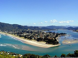
The town of Pauanui is on the east coast of the Coromandel Peninsula in the North Island of New Zealand. It lies at the mouth of the Tairua River on its south bank, directly opposite the larger town of Tairua.

Waimakariri District is a local government district, located in the Canterbury Region of New Zealand's South Island. It is named after the Waimakariri River, which forms the district's southern boundary, separating it from Christchurch City and the Selwyn District. It is bounded in the north by the Hurunui District and in the east by the Pacific Ocean.

Tata Beach is a beach and small coastal settlement of predominantly holiday houses in the South Island, New Zealand. Found in the Golden Bay region, it is approximately 14 kilometres (8.7 mi) north-east of Tākaka.
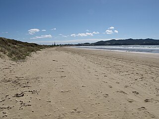
Waikuku is a small town in the Canterbury region of New Zealand, which sits 28 km north of central Christchurch. Waikuku lies 11.8 km (7.3 mi) south of Leithfield on state highway 1 and 3 km (1.9 mi) north of Woodend. In 1901 there were 86 people resident in Waikuku according to that year's census. Waikuku settlement had a population of 156 people at the time of the 2018 Census. It is popular with both those that commute into work in Christchurch each day and with owners of holiday houses. Waikuku was home to rope and twine works. This business started off using flax from local swamps. It closed in 1987. The nearby sandy beach and pine forests are popular with surfers, swimmers, campers and horse-riders, and the large estuary of the Ashley River hosts many species of birds.

Pegasus is a new town in the Waimakariri District of Canterbury, New Zealand. Named for the nearby Pegasus Bay, it is adjacent to the town of Woodend and is 25 km north of Christchurch. Once fully constructed, Pegasus will be home to up to 6000 people. The town will have approximately 1700 residential house sites. Retail and office space is located in the centre of the town adjacent to Lake Pegasus.

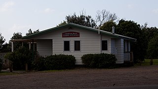
Woodend is a town in the Waimakariri District, in the Canterbury Region of the South Island of New Zealand. It may have been named because it was on the edge of what was then called the Maori Bush, or after an early settler, Thomas Wooding. It is situated with both the Waimakariri and Ashley / Rakahuri Rivers running either side. Woodend is 6.6 kilometres north of Kaiapoi and 6.3 kilometres to the east of Rangiora. Woodend is within walking distance of the town of Pegasus.

The Pines Beach is a small town situated roughly 4 km east of Kaiapoi in the Canterbury region of the South Island of New Zealand. It is 1 km north of the mouth of the Waimakariri River. It takes its name from its close proximity to both a pine forest and the beach.
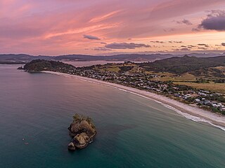
Whangapoua is a small settlement of mostly holiday houses located on the Coromandel Peninsula of New Zealand. It is situated 25 minutes drive east over the Coromandel Range from Coromandel along the northeastern coastline encompassing popular white sand beaches New Chums Beach, Matarangi, Kuaotunu Beach and Otama Beach.

Pōhara is a rural locality in the Tasman District of New Zealand's South Island. The locality is northeast of Tākaka and southwest of Tata Beach. To the north is Limestone Bay, part of Golden Bay / Mohua
Hihi or Hihi Beach is a village and rural community in the Far North District and Northland Region of New Zealand's North Island.
Hokio Beach or Hōkio is a village and rural community in the Horowhenua District and Manawatū-Whanganui region of New Zealand's North Island.
Marlborough Ridge is a subdivision of Fairhall in Marlborough, New Zealand. It is located directly west of Marlborough Golf Course, and was developed from the late 1990s. Marlborough Ridge Reserve is a small park in the subdivision.
Tokerau Beach is a settlement on the northwestern side of Doubtless Bay on the Karikari Peninsula of Northland, New Zealand.

Waipu Cove is a locality and bay of Bream Bay in the Whangarei District and Northland Region of New Zealand. It is about 9 km southeast of Waipu and 5 km northwest of Langs Beach. It has a long sandy beach.

Langs Beach is a locality on the shore of Bream Bay in the Whangarei District and Northland Region of New Zealand. It is about 5 km southeast of Waipu Cove and 10 km northwest of Mangawhai Heads.

Baddeleys Beach and Campbells Beach are a contiguous settlement on adjacent beaches on the southern side of Tāwharanui Peninsula in the Auckland Region of New Zealand. The beaches are on Millon Bay, which is a part of Kawau Bay.
Glenbrook Beach is a rural community at the northern end of a peninsula formed between the Waiuku River and Taihiki River in Auckland, New Zealand. Waiuku is 14 km south by road.
Rings Beach is a beach settlement on the Coromandel Peninsula of New Zealand, between Matarangi on the west and Kūaotunu on the east. The eastern end of the settlement is known as Kūaotunu West.

