West Eyreton

Last updated

West Eyreton
West Eyreton Hall.jpg
Community hall at West Eyreton
West Eyreton
Coordinates: 43°21′S172°23′E / 43.350°S 172.383°E / -43.350; 172.383
Country New Zealand
Region Canterbury
Territorial authority Waimakariri District
WardOxford-Ohoka Ward
CommunityOxford-Ohoka Community
Electorates
Government
  Territorial Authority Waimakariri District Council
  Regional council Environment Canterbury
   Mayor of Waimakariri Dan Gordon
   Waimakariri MP Matthew Doocey
   Te Tai Tonga MP Tākuta Ferris
Area
[1]
  Total114.89 km2 (44.36 sq mi)
Population
 (June 2023) [2]
  Total1,600
  Density14/km2 (36/sq mi)
Time zone UTC+12 (NZST)
  Summer (DST) UTC+13 (NZDT)
Postcode
7475
Area code 03

West Eyreton is a small rural village in the Canterbury region of New Zealand's South Island. It is west of Kaiapoi and north-west of Eyreton and is named after Edward John Eyre, a 19th-century lieutenant governor of the South Island, then known as New Munster. In the 2001 New Zealand census the population was 1,146 (573 males and 573 females), an increase of 306 or 36.4% since the 1996 census.

Contents

In the 1870s, poor transport led to the construction of the Eyreton Branch railway line, which opened on 17 December 1875. Despite its name it ran to the north of Eyreton and originally terminated in West Eyreton, extended to Bennetts Junction on the Oxford Branch on 1 February 1878. Beyond Horrelville closed on 9 February 1931, and on 26 May 1954 low traffic led to the closure of the branch. Little remains besides some of the formation and a loading bank at the site of station.

Demographics

The West Eyreton statistical area covers 114.89 km2 (44.36 sq mi). [1] It had an estimated population of 1,600 as of June 2023, [2] with a population density of 13.9 people per km2.

Historical population
YearPop.±% p.a.
20061,101    
20131,374+3.21%
20181,464+1.28%
Source: [3]

West Eyreton had a population of 1,464 at the 2018 New Zealand census, an increase of 90 people (6.6%) since the 2013 census, and an increase of 363 people (33.0%) since the 2006 census. There were 507 households, comprising 753 males and 711 females, giving a sex ratio of 1.06 males per female. The median age was 45.0 years (compared with 37.4 years nationally), with 300 people (20.5%) aged under 15 years, 210 (14.3%) aged 15 to 29, 756 (51.6%) aged 30 to 64, and 195 (13.3%) aged 65 or older.

Ethnicities were 94.7% European/Pākehā, 5.7% Māori, 0.6% Pasifika, 3.7% Asian, and 1.8% other ethnicities. People may identify with more than one ethnicity.

The percentage of people born overseas was 16.8, compared with 27.1% nationally.

Although some people chose not to answer the census's question about religious affiliation, 52.3% had no religion, 36.7% were Christian, 0.2% had Māori religious beliefs, 0.2% were Hindu, 0.2% were Buddhist and 2.3% had other religions.

Of those at least 15 years old, 216 (18.6%) people had a bachelor's or higher degree, and 180 (15.5%) people had no formal qualifications. The median income was $40,200, compared with $31,800 nationally. 273 people (23.5%) earned over $70,000 compared to 17.2% nationally. The employment status of those at least 15 was that 642 (55.2%) people were employed full-time, 216 (18.6%) were part-time, and 24 (2.1%) were unemployed. [3]

Education

West Eyreton School is West Eyreton's only school. It is a state coeducational full primary school [4] with a decile rating of 10 and a roll of 172 students (as of February 2024). [5]

Related Research Articles

Glenavy is a small town in the South Island of New Zealand. It is located at the southern extreme of the Canterbury region on the alluvial fan of the Waitaki River, three kilometres from the river's outflow into the Pacific Ocean.

<span class="mw-page-title-main">Oxford, New Zealand</span> Town in Canterbury, New Zealand

Oxford is a small town serving the farming community of North Canterbury, New Zealand. It is part of the Waimakariri District and is a linear town, approximately 2 kilometres (1.2 mi) long. Oxford has won awards for the most beautiful village and the most beautiful toilet.

<span class="mw-page-title-main">Colville, New Zealand</span> Place in Waikato, New Zealand

Colville, a small town in the north of the Coromandel Peninsula in the North Island of New Zealand, lies 26 kilometres north of Coromandel in Colville Bay on the Hauraki Gulf, and is the northernmost town of any note on the peninsula. North of Colville, 28 kilometres of rough road lead to the small settlement of Port Jackson, close to the peninsula's northwesternmost point, Cape Colville and 20 km to Port Charles on the northeastern side.

<span class="mw-page-title-main">Maungaturoto</span> Place in Northland Region, New Zealand

Maungaturoto is a small town in the Northland Region of New Zealand.

<span class="mw-page-title-main">Kirwee</span> Settlement in Canterbury, New Zealand

Kirwee is a town located west of Christchurch in the Canterbury region of New Zealand's South Island. It was named after Karwi in India by retired British Army colonel De Renzie Brett. Kirwee is also home to the South Island Agricultural Field Days, held biennially.

<span class="mw-page-title-main">Dunsandel</span> Town in Canterbury, New Zealand

Dunsandel is a small rural town in the Canterbury region of the South Island, New Zealand. The town is located on the Canterbury Plains just south of the Selwyn River / Waikirikiri and about 40 km south of Christchurch. Dunsandel is a junction town on SH1, halfway between Christchurch and Ashburton, with roads leading to Leeston, Southbridge and Hororata. The town provides an important refreshment stop for main road travellers with eateries and coffee shops, as well as acting as a support town for the rural hinterland.

<span class="mw-page-title-main">Upper Moutere</span> Rural locality in Tasman, New Zealand

Upper Moutere is a locality in the Tasman District near Motueka at the top of New Zealand's South Island.

<span class="mw-page-title-main">Swannanoa, New Zealand</span> Settlement in Canterbury, New Zealand

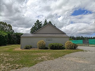
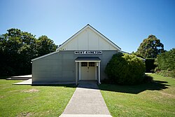
Swannanoa is a small village in Canterbury, New Zealand. It is located 35 kilometres northwest of the largest city in the South Island, Christchurch. The area has an estimated population of 1,040 with 280 pupils enrolled in the primary school. The population is slowly increasing due to new subdivisions being developed there and in neighbouring Mandeville North.

Rahotu is a community in the west of Taranaki, in the North Island of New Zealand. It is located on State Highway 45, 16 kilometres north of Ōpunake and 11 km south of Warea.

<span class="mw-page-title-main">Paterangi</span> Settlement in Waikato, New Zealand

Paterangi is a settlement in the Waikato region of New Zealand's North Island. It is located 10 km northwest of Te Awamutu. It is close to the site of one of the most strongly fortified pā built during the New Zealand wars of the late 19th century.

Pukepoto is a town in Northland, New Zealand. It lies south west of Kaitaia and north east of Ahipara. The Herekino Forest lies to the south east.

Maromaku is a locality in the Northland Region of the North Island of New Zealand. Kawakawa is north, and Towai is southeast. State Highway 1 runs past Maromaku to the north, and the North Auckland Line runs through it.

<span class="mw-page-title-main">Broad Bay, New Zealand</span> Settlement in New Zealand

The settlement of Broad Bay is located on the Otago Harbour coast of Otago Peninsula, in the South Island of New Zealand. It is administered as part of the city of Dunedin, and is technically a suburb of that city, though its isolation and semi-rural nature make it appear as a settlement in its own right.

Stirling is a settlement in New Zealand. It is located in South Otago, approximately 5 km from Balclutha, and just north of the Matau Branch of the Clutha River.

<span class="mw-page-title-main">Hamilton West, New Zealand</span> Suburb of Hamilton, New Zealand

Hamilton West is a suburb in western Hamilton in New Zealand.

<span class="mw-page-title-main">Matapihi</span> Suburb of Tauranga, New Zealand

Matapihi is a suburb and peninsula of Tauranga in the Bay of Plenty region of New Zealand's North Island, surrounded on most sides by the Tauranga Harbour.

Waianiwa is a town and statistical area in the Southland region of the South Island of New Zealand.

Aka Aka is a rural locality on the Aka Aka Stream, a tributary of the Waikato River. It lies about 7 km southeast of Waiuku.

Holdens Bay is an eastern suburb of Rotorua in the Bay of Plenty region of New Zealand's North Island.

Glenwood is a suburb of Timaru, in the South Canterbury area and Canterbury region of New Zealand's South Island. It is located west of the town centre.

References

  1. 1 2 "ArcGIS Web Application". statsnz.maps.arcgis.com. Retrieved 30 August 2021.
  2. 1 2 "Population estimate tables - NZ.Stat". Statistics New Zealand . Retrieved 25 October 2023.
  3. 1 2 "Statistical area 1 dataset for 2018 Census". Statistics New Zealand. March 2020. West Eyreton (313600). 2018 Census place summary: West Eyreton
  4. Education Counts: West Eyreton School
  5. "New Zealand Schools Directory". New Zealand Ministry of Education. Retrieved 14 March 2024.