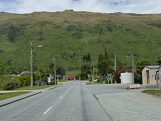
Kingston is a small town at the southernmost end of Lake Wakatipu, just north of the border of Otago and Southland, in New Zealand's South Island. It is 47 kilometres south of Queenstown by a road, "The Devil's Staircase", which winds between the lake to the west and The Remarkables mountains to the east. It is 70 kilometres north of Lumsden, and close to the headwaters of the Mataura River.
Glenavy is a small town in the South Island of New Zealand. It is located at the southern extreme of the Canterbury region on the alluvial fan of the Waitaki River, three kilometres from the river's outflow into the Pacific Ocean.
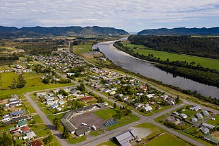
Dobson is a small town on the banks of the Grey River in the South Island of New Zealand. It is 10 kilometres (6 mi) east from the river's mouth at Greymouth. The settlement of Taylorville is across the river from Dobson, but no bridge directly connects the two. State Highway 7 passes through Dobson.
Hawarden is a small town in the Canterbury region of New Zealand's South Island. It is located near Waikari, just off State Highway 7.

Ōmokoroa is a small urban area in the Western Bay of Plenty District of New Zealand. The suburb is considered part of Greater Tauranga, and is within the Coromandel electorate. Ōmokoroa began as a small rural holiday village, but is expanding to be a commuter town, with a 25-minute drive to Tauranga City.

Ōhura is a small town in the west of the North Island of New Zealand. It is located to the west of Taumarunui in the area known as the King Country, in inland Manawatū-Whanganui. It lies on the banks of the Mangaroa Stream, a tributary of the Ōhura River which is a tributary of the Whanganui River.
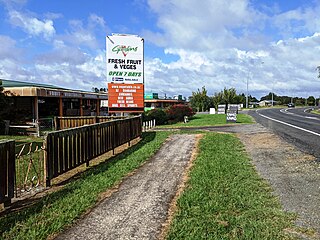
Te Kowhai is a small rural town situated 15 km north west of Hamilton City in New Zealand. It consists of mainly dairy and cattle farms and also includes a small dairy/takeaway, fresh vegetable and fruit store, cafe, bakery, a large park with a playground and skate park, and mechanics shop. Te Kowhai Aerodrome is situated near the township. The town is popular for new subdivisions.
Wallacetown is a small town in Southland, in the South Island of New Zealand. Wallacetown is to the west of Invercargill, on high ground between the Makarewa and Ōreti rivers, near the Ōreti's estuary. Both rivers are popular for trout and whitebait fishing. It is considered to be a satellite town of Invercargill. It is served by State Highway 99, which skirts the town's northern edge.

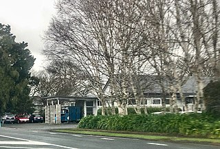
Maunu is a suburb in the south west of Whangārei in Northland, New Zealand. A volcanic hill to the west is also called Maunu and has a peak 395 m above sea level. State Highway 14 runs through the suburb.

Wainui Beach is a small settlement on the coast of New Zealand's North Island, located just to the north of Tuaheni Point, some 8 km to the east of Gisborne, to which it is linked by State Highway 35.

Cust is a rural village in the South Island of New Zealand. It is located in North Canterbury and comes under seat of the Waimakariri District Council. It is located approximately 16 km east of Oxford and 17 km west of Rangiora. The town is named after Sir Edward Cust, who was a member of the Canterbury Association which organised European settlement of the area around 1850. Earlier names for the town were Moeraki Downs and Middleton-on-the-Cust.
Waitoa is a settlement in the Matamata-Piako District of New Zealand. State Highway 26 runs through the town, and connects to Te Aroha 10 km to the north-east.

St Andrews is a small town in the south Canterbury region of New Zealand's South Island. It is located on State Highway 1 five kilometres south of Pareora and 17 kilometres south of Timaru. It was linked to Timaru by rail in 1876, and grew after the subdivision of the Pareora Run. It remains a rural service town.

Ashley is a small town in North Canterbury, in the South Island of New Zealand. It used to have a railway station on the Main North Line that runs through the village.
Southbrook is a suburb of Rangiora, in North Canterbury, New Zealand. It is located at the south end of the town. The population in the 2013 Census was 801. As the term "town" has no official meaning in New Zealand, Southbrook is sometimes considered as a separate town.

Waitakaruru is a rural community in the Hauraki District and Waikato region of New Zealand's North Island. It is situated at the mouth of Waitakaruru River
Ngāhinapōuri is a rural community in the Waipa District and Waikato region of New Zealand's North Island. It is located on State Highway 39, between Whatawhata and Pirongia.

Waiau Pa is a small town of Auckland, New Zealand. It is in the Franklin Ward of Auckland Council. The name means "River of swirling currents" in the Māori language.
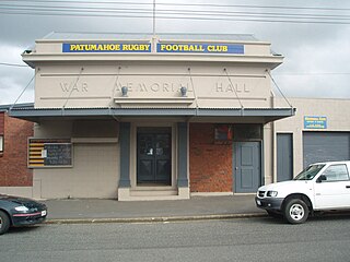
Patumāhoe is a small town of Auckland, New Zealand. It is in the Franklin Ward of Auckland Council.

Tauwharenīkau is a rural locality and a statistical area in the South Wairarapa District and Wellington Region of New Zealand's North Island. The locality is on SH 1 about 5 km east of Featherston and 7 km southwest of Greytown by road, and the statistical area covers the Tauwharenīkau River valley and plain north of SH 53. The statistical area surrounds but does not include Greytown.