
Cheviot is a town in the Hurunui District of north Canterbury, on the east coast of the South Island of New Zealand. It is located on State Highway 1, approximately 112 kilometres (70 mi) north of Christchurch and 68 kilometres (42 mi) south of Kaikōura.

Rangiora is the largest town and seat of the Waimakariri District, in Canterbury, New Zealand. It is 29 kilometres (18 mi) north of Christchurch, and is part of the Christchurch metropolitan area. With an estimated population of 19,600, Rangiora is the 30th largest urban area in New Zealand, and the fifth-largest in the Canterbury region.
Richard James Gerard is a former New Zealand politician. He was a National Party Member of Parliament from 1984 to 1997.

Oxford is a small town serving the farming community of North Canterbury, New Zealand. It is part of the Waimakariri District and is a linear town, approximately 2 kilometres (1.2 mi) long. Oxford has won awards for the most beautiful village and the most beautiful toilet.

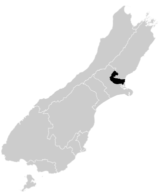
Waimakariri District is a local government district, located in the Canterbury Region of New Zealand's South Island. It is named after the Waimakariri River, which forms the district's southern boundary, separating it from Christchurch City and the Selwyn District. It is bounded in the north by the Hurunui District and in the east by the Pacific Ocean.

The Main North Line, sometimes referred to as part of the South Island Main Trunk railway, is a railway line that runs north from Christchurch in New Zealand up the east coast of the South Island through Kaikōura and Blenheim to Picton. It is a major link in New Zealand's national rail network and offers a connection with roll-on roll-off ferries from Picton to Wellington. It was also the longest railway construction project in New Zealand's history, with the first stages built in the 1870s and not completed until 1945.

The Great Swamp National Wildlife Refuge is located in Morris County, New Jersey. Established in 1960, it is among what has grown to be more than 550 refuges in the United States National Wildlife Refuge System.

Flaxton is a small village and civil parish in North Yorkshire, England. It is close to the A64 between York and Malton. The village lies entirely within a Conservation Area as defined by Planning 1990.
Waimakariri is a New Zealand parliamentary electorate, formed for the 1996 election and returning one Member of Parliament to the New Zealand House of Representatives. The MP for Waimakariri is Matt Doocey of the National Party. He has held this position since the 2014 election and takes over from Kate Wilkinson, who defeated Clayton Cosgrove (Labour) in the 2011 election.
Swannanoa is a small village in Canterbury, New Zealand. It is located 35 kilometres northwest of the largest city in the South Island, Christchurch. The area has an estimated population of 1,040 with 280 pupils enrolled in the primary school. The population is slowly increasing due to new subdivisions being developed there and in neighbouring Mandeville North.
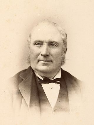
Edward Dobson was Provincial Engineer for Canterbury Province, New Zealand from 1854 to 1868.

Pegasus is a new town in the Waimakariri District of Canterbury, New Zealand. Named for the nearby Pegasus Bay, it is adjacent to the town of Woodend and is 25 km north of Christchurch. Once fully constructed, Pegasus will be home to up to 6000 people. The town will have approximately 1700 residential house sites. Retail and office space is located in the centre of the town adjacent to Lake Pegasus.

Dismal Swamp State Park is a North Carolina state park in Camden County, North Carolina, in the United States. The park was created as a state natural area in 1974 with the help of The Nature Conservancy, and on July 28, 2007, the North Carolina General Assembly re-designated it as a state park. It opened to the public in 2008. This marked the first time that public access to Great Dismal Swamp was made possible in North Carolina. The park covers 14,432 acres (58.40 km2) of protected land on the North Carolina/Virginia border. Park offices are 3 miles (4.8 km) south of the border on U.S. Route 17 near South Mills. Features of the park include the canal which is used regularly by boaters using the Intracoastal Waterway and several miles of hiking and biking trails.

The Cust River is a river in the Canterbury region of New Zealand. It flows east across the upper Canterbury Plains from its source north of the town of Oxford, New Zealand, flowing into the Cam River / Ruataniwha close to the town of Rangiora. The small town of Cust lies on the banks of the river. The lower part of the river, to the south-west of Rangiora, is diverted into a channel and called the "Main Drain". The channel was built in 1862 to drain the swampy land between Rangiora and the Waimakariri River, and when it was enlarged in 1868 it accidentally captured the Cust.
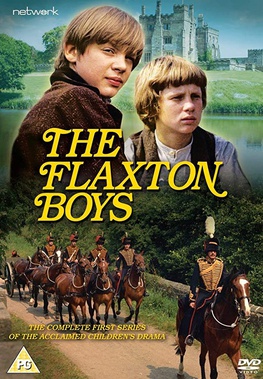
The Flaxton Boys is a British historical children's television series set in the West Riding of Yorkshire and covering a timespan of almost a century. The series was made by Yorkshire Television and was broadcast on ITV between 1969 and 1973, running for 4 series and 52 episodes, each of 30 minutes duration.
Dudley Park is a cricket ground in Rangiora, Canterbury, New Zealand. The park precincts, situated between Church and White Streets, also include an aquatic centre, netball courts and hockey ground. It was the main cricket ground in Rangiora between 1929 and 2004.
Rangiora Airfield (NZRT) is located 4.8 kilometres west-north-west of Rangiora township, north of Christchurch, New Zealand. It is managed by the Waimakariri District Council. It is the base of startup airline Electric Air. The company operates ZK-EAL, a Pipistrel Alpha Electro from the airfield.
Rangiora High School is a state co-educational secondary school located in Rangiora, New Zealand. Established in 1881 by an act of parliament and opened in 1884, the school has a roll of 1,652 students from years 9 to 13 as of February 2024, making it the fifth-biggest school in the South Island.
Rangiora New Life School is a state-integrated Christian area School situated in Southbrook, Rangiora, New Zealand. It was established in 1979 as a private school and integrated into the state education system in March 1994. The school has a roll of 440 students from years 1 to 13 as of February 2024, many of whom are not of religious conviction. The current principal is Stephen Walters.
The Hurunui by-election 1961 was a by-election held in the Hurunui electorate in North Canterbury during the term of the 33rd New Zealand Parliament, on 10 June 1961.
