Glendower Street, Monmouth

Last updated

Glendower Street, Monmouth
Old map of Monmouth, Wales.jpg
1610 map of Monmouth by John Speed
Location Monmouth, Monmouthshire, Wales
Coordinates 51°48′40″N2°42′52″W / 51.8111°N 2.7144°W / 51.8111; -2.7144
WestSt John's Street
Agincourt Street

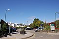
Glendower Street is a historic street in the town centre of Monmouth, Monmouthshire, Wales. It extends to the southeast from the intersection of Agincourt Street and St John's Street, within the medieval town walls. Glendower Street is lined with numerous listed buildings, including one of the 24 blue plaque buildings on the Monmouth Heritage Trail.

Contents

History and location

The Telegraph of 25 February 2006 praised Glendower Street as one of the most beautiful in Monmouth, singling out its "charming townhouses." [1] Glendower Street is home to a number of listed buildings, some of the most notable including an award-winning residence converted from a chapel, [2] an apartment building that has seen use first as a gymnasium and then as a museum, [3] and a blue plaque building on the Monmouth Heritage Trail. [4] Glendower Street is located within the medieval walls of Monmouth that were built around 1300 and are shown on Speed's map of the town (pictured). [5] In the medieval and post-medieval period, extending into the mid 19th century, Glendower Street was referred to as Grinder Street or Grinders Street. [6] [7]

In 1804, author Charles Heath indicated that Monmouth was formerly divided into four parochial wards: Wye Bridge Ward, Castle Bailey Ward, Monnow Street Ward, and Over Monnow Ward. Glendower Street was split between two of the wards, with Castle Bailey Ward containing the left side of Grinder Street and Monnow Street Ward containing the right side of Grinder Street. [7] The street now bears the anglicised version of the name of Welsh leader Owen Glendower (Owain Glyndŵr). [8] [9] Glendower Street extends to the southeast from the intersection of Agincourt Street and St John's Street. [10] In 1960, the Monmouthshire County Council ordered that the two streets at the west end of Glendower Street both be made one-way streets, such that traffic proceeded on Agincourt Street from Agincourt Square to Glendower Street (west to east), and traffic proceeded on St John's Street from Glendower Street to Monnow Street (east to west). [11] Since the Coflein listings, there has been at least a partial renumbering of the buildings on Glendower Street (see below).

Buildings

1 and 3 Glendower Street are listed together. They are both 18th-century, three-storey buildings. 1 Glendower Street has a brick exterior and pantile (clay tile) roof. 3 Glendower Street has a stucco finish, with a roof that is a mix of slate and pantile. [12]

The Nelson Rooms (pictured below) at 2 Glendower Street is a 19th-century, Grade II listed building. [13] Thought to have been designed by Newport architect Benjamin Lawrence, the building initially served as a gymnasium and was a gift from Lady Llangattock to the town. [3] [14] It was known as both the Working Men's Gymnasium and the Monmouth Gymnasium. [3] [15] In 1924, after Lady Llangattock's death, the building reopened as the Nelson Museum. [3] It showcased the collection of memorabilia of Admiral Horatio Nelson that the baroness had amassed. [14] The Nelson Museum transferred to the Market Hall in 1969. [16] Since the move of the museum, the building at 2 Glendower Street served for a time as an auction venue. In 2006, the building was converted to residential apartments. [17] The building derives its name, The Nelson Rooms, from the museum that was housed there from 1924 to 1969. [3] It is situated with one elevation along Glendower Street and its gable end along Agincourt Street. The two-storey building has first floor ceilings which are substantially higher than those of the ground floor. The exterior is of red sandstone rubble with contrasting Bath Stone quoins and trim. Both the Glendower Street and Agincourt Street elevations have windows with castellated parapets and aprons. [3]

4 (Hamilton House) and 6 Glendower Street are listed together. They are both 18th-century, three-storey houses with roughcast exteriors and slate roofs. [18] [19]

5 and 7 Glendower Street are listed together. The 18th-century, three-storey listed dwellings have a brick exterior and slate roof. [20]

8 and 10 Glendower Street are listed together. The mid 19th-century, three-storey listed buildings have a roughcast exterior and a slate roof. [21]

9 Glendower Street is an 18th-century, three-storey listed building. It has a two-bay elevation, with a stucco finish and slate roof. [22]

St John's has been described as "one of Monmouth's best-kept secrets." [23] It has had its address recorded at 11 Glendower Street in the late 19th through early 21st centuries. The villa is an 18th-century, Grade II listed building. [24] [25] The eight-bedroom home includes a main building and an annex. [23] It has a two-storey, three-bay street elevation, and a three-storey rear elevation. [23] [24] The facade has a roughcast exterior and fluted columns which flank the pedimented entrance. [24] The property is remarkable for a cast iron, Coalbrookdale verandah along the rear elevation, as well as a formal, Victorian, walled garden which has been separately listed with the Cadw/ICOMOS Register of Parks and Gardens of Special Historic Interest in Wales and is also registered with the Welsh Historic Gardens Trust. [26] [27] [28] [29]

Cranford, formerly at 13 Glendower Street, is thought to be of the early 17th century. The building was altered around 1800 and the current exterior is primarily from that period. The two-storey, three-bay elevation has a painted finish. There is a Welsh slate roof with two chimneys, one to the left and a taller one in the back to the right. The doorway is centrally positioned, and has a six paneled door with fanlight. Early 19th-century windows flank the door and the first floor windows are small, with keystones. [30] In 2012, Cranford has a 15 Glendower Street address. [31]

15 and 17 Glendower Street are listed together. [32]

16 Glendower Street is the premises of a funeral director.[ citation needed ]

The Monmouth Police Station (pictured below), currently at 19 Glendower Street, is a mid 19th-century, Grade II listed building. The main building is three storeys and there is a two-storey extension to the right. The exterior is stucco and there is a hipped tile roof. [33] [34] The police station was formerly at 17 Glendower Street. [35] 19 Glendower Street had a separate Coflein listing. It described an old pub with a two-storey, two-bay elevation and a roughcast exterior. This is a reference to the Druid's Head Inn next door (see below). [36] The police station not only houses the local police; it serves as a response center for the Gwent Police. [37] The station was one of the Monmouth facilities that welcomed visitors in September 2011 during Open Doors 2011, European Heritage Days in Wales. [38] On 13 March 2012, the BBC News reported that in July 2012 the Monmouth Police Station would be one of seventeen police stations in South East Wales that would no longer be open to the public. [39]

The Druid's Head Inn (pictured below) on Glendower Street is now home to the Monmouth Rugby Football Club. 19th and early 20th century proprietors of the Druid's Head Inn included William Beavan, [40] David Evans, [41] John Mills, [42] and John Pembridge. [43] One of them, David Evans, went on to the Black Swan on nearby St John's Street as an innkeeper by 1881, despite having declared bankruptcy in 1877. [41] The Druid's Head Inn was Grade II listed on 15 August 1974. [44] The Monmouth Rugby Football Club purchased the public house as its headquarters by 1969. [45] [46] The address of the Druid's Head Inn was previously 19 Glendower Street. The facade has a two-storey, two-bay elevation with a roughcast exterior. [36]

22 and 26 Glendower Street are listed together. [47]

Hyam's Mineral Water Works (pictured below) at 23 Glendower Street is one of 24 blue plaque buildings on the Monmouth Heritage Trail. [4] The listed building had served as a bottling plant for mineral water. [48] The proprietor in 1901, John Benjamin Hyam, was described as a "mineral & aerated water manufacturer & ale & porter merchant." [49] Charles Nathaniel Ballinger, manufacturer of "Ballinger's Famous Mineral Waters" since the 1890s, purchased the building at Glendower Street in the 20th century. [50] (Ballinger had been at the Griffin inn at the corner of St Mary's Street and Whitecross Street in 1901.) [49] The Glendower Street building was eventually converted into residential apartments and is now known as Hyam Court. Hyam Court Management Limited incorporated in 1991. [51]

Glendower House (pictured below) was formerly the Glendower Street Congregational Church. It is a 19th-century, Grade II* listed building that was originally built in 1834, and then reconstructed in 1844, designed by William Armstrong of Bristol and built by Lawrence of Monmouth. [2] [52] The three bay, classical facade on Glendower Street features a central entrance flanked by elaborate columns. The bays are square-headed on the ground floor, and round-headed on the first floor. [2] [53] The building was listed on 27 October 1965; its gates and railings were listed on 15 August 1974. [54] [55] In 2002, the chapel which had stood vacant for forty years (the last service in 1962) was restored and converted into an award-winning residence. The original design of the exterior was maintained, exceptions including the addition of two round bays in the back elevation to permit visualization of the garden, and the reduction in height of some of the windows on the sides to match the front facade. The bedroom was on the ground floor, owing to the large amount of daylight on the first floor. [56] [57]

The Glover Music School was considered by author John Newman to be one of two notable buildings on Glendower Street, the other being the Congregational Church. [58]

The Glendower Street Smithy, a listed building, was a blacksmith's workshop. [59]

Henry Burton Court(pictured below) on the south side of Glendower Street provides housing for older people through an almshouse charity managed by Burton Trust. The eight apartments were constructed in 1928 and redeveloped in 1991. The one-bedroom flats are reserved for people who have lived for at least five years in the county. [60] The Henry Burton Almshouse Charity operates in Monmouthshire. The charitable activities of the organization focus on housing and the elderly. [61] At least six of the apartments were Grade II listed on 8 October 2005. [62] [63] [64] [65] [66] [67]

See also

Related Research Articles

<span class="mw-page-title-main">Monmouth Museum</span>

The Monmouth Museum, previously known as The Nelson Museum and Local History Centre, was a museum in Monmouth, Monmouthshire, south east Wales. It featured a collection of artefacts associated with Admiral Horatio Nelson, and a local history collection. The museum was located in the Market Hall in the town centre. It was closed during the COVID-19 pandemic in the United Kingdom and did not re-open thereafter. In 2021 Monmouthshire County Council announced plans to move the museum collection to the Shire Hall in Agincourt Square. The five-year project, supported by the National Lottery Heritage Fund, will see a new museum open at the Shire Hall by 2027. The Market Hall site will be let as commercial premises.

<span class="mw-page-title-main">Shire Hall, Monmouth</span> Building in Monmouth, Wales

The Shire Hall, Monmouth, Wales, is a prominent building on Agincourt Square in the town centre. It was built in 1724, and was formerly the centre for the Assize Courts and Quarter Sessions for Monmouthshire. The building was also used as a market place. In 1839–40, the court was the location of the trial of the Chartist leader John Frost and others for high treason for their part in the Newport Rising.

<span class="mw-page-title-main">Robin Hood Inn, Monmouth</span> Public house in Monmouth, Wales

The Robin Hood Inn, Nos. 124 and 126, Monnow Street, Monmouth, Monmouthshire, Wales, is a public house of late medieval origins. It was Grade II* listed in 1952.

<span class="mw-page-title-main">Beaufort Arms Hotel, Monmouth</span> Building in Monmouth, Wales

The Beaufort Arms Hotel, in Agincourt Square in the town of Monmouth, south-east Wales is a former coaching inn dating from the early eighteenth century. The frontage was modified in the 1830s, possibly by the prolific early Victorian architect George Vaughan Maddox. A stone cornice on the central block carries the inscription "The Beaufort Arms". A Grade II* listed building, it features in the Monmouth Heritage Trail. In the 20th century, the building was converted to residential apartments.

<span class="mw-page-title-main">Agincourt House, Monmouth</span> 17th century building in Monmouth, Wales

Agincourt House, No. 1 Agincourt Square, Monmouth, Monmouthshire, Wales is a notable early seventeenth century half-timbered building.

<span class="mw-page-title-main">Hyam's Mineral Water Works</span> Building in Monmouth, Wales

Hyam's Mineral Water Works is a nineteenth century building at 23 Glendower Street, Monmouth, Wales. Formerly a mineral water works, it is currently used as residential apartments. The building holds one of the 24 blue plaques awarded by the Monmouth Civic Society to buildings of especial historical and social interest, and features on the Monmouth Heritage Trail.

<span class="mw-page-title-main">Glendower House, Monmouth</span> Listed building in Monmouth, Wales

Glendower House, Glendower Street, Monmouth, Wales, is a Victorian former Congregational chapel constructed in a Classical style. The Royal Commission on the Ancient and Historical Monuments of Wales describes it as "a chapel of exceptional sophistication and elaboration of design and one of the earliest Italianate chapels in Wales". It is named after Owain Glyndŵr.

<span class="mw-page-title-main">Monmouth town walls and defences</span>

The Monmouth town walls and defences comprise the defensive system of town walls and gates built in Monmouth, Wales between 1297 and the early part of the following century. Wye Bridge Gate, East Gate, Monk's Gate, and Monnow Bridge Gate were access points to the town. West Gate, across Monnow Street, also provided access. Only the Monnow Bridge Gatehouse survives intact, albeit in a substantially modified version from the original.

<span class="mw-page-title-main">Whitecross Street, Monmouth</span>

Whitecross Street is a historic street in the town centre of Monmouth, Monmouthshire, Wales. It was in existence by the 15th century, and appears as Whit crose on the 1610 map of the town by cartographer John Speed. It runs in an east-west direction, between Church Street and St James Square. It has been suggested that the street takes its name from a plague cross. Whitecross Street is lined with numerous listed buildings.

<span class="mw-page-title-main">33 Whitecross Street, Monmouth</span>

33 Whitecross Street is a grade II listed building in Monmouth, Wales in the area of St James Square. The property was the site of an archaeological excavation in 2009, which found evidence of Neolithic (prehistoric), Roman, and Medieval activity. The following year, archaeological excavation in the square discovered the first evidence of Mesolithic human settlement in Monmouth.

<span class="mw-page-title-main">Monk Street, Monmouth</span>

Monk Street is an historic street in the town of Monmouth, Monmouthshire, Wales. A portion of it was in existence by the 14th century, and appears on the 1610 map of the town by cartographer John Speed. It runs in a north-south direction, extending northward from its intersection with Whitecross Street. The name of the street relates to the nearby Priory, as well as the gate which was originally on this road and provided part of the town's defences, Monk's Gate. Monk Street is lined with numerous listed buildings.

<span class="mw-page-title-main">Kingsley House and Hendre House, Monmouth</span>

Kingsley House and Hendre House are a pair of 19th-century, semi-detached houses on the North Parade section of Monk Street in Monmouth, Monmouthshire, Wales. The grade II listed houses were designed by noted Monmouth architect and builder George Vaughan Maddox, who also designed at least two of the twenty-four blue plaque buildings on the Monmouth Heritage Trail, including the Market Hall and the Monmouth Methodist Church. Hendre House should be distinguished from The Hendre, the estate of the Rolls family.

<span class="mw-page-title-main">St James Square, Monmouth</span>

St James Square is a historic square in the town centre of Monmouth, Monmouthshire, Wales. It is located at the eastern end of Whitecross Street, within the medieval town walls. The area features the Monmouth War Memorial and the controversial, historic Indian Bean Tree. In addition, in 2010, the square was the site of discovery of the first Mesolithic artefacts in Monmouth. St James Square is lined with numerous listed buildings. It is also home to the Monmouth Catalpa Tree.

<span class="mw-page-title-main">St James Street, Monmouth</span>

St James Street is a historic street in the town centre of Monmouth, Monmouthshire, Wales. It appears as a segment of Whitecross Street on the 1610 map of the town by cartographer John Speed and is within the medieval town walls. On more recent maps, it extends from St James Square southwest to Almshouse Street. In 2010, the street was the site of discovery of Mesolithic era artefacts. St James Street is lined with numerous listed buildings.

<span class="mw-page-title-main">Nelson Rooms, Monmouth</span>

The Nelson Rooms is a grade II listed building in Monmouth, Monmouthshire, Wales. It is in the historic Glendower Street and Agincourt Street neighbourhood, within the medieval town walls. The building initially served as a gymnasium and was a gift from Lady Llangattock to the town of Monmouth. In 1924, after the benefactor's death, it reopened as the Nelson Museum, and showcased the collection of memorabilia related to Admiral Horatio Nelson that had been amassed by the baroness. The Nelson Museum moved to new quarters at the Market Hall in 1969. The former gymnasium and museum is now an apartment building.

<span class="mw-page-title-main">Monmouth Police Station</span>

The Monmouth Police Station is a Grade II listed building in the town centre of Monmouth, Monmouthshire, Wales. It is located in Glendower Street, within the medieval town walls. In March 2012, it was announced that the Monmouth Police Station was one of seventeen police stations in South East Wales that would no longer be open to the public.

<span class="mw-page-title-main">Druid's Head Inn</span>

The Druid's Head Inn is a grade II listed building in the town centre of Monmouth, Monmouthshire, Wales. It is located in the historic Glendower Street and Chippenhamgate Street neighbourhood, within the medieval town walls. The building served as a public house during most of its history, but for the last several decades has been the headquarters of the Monmouth Rugby Football Club.

<span class="mw-page-title-main">St John's, Monmouth</span>

St John's is a grade II listed building in the town centre of Monmouth, Wales. It is located in Glendower Street within the medieval town walls. The house is most remarkable for the rear of the property which features a Coalbrookdale verandah and formal walled garden that have been separately grade II listed with the Cadw/ICOMOS Register of Parks and Gardens of Special Historic Interest in Wales. The villa's garden is also registered with the Welsh Historic Gardens Trust.

<span class="mw-page-title-main">Perth-hir House</span> House in Rockfield, Monmouthshire

Perth-hir House, Rockfield, Monmouthshire, Wales, was a major residence of the Herbert family. It stood at a bend of the River Monnow, to the north-west of the village. At its height in the 16th century, the mansion, entered by two drawbridges over a moat, comprised a great hall and a number of secondary structures. Subsequently in the ownership of the Powells, and then the Lorimers, the house became a centre of Catholic recusancy following the English Reformation. By the 19th century, the house had declined to the status of a farmhouse and it was largely demolished in around 1830. Its ruins, and the site which contains considerable remnants of a Tudor garden, are a scheduled monument.

<span class="mw-page-title-main">Registered historic parks and gardens in Monmouthshire</span> List of buildings in the county of Wales

Monmouthshire is a county of Wales. It borders Torfaen and Newport to the west; Herefordshire and Gloucestershire to the east; and Powys to the north. The largest town is Abergavenny, with other large settlements being Chepstow, Monmouth, and Usk. The present county was formed under the Local Government (Wales) Act 1994, which came into effect in 1996. It has an area of 850 km2 (330 sq mi), with a population of 93,200 as of 2021. Monmouthshire comprises some sixty per cent of the historic county, and was known as Gwent between 1974 and 1996.

References

  1. Max Davidson (25 February 2006). "City spotlight: Monmouth". The Telegraph . Archived from the original on 28 May 2010. Retrieved 29 May 2012.
  2. 1 2 3 "Glendower Street Congregational Church; Glendower House, Monmouth (10896)". Coflein. RCAHMW . Retrieved 28 May 2012.
  3. 1 2 3 4 5 6 "The Nelson Rooms, Glendower Street, No. 2, Monmouth (404433)". Coflein. RCAHMW . Retrieved 29 May 2012.
  4. 1 2 "Monmouth Trails". visitwyevalley.com. Wye Valley & Vale of Usk. Retrieved 3 June 2012.[ permanent dead link ]
  5. "Monnow Bridge". cofiadurcahcymru.org.uk. The Glamorgan-Gwent Archaeological Trust Historic Environment Record. Archived from the original on 6 March 2016. Retrieved 3 June 2012.
  6. William Meyler Warlow (1899). A history of the charities of William Jones (founder of the "Golden lectureship" in London), at Monmouth & Newland. W. Bennett. p. 37. Retrieved 3 June 2012.
  7. 1 2 Charles Heath (1804). "Monmouth – Etymology. Situation. Parochial Boundary.". Historical and Descriptive Accounts of the Ancient and Present State of the Town of Monmouth. Charles Heath. p. no page numbers, see chapter. Retrieved 1 June 2012.
  8. "History of Monmouth". monmouthrfc.com. Monmouth Rugby Football Club. Archived from the original on 31 May 2012. Retrieved 3 June 2012.
  9. "Owen Glendower". britannica.com. Encyclopædia Britannica, Inc. Retrieved 3 June 2012.
  10. "Virtual Map of Monmouth". monmouth.org.uk. The Monmouth Website. Retrieved 3 June 2012.
  11. "The London Gazette" (PDF). The London Gazette . 28 October 1960. p. 7307. Retrieved 1 June 2012.
  12. "Glendower Street, No 1 & 3 (36928)". Coflein. RCAHMW . Retrieved 31 May 2012.
  13. "Nelson Rooms, Monmouth". britishlistedbuildings.co.uk. British Listed Buildings. Retrieved 3 June 2012.
  14. 1 2 "Monmouth and Its Rich Past". Herefordshire Life. 19 February 2010. Archived from the original on 13 January 2013. Retrieved 3 June 2012.
  15. "Kelly's Directory of Monmouthshire 1901 – Monmouth – Part 6: Commercial List". freepages.genealogy.rootsweb.ancestry.com. Hosted by Rootsweb . Retrieved 3 June 2012.
  16. "Monmouth Museum". monmouthshire.gov.uk. Monmouthshire County Council. Archived from the original on 14 June 2012. Retrieved 3 June 2012.
  17. "Case File". idox.monmouthshire.gov.uk. Monmouthshire County Council. Archived from the original on 21 October 2016. Retrieved 6 June 2012.
  18. "Glendower Street, Nos 4 & 6 (36929)". Coflein. RCAHMW . Retrieved 31 May 2012.
  19. "A Research Framework for the Archaeology of Wales Southeast Wales – Medieval, key sites" (PDF). archaeoleg.org.uk. Research Framework for the Archaeology of Wales. 22 December 2012. Retrieved 1 June 2012.
  20. "Glendower Street, Nos 5 & 7 (36930)". Coflein. RCAHMW . Retrieved 3 June 2012.
  21. "Glendower Street, Nos 8 & 10 (36931)". Coflein. RCAHMW . Retrieved 3 June 2012.
  22. "Glendower Street, No 9 (36932)". Coflein. RCAHMW . Retrieved 31 May 2012.
  23. 1 2 3 "Monmouth's best-kept secret". Western Mail . Cardiff, Wales. 15 March 2003. Retrieved 3 June 2012.
  24. 1 2 3 "St John's, Glendower Street, 11, Monmouth (36933)". Coflein. RCAHMW . Retrieved 3 June 2012.
  25. "St. John's, Monmouth". britishlistedbuildings.co.uk. British Listed Buildings. Retrieved 6 June 2012.
  26. "St John's, Monmouth, Wales". parksandgardens.ac.uk. Parks and Gardens UK. Archived from the original on 23 December 2012. Retrieved 6 June 2012.
  27. "St Johns Garden, Monmouth (266092)". Coflein. RCAHMW . Retrieved 7 June 2012.
  28. "St John's, Monmouth". coflein.gov.uk. Cadw/ICOMOS Register of Parks and Gardens of Special Historic Interest in Wales. Archived from the original on 4 March 2016. Retrieved 6 June 2012.
  29. Cadw. "Monmouth, St. John's (PGW(Gt)47(MON))". National Historic Assets of Wales . Retrieved 31 March 2023.
  30. "Glendower Street, No 13; Cranford, Monmouth (36934)". Coflein. RCAHMW . Retrieved 6 June 2012.
  31. "Contact Us". millieandme.net. Made by Millie and Me. Retrieved 6 June 2012.
  32. "Glendower Street 15–17 (36927)". Coflein. RCAHMW . Retrieved 3 June 2012.
  33. "Monmouth Police Station, Monmouth". britishlistedbuildings.co.uk. British Listed Buildings. Retrieved 4 June 2012.
  34. "Police Station (31994)". Coflein. RCAHMW . Retrieved 31 May 2012.
  35. "Railings and Gate of No.17 (Police Station) fronting Chippenham, Monmouth". britishlistedbuildings.co.uk. British Listed Buildings. Retrieved 8 June 2012.
  36. 1 2 "Glendower Street, No 19 (36935)". Coflein. RCAHMW . Retrieved 3 June 2012.
  37. "Open Doors 2011: Monmouthshire". Wales Online . 8 August 2011. Retrieved 29 May 2012.
  38. "Monmouthshire". civictrustwales.org. Open Doors 2011 European Heritage Days in Wales. Archived from the original on 27 July 2012. Retrieved 3 June 2012.
  39. "Gwent Police to close 17 stations to public and cut 19 jobs". BBC News . 13 March 2012. Retrieved 4 June 2012.
  40. "U.K., City and County Directories, 1600s–1900s". ancestry.com. Pigot's Directory of Monmouthshire 1844 (as re-printed on Ancestry.com).{{cite web}}: Missing or empty |url= (help)
  41. 1 2 "The London Gazette" (PDF). The London Gazette. 16 October 1877. Retrieved 4 June 2012.
  42. Mills, John. "1881 Wales Census". ancestry.com. Census Returns of England and Wales, 1881. The National Archives of the UK (as re-printed on Ancestry.com).{{cite web}}: Missing or empty |url= (help)
  43. "Kelly's Directory of Monmouthshire 1901 – Monmouth – Part 6: Commercial List". freepages.genealogy.rootsweb.ancestry.com. Hosted by Rootsweb. Retrieved 7 June 2012.
  44. "Monmouth Rugby Football Club, Monmouth". britishlistedbuildings.co.uk. British Listed Buildings. Retrieved 31 May 2012.
  45. "Ruby club to take on Rifles in memory of Jamie Gunn". Monmouthshire Beacon . 8 March 2012. Retrieved 7 June 2012.
  46. "history of the club". monmouthrfc.com. Monmouth Rugby Football Club. Archived from the original on 31 May 2012. Retrieved 31 May 2012.
  47. "Glendower Street, Nos 22 & 26 (36936)". Coflein. RCAHMW . Retrieved 3 June 2012.
  48. "Glendower Street (33340)". Coflein. RCAHMW . Retrieved 28 May 2012.
  49. 1 2 "Kelly's Directory of Monmouthshire 1901 – Monmouth". freepages.genealogy.rootsweb.ancestry.com. hosted by rootsweb. Retrieved 28 May 2012.
  50. "Delicious, Strong and Exquisitely Fine". herefordshire.greatbritishlife.co.uk. Herefordshire & Wye Valley Life. Retrieved 8 June 2012.
  51. "Hyam Court Management Limited". cdrex.com. Company Date Rex. Archived from the original on 4 March 2016. Retrieved 8 June 2012.
  52. Keith Kissack (1997). "Nonconformity in Monmouth" (PDF). capeli.org.uk. The Chapels Heritage Society. Retrieved 28 May 2012.
  53. John Newman (11 March 2000). Gwent/Monmouthshire (illustrated ed.). Yale University Press. p. 399. ISBN   9780300096309 . Retrieved 7 June 2012.
  54. "Glendower House, Monmouth". britishlistedbuildings.co.uk. British Listed Buildings. Retrieved 28 May 2012.
  55. "Gatepiers, Gates and Railings of Glendower House, Monmouth". britishlistedbuildings.co.uk. British Listed Buildings. Retrieved 1 June 2012.
  56. "The Welsh Civic Societies' Local Design Awards 2003-4" (PDF). civictrustwales.org. Civic Trust for Wales. Archived from the original (PDF) on 21 November 2008. Retrieved 7 June 2012.
  57. Anthony Sully (2003). "Converting a Chapel into a Home: Glendower Street Congregational Chapel, Monmouth" (PDF). capeli.org.uk. The Chapels Heritage Society. Retrieved 29 May 2012.
  58. John Newman (11 March 2000). Gwent/Monmouthshire (illustrated ed.). Yale University Press. p. 409. ISBN   9780300096309 . Retrieved 3 June 2012.
  59. "Glendower Street Smithy (41196)". Coflein. RCAHMW . Retrieved 3 June 2012.
  60. "Henry Burton Court". housingcare.org. Elderly Accommodation Counsel. Retrieved 3 June 2012.
  61. "Henry Burton Almshouse Charity". cafonline.org. Charities Aid Foundation. Retrieved 4 June 2012.
  62. "No.1 Henry Burton Court, Monmouth". britishlistedbuildings.co.uk. British Listed Buildings. Retrieved 4 June 2012.
  63. "No.2 Henry Burton Court, Monmouth". britishlistedbuildings.co.uk. British Listed Buildings. Retrieved 4 June 2012.
  64. "No.3 Henry Burton Court, Monmouth". britishlistedbuildings.co.uk. British Listed Buildings. Retrieved 4 June 2012.
  65. "No.4 Henry Burton Court, Monmouth". britishlistedbuildings.co.uk. British Listed Buildings. Retrieved 4 June 2012.
  66. "No.5 Henry Burton Court, Monmouth". britishlistedbuildings.co.uk. British Listed Buildings. Retrieved 4 June 2012.
  67. "No.6 Henry Burton Court, Monmouth". britishlistedbuildings.co.uk. British Listed Buildings. Retrieved 4 June 2012.