Gmina Pawłów

Last updated
Gmina Pawłów
Pawłów Commune
Gmina
POL gmina Pawlow COA.jpg
Coat of arms
Coordinates(Pawłów): 50°57′59″N21°6′35″E / 50.96639°N 21.10972°E / 50.96639; 21.10972 Coordinates: 50°57′59″N21°6′35″E / 50.96639°N 21.10972°E / 50.96639; 21.10972
CountryFlag of Poland.svg  Poland
Voivodeship Świętokrzyskie
County Starachowice
Seat Pawłów
Area
  Total 137.39 km2 (53.05 sq mi)
Population (2006)
  Total 15,064
  Density 110/km2 (280/sq mi)
Website http://www.gmina-pawlow.pl

Gmina Pawłów is a rural gmina (administrative district) in Starachowice County, Świętokrzyskie Voivodeship, in south-central Poland. Its seat is the village of Pawłów, which lies approximately 10 kilometres (6 mi) south of Starachowice and 36 km (22 mi) east of the regional capital Kielce.

Gmina administrative division of Poland

The gmina is the principal unit of the administrative division of Poland, similar to a municipality. As of 2010 there were 2,478 gminy throughout the country. The word gmina derives from the German word Gemeinde, meaning "community".

Starachowice County County in Świętokrzyskie, Poland

Starachowice County is a unit of territorial administration and local government (powiat) in Świętokrzyskie Voivodeship, south-central Poland. It came into being on January 1, 1999, as a result of the Polish local government reforms passed in 1998. Its administrative seat and largest town is Starachowice, which lies 37 kilometres (23 mi) north-east of the regional capital Kielce. The only other town in the county is Wąchock, lying 5 km (3 mi) north-west of Starachowice.

Świętokrzyskie Voivodeship Voivodeship in Poland

Świętokrzyskie Voivodeship, Świętokrzyskie Province, or Holy Cross Province is one of the 16 voivodeships (provinces) into which Poland is divided. It is situated in southeastern Poland, in the historical province of Lesser Poland, and takes its name from the Świętokrzyskie mountain range. Its capital and largest city is Kielce.

Contents

The gmina covers an area of 137.39 square kilometres (53.0 sq mi), and as of 2006 its total population is 15,064.

The gmina contains parts of the protected areas called Jeleniowska Landscape Park and Sieradowice Landscape Park.

Protected area location which receives protection because of its recognised natural, ecological or cultural landscape values

Protected areas or conservation areas are locations which receive protection because of their recognized natural, ecological or cultural values. There are several kinds of protected areas, which vary by level of protection depending on the enabling laws of each country or the regulations of the international organizations involved.

Jeleniowska Landscape Park is a protected area in south-central Poland, covering an area of 42.95 square kilometres (16.58 sq mi).

Sieradowice Landscape Park is a protected area in south-central Poland, covering an area of 121.06 square kilometres (46.74 sq mi).

Villages

Gmina Pawłów contains the villages and settlements of Ambrożów, Bronkowice, Brzezie, Bukówka, Chybice, Dąbrowa, Godów, Grabków, Jadowniki, Kałków, Krajków, Łomno, Modrzewie, Nieczulice, Nowy Bostów, Nowy Jawor, Pawłów, Pokrzywnica, Radkowice, Radkowice-Kolonia, Rzepin Drugi, Rzepin Pierwszy, Rzepin-Kolonia, Rzepinek, Stary Bostów, Stary Jawor, Świętomarz, Świślina, Szeligi, Szerzawy, Tarczek, Trzeszków, Warszówek, Wawrzeńczyce, Wieloborowice and Zbrza.

Ambrożów Village in Świętokrzyskie, Poland

Ambrożów is a village in the administrative district of Gmina Pawłów, within Starachowice County, Świętokrzyskie Voivodeship, in south-central Poland. It lies approximately 3 kilometres (2 mi) south of Pawłów, 13 km (8 mi) south of Starachowice, and 36 km (22 mi) east of the regional capital Kielce.

Bronkowice Village in Świętokrzyskie, Poland

Bronkowice is a village in the administrative district of Gmina Pawłów, within Starachowice County, Świętokrzyskie Voivodeship, in south-central Poland. It lies approximately 8 kilometres (5 mi) west of Pawłów, 9 km (6 mi) south-west of Starachowice, and 31 km (19 mi) east of the regional capital Kielce.

Brzezie, Starachowice County Village in Świętokrzyskie, Poland

Brzezie is a village in the administrative district of Gmina Pawłów, within Starachowice County, Świętokrzyskie Voivodeship, in south-central Poland. It lies approximately 6 kilometres (4 mi) south-west of Pawłów, 13 km (8 mi) south of Starachowice, and 32 km (20 mi) east of the regional capital Kielce.

Neighbouring gminas

Gmina Pawłów is bordered by the town of Starachowice and by the gminas of Bodzentyn, Brody, Kunów, Nowa Słupia, Wąchock and Waśniów.

Gmina Bodzentyn is an urban-rural gmina in Kielce County, Świętokrzyskie Voivodeship, in south-central Poland. Its seat is the town of Bodzentyn, which lies approximately 25 kilometres (16 mi) east of the regional capital Kielce.

Gmina Brody is a rural gmina in Starachowice County, Świętokrzyskie Voivodeship, in south-central Poland. Its seat is the village of Brody, which lies approximately 11 kilometres (7 mi) east of Starachowice and 45 km (28 mi) east of the regional capital Kielce.

Gmina Kunów is an urban-rural gmina in Ostrowiec County, Świętokrzyskie Voivodeship, in south-central Poland. Its seat is the town of Kunów, which lies approximately 9 kilometres (6 mi) west of Ostrowiec Świętokrzyski and 48 km (30 mi) east of the regional capital Kielce.

Related Research Articles

Gmina Nowy Kawęczyn is a rural gmina in Skierniewice County, Łódź Voivodeship, in central Poland. Its seat is the village of Nowy Kawęczyn, which lies approximately 11 kilometres (7 mi) south-east of Skierniewice and 55 km (34 mi) east of the regional capital Łódź.

Gmina Janów Podlaski is a rural gmina in Biała Podlaska County, Lublin Voivodeship, in eastern Poland, on the border with Belarus. Its seat is the village of Janów Podlaski, which lies approximately 20 kilometres (12 mi) north of Biała Podlaska and 115 km (71 mi) north-east of the regional capital Lublin.

Gmina Księżpol is a rural gmina in Biłgoraj County, Lublin Voivodeship, in eastern Poland. Its seat is the village of Księżpol, which lies approximately 15 kilometres (9 mi) south of Biłgoraj and 93 km (58 mi) south of the regional capital Lublin.

Gmina Wojsławice is a rural gmina in Chełm County, Lublin Voivodeship, in eastern Poland. Its seat is the village of Wojsławice, which lies approximately 26 kilometres (16 mi) south of Chełm and 78 km (48 mi) south-east of the regional capital Lublin.

Gmina Stary Zamość is a rural gmina in Zamość County, Lublin Voivodeship, in eastern Poland. Its seat is the village of Stary Zamość, which lies approximately 11 kilometres (7 mi) north-west of Zamość and 65 km (40 mi) south-east of the regional capital Lublin.

Gmina Nowa Sucha is a rural gmina in Sochaczew County, Masovian Voivodeship, in east-central Poland. Its seat is the village of Nowa Sucha, which lies approximately 9 kilometres south-west of Sochaczew and 57 km south-west of Warsaw.

Gmina Wiskitki is a rural gmina in Żyrardów County, Masovian Voivodeship, in east-central Poland. Its seat is the village of Wiskitki, which lies approximately 5 kilometres (3 mi) north-west of Żyrardów and 44 km (27 mi) west of Warsaw.

Gmina Piątnica Gmina in Podlaskie, Poland

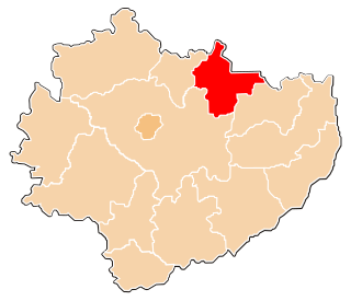
Gmina Piątnica is a rural gmina in Łomża County, Podlaskie Voivodeship, in north-eastern Poland. Its seat is the village of Piątnica, which lies approximately 3 kilometres (2 mi) north-east of Łomża and 72 km (45 mi) west of the regional capital Białystok.

Gmina Mykanów is a rural gmina in Częstochowa County, Silesian Voivodeship, in southern Poland. Its seat is the village of Mykanów, which lies approximately 14 kilometres (9 mi) north of Częstochowa and 76 km (47 mi) north of the regional capital Katowice.

Gmina Nowy Korczyn Gmina in Świętokrzyskie, Poland

Gmina Nowy Korczyn is a rural gmina in Busko County, Świętokrzyskie Voivodeship, in south-central Poland. Its seat is the village of Nowy Korczyn, which lies approximately 20 kilometres (12 mi) south of Busko-Zdrój and 67 km (42 mi) south of the regional capital Kielce.

Gmina Mirzec is a rural gmina in Starachowice County, Świętokrzyskie Voivodeship, in south-central Poland. Its seat is the village of Mirzec, which lies approximately 10 kilometres (6 mi) north of Starachowice and 42 km (26 mi) north-east of the regional capital Kielce.

Gmina Wąchock is an urban-rural gmina in Starachowice County, Świętokrzyskie Voivodeship, in south-central Poland. Its seat is the town of Wąchock, which lies approximately 5 kilometres (3 mi) north-west of Starachowice and 35 km (22 mi) north-east of the regional capital Kielce.

Gmina Barwice is an urban-rural gmina in Szczecinek County, West Pomeranian Voivodeship, in north-western Poland. Its seat is the town of Barwice, which lies approximately 23 kilometres (14 mi) west of Szczecinek and 122 km (76 mi) east of the regional capital Szczecin.

Nowy Jawor Village in Świętokrzyskie, Poland

Nowy Jawor is a village in the administrative district of Gmina Pawłów, within Starachowice County, Świętokrzyskie Voivodeship, in south-central Poland. It lies approximately 3 kilometres (2 mi) south of Pawłów, 12 km (7 mi) south of Starachowice, and 35 km (22 mi) east of the regional capital Kielce.

Radkowice, Starachowice County Village in Świętokrzyskie, Poland

Radkowice is a village in the administrative district of Gmina Pawłów, within Starachowice County, Świętokrzyskie Voivodeship, in south-central Poland. It lies approximately 6 kilometres (4 mi) west of Pawłów, 8 km (5 mi) south of Starachowice, and 32 km (20 mi) east of the regional capital Kielce.

Radkowice-Kolonia Village in Świętokrzyskie, Poland

Radkowice-Kolonia is a village in the administrative district of Gmina Pawłów, within Starachowice County, Świętokrzyskie Voivodeship, in south-central Poland. It lies approximately 6 kilometres (4 mi) west of Pawłów, 10 km (6 mi) south of Starachowice, and 31 km (19 mi) east of the regional capital Kielce.

Rzepin Pierwszy Village in Świętokrzyskie, Poland

Rzepin Pierwszy is a village in the administrative district of Gmina Pawłów, within Starachowice County, Świętokrzyskie Voivodeship, in south-central Poland. It lies approximately 3 kilometres (2 mi) north-west of Pawłów, 8 km (5 mi) south of Starachowice, and 35 km (22 mi) east of the regional capital Kielce.

Rzepin-Kolonia Village in Świętokrzyskie, Poland

Rzepin-Kolonia is a village in the administrative district of Gmina Pawłów, within Starachowice County, Świętokrzyskie Voivodeship, in south-central Poland. It lies approximately 2 kilometres (1 mi) west of Pawłów, 10 km (6 mi) south of Starachowice, and 35 km (22 mi) east of the regional capital Kielce.

Stary Jawor Village in Świętokrzyskie, Poland

Stary Jawor is a village in the administrative district of Gmina Pawłów, within Starachowice County, Świętokrzyskie Voivodeship, in south-central Poland. It lies approximately 4 kilometres (2 mi) south-west of Pawłów, 12 km (7 mi) south of Starachowice, and 34 km (21 mi) east of the regional capital Kielce.

References