
Old Goa is a historical city situated on the southern banks of the Mandovi River in the Ilhas sub-district of North Goa district in the Indian state of Goa.

The Mahadayi/Mandovi River, also known as Mahadayi or Mhadei river, is described as the lifeline of the Indian state of Goa. The Mandovi and the Zuari are the two primary rivers in the state of Goa. Mandovi joins with the Zuari at a common creek at Cabo Aguada, forming the Mormugao harbour. Panaji, the state capital and Old Goa, the former capital of Goa, are both situated on the left bank of the Mandovi.

Ribandar is a town in Ilhas, Goa, located between the cities of Panjim and Old Goa.

Chorão, also known as Choddnnem or Chodan, is an island along the Mandovi River near Ilhas, Goa, India. It is the largest among other 17 islands of Goa. It is located 5 kilometres away from the state capital, the city of Panaji and 10 kilometres away from the city of Mapusa.

The island of Divar or Divaade lies in the Mandovi river in the Indian state of Goa.

Tiswadi or Ilhas de Goa is a Sub-District in North Goa in the state of Goa, Konkan region, India. This was one of the first territories to be annexed by Portugal in 1510.
Cumbarjua, is an island and town within the Mandovi River in Goa. It is situated to the east of Goa's capital Panjim at a distance of 20 kilometres. It is one of 6 major islands between the Mandovi and Zuari, he others being:

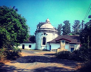
Cortalim is a village in Morumugão, Goa, India. Its native Goan population is entirely Catholic and their main occupations include fishing and agriculture. Located on the banks of the Zuari River, it was previously known as Kushasthale.

Candola is a village and census town in Ponda Sub-District, North Goa district in the state of Goa, India. It is located in the Novas Conquistas region of the state.
Amona is a census town in North Goa district in the state of Goa, India.
Santo Estêvão or St Estevam is an island in Ilhas, Goa, India. St Estevam is known also Jua and in the past was known as Shakecho Juvo – the isle of vegetables – known for its long, seven-ridged, light green ladyfingers. Therefore the people of Jua came to be nicknamed 'bhende'. The island is named after St. Stephen. It is one of Goa's most prosperous villages, often quoted by ex-Chief Minister Pratapsingh Rane for having a high per capita income.

São Mathias also known as Malar is a village on Divar island, Tiswadi or Ilhas, in the Indian state of Goa. The island is located 10 km upriver from Panjim.
The Zuari Bridge is a bridge between North Goa and South Goa, India. It carries the NH 66 over the tidal part of the Zuari River, between the villages of Agaçaim and Cortalim. It is a few metres downstream of the Konkan Railway Bridge.

Vanxim or Capão is an island of Goa situated in the Ilhas region. One can reach here by taking a ferry from Divar. The colonial name for Vanxim was Capão. One may see a lot of houses with few villagers many of whom are fisher-folk in the area. Silveiras, Furtados, Vas, Olivera are surnames of people. Mahendra Gaunekar sold the parts of the island to Ozone corporate. Luxury hotel and Golf Course is sort to be forced upon this island but faced resistance from alert islanders and others.
Santa Cruz Assembly constituency is one of the original Goa Legislative Assembly constituency seats in the Tiswadi Taluka of North Goa District in the State of Goa. The other constituencies in Tiswadi are Panaji, Taleigao, St. Andre and Cumbarjua.
Naroa is a village located on the eastern tip of the island of Divar, in the Indian state of Goa. It has a population of barely a thousand people, with about 80 houses.

The Atal Setu is a cable-stayed bridge in Goa that runs between Panaji and Porvorim. It carries National Highway 66 over the tidal part of the Mandovi River. It is 5.1 kilometres (3.2 mi) long, making it the third longest cable-stayed bridge in India. Two wheelers, three wheelers and bullock carts are prohibited from using the Atal Setu due to its height of 30 metres (98 ft). It officially opened on 5 February 2019.

The Mandovi bridge is a set of two bridges. It carries four lanes of NH66 over river Mandovi. It was Russian in design and the first to be used in this country. The first Mandovi bridge was built in 1971 and the second one in 1998.

Gandaulim is a village located on the western bank of the Cumbarjua Canal, within Ilhas in the state of Goa, India. Residents of the village and of Dubrovnik, Croatia believe that it was a colonial outpost of the Republic of Ragusa although there is no historical evidence in support of this theory.
The Cumbarjua Canal is a distributary channel formed by the merger of the Mandovi and Zuari rivers in Goa, India. It's flow has led to the formation of river deltas, most prominent of them are - Goa, Cumbarjua and St Estevam.


