
Tangra is a region in East Kolkata that traditionally housed many tanneries owned by people of Hakka Chinese origin.
Maniktala is a residential area of North Kolkata, in Kolkata district, West Bengal, India.

Chittaranjan Avenue, more commonly C.R. Avenue, a principal north-south thoroughfare in Central-North Kolkata. It starts from Beadon Street crossing in the north and ends at Chowringhee Road-Bentinck Street Junction (Esplanade) in the south. The road is renamed after Deshbandhu Chittaranjan Das, a nationalist politician and freedom-fighter of India. North of Beadon Street crossing, Chittaranjan Avenue becomes Jatindra Mohan Avenue.
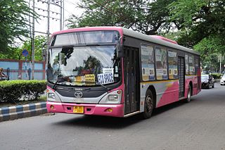
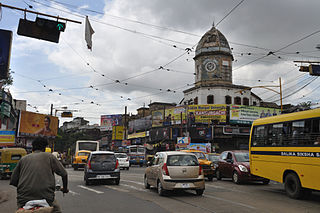
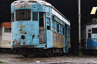
The transport system of Kolkata, a city in India, is a mix of modern mass rapid transport and old transport modalities like rickshaws. Kolkata is connected to the rest of India by the National Highways, the extensive network of the Indian Railways, National Waterways and by air. The most traffic to Northeast India route is via Kolkata.

Tiretta Bazaar, also known as Chinatown, is a neighborhood near Lalbazar in Central Kolkata. It is usually called Old China Market. The locality was once home to 20,000 ethnic Chinese Indian nationals, but now the population has dropped to approximately 2,000. Most of the Hakka Chinese people in the area moved closer to Tangra. The traditional occupation of the Chinese Indian community in Kolkata had been working in the nearby tanning industry as well as in Chinese restaurants. The area is still noted for the Chinese restaurants where many people flock to taste traditional Chinese and Indian Chinese cuisine.

Park Circus is a neighbourhood of South Kolkata in Kolkata district, West Bengal, India.
Sarat Bose Road, previously known as Lansdowne Road, is a 3.5 km long stretch of road that connects Southern Avenue with AJC Bose Road and separates two major localities of Ballygunge and Bhawanipore in South Kolkata, India. South of Southern Avenue crossing, Sarat Bose Road becomes Deboki Kumar Bose Sarani.

Entally is a neighbourhood of Central Kolkata, in Kolkata district in the Indian state of West Bengal. It was considered close to the area which was home to the poor and the depressed castes. Mother Teresa started her activities in Entally.

Acharya Jagadish Chandra Bose Road and its continuation northwards called Acharya Prafulla Chandra Road, are together the longest and the most important north-south thoroughfare in Kolkata, India.

Beliaghata, also known as Beleghata, is a neighbourhood of Central Kolkata, in Kolkata district, West Bengal, India.
The 2007 Kolkata riots took place in Kolkata on 21 November 2007, when Muslim anti-Taslima protesters under the banner of All India Minority Forum blockaded major portions of central Kolkata and resorted to arson and violence. The Left Front led State Government deployed the army in the afternoon of that day.
Tiljala is a neighbourhood of East Kolkata, in West Bengal, India.

Topsia is a neighbourhood of East Kolkata, in West Bengal, India. Topsia falls in Kolkata district situated in West Bengal state, with a population 94809. The male and female populations are 49388 and 45421 respectively. The size of the area is about 2.8 square kilometer.
Ward No. 56, Kolkata Municipal Corporation is an administrative division of Kolkata Municipal Corporation in Borough No. 7, covering parts of Entally and Tangra neighbourhoods in central Kolkata, in the Indian state of West Bengal.
Ward No. 58, Kolkata Municipal Corporation is an administrative division of Kolkata Municipal Corporation in Borough No. 7, covering parts of Tangra, Dhapa (Mathpukur) and East Kolkata Wetlands (Arupota-Bosetala-Boinchtala-Durgapur-Anandabad-Khanaberia) neighbourhoods in central-east Kolkata, in the Indian state of West Bengal. The Eastern Metropolitan Bypass cuts across the ward.
Ward No. 59, Kolkata Municipal Corporation is an administrative division of Kolkata Municipal Corporation in Borough No. 7, covering parts of Beniapukur, Gobra and Tangra neighbourhoods in central Kolkata, in the Indian state of West Bengal.
Ward No. 66, Kolkata Municipal Corporation is an administrative division of Kolkata Municipal Corporation in Borough No. 7, covering parts of Tangra (Chinatown) in central Kolkata and Topsia, Science City, Forum Atmosphere and Tiljala neighbourhoods in South Kolkata, in the Indian state of West Bengal.

Phoolbagan is a neighbourhood in North Central Kolkata in Kolkata district in the Indian state of West Bengal. Subhas Sarovar is one of the famous tourist attraction of Kolkata present in the locality of Phoolbagan.
Beniapukur is a neighbourhood of Central Kolkata in Kolkata district in the Indian state of West Bengal. It is adjacent to Park Circus.
Pulin Khatik Road is a famous thoroughfare in the city of Kolkata, India. It is 650 metre in length from Radhanath Chowdhuri Road to Chingrihata Lane in the Tangra area. The road crosses Gobinda Chandra Khatik Road at Tara Jewellers.


