Gobustan District

Last updated
Gobustan District
Gobustan District in Azerbaijan 2021.svg
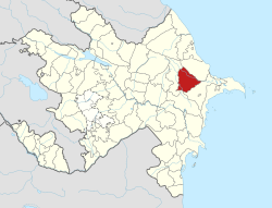
Map of Azerbaijan showing Gobustan District
Country Flag of Azerbaijan.svg  Azerbaijan
Region Mountainous Shirvan
Established24 April 1990
Capital Gobustan
Settlements [1] 33
Government
   Governor Adil Mammadov
Area
  Total1,370 km2 (530 sq mi)
Population
 (2020) [2]
  Total47,400
  Density35/km2 (90/sq mi)
Time zone UTC+4 (AZT)
Postal code
3700
Website qobustan-ih.gov.az

Gobustan District (Azerbaijani : Qobustan rayonu) is one of the 69 districts of Azerbaijan. It is located in the east of the country, in the Mountainous Shirvan Economic Region. The district borders the districts of Shamakhi, Khizi, Absheron, and Hajigabul. [3] Its capital and largest city is Gobustan. As of 2020, the district had a population of 47,400. [2]

Contents

History

The name "Gobustan" originated from the word "Gobu", which means "beam" in Azerbaijani. [4] The district's administrative centre, Gobustan was known as Maraza until 2009.

The territory of the district belonged to the neighbouring Shamakhi District from 1930 until 1943 and later again from 1960 until 1990 when it was re-established.

The ancient dwellings used to be in the area of present Gobustan which date back to the Stone Age. [4]

Infrastructure

There are six kindergartens in the region, and 30 general education schools. There are 23 cultural centers, 3 hospitals and medical enterprises, and 6 big and middle enterprises. [3]

Population

According to official statistics the district of Gobustan had a population of 46,100 inhabitants at the beginning of 2018; 36,700 of whom were living in rural areas. [5]

Population201020112012201320142015201620172018201920202021
Gobustan region40.541.141.842.543.244.044.845.446.146.747.447.9
urban areas8.28.38.58.68.89.09.19.39.49.59.79.8
rural areas32.332.833.333.934.435.035.736.136.737.237.738.1

Geography

Landscape

The territory of Gobustan ranges from the shores of the Caspian Sea to Mount Gijaki, the highest point in the eastern part of the Greater Caucasus. Peculiarities of Gobustan landscape are the rocks of lime and sandstone in the middle territory of the district, and mud volcanoes, which are located in the east part of Gobustan. [6]

Climate

Gobustan has a semi-arid climate, with mild winters and hot summers. There are rain seasons in early spring and late autumn. The annual precipitation is 250 mm. The western part of Gobustan is more precipitated in autumn and spring than the eastern part of Gobustan since Kura lowlands cover the western part. The highest mean temperature is observed in July (32 C) and the lowest mean temperature occurs in January (-1.6 C). [6]

Flora

Gobustan has a rich flora with 470 different plant species; in all of Azerbaijan there are 4000 different plant species. The vegetation of Gobustan has desert and semi-desert characteristics. Wild rose, Hibernian honeysuckle, wild pear, wild pomegranate, wild fig, and juniper can be found in Gobustan. [7]

Fauna

There are approximately 110 wild bird species in the Gobustan region. 53 of them are included in special European conversation concern, 9 of them are included in the Azerbaijan Red Data Book, and 9 of them are listed by the International Union for Conversation of Nature (IUNC). [6]

There are 28 different mammal species in Gobustan. Two of them are included in the Azerbaijan Red Book, and one species is listed in the IUCN. [6] There are two different types of amphibians and 20 different species of reptiles. Testudo greaca is included in the Red Book Data of Azerbaijan and IUCN. [7]

Economy

Agriculture

Agriculture is the core of the Gobustan economy. The most important agricultural product in the region is grain. The annual production of grain is approximately 1 ton per person. [8] Other major agricultural products are potato, cabbage, tomato, grape, pea, sunflower, and melon. [3]

Court

Gobustan District Court was established in 1990; it is called Gobustan District People's Court and is subordinate to the Ministry of Justice of Azerbaijan SSR. [9]

Related Research Articles

<span class="mw-page-title-main">Neftchala District</span> District of Azerbaijan

Neftchala District is one of the 69 districts of Azerbaijan. It is located in the southeast of the country and belongs to the Shirvan-Salyan Economic Region. The district borders the districts of Jalilabad, Bilasuvar, Salyan, Lankaran, and Masally. Its capital and largest city is Neftchala. As of 2020, the district had a population of 88,900.

<span class="mw-page-title-main">Absheron District</span> District of Azerbaijan

Absheron District is one of the 69 districts of Azerbaijan. Located in the east of the country, it belongs to the Absheron-Khizi Economic Region. The district borders the districts of Khizi, Gobustan, Baku, Hajigabul, Salyan, and the city of Sumgait. Its capital and largest city is Khyrdalan. As of 2020, the district had a population of 214,100. Although the district shares the same name as the Absheron Peninsula, the area covered by the district is not conterminous, being further west and mostly inland.

<span class="mw-page-title-main">Ujar District</span> District of Azerbaijan

Ujar District is one of the 69 districts of Azerbaijan. It is located in the centre of the country and belongs to the Central Aran Economic Region. The district borders the districts of Agdash, Goychay, Kurdamir, and Zardab. Its capital and largest city is Ujar. As of 2020, the district had a population of 89,500.

<span class="mw-page-title-main">Agsu District</span> District of Azerbaijan

Agsu District is one of the 69 districts of Azerbaijan. It is located in the east of the country, in the Mountainous Shirvan Economic Region. The district borders the districts of Ismayilli, Shamakhi, Kurdamir, and Hajigabul. Its capital and largest city is Agsu. As of 2020, the district had a population of 81,000.

<span class="mw-page-title-main">Balakan District</span> District of Azerbaijan

Balakan District is one of the 69 districts of Azerbaijan. It is located in the north of the country, in the Shaki-Zagatala Economic Region. The district borders the district of Zagatala, as well as the Kakheti region of Georgia and the Russian Republic of Dagestan. Its capital and largest city is Balakan. As of 2020, the district had a population of 99,100.

<span class="mw-page-title-main">Shabran District</span> District of Azerbaijan

Shabran District is one of the 69 districts of Azerbaijan. It is located in the northeast of the country, in the Guba-Khachmaz Economic Region. The district borders the districts of Khachmaz, Quba, Khizi and Siyazan. Its capital and largest city is Shabran. As of 2020, the district had a population of 59,900.

<span class="mw-page-title-main">Goychay District</span> District of Azerbaijan

Goychay District is one of the 69 districts of Azerbaijan. Located in the centre of the country, it belongs to Central Aran Economic Region. The district borders the districts of Agdash, Qabala, Ismayilli, Kurdamir, and Ujar. Its capital and largest city is Goychay. As of 2020, the district had a population of 121,700. It is famous for its pomegranate growing industry, and for its pomegranate festival.

<span class="mw-page-title-main">Hajigabul District</span> District of Azerbaijan

Hajigabul District is one of the 69 districts of Azerbaijan. It is located in the east of the country, in the Shirvan-Salyan Economic Region. The district borders the districts of Kurdamir, Agsu, Shamakhi, Gobustan, Absheron, Baku, Salyan, Sabirabad and the city of Shirvan. Its capital and largest city is Hajigabul. As of 2020, the district had a population of 76,600.

<span class="mw-page-title-main">Kurdamir District</span> District of Azerbaijan

Kurdamir district is one of the 69 districts of Azerbaijan. Located in the centre of the country, it belongs to the Central Aran Economic Region. The district borders the districts of Zardab, Ujar, Goychay, Ismayilli, Agsu, Hajigabul, Sabirabad, and Imishli. Its capital and largest city is Kurdamir. As of 2020, the district had a population of 117,900.

<span class="mw-page-title-main">Masally District</span> District of Azerbaijan

Masally District is one of the 69 districts of Azerbaijan. It is located in the southeast of the country and belongs to the Lankaran-Astara Economic Region. The district borders the districts of Lankaran, Lerik, Yardimli, Jalilabad, and Neftchala. Its capital and largest city is Masally. As of 2020, the district had a population of 227,700.

<span class="mw-page-title-main">Qabala District</span> District of Azerbaijan

Qabala District is one of the 69 districts of Azerbaijan. It is located in the north of the country in the Shaki-Zagatala Economic Region. The district borders the districts of Oghuz, Shaki, Agdash, Goychay, Ismayilli, Quba, Qusar, and the Russian Republic of Dagestan. Its capital and largest city is Qabala. As of 2020, the district had a population of 107,800.

<span class="mw-page-title-main">Sabirabad District</span> District of Azerbaijan

Sabirabad District is one of the 69 districts of Azerbaijan. Located in the centre of the country, it belongs to the Mil-Mughan Economic Region. The district borders the districts of Saatly, Imishli, Kurdamir, Hajigabul, Salyan, Bilasuvar, and the city of Shirvan. Its capital and largest city is Sabirabad. As of 2020, the district had a population of 178,800.

<span class="mw-page-title-main">Qusar District</span> District of Azerbaijan

Qusar District is one of the 69 districts of Azerbaijan. It is located in the northeast of the country, in the Guba-Khachmaz Economic Region. The district borders the districts of Quba, Qabala, Khachmaz, and the Russian Republic of Dagestan. Its capital and largest city is Qusar. As of 2020, the district had a population of 99,000.

<span class="mw-page-title-main">Salyan District (Azerbaijan)</span> District of Azerbaijan

Salyan District is one of the 69 districts of Azerbaijan. Located in the east of the country, it belongs to the Shirvan-Salyan Economic Region. The district borders the districts of Bilasuvar, Sabirabad, Hajigabul, Baku, Neftchala, and the city of Shirvan. Its capital and largest city is Salyan. As of 2020, the district had a population of 139,900.

<span class="mw-page-title-main">Shamakhi District</span> District of Azerbaijan

Shamakhi District is one of the 69 districts of Azerbaijan. It is located in the east of the country and belongs to the Mountainous Shirvan Economic Region. The district borders the districts of Quba, Khizi, Gobustan, Hajigabul, Agsu, and Ismayilli. Its capital and largest city is Shamakhi. As of 2020, the district had a population of 106,400.

<span class="mw-page-title-main">Kurdamir</span> City and municipality in Azerbaijan

Kurdamir is a city and the capital of the Kurdamir District of Azerbaijan. It is located in Aran Economic Region. The city's population is 18,100 people.

<span class="mw-page-title-main">Gobustan State Historical and Cultural Reserve</span> National park in Azerbaijan

Gobustan State Historical and Cultural Reserve is located west of the settlement of Gobustan, about 40 miles (64 km) southwest of the centre of Baku. It was established in 1966, when the area was declared a national historical landmark of Azerbaijan in an attempt to preserve the prehistoric rock carvings, mud volcanoes and musical stones in the region.

<span class="mw-page-title-main">Gobustan (town)</span> City and municipality in Gobustan, Azerbaijan

Gobustan is a town and municipality in and the administrative center of the Gobustan District of Azerbaijan. It has a population of 3,945.

<span class="mw-page-title-main">Sabirabad (city)</span> Place in Sabirabad, Azerbaijan

Sabirabad is the capital city of the Sabirabad District of Azerbaijan. The city was renamed in honor of the poet Mirza Alakbar Sabir. Sabirabad is the administrative center of Sabirabad District of the Republic of Azerbaijan. In 1935, the district received the status of subordinate city. Sabirabad is located on the right bank of the Kura River. In the vicinity of the city of Sugovushan, the Araz River is merged with the Kur River.

<span class="mw-page-title-main">Mountainous Shirvan Economic Region</span> Economic region of Azerbaijan

Mountainous Shirvan Economic Region is one of the 14 economic regions of Azerbaijan. It borders the economic regions of Shaki-Zagatala, Guba-Khachmaz, Absheron-Khizi, Shirvan-Salyan, and Central Aran. The region consists of the districts of Agsu, Ismayilli, Gobustan, and Shamakhi. It has an area of 6,130 square kilometres (2,370 sq mi). Its population was estimated to be at 324.8 thousand people in January 2021.

References

  1. "İnzibati-ərazi vahidləri" (PDF). preslib.az. Retrieved 28 February 2021.
  2. 1 2 "Population of Azerbaijan". stat.gov.az. State Statistics Committee . Retrieved 22 February 2021.
  3. 1 2 3 "Information on the administrative-territorial units". azerbaijan.az. Archived from the original on 2019-01-17. Retrieved 2018-09-06.
  4. 1 2 "Ganja Regional Culture and Tourism Department". regex.mctgov.az. Retrieved 2018-09-06.
  5. Samadov, Anar. "Population | The State Statistical Committee of the Republic of Azerbaijan". The State Statistical Committee of the Republic of Azerbaijan. Retrieved 2018-09-06.
  6. 1 2 3 4 Schmidt, Sebastian (2009). Potential Analysis for Further Nature Conservation in Azerbaijan: A Spatial and Political Investment Strategy. Greifswald: Geozon Science Media. ISBN   3941971018.
  7. 1 2 Permanent Delegation of the Republic of Azerbaijan to UNESCO. "Gobustan". unesco.mfa.gov.az. Retrieved 2018-09-07.
  8. "Rayon haqqında - QOBUSTAN RAYON Icra Hakimiyyəti". qobustan-ih.gov.az (in Azerbaijani). Retrieved 2018-09-07.
  9. "Gobustan District Court".

40°32′06″N48°55′16″E / 40.53500°N 48.92111°E / 40.53500; 48.92111